Highlights
- Hot and smoky through Thursday. Things should clear out a bit Thursday evening.
- Poor air quality at times over the next few days.
- Warm weather persists through the weekend and into the following week.
- No rain chances in sight, and this means thunderstorms too. Very dry over the next 10 plus days.
- If you have time and have not done so yet, check out my post from Friday on the coming El Nino. It’s a long read, but a good one full of information. the-looming-el-nino
Details
Salem’s highs are going to be above the 90 degree mark Tuesday through Saturday of this week; although, Saturday might end up in the upper 80s. This will be the longest stretch of such warm weather so far this summer. The hottest days should be Tuesday & Wednesday when highs soar into the mid to upper 90s despite the increasing smoke.
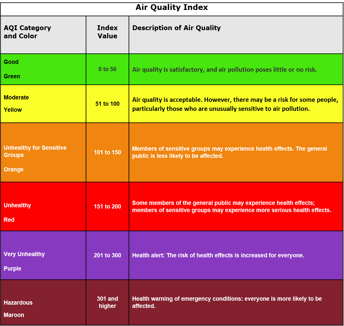
Speaking of smoke, the AQI (Air Quality Index) is forecasted to be in the 100 to 200 range for Salem Tuesday – Thursday afternoon. It’s already getting a little smoky out there today, but at the moment, the levels are still in the moderate category. Here’s an AQI chart below for reference.
What about nighttime temperatures? Plan on lows ranging from 58 to 64° through Saturday which is warm, but not as awful as the muggy low temperatures we had a couple weeks ago.
Stay safe out there. It’s not ideal, but it could be far worse. Praying for the people being directly affected by the wildfires east of the Cascades. Tough days for them and tragic for those losing their homes.

