Happy Sunday evening! I’ve got two topics for you in this post. First up is our forecast, and the second is a look at El Nino and how things are going so far.
The forecast
1.) A warm and sunny week ahead. Highs will range from the mid to upper 70s each day. A few morning clouds and patches of fog are possible – I think especially on Tuesday. Lows in the upper 40s to lower 50s. Very stable, and quite enjoyable October weather!
2.) A cold front moves in from the NW Friday evening. A period of light rain or at least a few showers can be expected Friday evening with showers and sunbreaks on Saturday. Highs Saturday will only reach the low 60s. This is not a big storm or a major washout. Most of Friday should still be dry, and honestly, much of Saturday looks dry too. Main effects will be the cooler daytime highs, & the chance of a few rain showers.
3.) Drier weather quickly returns Sunday. Morning lows around 44° and highs in the upper 60s. Dry weather looks to dominate the following week too.
A look back
Thinking back to my EL Nino prediction I made over the summer, I specifically mentioned a higher than normal chance for late summer rains during years with strong El Nino conditions. I also specifically mentioned August and provided stats to back the claim. For the life of me, I don’t know why I didn’t add September into my prediction as it would have helped paint the picture I was attempting to make with that lang range outlook. Take a look at precip anomalies for the month of September during the same exact 6 analog years as I used back in my original El Nino post.
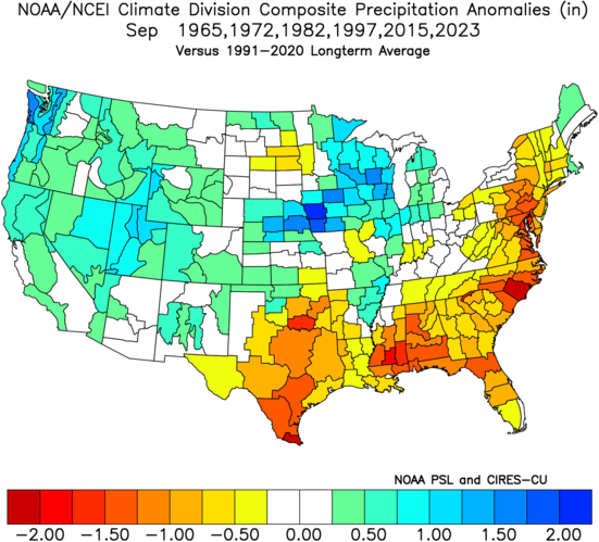
When combined with the August stats, there’s clearly a trend for late summer/early fall rains during strong El Nino years, and this year was no exception. I missed the August specific part, but the rains arriving the first few days of September, no long drawn out fire season, and rain chances returning at times throughout the month of September makes me feel good about how the bigger picture turned out.
In the last 5 weeks we have seen:
- An early season soaking the first week of September.
- A cool September.
- An early end to fire season.
- A wetter than average September with multiple days of rainy weather throughout the month.
Check out the precip totals from the month of September across the Pacific Northwest.
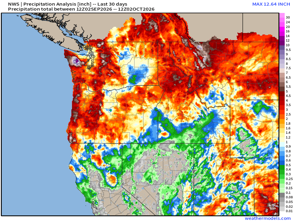
The entire Pacific Northwest experienced a wet month. Below is a chart with Salem’s precip for each day of the month of September and the final stats.
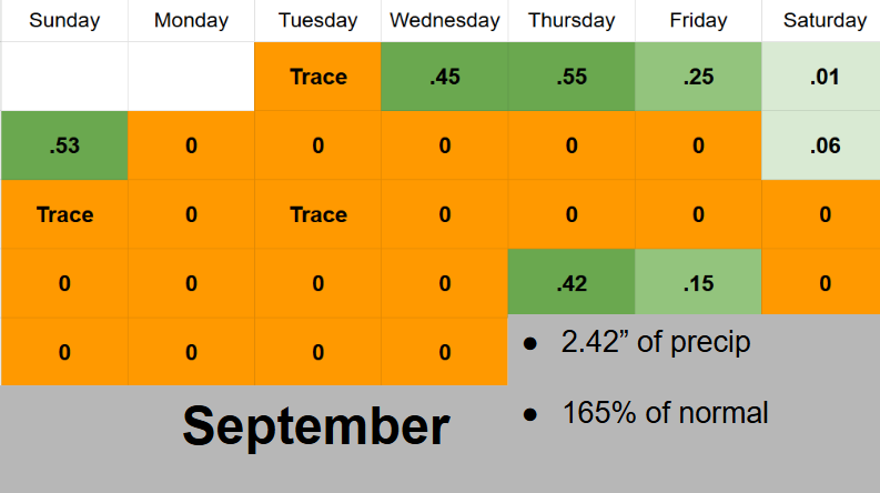
For September (our 3rd dries month on average), 8 rainy days and 2.42″ or rain is a lot!
Next we have a chart of our high temperatures for September – both observed highs and the average highs.
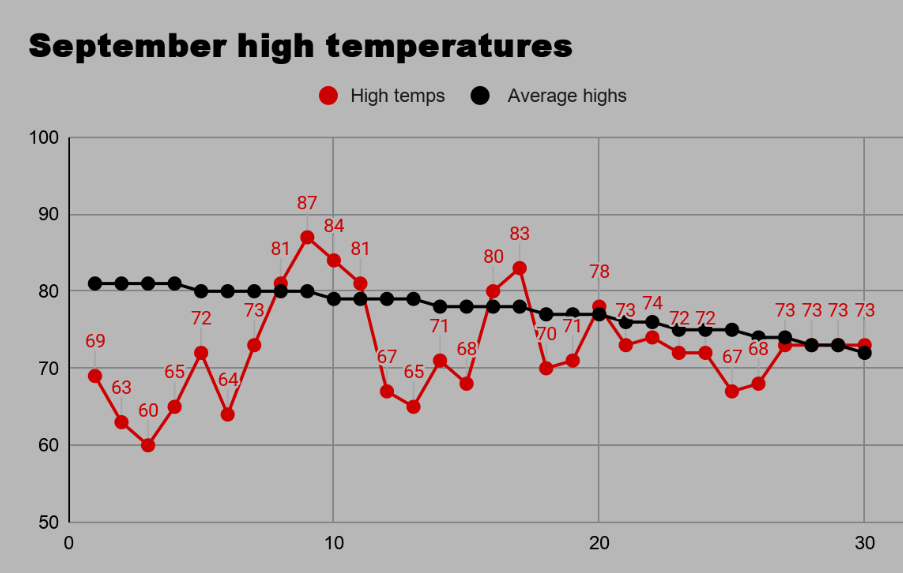
We spent most of the month below average, and when our lows are factored in, the month ended up being 2.8 degrees below normal. A chilly month for September standards.
But now things have taken a turn to the warmer side which, and this too falls into what I was expecting. Take a look at temperature anomalies for October during the previous six strongest El Nino years.
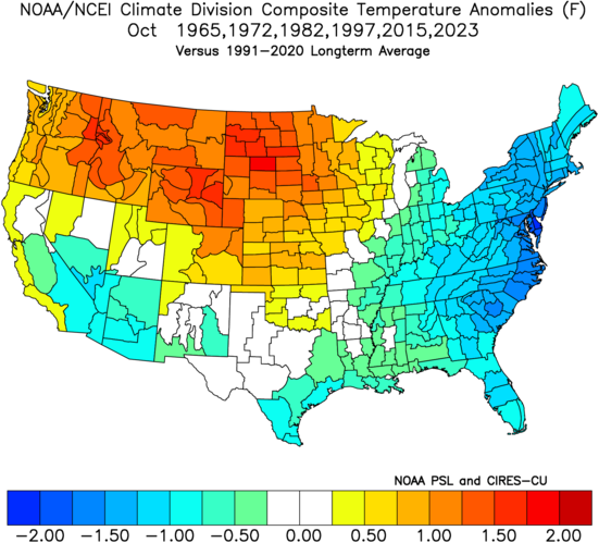
Seems like the warm October conditions we are currently experiencing are right in line with what we would expect to see during a strong El Nino. Thanks to the wet September, we are able to better enjoy this warm, sunny weather without major wildfire issues – an added blessing!
That’s everything I’ve got, or at least everything I have time for today. Still busy, busy, busy with school and my “new” teaching job.
Take care, stay safe, and enjoy the really great fall weather!

