This is short notice, but work and finishing my last semester of school take top priority. Still, hopefully better late than never. 😉 We have our first true windstorm of the season on tap for early Friday morning. This will be the first time since last winter that we have a threat for a few power outages (which I expect) along with some downed limbs or even a tree or two. It’s a one and done type deal because the weekend itself looks fairly decent and totally dry. Details below!
Rainfall
Rain moves in tonight – like any moment now, and it’s going to pour! Expect plenty of rain, and at times, very heavy rainfall. This image below shows moderate to heavy rain moving in this evening. Plan on it continuing for a good chunk of the night.
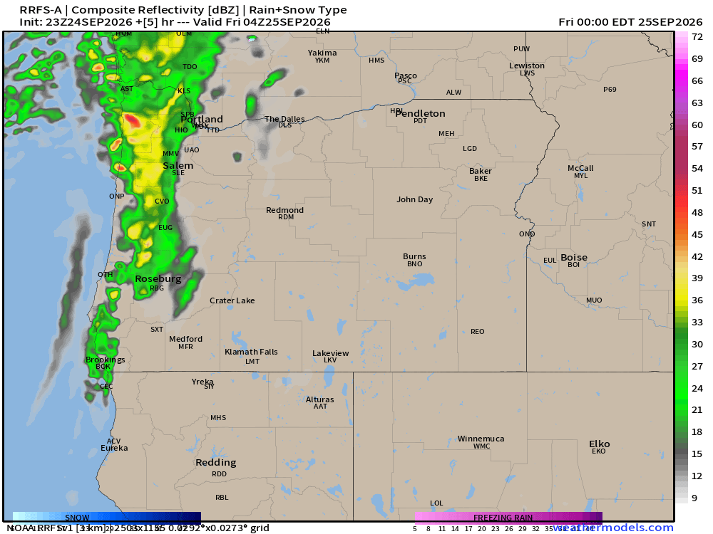
Rain transitions into showers, a few thundershowers, and definitely more downpours Friday morning through the afternoon. When all is said and done Friday night, rain totals will probably look something like what you see below.
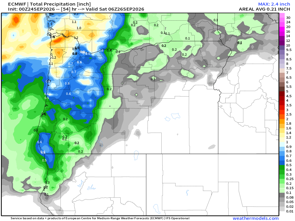
A good half inch to inch in the valley, & over an inch along the coast and in the mountains. A real soaker!
Showers become less frequent as the day goes on with increasing sunbreaks, but a shower/downpour is possible through the evening hour. Don’t panic about outdoor football games yet. While a shower or two is possible during the evening hours, the vast majority of us should stay dry past about 6pm.
Wind
Beginning early Friday morning between around 1 to 3am, winds will pick up with gusts 35 to 45mph. This should last until around 11AM. Breezy conditions of 20 to 25mph will last through the afternoon with occasional higher gusts associated with the heavier showers. This is not stronger than what we see a several times every winter, but being the first storm of the season and with trees still full of leaves for the most part, I’m fully expecting some power outages and downed tree parts. I would bring in or secure any lawn ornaments that you don’t want blowing around tonight.
Remember, the wind and rain both let up come dinner time.
Saturday – Monday
Dry. Fog at times during the morning hours. Lows in the mid 40s (coldest so far this season), and highs near 70°. Partly cloudy with lots of daytime sunbreaks.
Tuesday – Friday
Oregon will continue to be right on the edge of the storm track, but on the drier and calmer edge. I’m thinking we stay mainly dry for now with the best chance for a few showers (no big storms this time) Tuesday into early Wednesday, but very much subject to change.
Take care and enjoy the more wild fall weather!

