We’ve had a really decent July in regards to temperature. It’s the 20th, and we have yet to hit 90° this month. Of course this is all about to change, but it shows how relatively moderate our summer has been so far.
There are two big factors at play effecting our weather this week. The first is the leftovers of tropical storm Elida easily seen on this satellite image, but marked with a “L” somewhat near the center of this dying storm.
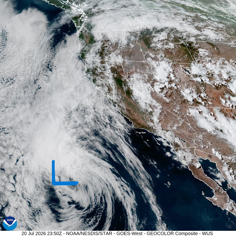
It will continue to move northward sending moisture and eventually a chance for thunderstorms to our region come Wednesday. The second factor at play is the “heat dome” which has been dominating much of the continental US. It’s finally moving close enough to give us some truly hot weather. Nights will be warm (mid to upper 60s), and the next two days will be hot and on the humid side with higher dew points and high temperatures reaching the mid to upper 90s. Details below:
Details
Tuesday
Pretty straightforward. It’s going to be mostly sunny and hot. Humidity will be on the higher end of what we are accustomed to. Highs will soar into the mid 90s. Sunny, sticky, and hot.
Wednesday
Another very hot day. Probably even more noticeable will be the very warm morning low of 67°. Far too warm to effectively cool down a house that does not have AC. Highs will again reach the 90s, but tropical moisture from what is left of tropical storm Elida will send clouds and possibly a shower or thunderstorm into the Willamette Valley Wednesday afternoon. Think hot and humid.
Thursday
Thunderstorm chances remain present Wednesday night through early Thursday morning (very similar timing to last week’s storms). The afternoon should clear up a bit and highs will still reach the mid 80s. Not everyone will see a thunderstorm, but the chances are certainly high enough that it’s worth mentioning. Still muggy feeling, especially with any leftover moisture from the showers or storms we may see the night before.
Friday through Sunday
Mostly sunny skies dominate the weekend with highs in the mid 80s for Friday and low 80s both Saturday and Sunday.
By the way, I saved this image courtesy of Fox 12 from last week’s thunderstorm outbreak.
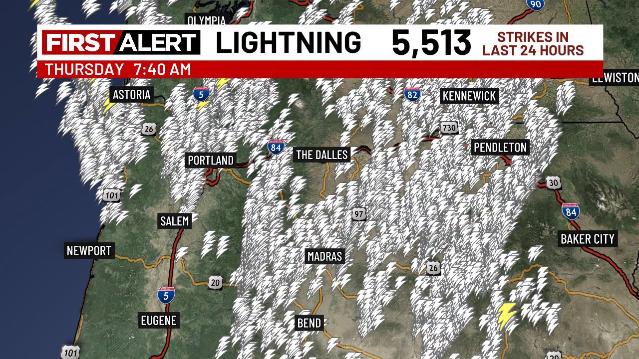
Sure enough, storms stayed mainly north of Salem here in the Willamette Valley. Widespread storms along and east of the Cascades which lead to many of the current wildfires burning east of the mountains right now. You can track the current wildfire situation here wildfire updates.
Enjoy the heat and stay safe out there!
 Bryan Weather Alerts