Quick Highlights
- Dry now through Sunday night. Varying amounts of morning clouds followed by ample sunshine each day. Highs 70s and low 80s.
- Rainy Monday and showers on Tuesday. Highs back into the upper 50s Monday, and low 60s on Tuesday.
Details
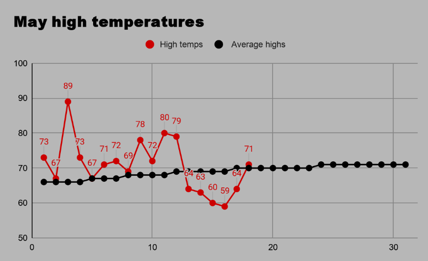
The past month has provided us with some wild temperature swings, something which is very typical in the PNW during spring. Look at the temperatures chart below for Salem. The past week has been cooler than the first two weeks of the month. Odd, but possible as we see alternating periods of warm/dry weather and cooler & wetter weather.
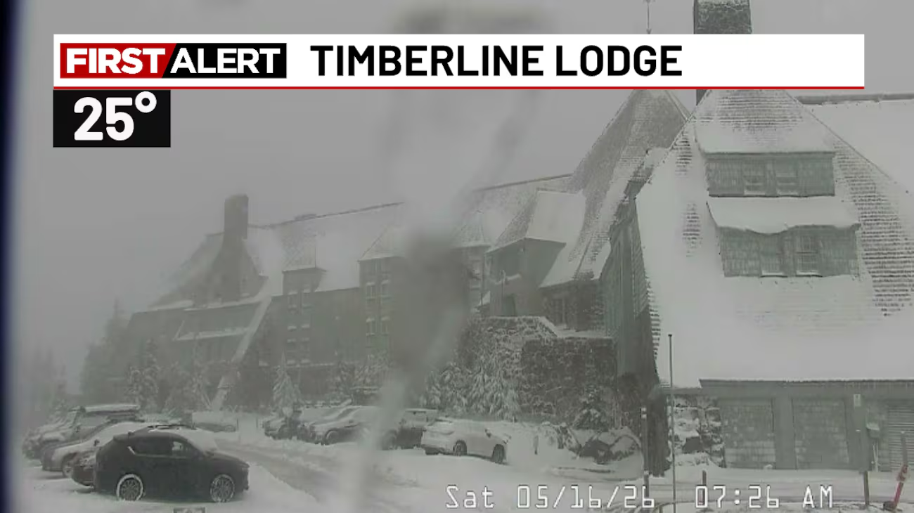
The latest round of cooler weather even brought snowfall to the mountains. I saved this image of Timberline Lodge Saturday morning. It’s normal to see snow in May up there, but with how dry and relatively warm we have been this past year, it was exciting to see.
So, what’s ahead?
Dry the rest of the week and dry through Sunday. Yes, the majority of the Memorial Day Weekend will remain dry. I think temperatures peak this week on Thursday with highs 82 – 84°. Nice warm and dry weather continues Fri – Sun, highs in the upper 70s to low 80s (depending on morning clouds). Very pleasant overall.
Rain arrives Monday. There is no question about this, and breezy winds will accompany the rain along with cooler temperatures. I see a day with highs back into the upper 50s. Rain Monday will transition to showers Monday night lasting through Tuesday. Arrival of rainfall looks to be mid morning, so don’t get your hopes us that this rain will hold off until your camping trip or Monday plans are finished up.
Monday will be cloudy and wet most of the day whereas Tuesday will be more of a shower and sunbreak type of day. Highs Tuesday will be in the low to mid 60s.
Snowfall (2 to 4 inches) is expect Monday night and Tuesday morning of next week in the Cascades with the incoming cold front. Keep this in mind if your travels, hikes, or camping trips take you above about 4500 feet.
Stay safe and have a great rest of your week!

