Big time forecast right here with a lot to cover, so let’s get down to it!! Highlights first and then the extra details.

Highlights
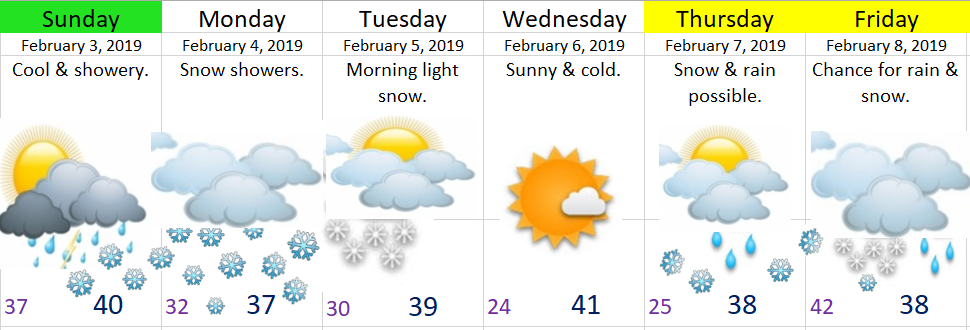
Today: Showers much of the day with snow levels around 500’ – 1000’.
Tonight. Snow level drops down to the valley floor.
Monday: Snow showers throughout the day with highs in the mid to upper 30s. Everyone should at least have a coating of snow with a few inches very possible for those of you around 500’ or higher. A cold day for sure!
Tuesday: Very light snow early on turning partly cloudy in the afternoon. Highs will be close to 40°.
Wednesday: Cold & dry.
Thursday – Saturday: More opportunities for snow as both cold air and moisture come together right over our area. More on that another day, for now you just know that this cold and potentially snowy weather is going to continue for a while.
Details, and lots of them 😉
I’m watching very closely our temps both at the surface and up above to help determine our chances for sticking snow on the valley floor. It seems likely that we all see at least a coating of snow with the higher hills around town picking up 1 – 3 inches through Monday evening. Keep in mind that it’s possible our roads stay mostly clear even if we get a little coating of snow as it’s hard for snow to really stick to pavement when it’s only 32/33° especially during the daylight hours. If we stay just a couple degrees colder than what I’m thinking and or if there ends up being more moisture then we could easily see more snowfall.
Monday night into early Tuesday a band of light precipitation will likely drop another dusting of snow for just about all of us.
I continue to believe that the east side of the Willamette Valley will see higher snow totals these next few days as the moisture and snow showers sort of “backs up” against the foothills of the Cascades.
Beyond Tuesday there are three things popping out at me. One is the nice dry break in the weather Tuesday afternoon through Wednesday night. Second thing is the consistency in the weather models showing more opportunities for snow starting Thursday and lasting through next Sunday. In fact I have fairly high confidence we see even more snow during that second half of the week than we see these next few days!
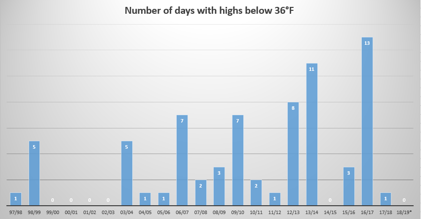
The third thing is perhaps the most interesting thing to me. Starting today it appears as though we will be entering into a near historic cold spell. Not historic because of how cold it will be, but historic due to the sheer length of time I expect the colder than average weather to last. I understand this could change, but I have to say that in all my experience forecasting weather I have rarely seen this much agreement between models for the extended period which leads me to believe this colder pattern is going to last quite a while. Naturally one would expect increased chances for snow with such a cold pattern, and that’s exactly what I’m seeing. In fact I see numerous opportunities for snow over the next couple of weeks. So like it or not, it’s quite possible we are in for a very prolonged February cold spell!!
The Coast, Coast Range, & Cascades
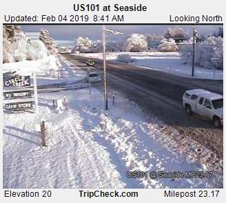
Snow should fall to sea level Sunday night and Monday. This pattern also favors snow along the coast. The Coast Range will be very snowy with 4 to 8 inches expected now through Tuesday, and the Cascades will of course be snowy as well with 6 to 12 inches up there over the next 3 days.
Some fun “do it yourself” forecasting tools for predicting snow
You may want to keep an eye on these maps as they are some of the best indicators as to whether or not we will have snow. I don’t think I’ve had links like this so hopefully they work 😉
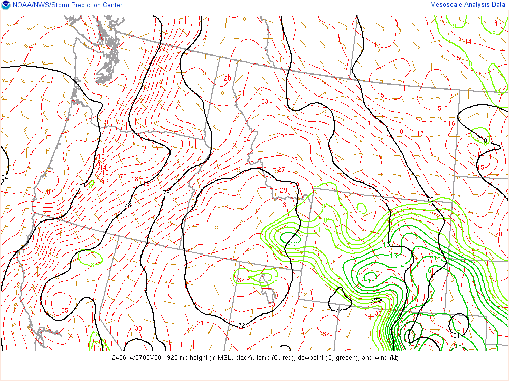
This first map shows temps in Celsius at roughly the elevation of Santiam pass (about 4,800′). When winds are out of the south or from the west (onshore winds) we generally want to see at least -6° or colder in order to see sticking snow to the valley floor. “Warmer” temps can do the trick just fine if and only if: 1.) the precip is heavy enough, 2.) the winds are very light or calm, or 3.) if winds are out of the north or east like the cold winds out of the Gorge. Basically as long as we are on the blue side of the lines.

This second map shows temps in Celsius at about 2500′ in elevation. If you are rooting for snow than all we typically need is to be somewhere in the blue. It’s better to be at -2°C or colder, but even 0°C at this elevation can do the trick if precip is heavy enough or if the winds are light or calm or from the north or east.