It truly is going to be an extremely wild couple of weeks regarding the weather, and depending on how things set up such as tracks of the storms, how cold the air is, and how much moisture there is, we could be looking at some very “epic” snow totals.
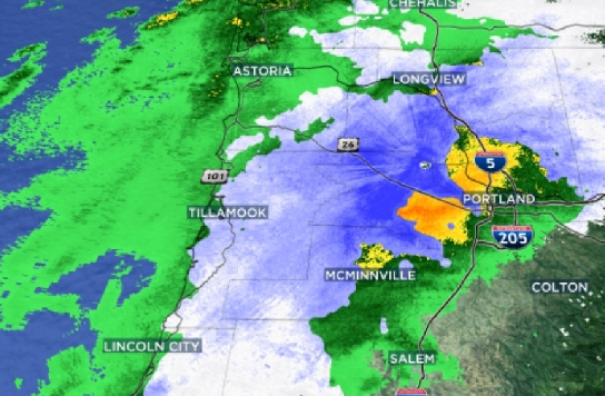
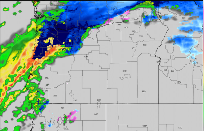
First things first. This evening we have a strong front pushing in from the NW bringing a good dose of precipitation with it. Here’s a link to the radar:

Timeline
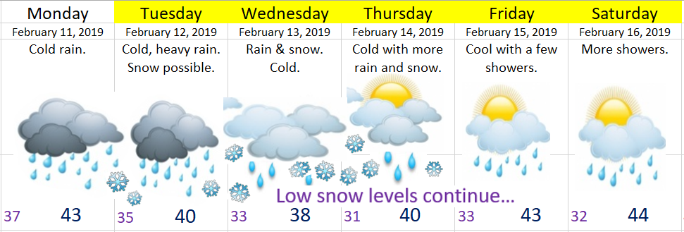
Tonight: Rain, heavy at times. Snow could easily mix in down to the valley floor, but it will not stick in the lowest elevations initially. This is tricky business as both elevation and proximity to the Gorge will make all the difference in the world for how much snow everyone sees.
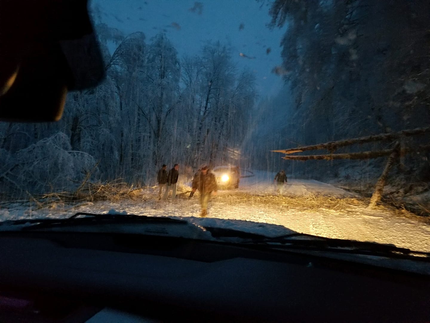
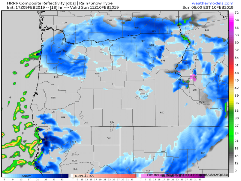
Check out these pics from around 4:30pm. Snow sticking in the Coast Range of NW Oregon and that cold air and precip is headed our direction.
Possible Game Changers
If temps are just a couple degrees colder than forecast giving us much more snow.
If the low pressure takes longer to drop south then we will end up with mostly just a cold rain.
Precip sticks around longer than forecast Saturday allowing for higher snow totals.
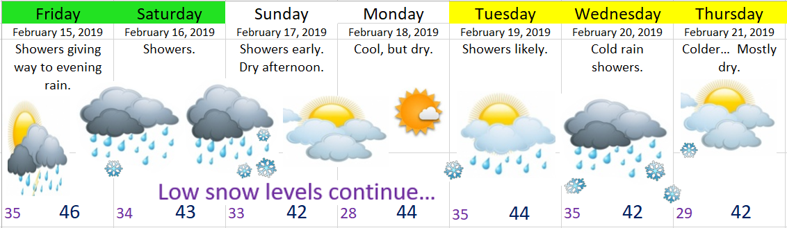
Details
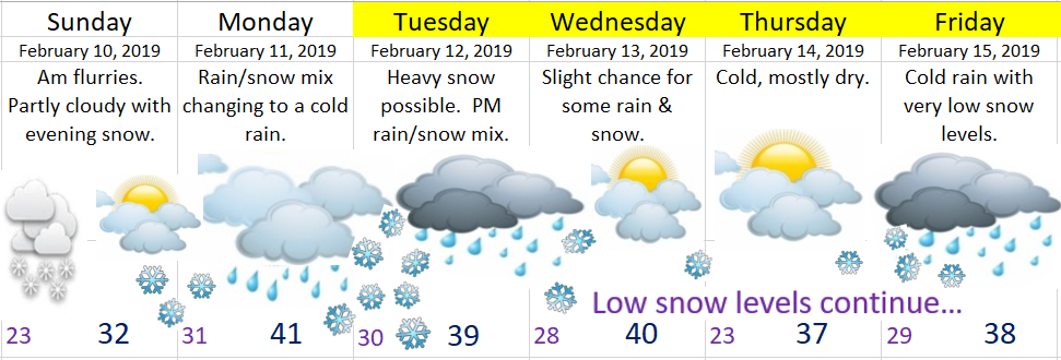
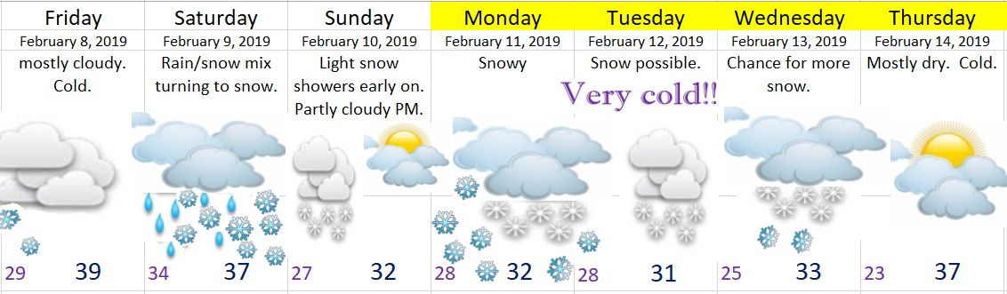
Saturday: Snow showers with temps holding really close to 33/34° which makes it super difficult to forecast snow totals. My best guess is a dusting to 3 inches. 4 to 5 inches above 500’. This is still not looking like a big snowstorm for us Salem people.
Sunday: We start off cold. Probably somewhere in the low to mid 20s before warming up close to freezing. Snow moves in Sunday night giving us another shot at a dusting to an inch or two before changing over to rain very early Monday morning.
Monday morning: Could end up being a fairly regular first half of the day with a cold rain or rain/snow mix. Snow levels around 1000’.
Monday afternoon – Tuesday: I’m watching for what could be a very snowy storm. In my last forecast I had this storm coming in on Monday. Well changes happen and expect many more changes to occur over the next day or two as we get closer to the event. The most recent changes have made the forecast much more complicated. The amount of moisture has increased since my last update which could give us more snow if it’s cold enough. There’s also a chance we get plain old rain or freezing rain for part of the storm. Either way we still look good for at least a couple of inches of snow during this timeframe.
Wednesday – Friday: More opportunities for snow as we stay in a very cold, but wet pattern.
Keep checking for the latest forecasts, and keep an eye on the WEATEHR ALERTS tab/page as that’s where I will post updates regarding any last minute “game changers.”
Summary
Sometime tonight we switch to snow. Everyone should get at least a dusting of snow and possibly up to 4 inches for the valley floor when all is said and by done Sunday morning. Our roads might start off slushy/snowy, but I’m guessing that for the most part our roads stay clear much of the day. As soon as the sun goes down Saturday evening everything will be freezing up quickly making travel anywhere Saturday evening treacherous.
Sunday: Cold, dry with late day/evening snow. A dusting to 2”.
Monday: Rain or a rain/snow mix turning back into snow Monday night. Another 1 – 3”.
Tuesday: Freezing rain, rain and snow all are possible. Basically a big mess. Should have a lot more actual details within a day or two.
My take away message: There is no sign of this cold weather pattern ending. I’ve been saying it and I will say it again, we are looking at a prolonged period of cold weather with numerous opportunities for snow. Buckle up, because it’s going to get crazy!!