
After a cooler than average June, we are turning up the heat quite a bit! No sign of rain returning either which means summer weather is here to stay for the time being. Details below.
Details
Today – Tuesday
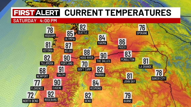
We just cracked 90° today. At 4pm this is what temperatures across the northwest looked like.
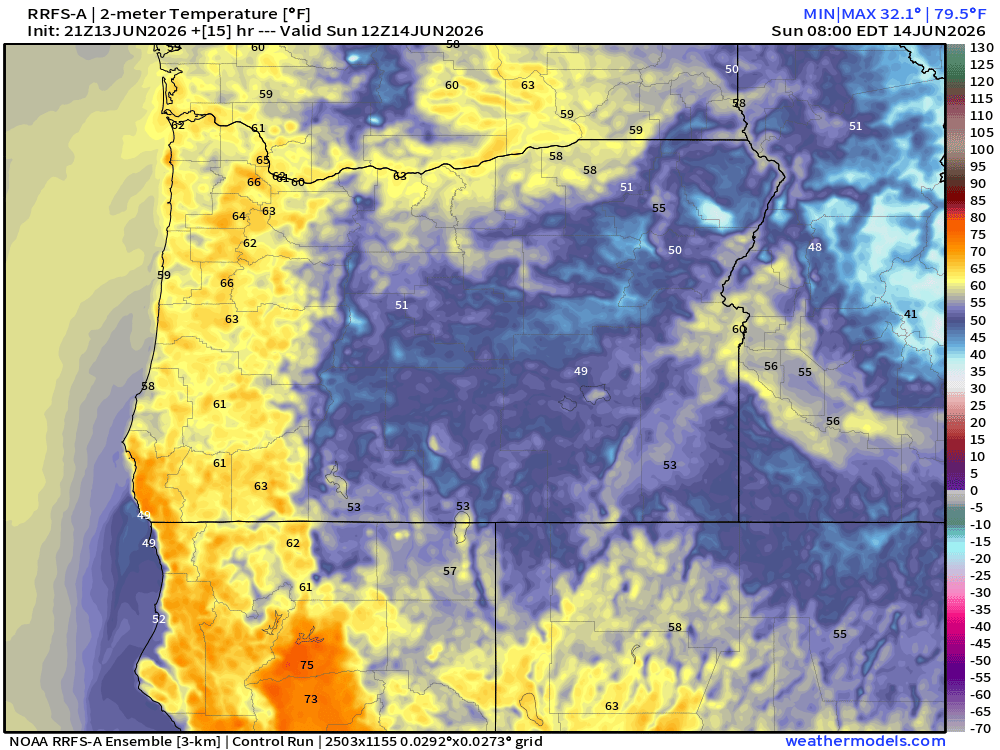
Hot, but we are already heading back down (very slowly). As of 5:30pm we are at 90. Winds have also been gusty (just shy of 30mph), and I expect similar conditions Sunday afternoon/evening too. Obviously this is not our typical cool summer breeze, but a hot offshore wind. These conditions are going to prevent temperatures from cooling off a lot tonight. Temperatures at 5am Sunday morning are expected to bottom out in the low 60s for much of the valley. Check it out:
The heat continues Sunday and Monday featuring highs in the upper 90s. Tuesday will be back down to near 90°. Our most uncomfortable low temperatures occur Monday morning with lows only in the mid 60s. Not very convenient for cooling the house down at night.
Wednesday – next Sunday
Excellent regular summertime weather with highs ranging from 80 to 85° depending on morning cloud cover. A very stable, warm, and dry period. No thunderstorms, no sprinkles, no rain. Warm/briefly hot afternoons, and decently cool nights again with lows back down well into the low to mid 50s. Very pleasant summer weather if you ask me! 🙂
Stay safe and cool!
