
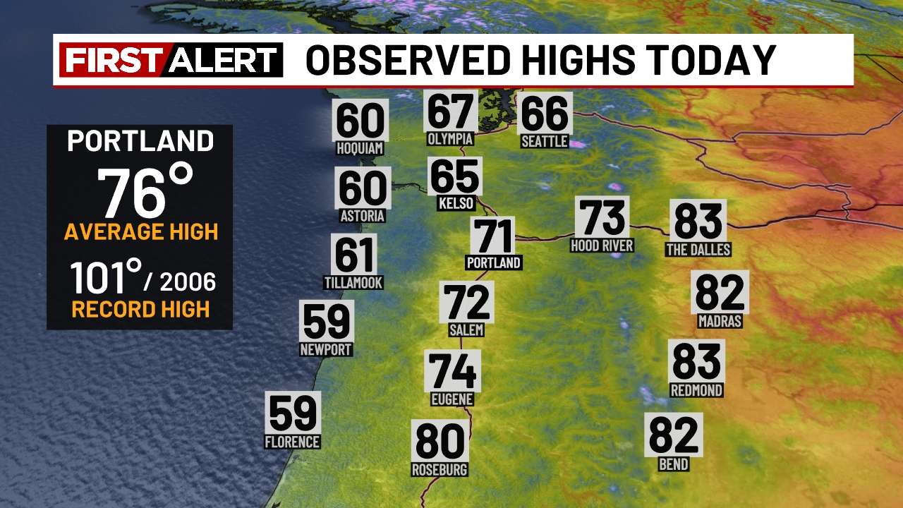
We’ve had a pretty warm/hot week with three days in a row topping 90, but today is much different! Our unofficial high temperatures for today look like this:
A much chillier day today as cloudy weather has set in. Even central Oregon was toned down a bit with highs only in the lower 80s. The cooler weather is here to stay for the next 8 or 9 days. Details below!
Details
Friday
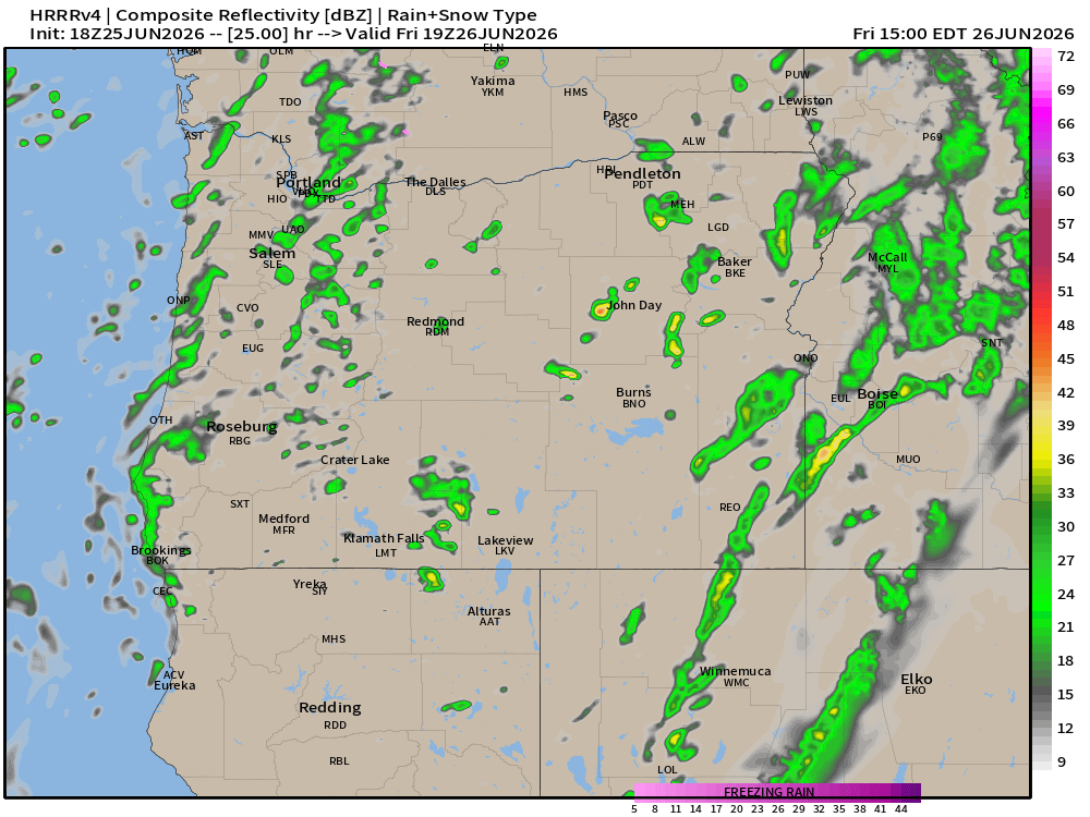
Mostly cloudy day with a few showers. Similar to today, but with a slightly higher chance of a shower. High of 65°. Estimated radar for noon Friday looks like this:
Saturday
Sunbreaks with showers. A few downpours, and even a brief thunderstorm are all likely at anytime Saturday. High of 66°. Keep in mind that while the sun may make an appearance at for a little while, it could change with showers possible right on through Saturday night.
Sunday
Mostly cloudy with slight chance for a shower, but the majority of this day will be dry. High of 67°.
Monday – Wednesday
Lots of clouds with afternoon sunbreaks. Mainly dry. Most areas will be dry, but with strong onshore flow at times, I cannot totally rule out a brief light shower. Highs in the low 70s.
Thursday and Friday
Showers return Thursday and could last through Friday. Highs back down to the mid and upper 60s.
Early look at the 4th of July!
Partly cloudy, cool (for summer time). Highs 70 – 73°. Currently looking dry.
Have an excellent rest of your week and enjoy the much cooler and wetter weather. Poor timing for weekend plans (I can attest to that), but it will be beneficial in many other ways.
