Time for another addition of “The Good, the Bad, & the Ugly!”
The Good, the bad & the Ugly!
I’m sitting here tonight happy that everyone got at least a little bit of snow (good). My forecast of 3 to 5 inches was too high (bad). Totals ended much closer to 1 to 3 inches. The higher hills in south Salem received 3 inches (good). Everyone else ended up closer to the 1 inch range (bad).
The Eugene and Springfield area received some very heavy snowfall with 8 to 14 inches for most locations south of roughly Junction City and Brownsville (good).
The temperature last night in Salem was a couple degrees warmer than I anticipated which resulted in a longer and slower than expected transition from rain/snow mix to all snow last night (bad).
It’s been a cold day. The sun never came out and we stayed in the 30s all day long (good). In fact our high temp today was 38° recorded just after midnight before the rain, snow, and colder air moved in. Our “daytime high” temp was only 36°.
It wasn’t a huge storm or even close to it for the immediate Salem area, but as you can see we were not far from receiving much higher totals had the snow band stalled just a little closer to us. See how a little distance can make a huge difference??
All things considered I feel good about how the forecast turned out. A little bummed it ended up being another mediocre snow event here in Salem as we yet again managed to avoid the heavier snow, but I’ll take 1 – 3 inches over nothing almost any day. 🙂 😉
Here’s some pics from around the region to help give an idea of the different conditions experienced. This first set is from the hills of south Salem.


This pic comes from the hills of Eugene courtesy of Micah Sardell where 16 inches fell!!
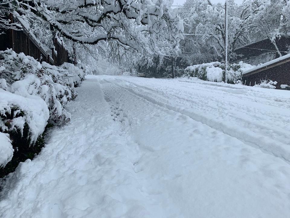
And last, but not least, from my own backyard 😉


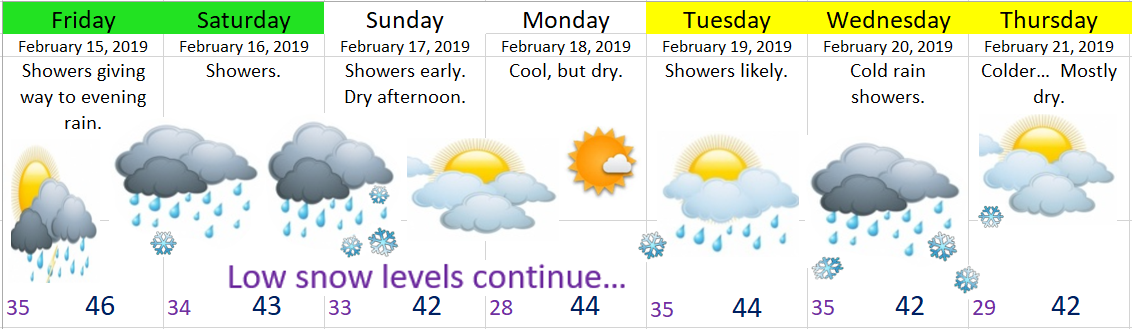
A look ahead, and sorry, but no super fancy graphic tonight 😉
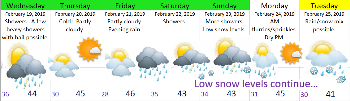
Tonight: Cold & dry. A very chilly night with lows getting into the mid to low 20s. Icy roads likely in spots.
Tuesday: Very cold start, but should stay dry. Highs in the upper 30s.
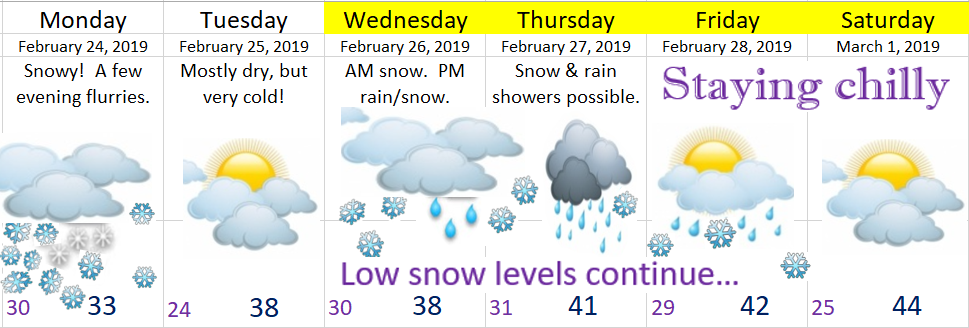
Wednesday: Light snow during the morning hours transitioning to flurries or even some sprinkles during the afternoon. For now I’m leaning towards just a dusting to an inch tops. I expect no real travel issues Wednesday unless this storm ends up being stronger than current forecasts are predicting.
Thursday & Friday: The threat for snow & rain showers continues with highs in the upper 30s to low 40s and lows generally between 29 and 32°.
Saturday – Monday: Lots of sunshine, very cold mornings, and dry. Lows 22 – 26°, and highs 44 – 50°.
Will be watching late Tuesday night through Friday for any changes, but as of right now I’m not seeing any major snow events during this time frame.
The Cascades and Beyond
Up in the mountains, and basically everywhere east of the Cascades it’s been ridiculously snowy, and with more snow on the way I don’t expect easy travel condions in those parts anytime soon.