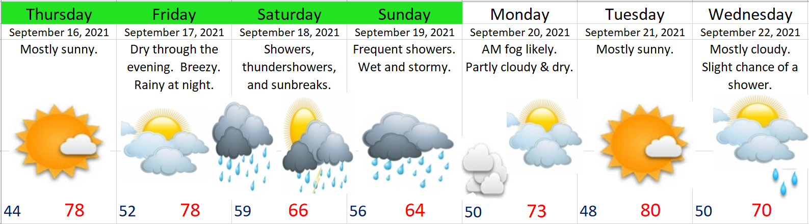
By every definition of the word today is going to be a very stormy day.
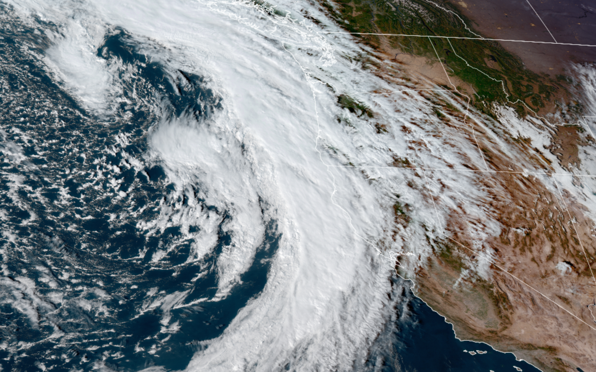
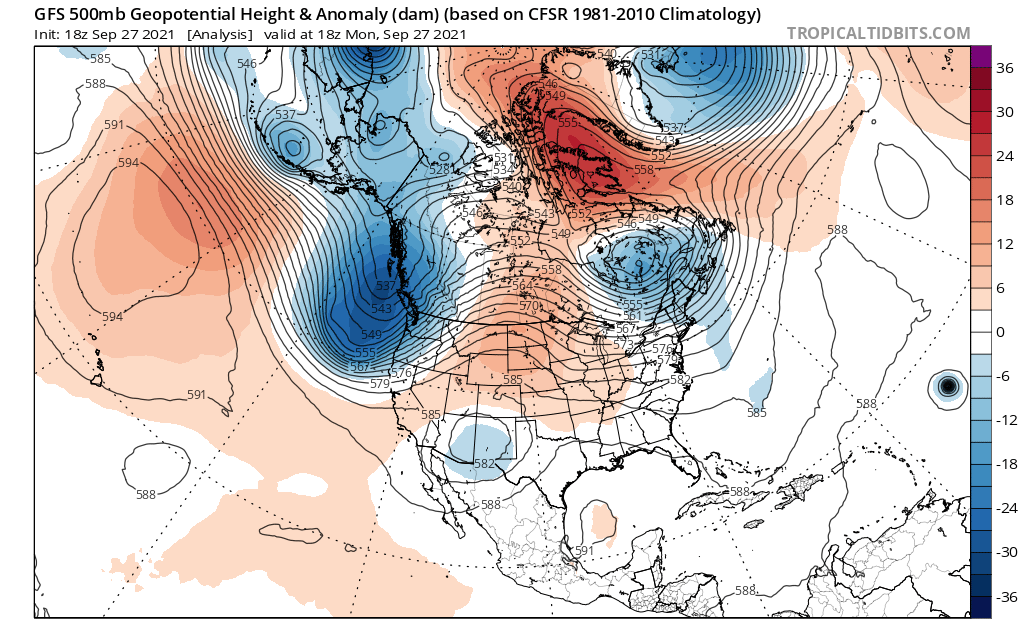
By the way, you may have heard by now about our “bomb” cyclone/storm offshore. I can tell you that yes, this is one of the strongest storms on record this close to our coastline; however, it’s 100s of miles away and the winds from it will be nothing more than what we see with a typical wintertime storm. With that said, we still have a lot of very stormy weather on tap for today.
Highlights
1.) Winds will gust 30 to 40mph today and tonight which is still enough to cause a few scattered power outages.
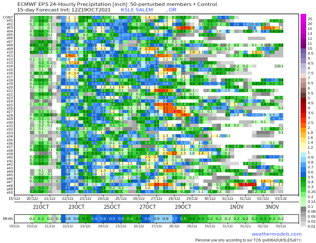
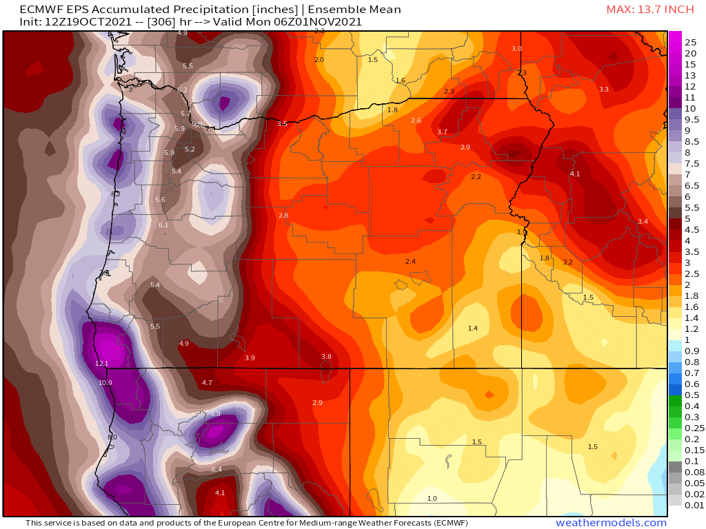
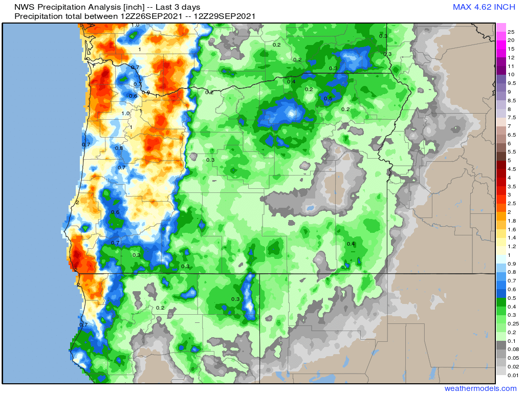
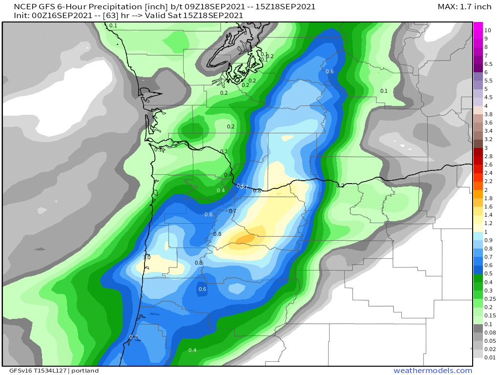
2.) Showers have the potential to be very heavy with this storm. I expect some neighborhoods will see ponding on roads and maybe some spots of brief localized flooding especially where drains are clogged. Some low laying areas could be at risk if a heavy shower stalls overhead. This type of weather pattern is conducive to showers stalling over the same locations leading to heavy rainfall totals in localized spots.
3.) The coast will see some massive waves today. Waves up to 40 some feet are possible through tonight.
4.) The coast is also at risk of seeing some weak funnel clouds and or tornados. Not trying to frighten anyone, and if any do form they will likely be the typical weak NW variety. Regardless, even a weak tornado can still cause damage.
5.) Anyone could hear thunder as the atmosphere is very unstable today.
Monday will be similar as this storm system takes its time moving across the region.
Stay safe and enjoy the stormy fall weather.