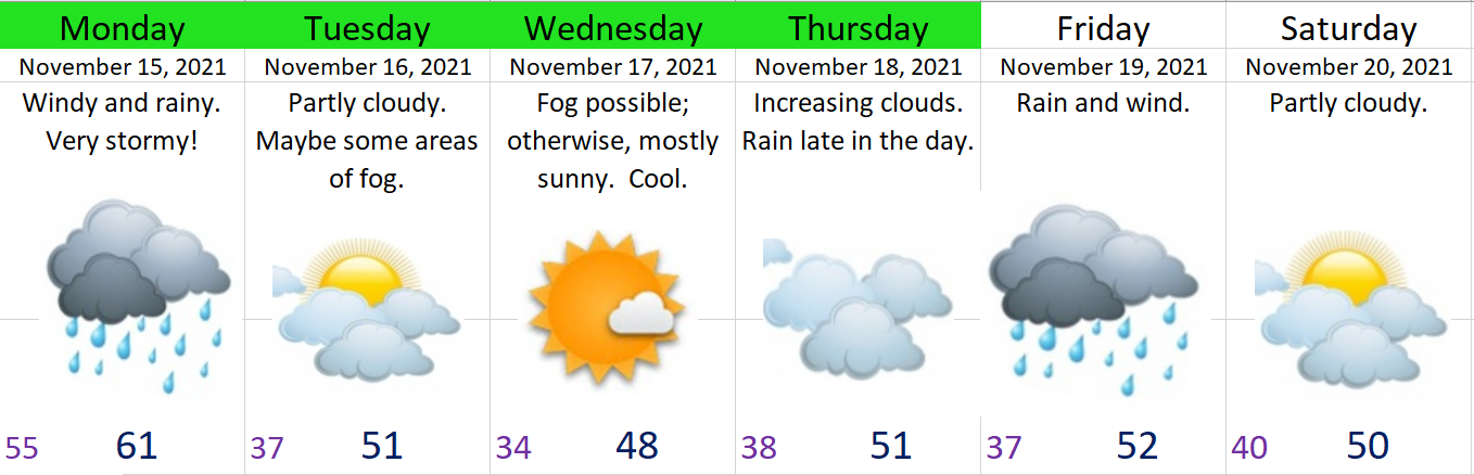
Okay, it’s crunch time. Here’s my latest thoughts.
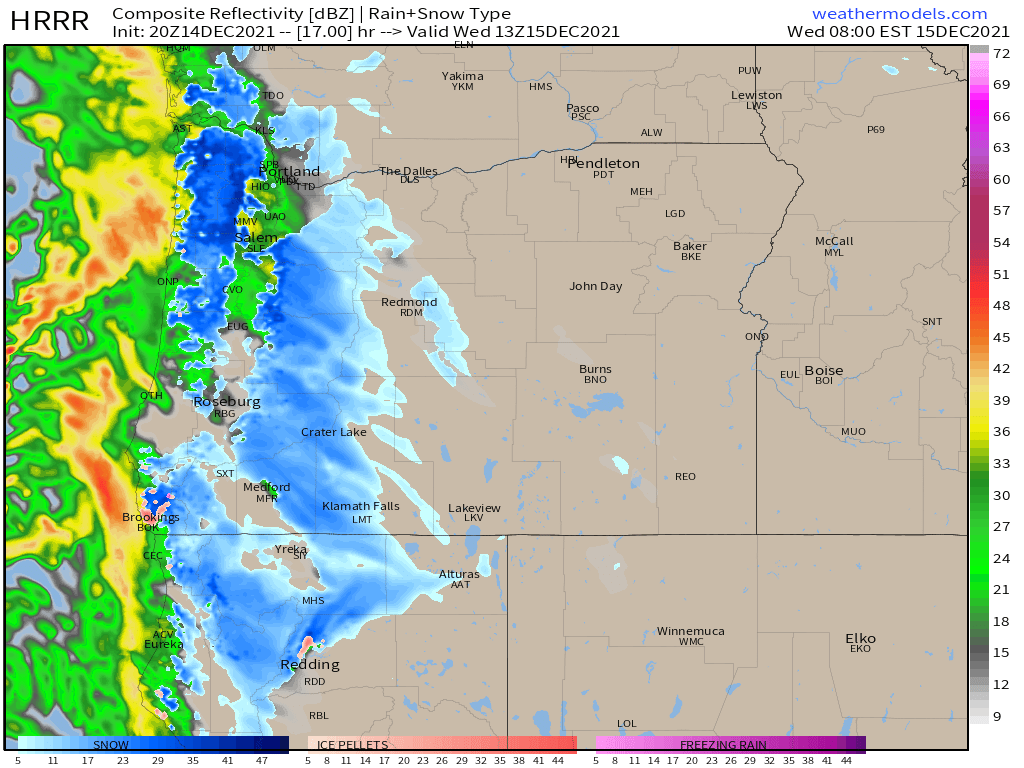
This radar image for 6AM Wednesday morning shows just how close we will be to seeing snow here in Salem. This image shows sticking/accumulating snow is more likely to occur in the western parts of the Willamette Valley and locations higher up in elevation. Remember you can click on the image to get a closer look. 🙂
Main Points
I don’t expect any significant accumulations right here in Salem.
Any and all snowfall should take place primarily between 4 and 11AM. Everyone here in the valley should see at least a rain/snow mix if not all snow for a period of time before we warm up and eventually change over to rain.
Accumulating snow will likely be confined to the western Willamette Valley and elevations above roughly 500′. South and west Salem, Amity, as well as in Independence, Dallas, Newberg, and McMinnville all stand a better chance at seeing sticking snow tomorrow morning for a short period of time.
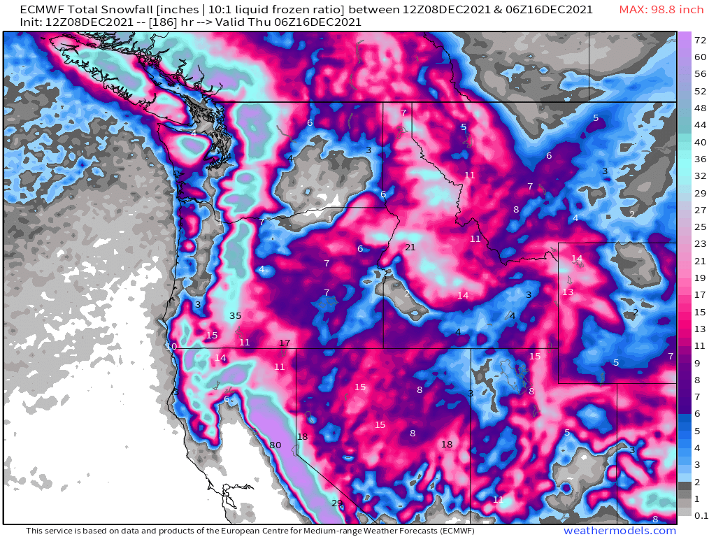
This will be a decent snow event for locations up in the Coast Range with 1 to 4 inches expected in those passes.
Snow could stick across all of Salem the way it did last January for a few hours, but let me emphasize again this is not the likely outcome.
Snow or no snow at all this event will be over by evening time Wednesday. Regular showers will resume Wed night and Thursday.
Drive safely out there and have a great Wednesday!!