May 2020 is over and it ended up wetter than average, and despite the extra rain, Salem was still 1.6°F warmer than average for the month. I graphed out the total May rainfall for each year going back to 1997. The dark blue bars are years when May ended with above normal precipitation, so by process of elimination you should know what the yellow bars mean. 😉
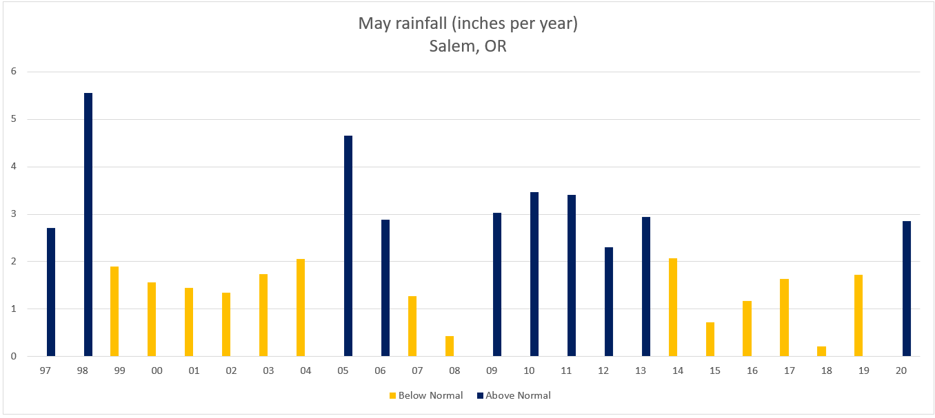
One could say that Salem was “overdue” for a wetter than average May considering our last wetter than normal May occurred back in 2013.
Look ahead
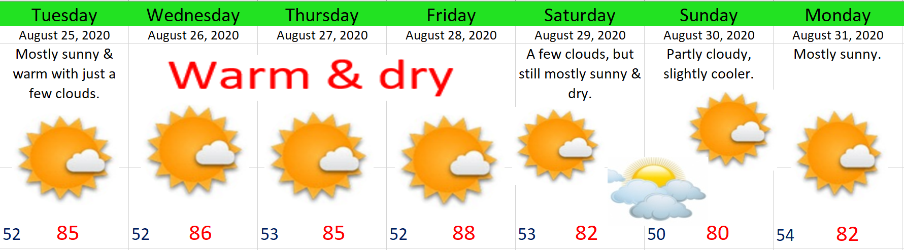
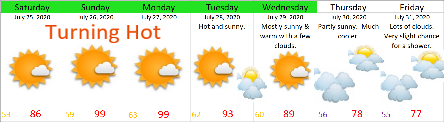
Unfortunately, I have bad news for those of us who prefer/enjoy sunny weather this time of year. Keep in mind this week will still be mostly dry; however, it won’t be all that warm. Nicest days this week will be Wed & Thu.
Details
Mon: Basically dry with lots of clouds around. Slight chance of a sprinkle/quick shower. Highs in the mid – upper 60s.
Tue: Gray and wet – especially during the afternoon. Highs around 65°.
Wed: Partly cloudy with highs in the mid 70s. Very slight chance for a shower.
Thu: Partly cloudy. Highs around 77°.
Fri & Sat: Showers return along with cooler temps. Highs 63 – 67°.
Peace out and have a good week!