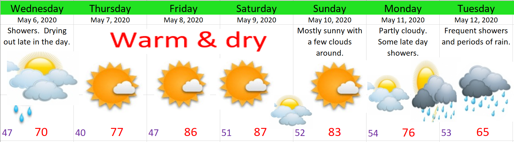
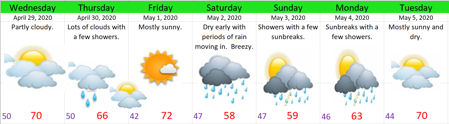
We have one more day of showery weather to get through before switching to a much warmer summer time pattern. I’ve got the next 7 days mapped out for you right here.

Wed: One final day of showers. We should also dry out fairly quickly during the late afternoon leading to a dry or mostly dry evening.
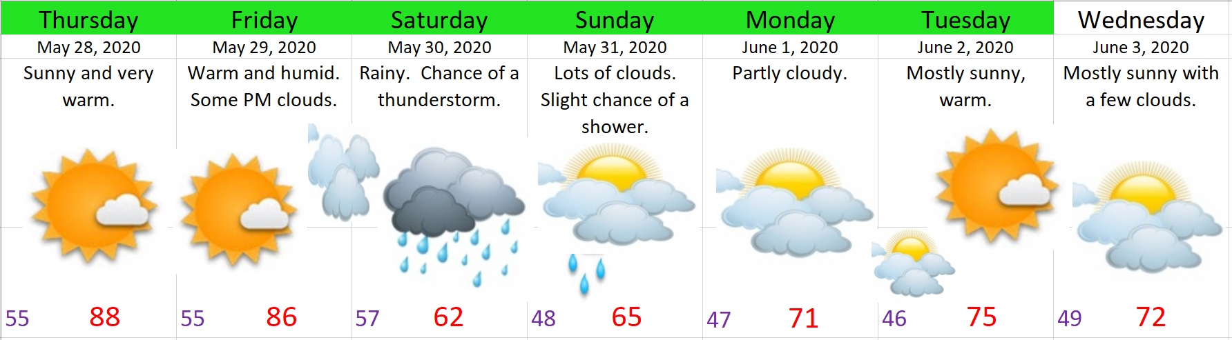
Thu – Sun: Very warm weather with Fri & Sat being the hottest days. If everything lines up right or wrong (depending on how you feel about hot weather) we could reach 90° one of those days.
Mon: I’m watching for what could be a much better opportunity for thunderstorms Monday evening. Better at least than the chances we had this past weekend. Thunderstorms or not, Monday evening looks wet as showers return to the area.
Tue: Wet with plenty of showers and cooler temperatures.
And just for fun…
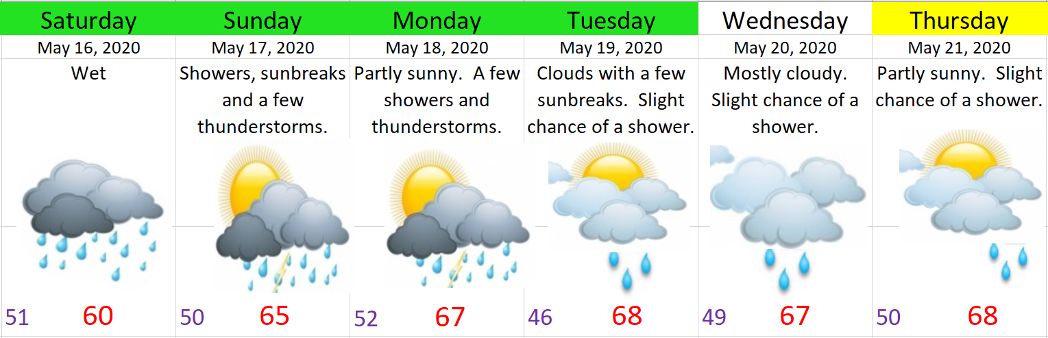
A quick recap of the storms from this past weekend. We may have not received any thunder or lightning, but we got a healthy amount of rainfall. Rainfall totals ranged from around half an inch to one and a half inches depending on location. This was the most rain we have seen on back to back days since March.
With the exception of January every month since September has featured below normal precipitation. As much as we like the sun, a wetter than average May would be both beneficial in preventing an early start to fire season as well as it would ease drought concerns. With the rain we received over the weekend and with forecasts showing a return to wetter weather next week I’m thinking May could end up above normal.