
A short, but important update. Wet weather is looking more likely Tuesday – Saturday of this coming week. Not total washouts like we saw today, but a chance for showers will be with us every single day – a change from my previous update. Showers with a few sunbreaks are still on for Monday. That part hasn’t changed.
Details
The key word for this coming week is “showers.” I see no large bands of rain, no atmospheric rivers, no big fronts. Just waves of scattered showers. These showers will be possible at any point during the day and night; however, afternoon heating will enhance the showers .
What will each day look like?
Expect occasional downpours of rain and even some small hail too. Showers could also produce brief rounds of gusty winds. Each day will also have plenty of breaks between showers with the breaks outnumbering the showers. Some of these breaks could be fairly sunny as well! Highs 52 – 58°. Lows 40 – 44°.
Cascades
Cool temperatures coupled with precip means snow for the Cascades. This will be the first widespread snowfall of the season above 4500′. The snowfall map below takes us through early Saturday morning. It shows 6 to 12 inches for the Cascade peaks, and probably 3 to 6 inches around pass level.
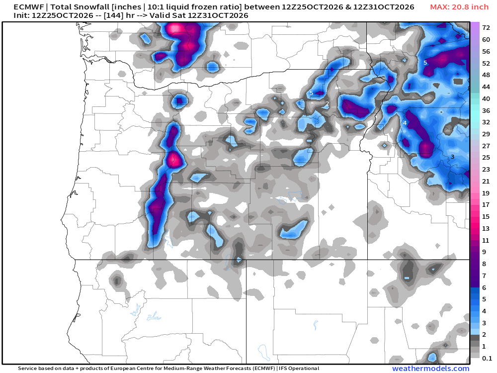
After the disastrous snow season last year, this will hopefully be the first of many, many mountain snowfalls. Regardless, it’s nice to see.
The good news is that the weekend is looking drier. Saturday could have a few showers/brief downpours still hanging around, but lots of dry breaks in between. Sunday should be totally dry.
Have an excellent week and remember to do all things as if doing them for the Lord. 🙂

