Highlights
Time for a short update. I’m noticing a wide range of forecasts calling for anything from totally dry to soaking wet this Sunday and Monday. Your favorite weatherman is here to clear things up haha! It’s going to rain Sunday and showers will persist through Monday evening. There. Pretty straight forward.
Between now and then, we have two chilly mornings with frost likely. Our first official freeze of the year could be on tap. Highs each afternoon (Friday and Saturday) will reach the mid 60s with partly cloudy skies.
The forecast
Sunday
A cold front will move in from the northwest bringing a period of steady rain during the afternoon and early evening hours. Could be a soaker too! The image below shows what things could look like around 11am/noon Sunday.
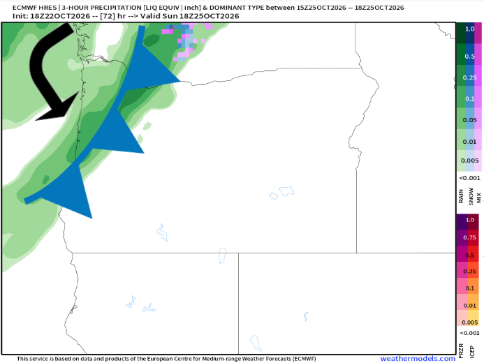
Notice the nice solid band of precip moving inland with the cold front. Sunday morning could very likely be dry, but rain will be here by about lunchtime and will last through the evening.
Monday
Showers with maybe a few sunbreaks. Chilly too. High of 58°. You can see lots of green over western Oregon representing rain on this next map valid for 5pm Monday.
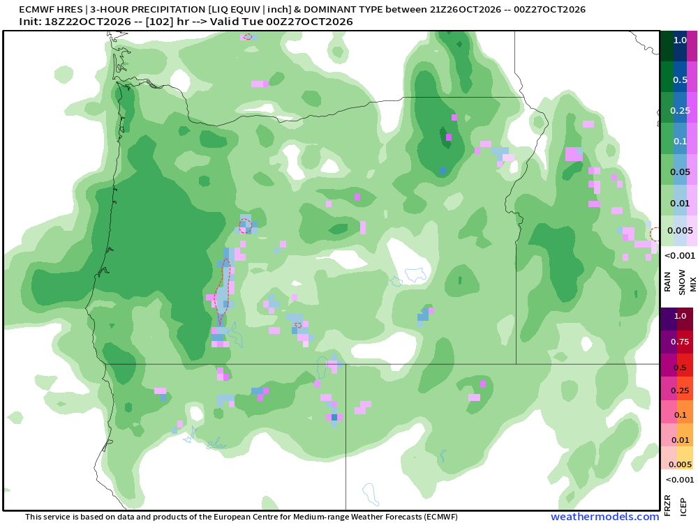
Over these two days I’m expecting around an inch of rain or more. That’s a lot, especially after our extremely dry October. I will add that while it could be breezy, this is not a windstorm type pattern. No strong winds expected with this storm. The biggest concerns or impacts will be localized street flooding due to the clogged drains coupling with heavier downpours.
Tuesday – Friday
The majority of these days will be dry. No big storms. Maybe some rain returning on Friday (the 30th). Lots of upper 30s in the mornings and low to mid 60s in the afternoons.
That’s all for now. Short post on a busy work night.
Take care and stay safe!

