
Highlights
We have a few days of wetter weather, lots of clouds, and then a return of much cooler weather next week. The weekend should be mostly, if not totally dry, but with plenty of clouds around. No early season tans just yet lol…
Details
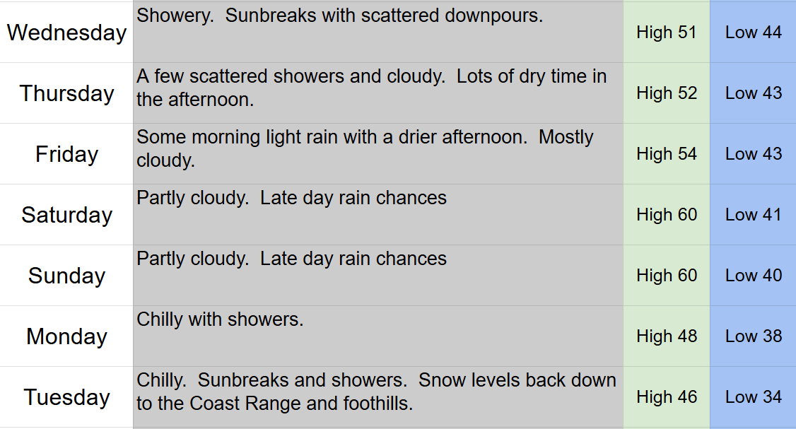
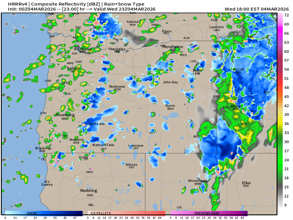
Wednesday details
This estimated radar image depicts my thoughts pretty well. Scattered showers roaming around Wednesday afternoon with sunbreaks in between and plenty of mountain snow. This is for 3pm tomorrow. Remember, don’t focus on exact details, but look at the overall idea. 🙂
Cascades
Snowy roads most of the day Wednesday through Thursday morning. Thursday afternoon through Friday morning will be better with spots of slush, and Friday afternoon through Sunday should feature bare and or wet roads. 6 to 12 inches of new snow through Thursday night with most of that falling tonight and Wednesday. Hoodoo is down to 18 inches, but I’m pretty hopeful this will be enough to keep them open through the coming weekend.
Short and sweet tonight. Have a great rest of your week and stay safe out there! 🙂
