
Today was a little bit of a surprise, but in a good way I suppose. There was very little rain during the daylight hours, and many more sunbreaks than I anticipated (I can admit when I’m wrong). The rain last night and early this morning however did not disappoint. Salem up to Portland generally had around 0.3″ of rain or more – a decent summer soaking.
Main headline
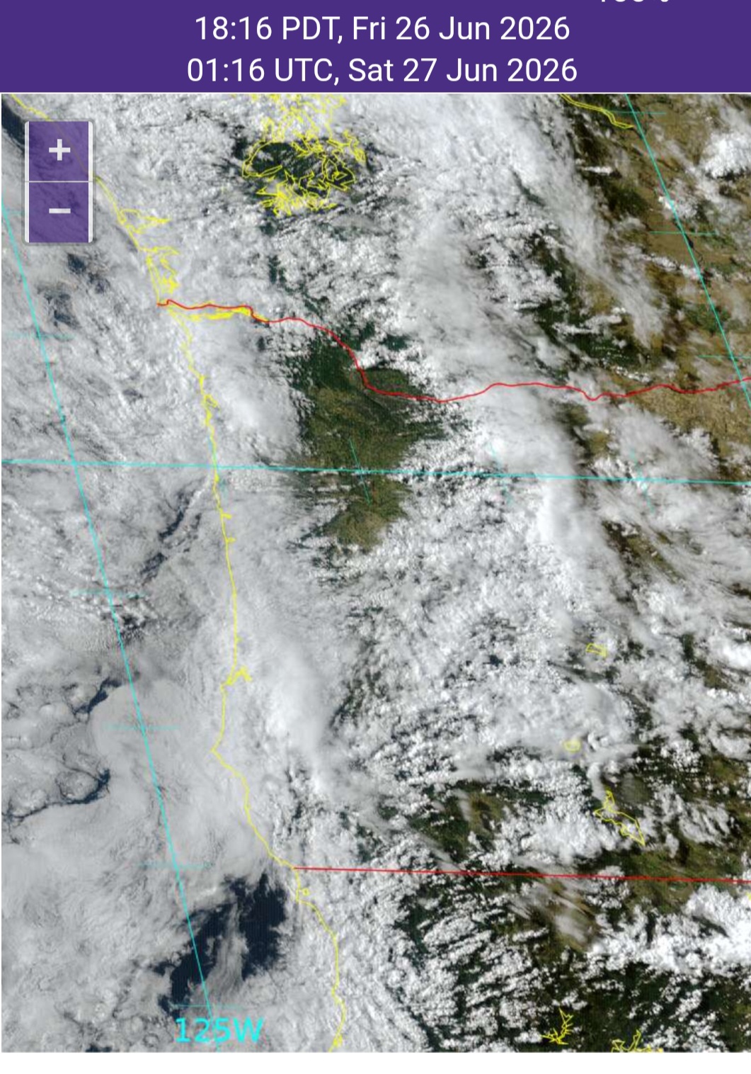
The drier day today was well within the realm of possibility when I was looking at the models and maps yesterday, but I didn’t think it would be this dry. Check out this satellite image from a little after 6pm this evening. Turns out this mostly sunny weather was limited to an area from Corvallis and Albany north through Portland and Vancouver. Everyone else west of the Cascades was cloudy most of the day.
We got lucky today, but don’t count on it for Saturday. Saturday will almost certainly be much wetter with showers, downpours, and some thundershowers even. Yes, brief lightning and thunderstorms are possible during the day tomorrow. On and off showers last at time through the late evening hours.
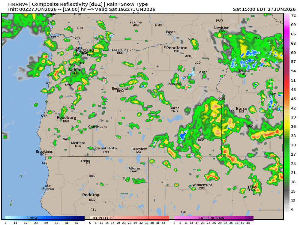
This image for noon on Saturday shows much stronger and more widespread showers than what this model depicted for today. Another reason (among several) as to why I believe Saturday will be wetter and stormier.
Sunday and next week
A few light showers Sunday and maybe even Monday with highs in the mid 60s.
Tue & Wed will be partly cloudy and dry. Highs in the low 70s.
Thursday and Friday: Showers return. Not an all day washout, but wet at times for most locations west of the Cascade crest with occasional showers. Highs back into the mid or upper 60s.
Independence Day (July 4th)
Still looking dry with highs in the low to mid 70s.
Have a great and safe weekend!!
