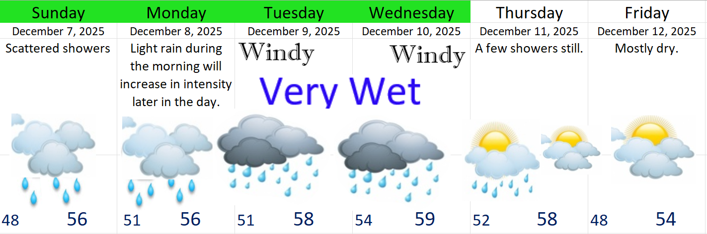
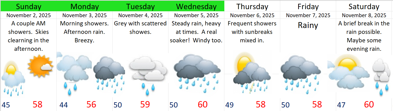
It’s been far too long since you received a good weather update from your local weatherman, and I’ve missed it. Time to get back into the swing of things. We have two very wet and stormy days ahead followed by several more dry days.
Quick highlights
- Wednesday: Rainy, windy at times, and chilly! Mountain snow in the Cascade passes too. Thursday will be more showery with increasing sunbreaks during the later afternoon, and showers ending Thursday evening.
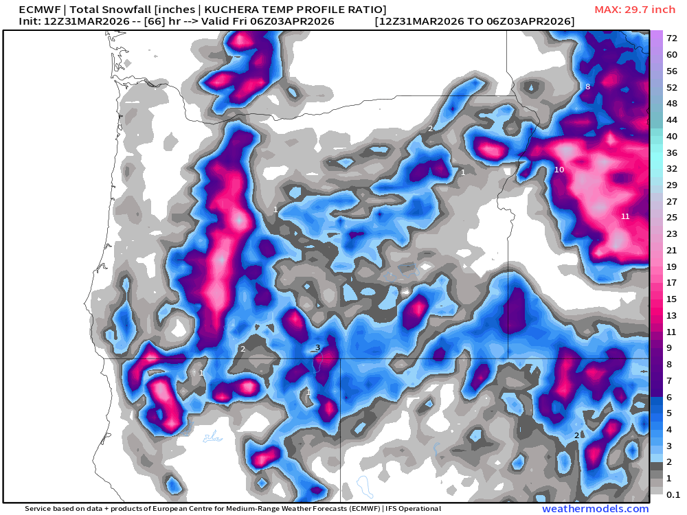
- Cascades will be snowy later tonight through Friday morning.
Details
WED & THU: It will feel like winter for a couple of days, but any long time resident will tell you that brief periods of chilly, wet weather are common in spring here in western Oregon. I’ve attached a series of maps to walk us through what the next couple of days will look like beginning Wednesday morning.
Wednesday morning
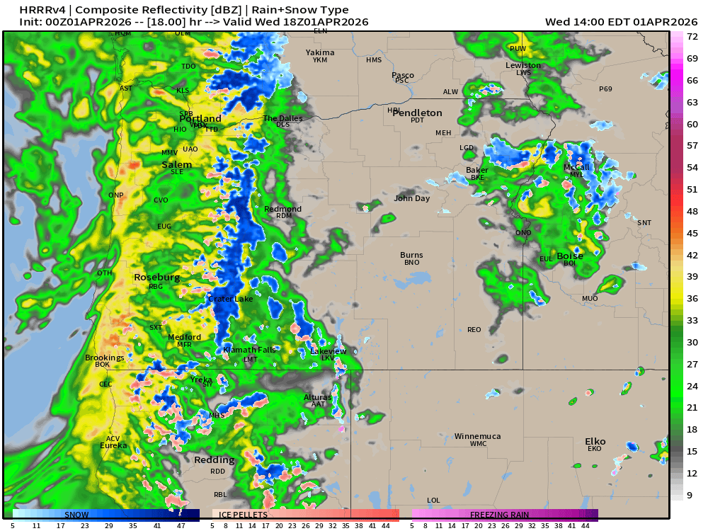
West of the Cascades will be wet with steady rain, windy at times with gusts 30 to 35mph, and chilly. Temperatures in the mid to upper 40s. This map is for about 11AM.
Wednesday afternoon and evening (2PM – midnight)
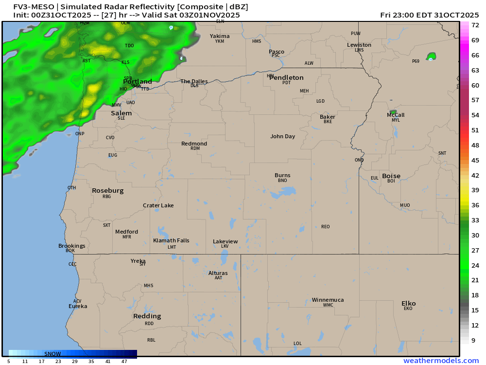
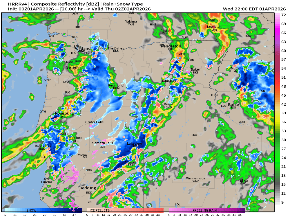
Showery with occasional sunbreaks, and heavy downpours of rain and small hail. Thunder and lightning are possible with these showers. Every indication I look at tells me there will be some vigorous showers/storms tomorrow afternoon through Wednesday night. This radar image below is for 7pm. Don’t fixate too much on exact details. Focus instead on the big picture showing heavy showers scattered around the region. I also see a lot of snow (the blue coloring) in the Cascades. It will be a snowy 48 hours across all Oregon Cascade passes WED and THU.
Thursday (through 7pm)
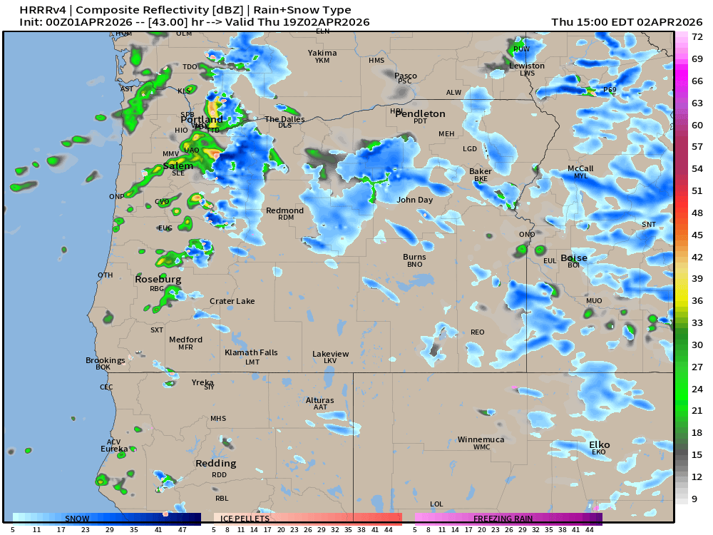
Fewer showers, and an increasing amount of sunbreaks might make it feel not too bad at times. Highs in the mid 50s, but showers will still be around, and some of them could still be quite heavy. Just not nearly as widespread or prominent as what we will probably see on Wednesday. This estimated radar image for noon Thursday indicates just that. Notice the larger gaps between showers here.
Friday
Then we dry out! Friday morning could very likely start out below freezing for most of us. Lows 30 to 35 depending on your location, and we will only warm to the upper 50s.
Mountain snowfall totals look something like this. A good 10 to almost 20 inches in the OR Cascades from Hood all the way down to Shasta! Plan on snowy passes through Friday morning.
Easter weekend
Looks amazing! Upper 60s on Saturday, and maybe low 70s Sunday and again on Monday! Perfect timing for weekend plans! 🙂
Next week
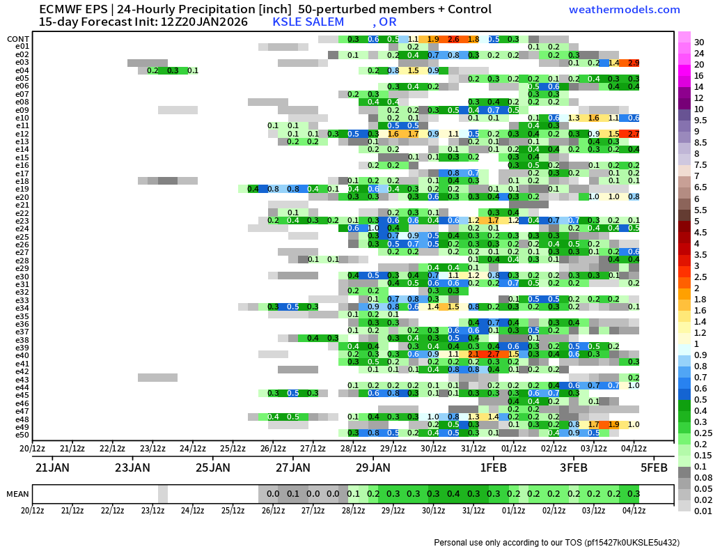
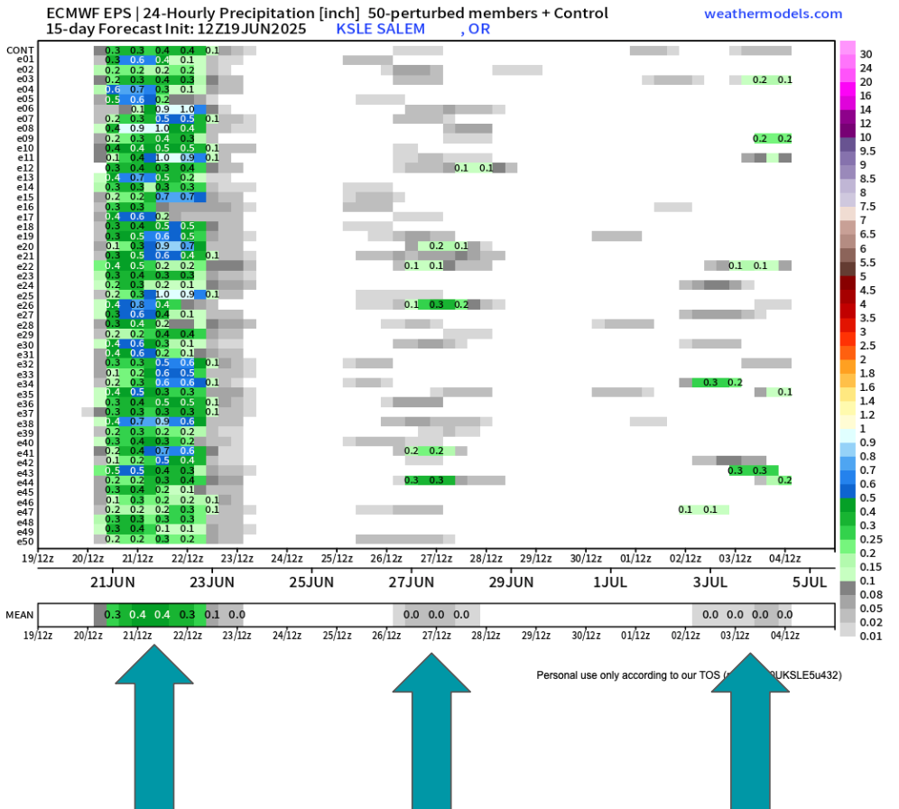
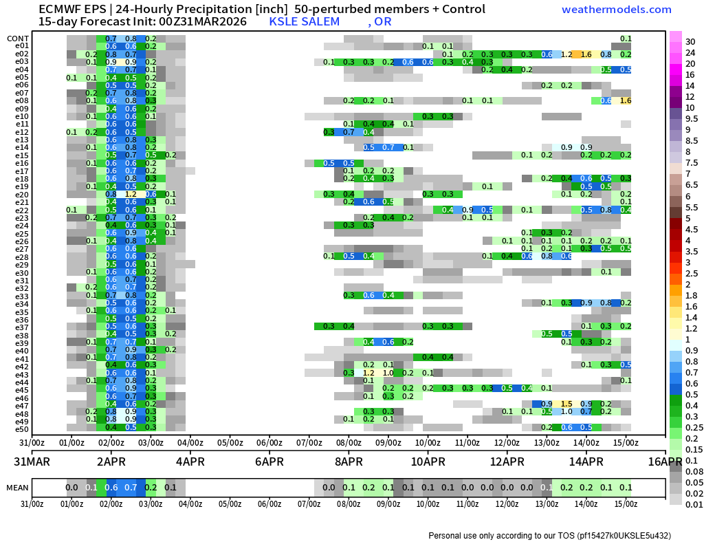
This last chart shows 24 hour precip totals for Salem over the next two weeks. Seems like rain and showers return briefly the middle of next week (probably Wednesday and Thursday again) before drying out (hopefully) for the following weekend (11th and 12th). Good timing huh? 🙂
Take care and have a great, and safe rest of your week!!