Hotter times are coming

Another stretch of above average temps will arrive tomorrow and will last through Wednesday of next week.

7.24.20

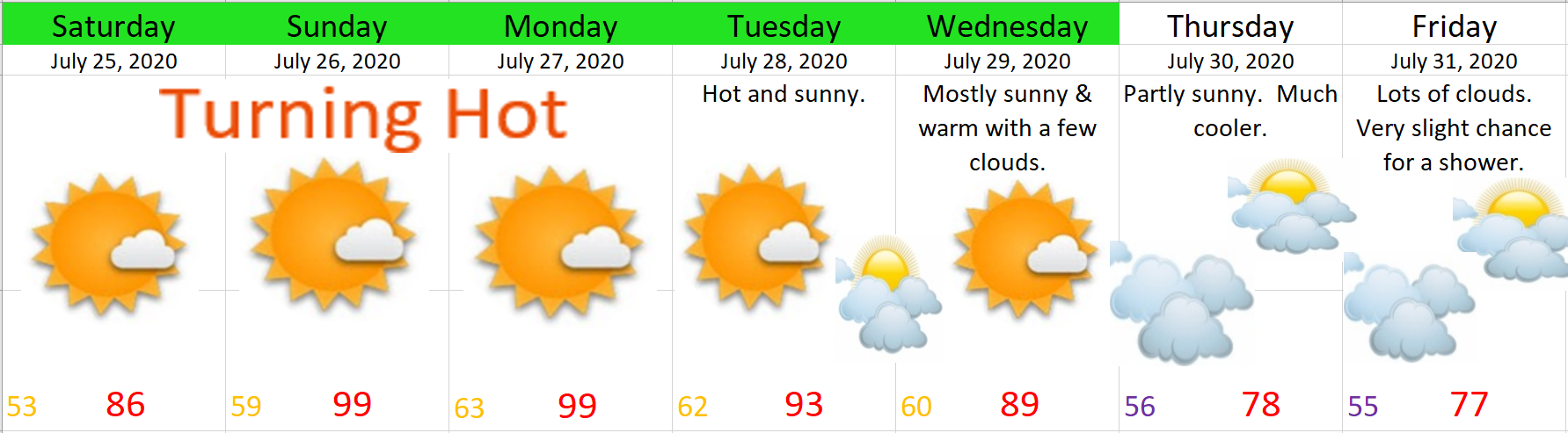
As you can see, plenty of hot weather, and aside from a very slight chance for a shower or two on Thu & Fri, no decent shot at rain in sight, and if we look even further out it appears as though August will start off on the warm and sunny side.

The Cascades and Central Oregon

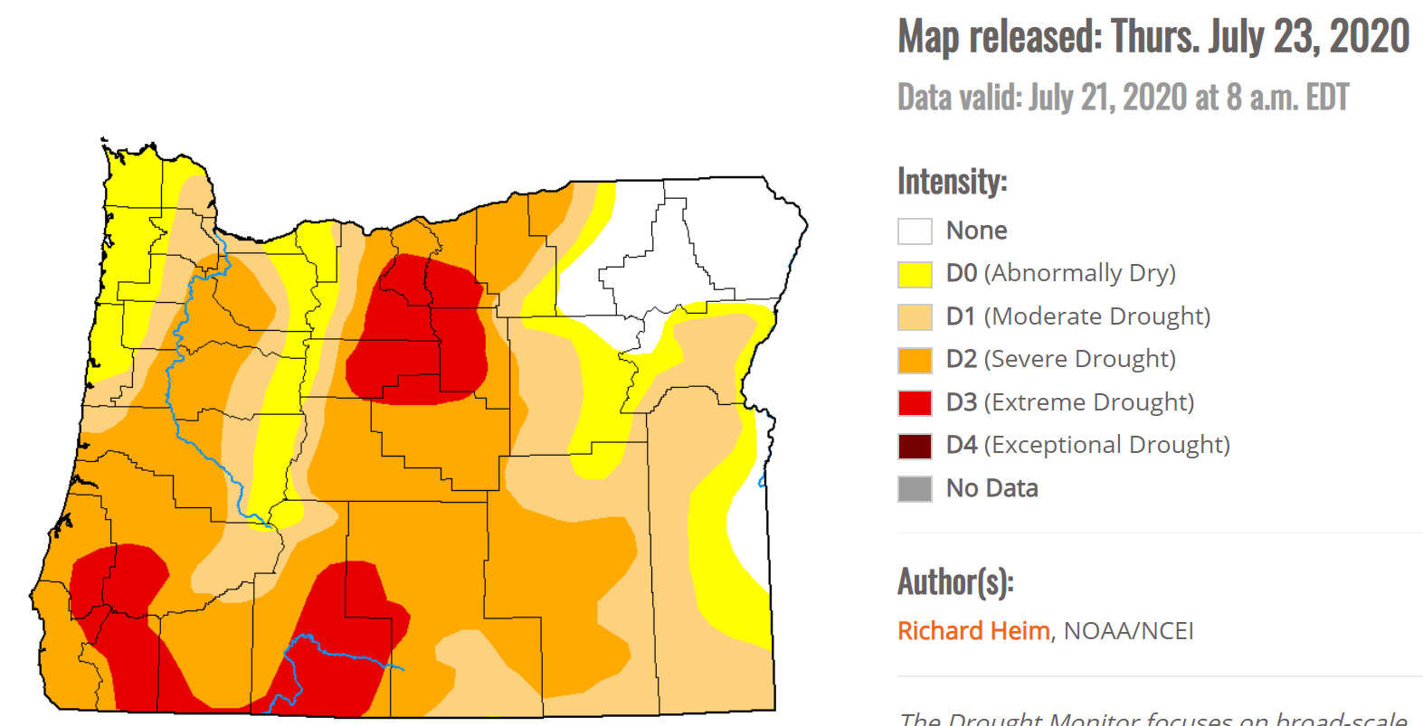
Thunderstorms are possible in the Cascades Mon – Wed with the threat extending into Central Oregon Tue & Wed.  This could spell bad news for wildfires as we have been dry now for awhile.  Here’s a look at our current drought status.  Most of the state is running below normal in regards to precipitation.

OR drought 7.24.20

Central Oregon Coast

The forecast for the coast in summer can be so dang tricky, but I figured I ought to give it shot just in case any of you are fortunate enough to make it over there.  😉  Sunday should be the warmest day along the beaches with close to full sunshine, but it will likely be fairly breezy.  Mon and Tuesday will likely be much cloudier and consequently a bit cooler, but not quite as windy.  Slight chance for some light rain showers Thursday and Friday along with even cooler temps.

There you have it!

ENJOY!!!

Nothing but sunshine!

I have great news for you warm weather lovers, that is people who love warm weather, not to be confused with people who “love” in warm weather 😉 lol….

The news is we have plenty of 80+ degree weather ahead (maybe even some 90s) and no sign of rain.  A very typical warm weather pattern for July.

Enjoy this nice weather.

Stay safe and stay healthy!!

The good news

By summer standards today is rather chilly despite occasional sunbreaks.  Looking ahead I see no sign of an extended period of wet weather.  A few highlights for you all.

1.)  The rest of today will feature a very slight chance for a shower, but overall a mainly dry afternoon and evening.

2.)  Tuesday will be the only other “wet” day in the foreseeable future, and even then it’s not looking like a washout by any means.  Only a few showers the first half of the day before drying out.

3.)  Wednesday kicks off a stretch of dry weather with lots of upper 70s and low 80s for the rest of the week through next weekend.  No heatwaves in sight, but also no more days and days of showers like we had through much of May and the first half of June.

There you have it!  Nothing worth getting excited or worked up about.  Just some plain ol’ dry and mild summer weather with the sole exception of this coming Tuesday.  Should anything “exciting” pop up you can be sure your number one weather guy will let you know all about it!  🙂   😉


Take care and stay safe!

May 2020 and look ahead

May 2020 is over and it ended up wetter than average, and despite the extra rain, Salem was still 1.6°F warmer than average for the month.  I graphed out the total May rainfall for each year going back to 1997.  The dark blue bars are years when May ended with above normal precipitation, so by process of elimination you should know what the yellow bars mean.  😉

May Salem rainfall graph

One could say that Salem was “overdue” for a wetter than average May considering our last wetter than normal May occurred back in 2013.

Look ahead

Unfortunately, I have bad news for those of us who prefer/enjoy sunny weather this time of year.  Keep in mind this week will still be mostly dry; however, it won’t be all that warm.  Nicest days this week will be Wed & Thu. 

Details 

Mon:  Basically dry with lots of clouds around.  Slight chance of a sprinkle/quick shower.  Highs in the mid – upper 60s.

Tue:  Gray and wet – especially during the afternoon.  Highs around 65°.

Wed:  Partly cloudy with highs in the mid 70s.  Very slight chance for a shower.

Thu:  Partly cloudy.  Highs around 77°.

Fri & Sat:  Showers return along with cooler temps.  Highs 63 – 67°.

Peace out and have a good week!

Stormy 24 hours

The next 24 hours have the potential to be very stormy.  Here’s the quick scoop for you.

Tonight – (roughly) noon Saturday:  A chance for some scattered thunderstorms.  Anyone in the valley could see a good light show during this timeframe.

Sat early afternoon through early Sunday morning:  Wet.  Probably no more thunderstorms at this point, but plenty of rain.

Enjoy your weekend, and stay safe!

May 27th Forecast

A quick forecast this fine evening.

Extended Forecast

5.27.20

Details

  • Both Thursday and Friday will be very warm and dry.  Only difference is Friday will feel more humid and will also feature some afternoon clouds.


  • Slight chance of a thunderstorm very late Friday night into Saturday.  Thunder or no thunder, Saturday is going to be a very wet day.  Plan on rain and frequent showers the whole day.


  • Good news is the Saturday storm will be a one hit wonder.  Sunday through next Wednesday will stay mild and dry.  Only exception is a very slight chance of a shower Sunday; otherwise this time frame looks nice & dry.

There you have it!  Take care and enjoy the sunshine!

Thunderstorm chances increasing

As expected the sunbreaks today are destabilizing the atmosphere enough that we are seeing some hefty showers and thunderstorms forming around the region.  No guarantees we see a storm as they will be scattered in nature, but our chances are definitely much higher than usual.

I have a couple of links to help you keep track of the storms today.  This first link tracks lightning strikes:

https://www.lightningmaps.org/?lang=en#m=oss;t=3;s=0;o=0;b=2.31;ts=0;z=6;y=40.2236;x=-116.0707;d=2;dl=2;dc=0;tr=0;

This second link is to the radar which updates every ten minutes.  Click on the map for a closer look.

Tomorrow should be a near repeat of today with the only difference being a few more sunbreaks, but still a chance for showers and storms.

Have a fantastic Sunday and be safe!