It’s been several days since I last posted. Work, school, and life keep me busy, plus, the weather is really not doing anything exciting. Sadly, things have trended drier and drier since my last forecast. I understand many people enjoy the sunny weather; however, we need rain and mountain snow, and if the dry weather continues to dominate our weather, then we could be looking at some severe drought conditions this summer. Yes, we still have all of February, March, & April, so I’m not too concerned yet, but the ski resorts are missing out on valuable income with each passing day, and could really use more snow asap.
The current snow water equivalent map looks like this. Basically, this is a map showing the percentage of water in the current snowpack compared to where we should be at this time of year.
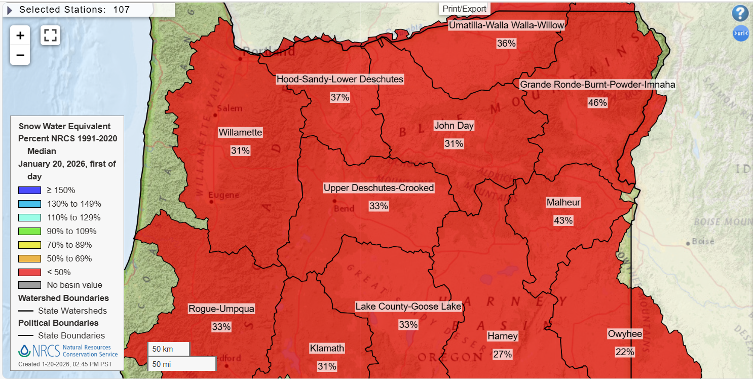
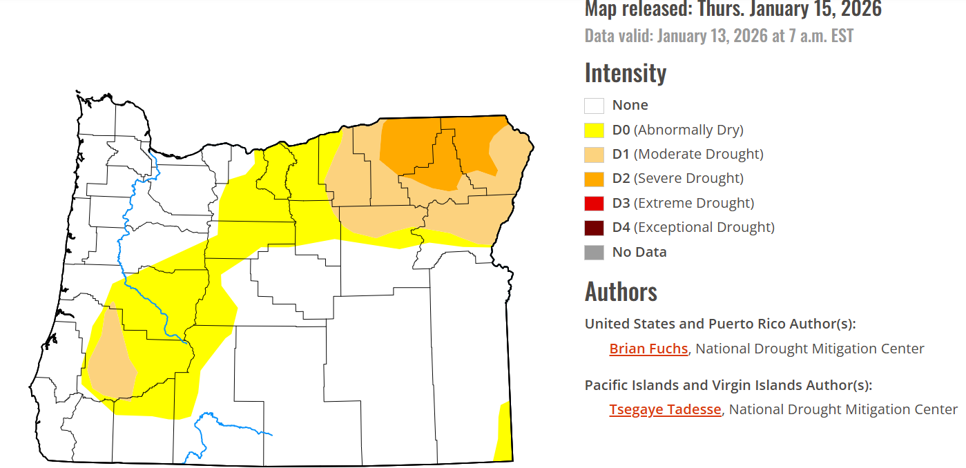
Well below average across the entire state. The drought monitor on the other hand does not look nearly as bad right now, and that is largely due to the big rainstorms we saw back in December.
Forecast details
1.) Dry weather continues through at least next Tuesday or Wednesday.
2.) Nights remain very cold. Salem was 24 degrees this morning. Brrrr! Lows continue to dip well into the 20s. A reinforcing shot of cool, but very dry air moves south from Canada Friday. Unfortunately, it will be a dry airmass, so no mountain snow. Just more cold clear nights and sunny days.
3.) Next chance for rain doesn’t arrive until at least next Monday or Tuesday. Rain chances increase quite a bit after the middle of next week as indicated by this chart below:
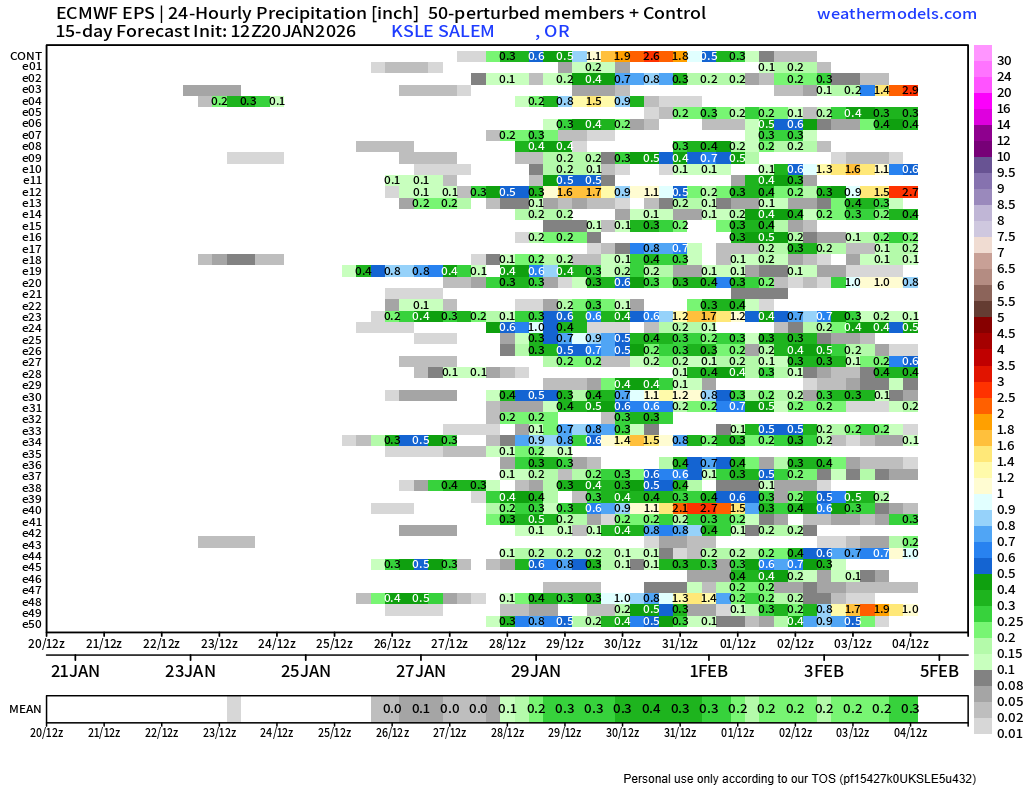
You can see the dramatic increase in members showing rainfall around the 28th and 29th. Let’s hope those don’t dry out, and let’s hope they end up being cooler systems for some mountain snow.
One final thought.
Navigating truth and reality versus scary, clickbait, or agenda driven biased information can be tricky online. This is not a statement as to how much climate change is driven by the actions of humans versus natural cycles. It’s simply a statement to help inform and keep my wonderful viewers in touch with the reality side of news and information. This type of dry, snowless winter has happened before, and will happen again. I have some “modern” examples, but there are even records dating back to the early years of Europeans arriving in Oregon of very dry winters “randomly” occurring.
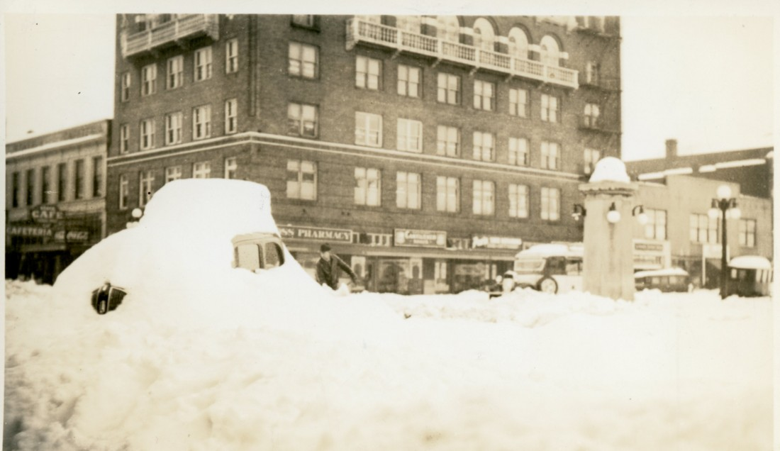
In more modern times, the winter of 1976/1977 stands as the driest on record for many western Oregon locations. Less than an inch of rain fell for the entire month of January that winter, and Salem recorded 68 completely dry days between November through January. Imagine being a ski resort operator that winter or a farmer relying on ground water or seasonal streams to water crops.
These very dry winters happen, and living through them sucks, especially for farmers and people in the snow recreation business, but they do happen. The winter of 2000/2001 was another extremely dry year as well, and Salem saw two snowless winters in the early 2000s (2002/2003 and 2004/2005).
Will we get a February snow event? Maybe, but it is also possible we finally see a completely snowless winter. Portland has been setting a record for most winters in a row with measurable snow for the past few years now. As of last winter, they are at 10 years in a row with measurable snowfall! The previous record was just 7 years.
So yes, things currently look bad, and there’s no guarantee they turn around this season, but such things have happened before, and as of right now, we are not in an unprecedented situation.
If you are wealthy, have lots of extra time on your hands, and love snow, then book a ticket to the North Carolina or Virginia. A massive snow and ice storm is expected over there this coming weekend. Many locations will pick up well over a foot of snow with just this one storm.
Stay safe, and enjoy the beautiful weather the best you can!