Friday thunderstorms

New post tonight highlighting what looks to be a decent chance for late day thunderstorms Friday. Here’s the basics with details below.

Highlights

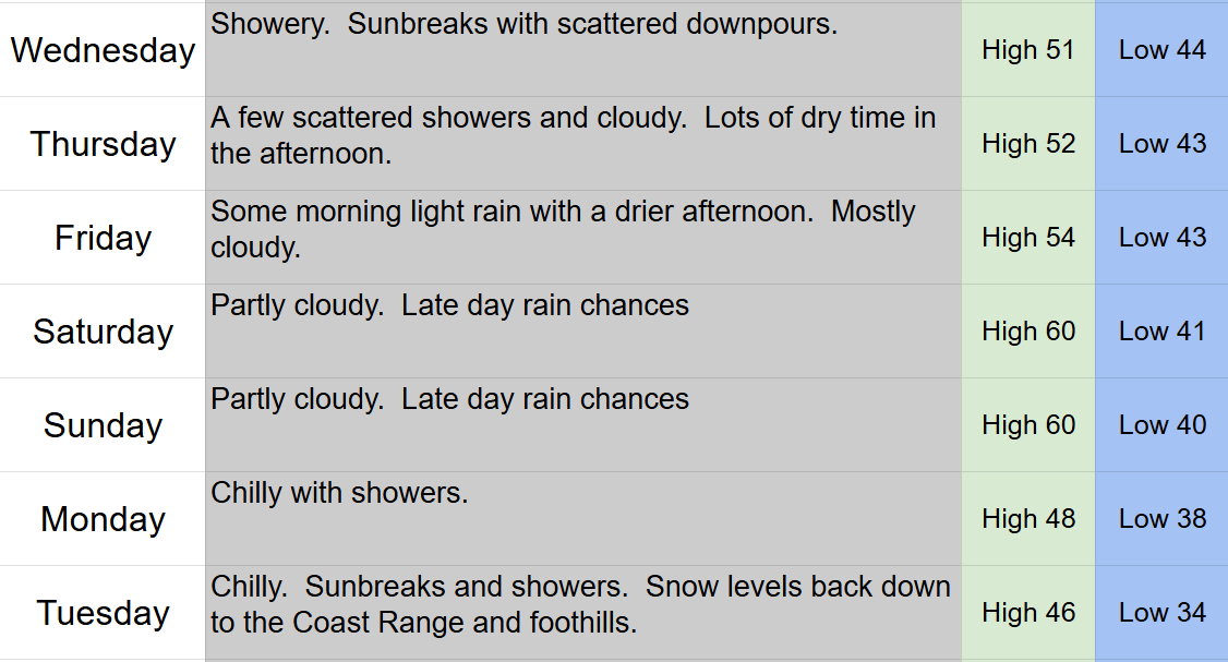
Friday: Warm and sunny start. Increasing clouds during the later afternoon. Decent chance for thunderstorms from roughly 4 to 8pm. High of 73° before cooling down with the late day showers/storms. Some storms could be strong with heavy rain, gusty winds, and frequent lightning.

Saturday: Showers and thundershowers. Sunbreaks at times. High of 67°.

Sunday: Scattered showers, but a few sunbreaks at times. High of 63°.

Monday: Partly cloudy. An isolated shower, but mostly dry. High of 58°.

Tuesday: Increasing clouds with showers and rain arriving late in the afternoon and lasting through the evening. High of 57°.

Wednesday: Showers decreasing throughout the day with frequent rain showers in the morning, mostly dry during the afternoon, and totally dry by evening. High of only 56°.

Thursday: Dry and mostly sunny. High near 60°.

Details

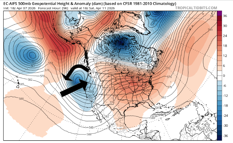
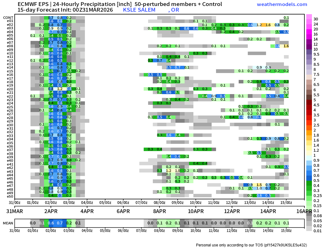
We have a pretty good setup to see thunderstorms right here in the Willamette Valley. This pattern doesn’t happen too often, but when it does, it can send storms up from the south/southeast, and that’s exactly what I’m expecting tomorrow.

Tonight through early Friday morning

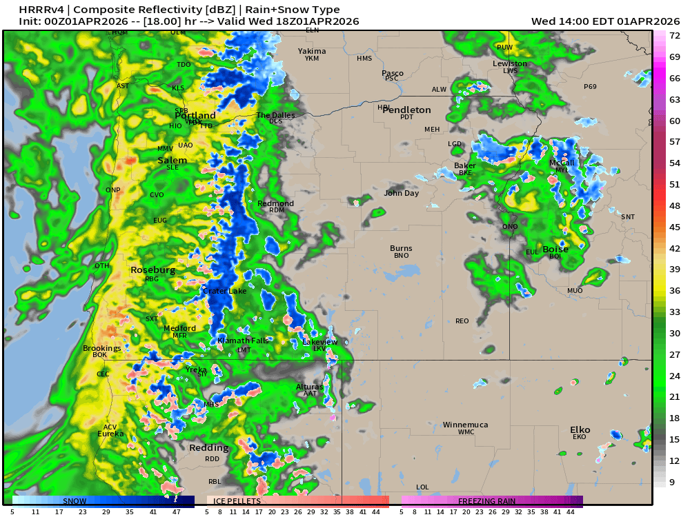
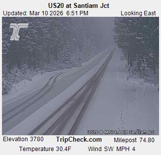
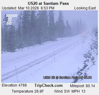
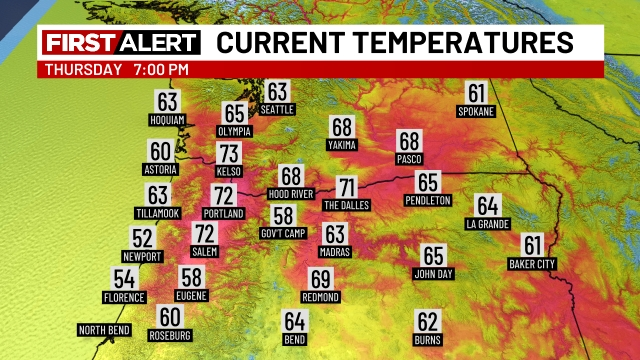
Lots of clouds move in overnight as the energy from dying storms moves northward over us. Happening right now actually as I type this up. As a result, very warm temperatures (for April) will persist during the overnight hours. Some rain or a few sprinkles are possible, but honestly, I don’t expect much. The main impact will be the very mild nighttime temps. Here’s where we were at as of 7PM.

Friday afternoon and evening

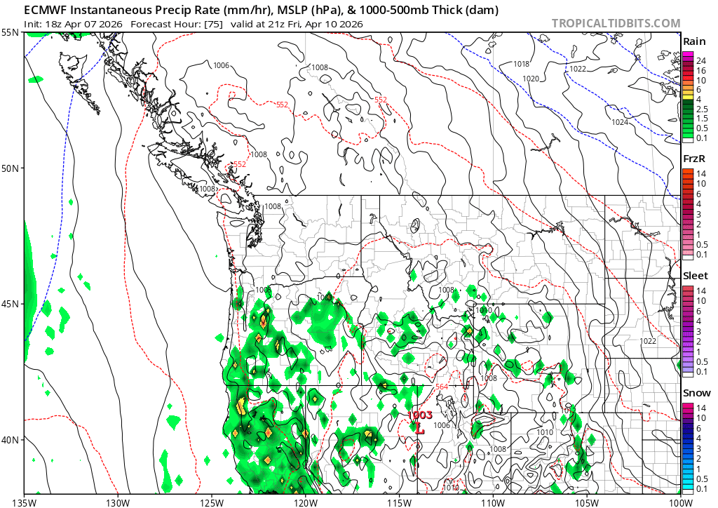
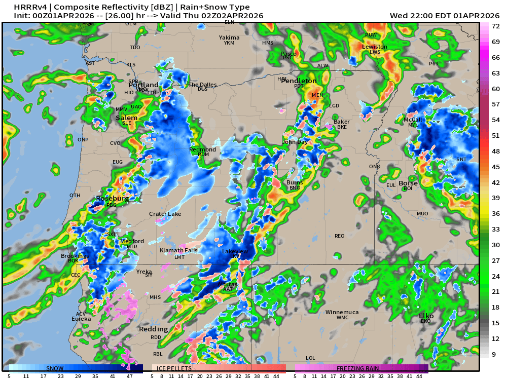
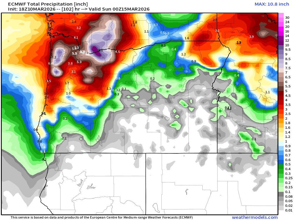
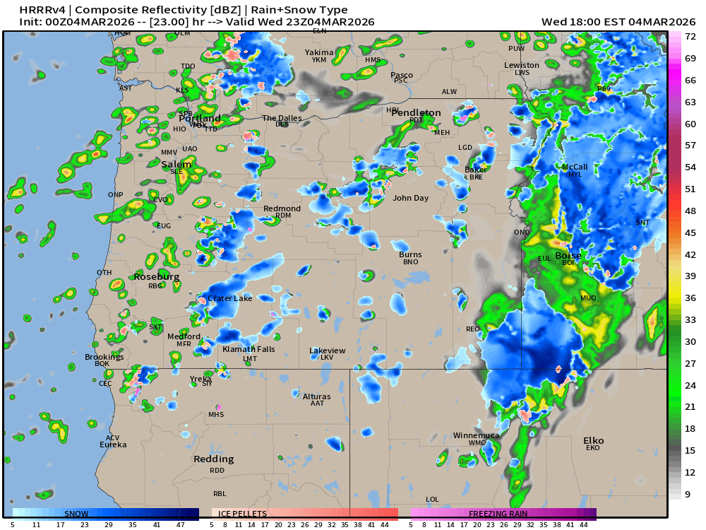
After a warm start to the day, the action really starts to pick up late in the afternoon through the early evening hours. This is important and will likely effect any late afternoon or evening plans you have. Several models are showing nearly an inch of rain falling in just a few hours between 4 and 8pm Friday. This heavy rain could also be accompanied by gusty winds and frequent lightning strikes. This could be a hazardous time to be outside. Here’s another model showing what the radar might look like around 6pm tomorrow.

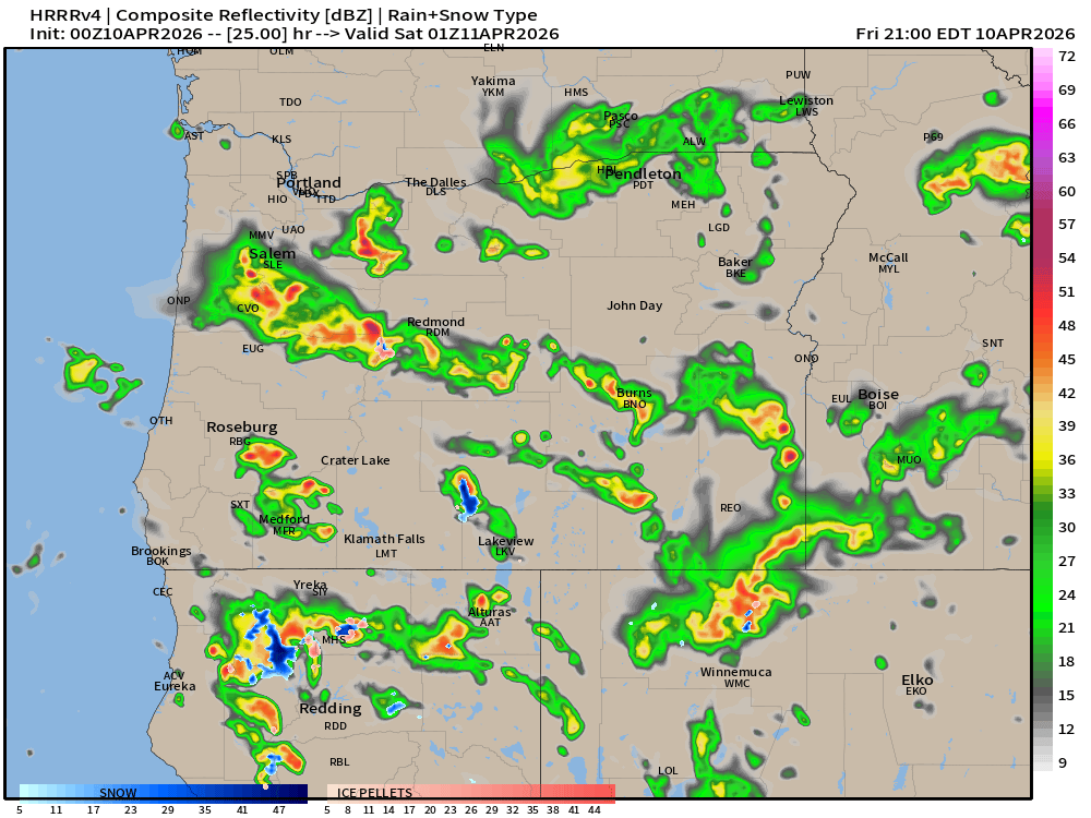
I see very heavy rain showers and storms rolling right up the Willamette Valley, so take note, and just be prepared if you have to be outside or traveling during this timeframe.
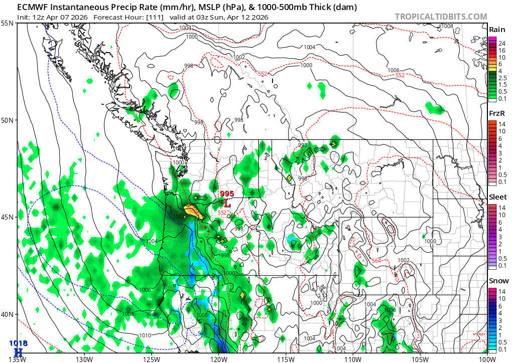
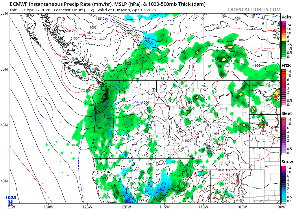
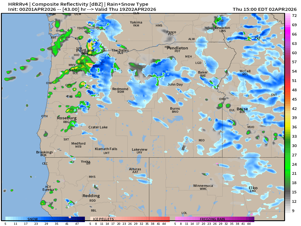
Saturday and Sunday

Both days look wet, but not a complete washout. There’s a decent chance we see a few dry hours in the middle of both days before more bands of rain move through. In a nutshell: plan on the weekend being wet, but know that there will be sizable breaks between showers. I plan/hope to get some yardwork done during those breaks.

Next week

Monday, and Tuesday morning should be mostly dry. The wettest time now appears to take place late Tuesday afternoon through Wednesday morning. Thursday now looks dry. Seasonable temperatures.

Have a great and safe Friday!

Wet weekend

Well, our luck with nice, dry weekends was bound to end eventually, and apparently this weekend is going to be that time. We have a few more mainly dry, albeit partly cloudy days ahead with mild afternoons. Showers return Friday evening with wet weather dominating both Saturday and Sunday.

  • WED & THU: Dry. Highs in the low 70s.
  • FRI: Mostly dry, but chance of a late day shower/thunderstorm. High near 70°.
  • SAT & SUN: Wet. Highs in the upper 50s to near 60°.

Details

Here’s the big picture for this weekend. Western Oregon will be under the influence of a cutoff upper level low Friday through Sunday. At first we will be under a southerly flow as depicted here. This type of flow is how we get thunderstorms in the Willamette Valley during spring and summertime. Note the flow up at around 18,000 feet heading into Oregon from the south Saturday morning.

Friday

Partly cloudy skies will turn mostly cloudy in the late afternoon and early evening hours as a few showers and maybe even a thunderstorm roll in from the south. This map is for 2pm Friday.

Saturday

By Saturday evening, it’s raining pretty good across most of western Oregon with snow in the Cascades.

Sunday

Wet weather continues for Sunday. This is for 5pm Sunday, and it shows a lot of steady rain falling from the B.C. border down through the entire Willamette Valley. High around 58°.

We are still several days away, and while some details may change, it’s becoming clear this coming weekend is going to be a wet one. Not just a quick shower, but probably over an inch of rain between the two days! Yes, a spring soaker is on the way!

Next week looks wet at times too. Monday and Tuesday will probably be dry, but as of right now, it looks like another very wet system arrives Wednesday the 15th and could last through next Thursday bringing rain to the middle of our work week.

We need the rain though, and this is good news. Yes, it’s a real bummer for baseball games and track and field, but it’s needed. With virtually no snowpack to speak of, it’s wet systems like these that could save us from a drought disaster this summer. We can’t fix the snowpack at this point, far too late for that, but we can keep the ground water filled up, the streams and rivers running at normal levels, and our forests well watered.

That’s it for tonight. Stay safe and have a wonderful rest of your week!

Two wet days

It’s been far too long since you received a good weather update from your local weatherman, and I’ve missed it. Time to get back into the swing of things. We have two very wet and stormy days ahead followed by several more dry days.

Quick highlights

  • Wednesday: Rainy, windy at times, and chilly! Mountain snow in the Cascade passes too. Thursday will be more showery with increasing sunbreaks during the later afternoon, and showers ending Thursday evening.
  • Cascades will be snowy later tonight through Friday morning.

Details

WED & THU: It will feel like winter for a couple of days, but any long time resident will tell you that brief periods of chilly, wet weather are common in spring here in western Oregon. I’ve attached a series of maps to walk us through what the next couple of days will look like beginning Wednesday morning.

Wednesday morning

West of the Cascades will be wet with steady rain, windy at times with gusts 30 to 35mph, and chilly. Temperatures in the mid to upper 40s. This map is for about 11AM.

Wednesday afternoon and evening (2PM – midnight)

Showery with occasional sunbreaks, and heavy downpours of rain and small hail. Thunder and lightning are possible with these showers. Every indication I look at tells me there will be some vigorous showers/storms tomorrow afternoon through Wednesday night. This radar image below is for 7pm. Don’t fixate too much on exact details. Focus instead on the big picture showing heavy showers scattered around the region. I also see a lot of snow (the blue coloring) in the Cascades. It will be a snowy 48 hours across all Oregon Cascade passes WED and THU.

Thursday (through 7pm)

Fewer showers, and an increasing amount of sunbreaks might make it feel not too bad at times. Highs in the mid 50s, but showers will still be around, and some of them could still be quite heavy. Just not nearly as widespread or prominent as what we will probably see on Wednesday. This estimated radar image for noon Thursday indicates just that. Notice the larger gaps between showers here.

Friday

Then we dry out! Friday morning could very likely start out below freezing for most of us. Lows 30 to 35 depending on your location, and we will only warm to the upper 50s.

Mountain snowfall totals look something like this. A good 10 to almost 20 inches in the OR Cascades from Hood all the way down to Shasta! Plan on snowy passes through Friday morning.

Easter weekend

Looks amazing! Upper 60s on Saturday, and maybe low 70s Sunday and again on Monday! Perfect timing for weekend plans! 🙂

Next week

This last chart shows 24 hour precip totals for Salem over the next two weeks. Seems like rain and showers return briefly the middle of next week (probably Wednesday and Thursday again) before drying out (hopefully) for the following weekend (11th and 12th). Good timing huh? 🙂

Take care and have a great, and safe rest of your week!!

Extremely wet

Highlights

Very wet weather is arriving now, and rain will fall the majority of the time through Saturday morning.

Some minor flooding is expected, but nothing close to the extent we saw back in December.

Steady rain will keep temps stuck in the mid 40s to low 50s. I don’t see us warming up above 55 degrees until Monday afternoon. It’s going to be a chilly several days!

Details

The heaviest periods of rain for the Salem and the mid valley area:

1.) Wednesday afternoon through Thursday evening.

2.) Friday night through early Saturday morning before drying out Saturday afternoon.

Additional rainstorm details

Keep in mind that the time frames mentioned above are the heaviest periods of rain. Rain is likely at any point now through early afternoon Saturday. Take a look at the estimated precip totals through Saturday. Over 3 inches for Salem, but “only” one inch down in Eugene. Portland is looking at over 4 inches of rain.

Some localized areas of flooding in the usual flood prone locations is possible. No major flooding is expected at this time here in the mid Willamette Valley, but pay attention to any new warnings or updates. This much rain in just a few days can cause problems.

Cascades

The snow level is low right now, and heavy snow has begun to fall in the Cascades.

Heavy snow continues through mid day Wednesday. A warm front causes the snow level to rise above pass level for Hoodoo and Willamette Pass by noon Wednesday.

The following forecast is for the pass going to Hoodoo (highways 20 and 22). Mount Hood will likely stay colder for a longer period of time this week which means more snow and lower snow levels on Hood. On the flip side, Willamette Pass and points south will most likely stay either as rain, or mostly dry as the brunt of this storm focuses on northwest Oregon.

  • Wed AM: Snowy
  • Wed PM: Rainy
  • Thu: Rain/snow mix. Snowy roads at times, but only near the top of the passes.
  • Friday and Friday evening: Rainy
  • Sat: Rain turning back into snow early. Dry evening.

That’s all for now. Plan on rain returning Sunday afternoon. Rainier the further north you go, so Portland can count on a rainy Sunday, Salem will likely see some rain, but Eugene and points south could see a dry Sunday. Something to keep in mind.

Have a safe rest of your week!

A chilly and wet week ahead

March has always been a battleground month. Just look at today. The first half of the day was so nice with ample sunshine and mild temperatures. At 3:30pm we were at 57°, but then clouds thickened up, winds shifted direction, and a few showers moved through. Temps are down to the mid 40s as of 10pm, and will continue to drop through the night. I’ve got a look at the week ahead, plus another update for the Cascades below that.

Details

Mon: Showers with sunbreaks. A few heavier showers possible including showers with small hail. Morning low of 37°, high of 49°.

Tue: Very similar to Monday, but slightly colder start to the day. Low of 34°, high of 47°.

Wed – Fri: Frequent periods of rain, and cloudy even when it’s not raining. This will be a gray and gloomy three day stretch. Steady rain and thick cloud cover will keep temps in the mid 40s at night and low 50s during the daytime hours. Terrible weather for outdoor sports, activities, practice, etc. The rain will have a sharp south to north gradient. Locations further north will see more rain this week whereas the south Willamette Valley may actually stay fairly dry.

The map below shows precip totals through 11AM Saturday morning. Eugene coming in with just under an inch of rain. Salem at 2.5″, and the Portland metro around 4+ inches!

Wet weather continues right on through the weekend. Saturday afternoon and evening could be mostly dry and even sunny, so not all hope is lost, but rain seems likely for Sunday.

The Cascades

The first half of the week looks great for the northern OR Cascades with low snow levels, and frequent snow showers adding up to 6 to 12 inches of snow through Wednesday morning. Plan on snowy roads through at least mid day Wed. The map below shows us 5AM early Wednesday (green is rain, blue snow, and the star is roughly our location in Salem) artistic, I know. 😉

But then the jet stream lifts north Wednesday afternoon and remains north through Friday night. Periods of light rain will fall at our ski resorts Thursday and Friday leaving the passes wet. Saturday could be rainy too, but there’s hope on some of the weather models that the cold air will push south again turning the precip back into snow up there just in time for the weekend. Hoodoo is back down to just 18″ at their base as of Sunday evening. My goal is to update you all midweek with better details concerning the weekend.

For now, have a safe and great week!

Rainy night and showery Wednesday

Highlights

We have a few days of wetter weather, lots of clouds, and then a return of much cooler weather next week. The weekend should be mostly, if not totally dry, but with plenty of clouds around. No early season tans just yet lol…

Details

Wednesday details

This estimated radar image depicts my thoughts pretty well. Scattered showers roaming around Wednesday afternoon with sunbreaks in between and plenty of mountain snow. This is for 3pm tomorrow. Remember, don’t focus on exact details, but look at the overall idea. 🙂

Cascades

Snowy roads most of the day Wednesday through Thursday morning. Thursday afternoon through Friday morning will be better with spots of slush, and Friday afternoon through Sunday should feature bare and or wet roads. 6 to 12 inches of new snow through Thursday night with most of that falling tonight and Wednesday. Hoodoo is down to 18 inches, but I’m pretty hopeful this will be enough to keep them open through the coming weekend.

Short and sweet tonight. Have a great rest of your week and stay safe out there! 🙂

Very wet three days

Headlines

  • Sun – Tue: A very wet three day period. Highs in the low 50s.
  • Wed: Few leftover showers. Partly cloudy. High of 53°.
  • Thu – Sun: Mostly dry. Highs in the mid 50s. I imagine there will be some morning fog, but leading to afternoon sunshine with a few clouds here and there. Lows each morning start out near freezing.

Details

The next three days will be very wet with frequent periods rain. Highs each day in the low 50s. More than 2 inches of rain is expected for the mid Willamette Valley through Tuesday night. 3 to 4 inches of rain in the mountains. Fortunately, some of that will fall as snow up in the Cascades.

Wednesday could feature leftover showers, but nothing long lasting, and sunbreaks will almost certainly make an appearance.

Thursday through next Sunday. This time frame currently looks dry. Highs creeping into the upper 50s, but morning lows still starting out near the freezing mark.

Cascades

Ski resorts can expect 6 to 14 inches of snow with this storm, but they should also expect melting rains at times as well. The boundary between cold and warm air will be draped almost directly over us through Wednesday. This means ski areas will be switching back and forth between rain and snow. Hoodoo has 28″ this afternoon, and it looks like it was a decent day up on the mountain. Let’s see where they are at by Wednesday morning.

“Snow” recap”

Thank goodness our uneventful brush with snow is over. That is hands down the most difficult pattern to forecast. Unlike last February’s snow storm, which was well predicted a few days ahead of time, this setup was very showery with lots of factors at play. Turns out most of us below 1000 feet in the mid valley saw no accumulating snow, but locations near the valley floor west of Hillsboro and Forest Grove saw multiple inches of snow. I also saw beautiful pictures of a snow covered highway near Cascade Head north of Lincoln City (which I’ll try and share at a later date), and snow covered docks near Tidewater, Seaside, and locations near Tillamook.

I expected someone somewhere in the mid Willamette Valley to at least end up with a slushy coating, but we didn’t, and that’s how those showery patterns go. I’m pretty happy I at least maintained the “nothing” or “no snow” outcomes as real possibilities for the valley, because in the end, that’s what most of us saw.

Most likely that was our one and only shot at snow this season, but who knows. Maybe we get another last chance in March. Have a wonderful and safe rest of your weekend!