It’s been a very rainy, and at times, windy week. The wind event Christmas night pretty much met expectations with most valley locations recording gusts between 45 and 50mph, and some locations reaching the 55mph mark. At the peak of the storm about 30,000 PGE customers were without power in Marion County.
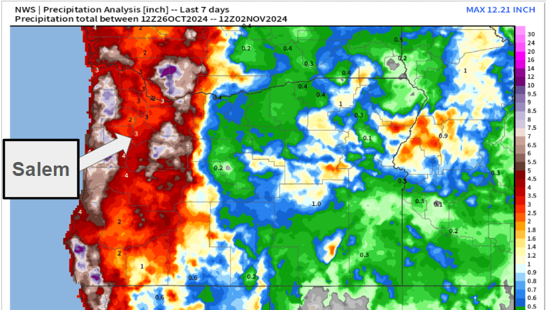
Rainfall has also been fairly consistent and even heavy at times. Here are rainfall totals for the past 7 days.
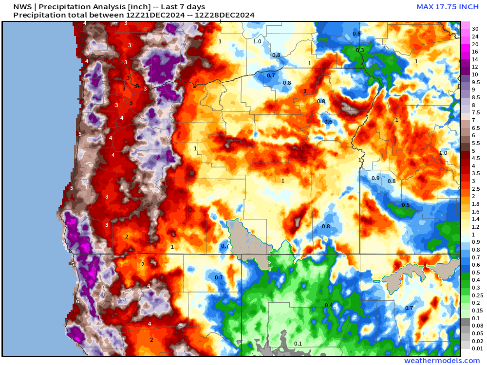
Generally 3 to 4 inches in the Willamette Valley upwards of 7 to 12 inches of precipitation in both the Coast and Cascade Ranges. Ignore the locations showing no rainfall. Sure, there’s a rain shadow effect, but it’s not that severe. Technical issues are to blame for those spots.
Salem can expect an additional inch of rain now through Sunday. All this rain is adding up and taking a toll on local rivers. Below is a chart showing both observed and forecasted river heights for the Willamette River in Salem.
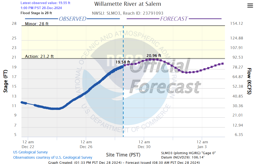
The Willamette is definitely running full, but it is forecasted to stop just short of causing any major issues or extensive road closures.
The Forecast
Steady rain returns overnight and lasts through Sunday morning. Sunday afternoon will feature showers and downpours with a few sunbreaks mixed in. Winds will once again turn quite strong during the day tomorrow. Gusts 30 to 40mph are possible late Sunday morning and Sunday afternoon.
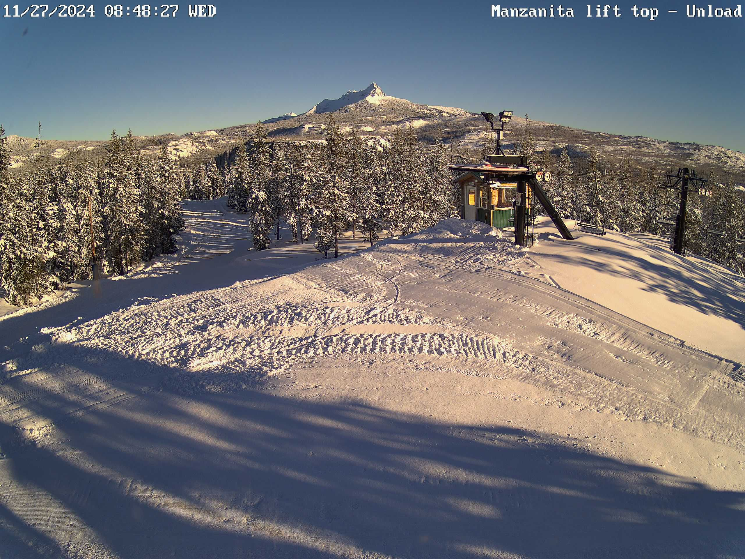
Snow will be heavy up in the Cascades with 12 to 18 inches of new snow falling above 4000′ tonight through Sunday night.
Monday: More sunbreaks, but scattered showers and downpours will show up from time to time.
Tue & Wed: Tuesday will be dry. Fog is likely Tuesday morning especially, but we should manage some decent sunbreaks during the afternoon. Rain moves in late Tuesday night right around midnight. So there are no guarantees your midnight street runs and fireworks will be completely dry. 😉
Thu – Sun: The rest of the week appears to stay on the wet side with periods of rain and frequent showers.
The rain Sunday could cause a few additional problems for some of you, but once we get through Sunday the threat for flooding will subside for the time being. There are no wind storms on the horizon either. Just regular Oregon rain as we ring in the new year.
Stay safe and enjoy the rest of your weekend!