It’s been a busy day for me looking over flood maps, rain charts, and different forecasts. Needless to say, we have some very heavy rain on the way, and not only heavy, but prolonged too with some flooding looking very likely now. Details below:
The quick version
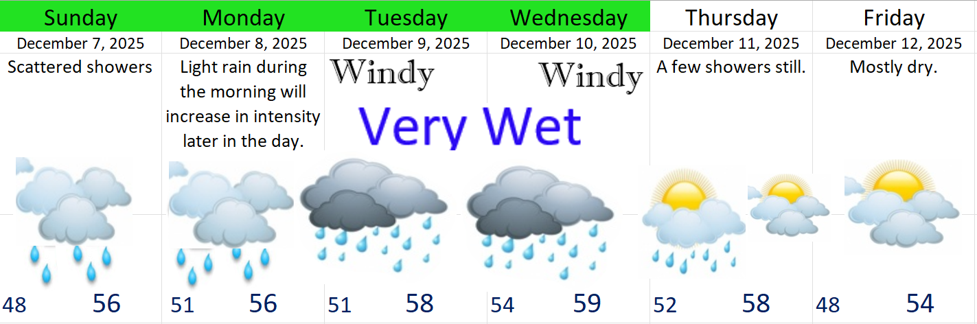
Typical rainy weather continues now through Monday, and by this I mean periods of rain or scattered showers. Some brief periods of moderate to heavy rain, but no threat for flooding during this time frame. Between now and Monday afternoon I expect around 1 – 1.5 inches of rain in total.
Monday night through Wednesday: Steady rain during the majority of both these days with frequent periods of heavier rain. Winds will be pretty gusty at times throughout this period too. I’m thinking gusts 35 to 40mph. Not real strong, but if soils are saturated, and they will be, I could see a few isolated instances of trees coming down here in the valley and along with those trees, some power lines. Please be prepared for some power outages next week.
Extended forecast
We are approaching the event and close enough to share some estimated rainfall totals. I’m thinking Salem easily sees over 2 inches between Tuesday and Wednesday alone, and this could be a rare time where we see upwards of 4 inches within a couple of days. Depending on which side of these totals we end up on, we could see some real serious localized flooding on the small creeks around town.
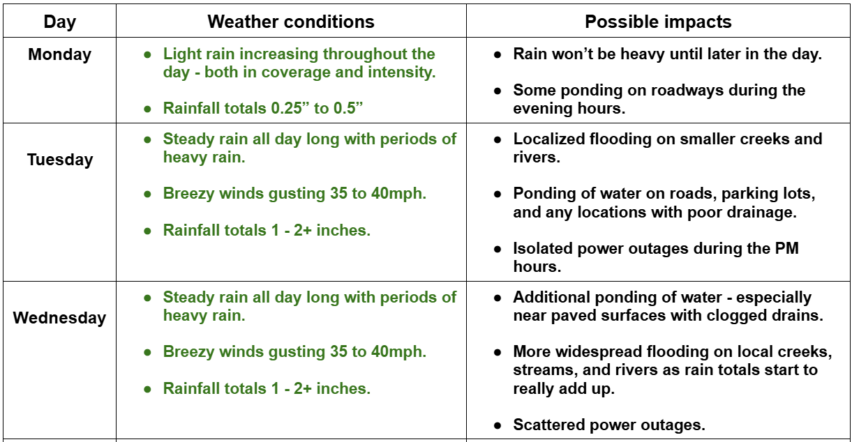
Remember, in situations like this conditions can vary greatly depending on location. My forecasts are typically centered around Salem, but generally can be used and are valid for locations like: Monmouth, Independence, Albany, Silverton, Wilsonville, Canby, and any locations nearby or in between. This next graphic shows my thoughts for this region for Monday – Wednesday.
This next graphic covers flood risk for local rivers. There are many more creeks and rivers around our region than I had time for, but this should give you a good idea of what to expect.

If you live near any sort of creek, river, flood basin etc. that is not listed, then you should be paying attention to water levels and hopefully you can sort of estimate what might happen based on the information I’ve provided.
For the most part, expect smaller creeks to rise quickly during the midst of our rainstorm next week, but those same creeks should fall shortly after the heaviest rains end. The mid sized streams and rivers take longer to rise to flood stage which is why most of those may not flood until late Tuesday night or Wednesday.
I still do not expect the Willamette River to flood. It will of course rise a lot, and I could see River Road heading out towards Independence closing (maybe), but there is just no snowpack to melt, and the Cascade reservoirs have a ton of storage capacity right now. Our biggest floods historically have always happened when we have a large snowpack present in the Cascades, and (typically) when the reservoirs are already closer to capacity. Those two factors are really going to save us from what could have been much worse flooding this time.
The coast and Coast Range
Stormy! Not necessarily super strong winds or huge waves, but the combination of the heavy rain, gusty winds, and higher than normal waves for several days straight will make for wild times along our coastline. Rain totals of 5 to 8 inches are likely over the next five days, wind gusts of 40 to 50mph Monday afternoon through Wednesday night, and at least some flooding is likely on most of the coastal rivers.
Phew! There’s a lot going on next week, and winter is still young, so I’ve created a Discord server with several “channels” on it. On Discord you will find a channel where you can share questions, comments, or your current weather conditions. There is a “photos” channel designed for easily sharing weather related photos. I’ve also added a couple of channels for linking these “Bryan Weather Alert” forecasts, and lastly, I added a channel which will be great for sharing quick, but important updates to the forecast! It should be a lot of fun, an easy place to finally share weather related photos together, and a great way to engage as a community a little.
Please feel free to join the Bryan Weather Alert community on this newly created Discord server! Bryan Weather Alerts on Discord
Take care, and stay safe out there! I’m certain I’ll have more updates in the next few days.