Warmer days ahead

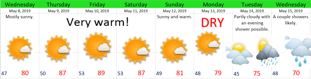
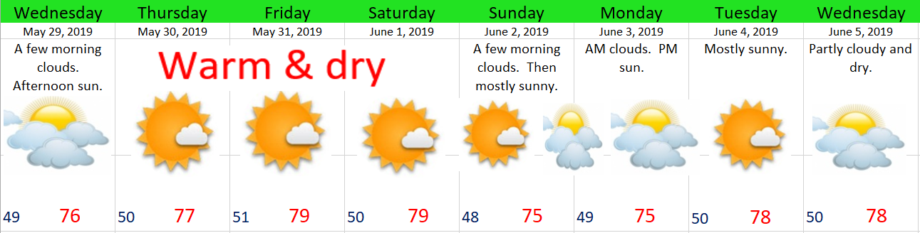
A real quick forecast this morning before I head out the door.  Basically mostly sunny and dry for at least the next 8 days.  No chances for rain or showers.

may29

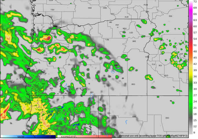
The one exception to our dry weather will be up in the Cascades and Central Oregon.  Isolated PM thunderstorms are possible each day from now through Saturday.  Something to keep in mind if you’re looking to hike or camp out that way.

Happy Wednesday!

Memorial Day Forecast

The next 7 days

May 23

Details

Friday & Saturday:  Sorry folks, but these days look gloomy with on and off showers.  Both days will have periods of dry weather in between showers, but they won’t be all that sunny as the clouds will be stubborn to leave.

Sunday:  Mostly dry with lots of sunshine.  Slight chance for an evening shower or storm.

Monday:  A near repeat of Sunday except a little warmer and a better chance at seeing a late day thunderstorm.

Tuesday – Thursday:  Sunny, warm, & dry.  The only exception will be a few extra morning clouds Tuesday morning.

Thunderstorms today

We have a fairly decent shot at seeing thunderstorms during the late afternoon and evening hours here in the mid valley.  Between now and roughly 4pm partly to mostly cloudy skies & increasingly mild temps will rule the day.  The warmer we get today the better chance we have at seeing thunderstorms later on this afternoon/evening.  You can keep track of  how warm our temps are getting right here on this handy dandy link provided by Fox 12’s Mark Nelson. Next I have an image of the simulated radar good for 4pm local time.  The oranges and reds indicate storms right over the valley.

thunderstorm chances 5.18

As is typically the case around here, not everyone will see an actual thunderstorm; however, chances are high you will at least get some heavier rain and possibly gusty winds.  Best guess at timing of storms is 3 to 5pm.

In the meantime enjoy the dry weather!

23 days

The rain today broke a 23 day dry streak we had going here in Salem which is fairly impressive for this time of year.  It’s now looking like wetter weather is here to stay for our foreseeable future.

May 14

Highlights

Wednesday & Thursday:  Cloudiest days this week with very few (if any) sunbreaks.

Friday afternoon – Saturday afternoon:  Mostly dry during this time frame.

Sunday – Tuesday:  Showers, but with a few sunbreaks mixed in.

Warm & sunny

May 7

Highlights

1.)  Sunny and hot weather is in store for us Thursday – Saturday.  Keep in mind our average high temp for this week is about 67° which means we will be running way above average in the temp department.

2.)  We stay dry through Tuesday afternoon.

3.)  Showers finally return next Tuesday night and Wednesday as we transition into a much cooler (and likely wetter) weather pattern.


Sunny and dry

I’ve taken a few looks at the weather maps and I see nothing but warm and dry weather for at least the next 8 to 10 days and perhaps even longer.

Details 

forecast image 7

The pic above just about sums up our forecast, but for those of you who love reading my posts I wrote out the details for you below…  😉

Friday will be our coolest day with highs in the upper 60s.

We reach the mid to upper 70s Saturday through Wednesday.

Tuesday will be slightly cooler with highs closer to 72°.  Still dry.

By next Thursday & Friday we should be seeing our first 80s of the year.

Low temps will hover between 42 – 48°.


Unusually cold tonight

We have some chilly temps coming for us tonight which means you might want to cover up or bring inside your warm weather plants.  Temps should fall down into the mid 30s with some spots approaching the freezing mark.  It’s most likely a one shot deal as low temps modify slightly for the rest of the week staying closer to 40 – 43°.