Our Extremely warm fall

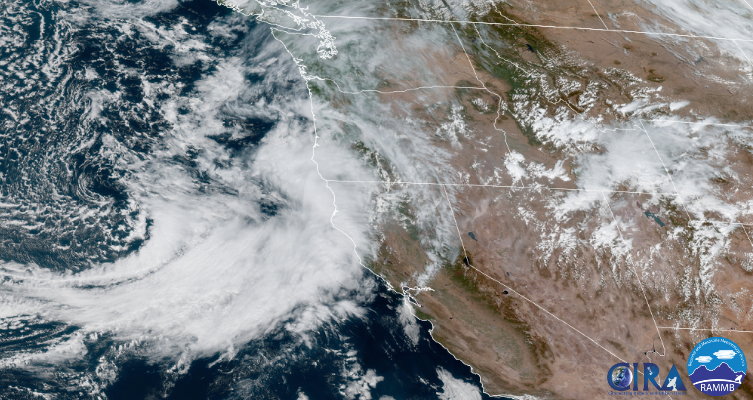
I admit I’m stating the obvious when I tell you that our fall season so far has been both extremely warm and dry; however, the part which sticks out the most is the warmth. We have been in record setting territory, but does this mean we might have a warm and mild fall/winter season too, or is there any correlation at all? We’ll take a look in this post. If you’re hoping for a forecast I can tell you that basically it’s looking dry for at least the next 7 or 8 days, so nothing new or exciting, and sadly nothing to really help put out the fires which continue to burn across the PNW.

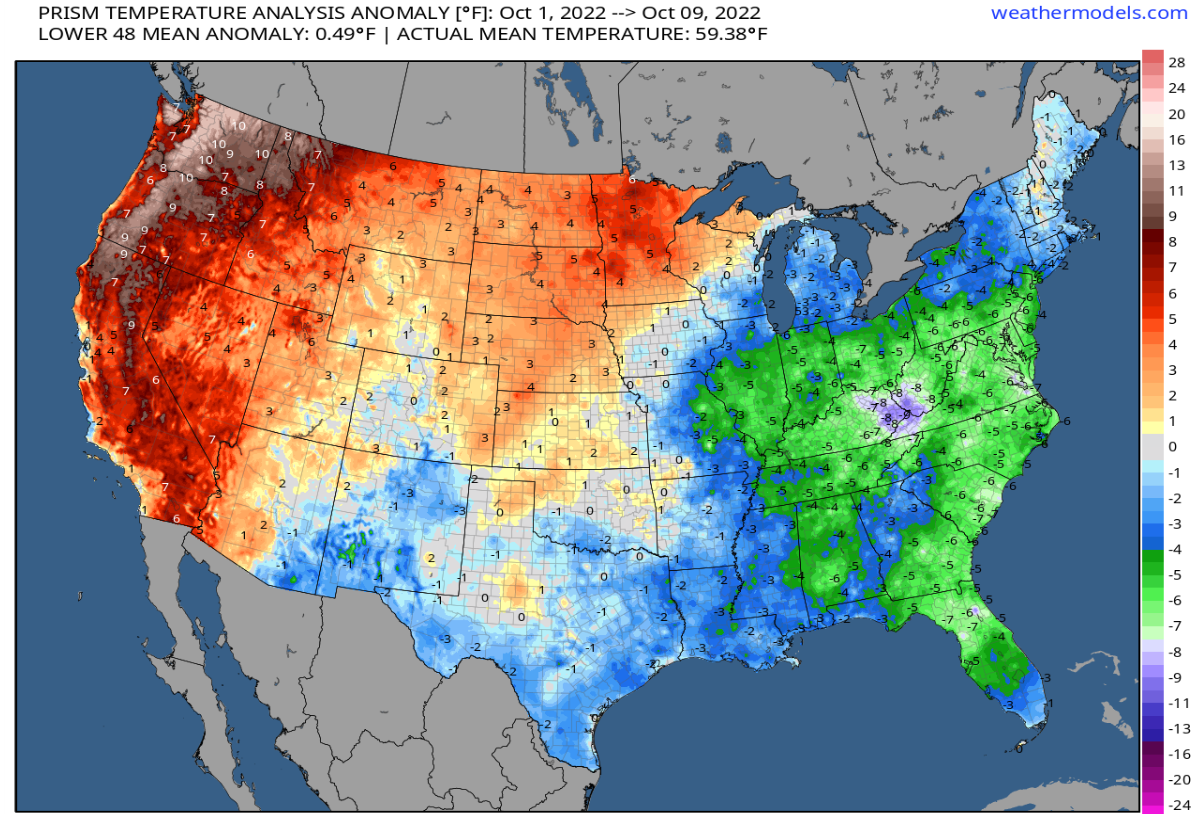
This past September ended up 3 degrees above normal with only .29″ of rain (just 20% of normal) making for an extremely dry month! In addition to that, September 2022 also recorded seventeen 80+ degree days making the past month feel like an extension of summer. Look at how warm the western half of the country was during September.

Much of the western U.S. was 3 to 5° for the month.

October has also started out extremely warm with 6 out of the first 10 days reaching the 80 degree mark vaulting Salem to 6 degrees above normal for the month! Here’s the temperature anomaly map for the month so far:

The entire state of Oregon and Washington are currently running 6 to 10 degrees warmer than normal for October.

What’s really bizarre though is we have seen years in the past with extremely warm and dry Septembers and even Octobers during La Nina conditions only to flip to stormy weather. Currently we are experiencing (for a third year in a row) La Nina conditions – something to keep in mind.

Let’s look at September 1974. It was a La Nina year and a mere .28″ of rainfall for the entire month which is almost identical to the amount we saw this September. September 1974 was also extremely warm with a whopping 21 days above 80 and 11 days at/above 90°!

So what happened in 1974 after such a warm and dry early fall? Well over 14 inches of rain fell in November and December alone coupled with tons of mountain snow. Let’s look at a few more examples.

Exactly one year later in 1975 (La Nina year), Salem recorded its driest September on record. Not a single drop of rain fell the entire month. It was also very warm with eighteen 80+ degree days. The second half of October through December brought over 16 inches of rain though, and even some pre Christmas snowfall.

How about one more example? September 1998 was very dry as well with only 0.68″ of precip and plenty of mild days to boot. The following November and December dumped 20 inches of rain here in Salem resulting in widespread flooding. Worth noting that this was also a La Nina winter…

Bottom line is a warm and dry first half of fall can easily switch to a very wet, cool, and stormy second half. To be honest, that’s exactly what I expect will happen this year within the next 2 weeks. Watch for updates as the rainy season draws near and enjoy the warm and dry weather while it lasts, because it won’t last for much longer. Winter and the rainy season is coming, it’s just taking it’s sweet sweet time to arrive, but remember this post and know that you’ve been warned. It is coming…. It won’t be long before everything is all soggy, puddles everywhere, the rivers flowing high, and we will start wishing for sun again.

Out of the blue

After a loooong long stretch of not posting, I’m back with a helpful update for you all.

I’ve seen a number of various forecasts for the coming days all disagreeing on whether or not it is going to rain here the next several days, and I figured it was time to leap back into action. I have all the details below.

Basically we are on the northern edge of very moist storm which is aimed for California. This is GREAT news for bringing the wildfires under control plus a good soaking rain like this should help prevent any new late season fires from starting. This satellite image from around 1:30PM does a good job of showing the storm’s location as it prepares to hit California.

Highlights

A round of showers and maybe even some thunderstorms roll into our region later this evening through the early morning hours of Sunday from the south/southeast – a fairly unusual pattern for western Oregon.

Monday: Mild and dry with highs in the low 80s.

Tuesday: Mainly dry here in Salem with the exception being locations just south of us roughly from Albany and Corvallis southward. Showers are much more likely down there.

Wed & Thu: Showers both days with highs in the low 70s.

Fri: Back to regular dry and mostly sunny early fall weather! 🙂

The rain coming up from the south should also help significantly with Oregon’s major fires too including the Cedar Creek fire. I fully expect much better news on the fire front come mid week.

Take care and stay tuned for more updates! 😉

Thunderstorms

We have had some incredibly hot weather this summer, and I plan on highlighting our extremely HOT weather in an end of summer post at a later date. For the moment I wish to highlight our thunderstorm potential here west of the Cascades.

Basically now through Wednesday morning we have a chance for showers and thunderstorms with some of the storms having the potential to be quite strong. This goes for Salem, the entire Willamette Valley, and the coastal cities too. The storms will not be widespread which makes it extremely tough to forecast who will see action and who won’t. Check out these 3 separate forecast images:

This estimated radar image shows Salem getting hit by the tail end of a hefty shower, but missing out on any large storms.
Salem stays dry while strong thunderstorms roll along the Coast Range in this forecast.
Meanwhile this forecast nails Salem with a powerful thunderstorm right over the center of town.

The main idea is that scattered showers and thunderstorms will be moving through the region between now and Wednesday morning. Regardless of whether or not we see storms here in Salem, Wednesday will end up being fairly cool with highs topping out only around 80 degrees.

We stay in the 80s through the weekend 🙂 before the heat returns again later next week :/

The Cascades and areas east of the mountains will likely see storms too. Depending on rainfall with the storms they can be a blessing or a curse as lightning could fuel more wildfires over there.

Time to see what happens, but don’t be surprised if you get rained on or if you hear thunder.

Keep on enjoying summer and stay safe out there!!

Extended heatwave

We are wrapping up day 2 of what will be one of the longer heatwaves we have seen in a few years. No, not the hottest (that title will likely remain with June 2021 for quite awhile), but it will be a very prolonged heatwave. Yesterday Salem reached a high of 94°, and as of 5PM today, we have reached 100°. Phew! Check out the toasty hot temperatures dominating the Pacific Northwest.

There is relief right along the coastline; otherwise, the rest of the northwest is baking (and will continue to bake) under the hot July sun. The sun below pretty much sums up the extended forecast. There are just a few highlights I wish to share with you before wrapping this post up.

1.) Nights will be unusually warm due to increasing humidity which will make it really tough to cool your house down with just open windows. Lows will bottom out 62 – 65° tonight through Monday morning of next week! Yes, it’s really going to be a long stretch of extremely hot weather!

2.) The length of the heat is my 2nd highlight. Highs anywhere from 96 to 102° are likely through Saturday with lower 90s continuing into early next week.

3.) Hang in there because much cooler weather should be arriving sometime around August 2nd or 3rd.

Stay cool, check up on people who may not have AC, and keep hydrated!!

May the 4th

For us Star Wars fans today is a great day to celebrate the Star Wars franchise. Every year on this date I see a number of Star Wars themed shirts and hoodies, and today was no different. Today was also a wonderful day to be outside with highs reaching the mid 70s this afternoon. You can check out the very nice high temps from around the NW today with 60s extending out to the coast as well. I hope you took full advantage of the nice weather, because looming on the horizon is a washout.

Now take a look at the total rainfall expected through Monday night.

Widespread totals around 2 inches here in the Willamette Valley, and what is perhaps even better news are the inch plus totals east of the Cascades where they still could really use the additional precip.

Next check out how much snow is expected as well.

The map above looks more like a winter time map than a early May map with snow levels Friday night through Tuesday running quite low for this time of year. I’m going with a solid 1 to 2 feet of new snow for the Cascades above about 4000′ with up to 10 inches down as low as 3000′. Really great news for delaying the start of any major wildfires.

I know this wet weather is going to start getting old, but it’s what we needed. This is a huge change in pace to the past few springs which have generally been very warm & dry, plus I can assure you that as long as we still have 4 or 5 feet of snow on the ground in the Cascades, our risk of having a big early season fire outbreak is next to none.

Salem’s Extended Forecast

Right here in Salem expect Thursday to be cloudy and wet – a real soaking for sure! Maybe some breezy conditions at times with highs in the upper 50s.

Friday will also be quite wet with periods of heavy showers, but with a slight chance of thunderstorms too – especially if we get lucky and see some sunbreaks that day.

Saturday & Sunday will be more of our typical sunbreak/shower type of days with a number of sunbreaks mixing in between downpours. Small hail, thunder, and lightning are definitely possible all weekend.

Next Monday will be a sunnier version of the weekend with showers slowly building through the course of the day after what should be a fairly sunny AM. Chilly though with lows dipping into the upper 30s possibly. The late afternoon and early evening hours on Monday feature the greatest threat for showers and storms.

I’m searching hard for our next 70 degree day and will alert you the moment I feel confident one is coming. This spring really is vastly different than what we experienced last year, and for the time being there seems to be no sign of things dramatically changing either…

Take care and be kind to each other.

Wild weather

It’s been awhile since I provided you all with a state of the art Bryan Weather Alert forecast! 😉

I’ve been focusing on spending extra time with family and job not to mention our weather here has really not been all that exciting; however, that’s all about to change as we have an extremely dynamic system arriving Sunday night and Monday. There’s a ton to cover with this storm, so let’s get started.

First things first, most of Sunday will still be dry which means you have time to get those outdoor projects done. Sometime between 4 and 6PM is when rain arrives and it should continue to fall through the night. Winds will kick up during the afternoon as the storm approaches with gusts up to 35mph.

This graphic for Monday’s weather covers the coast, Salem area, and the Cascades. Additional details below.

This type of pattern is great for giving the mountains 2 to 3 times as much precipitation as the valley which means tons of snow for the Cascades and a major soaking rain in the Coast Range. The total precipitation map through Tuesday night shows this very well.

The other concern on will be the thunderstorms we COULD see in between sunbreaks on Monday. The atmosphere is going to be unusually unstable Monday which could lead to the sudden development of thunderstorms at any point during the day Monday. These storms have the potential to contain lightning, thunder, and small hail; however, the largest threat with these storms will likely be the heavy downpours, and very gusty winds associated with them. Wind gusts could reach 40 to 45mph with some storms. These winds will be very localized, but they have the potential to cause a few problems for the areas they strike.

There is also a slight risk for a tornado or funnel cloud Monday across the region too.

We’ll see what happens, and of course even in a pattern like this, tornados in Oregon are typically very weak and still few and far between. It’s just going to be a bit more of a risk than we are use to seeing. Something to watch out for.

Looking ahead to the rest of the week, Tuesday will be a shower and sunbreak type of day with showers ending abruptly right around sunset. More snow for the Cascades.

Dry, sunny, and beautiful springtime weather Wednesday and Thursday with highs upper 60s Wed, and around 75° on Thu.

The threat of showers returns next weekend, but still a ways out, so we will focus on that later.

Take care and have a great rest of your weekend!!

Rain moving in soon

Right now (just before 11AM Saturday) as I type this up, it’s actually incredibly sunny outside with virtually no clouds in sight; however, things will change quickly this afternoon as a strong cold front races inland. The estimated radar for 2PM today shows a rather heavy band of rain moving right across the region at that time which will end our nice dry weather.

Here’s a link to the satellite loop which is also doing a good job of tracking our incoming system.

Gusty winds out of the south/southwest will accompany this band of rain with gusts of 35 to 45mph likely today and Sunday. Rain totals between now and Sunday night will come close to reaching 1 inch here in the mid valley with some “lucky” folks surpassing that. Here’s the total rainfall ending at 11PM Sunday night.

Notice totals over an inch around Corvallis and of course along the coast. Again, things will change QUICKLY here in the next few hours as we plung back into a very stormy pattern.

Next check out the snowfall totals for today and Sunday.

Plenty of new snow up in the Cascades with about 10 to 15 inches falling above 4000′. Hazardous travel conditions up there from 4/5PM today through most of the day tomorrow. Great news for the snowpack though!

There you have it. A sudden switch to stormy weather approaches. This is the first storm in a long, long series of storms, so I hope you enjoyed the dry weather while it has lasted.

Take care and happy Saturday!!