We have some fairly wild and active weather on tap for the remainder of the week. Keep in mind that small changes in storm tracks could lead to potentially much different outcomes which is why I plan to keep the updates rolling in through the course of the week.
Tonight: Winds are picking up out there and honestly, this will be a fairly significant period of gusty winds. Expect gusts 25 to 30mph overnight.
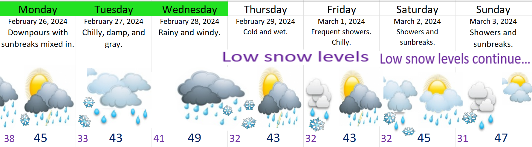
Wed: Winds continue and will even increase the second half of the day with the strongest gusts reaching 35 to 45mph. Rain will also increase in intensity during the afternoon and evening hours.
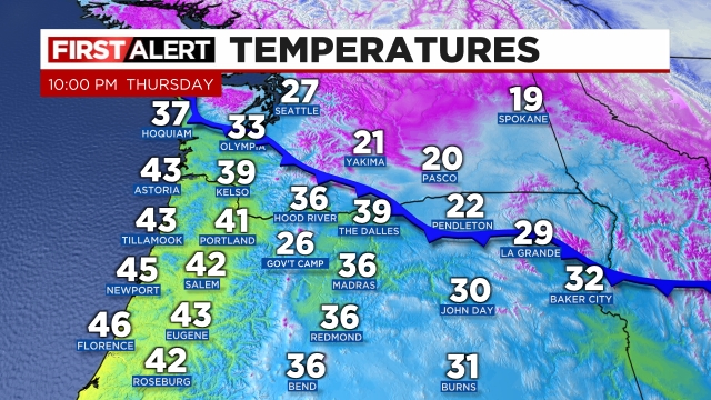
Thu: During the overnight hours Wednesday into early Thursday morning heavy rain, light winds, and a fresh batch of colder air will combine to drop snow levels close to the valley floor. This will be an exciting morning for some of you. Please pay close attention to the details.
– Any valley snow that does stick will melt quickly Thursday morning. This will be a very short lived event with regular driving conditions for most of the day.
– Locations further east (regardless of elevation) stand the best chance for seeing accumulating snowfall in this type of set up. Stayton, Sublimity, Amity, Fruitland) maybe the Hayesville neighborhood even) all stand a slightly higher shot at seeing snow accumulating briefly Thursday morning.
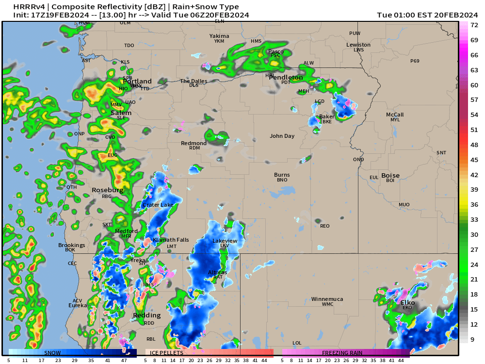
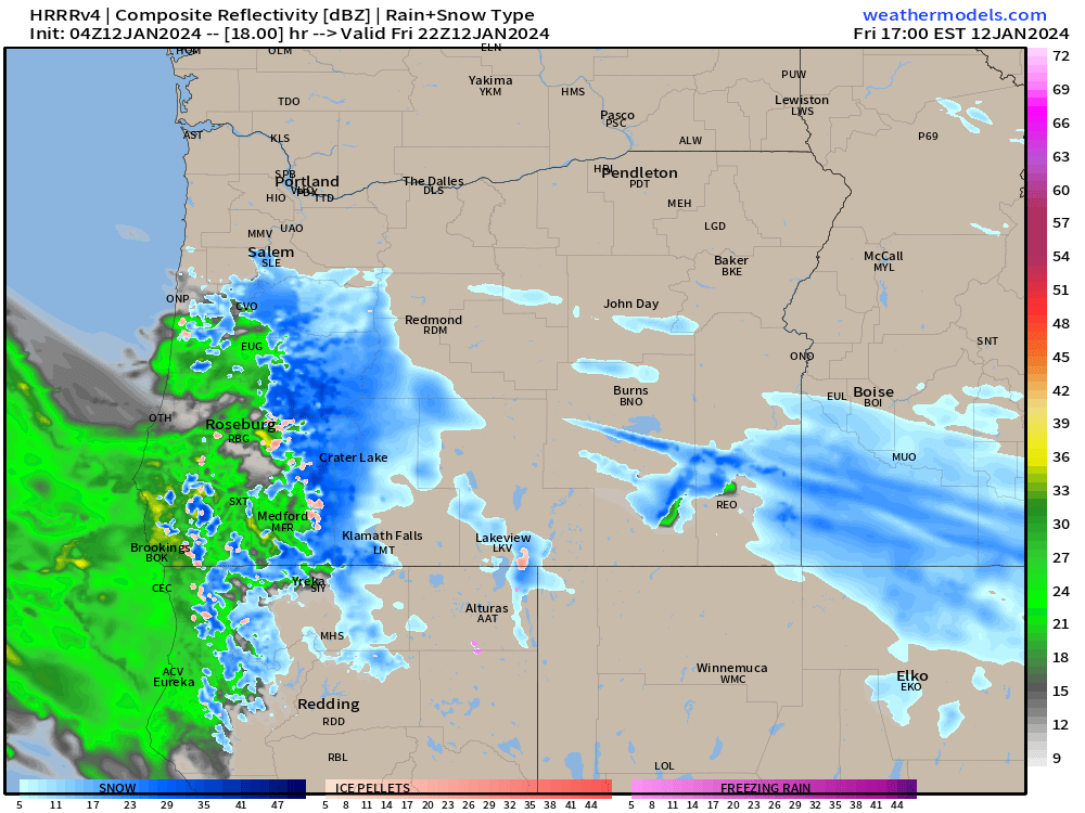
I hesitate to use these maps as it can be tempting to take them too literally. I use these to see the big picture. This shows the estimated radar for Thursday morning. Take a look first and then I’ll share my two cents. 🙂
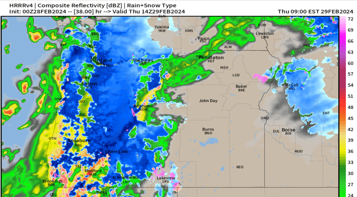
The strip of rain showing up just west of Salem down through Corvallis is just one indicator this event favors east locations. The snow level during this event will be running about 500 to 1000 feet, but where the precip is heavier and where it stalls out longer (east Willamette Valley), the snow level could reach the valley floor for a few hours dumping heavy wet snow.
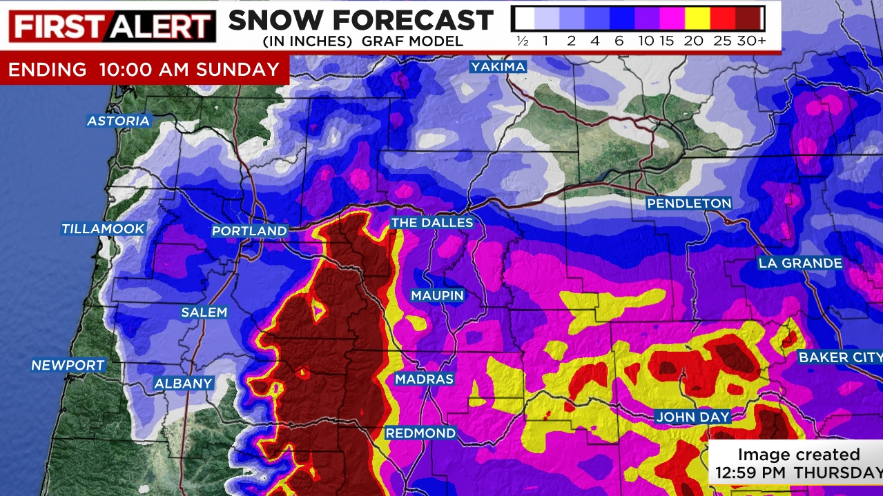
The rest of Thursday is easy. Chilly rain with lots of mountain snow.
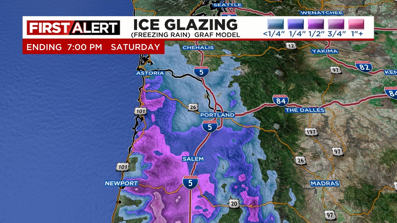
Friday: Low snow levels coupled with showers could result in slushy snow falling down to sea level again. In this scenario anyone could see snow if a heavy enough shower hits your neighborhood during the nighttime and morning hours. Elevation will also aid in your chances at seeing snow.
Rinse and repeat both Saturday and Sunday. During the daytime hours expect hail, graupel, and heavy rain with the showers along with sun breaks mixed in between.
Keep watching for updates. It is possible nothing happens Thursday; however, it is a close enough call that it is worth mentioning.
Stay safe out there! 🙂