Practical steps/most important info
Forecasting way out in time can be tricky, but it is very clear to me that we will be dealing with icy roads, snow, and cold at various times for the next few weeks. There are strong signals we will be in this wintry pattern for awhile. If you have snow tires and you think you would use them over the next few weeks then this weekend is the perfect time to put them on.
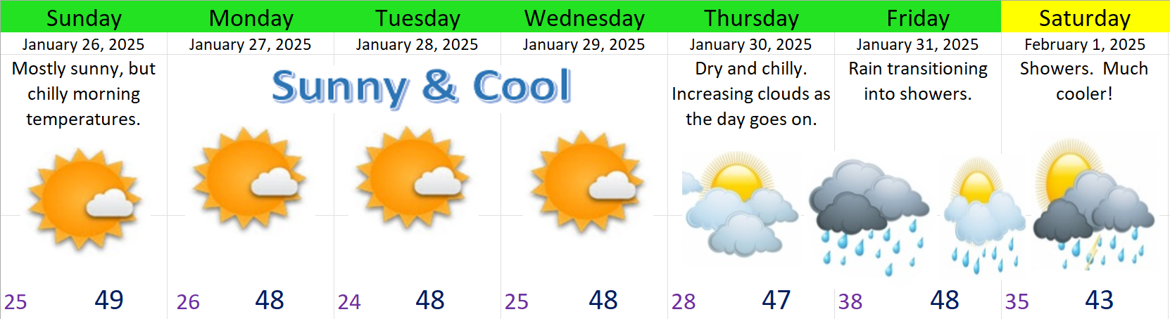
In the forecast below I’ve highlighted road conditions with red font, and important messages and snow totals in bold font.
If you don’t like driving in the snow or on icy roads, and you have a flexible schedule, then run your errands this weekend or else Mon & Tue afternoons. Plan on the nights and mornings being the worst for driving, and plan on slippery roads possibly all day long on Wed & Thu.
The current forecast for each individual day is just the best guess I can give with the information at hand. Don’t focus on details too much. Just keep in mind your travel plans and daily life could be effected by snow or icy roads pretty much each night and morning this week, and possibly all day long Wednesday and Thursday.
Details
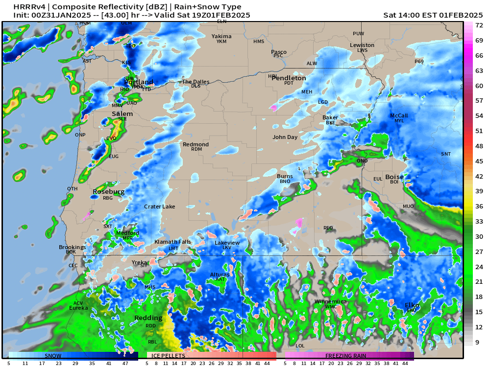
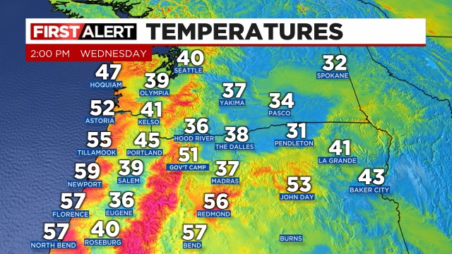
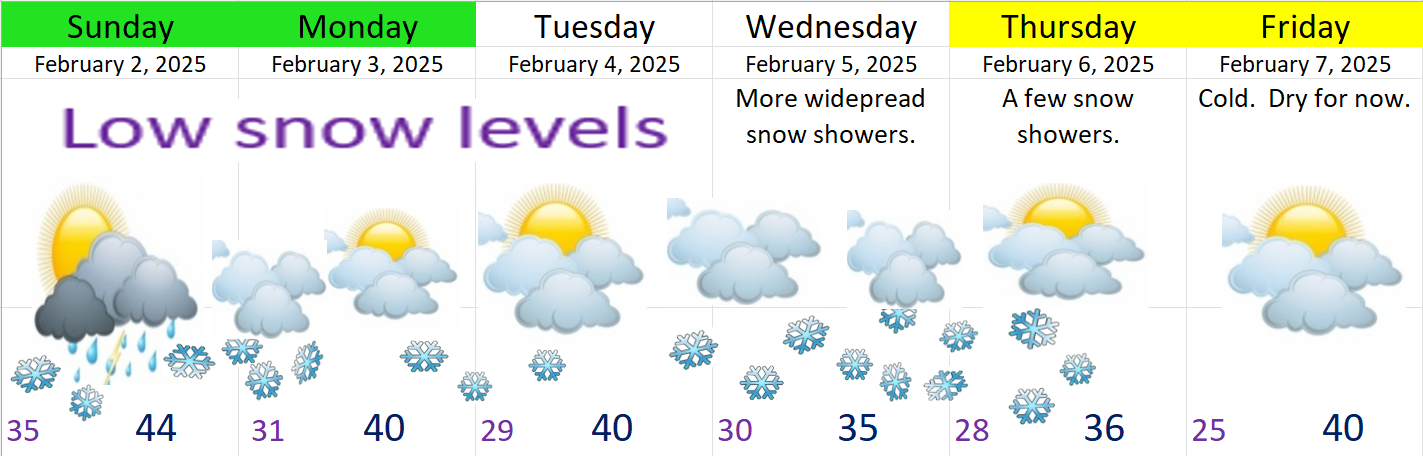
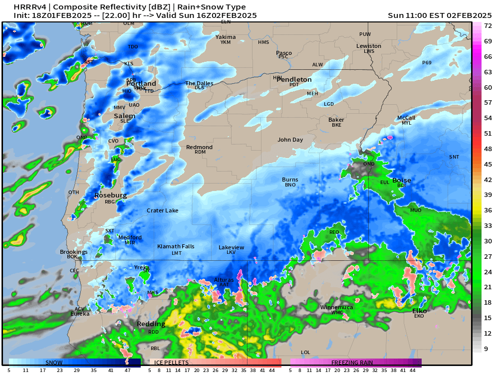
Sunday: Anyone could wake up to a little snow. Yes, this will be our first shot as seeing snowfall. Wet snow, graupel, and rain are all likely with the heavier showers during the day. Roads could briefly become covered, but afternoon temperatures will melt things off. The vast majority of roads tomorrow should be fine. Chances for snowy roads always go up with elevation in this type of pattern. Expect a few sunbreaks at times during the day, but not as many as we have today. Estimated radar for Sunday morning around 8am does a good job at conveying the main message of scattered showers and snow showers.
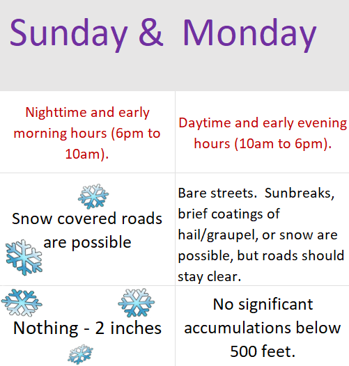
Mon & Tue: A few snow showers are possible each morning. Some people will wake up to snow, some of us to ice, and some with mostly bare roads. Hard to pinpoint when we are dealing with showers. Snowy and icy roads should clear up by late morning each day. This means life should be able to go on as normal roughly 10am to 6pm each day. Nothing – 2 inches of snow possible each morning. Anything that falls out of the clouds during the daytime hours will be in the form of snow thanks to the cold atmosphere, but it’s much less likely to stick during the day unless you find yourself at a higher elevation.
Wed: More widespread snow showers likely. 1 – 4 inches of snow possible at any elevation and even during the middle of the day as colder air works it’s way south. Roads could be bad all day long Wednesday. Subject to changes still.
Thu: Back to sunbreaks & scattered snow showers. Another inch or two of snow is possible during this time frame, and colder temperatures will make it tough for roads to melt off.
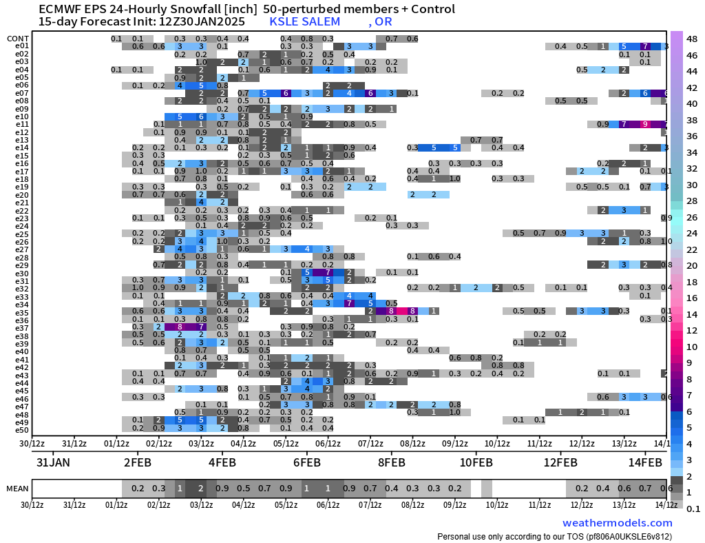
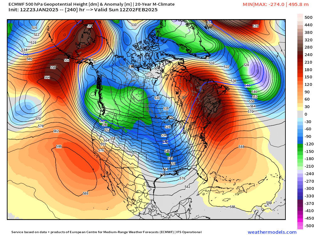
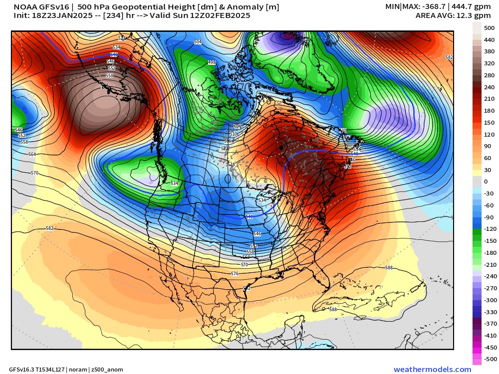
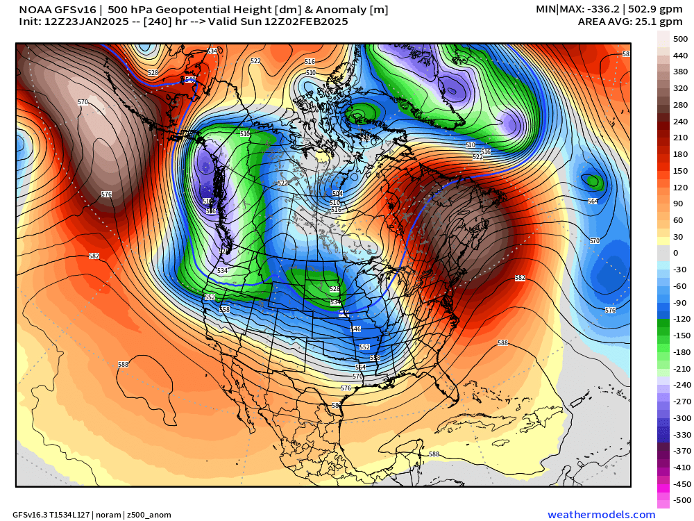
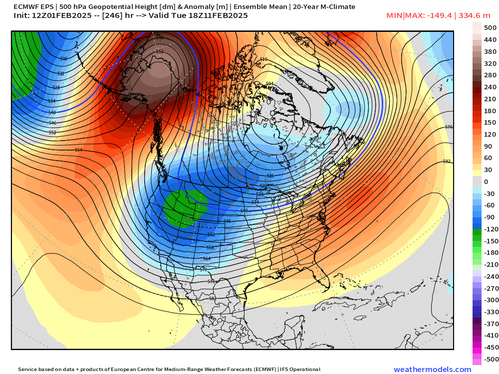
Super Bowl weekend and the week after look cold. Way too far out for details, but strong signals that we remain in a wintry pattern with more snow opportunities likely to present themselves.
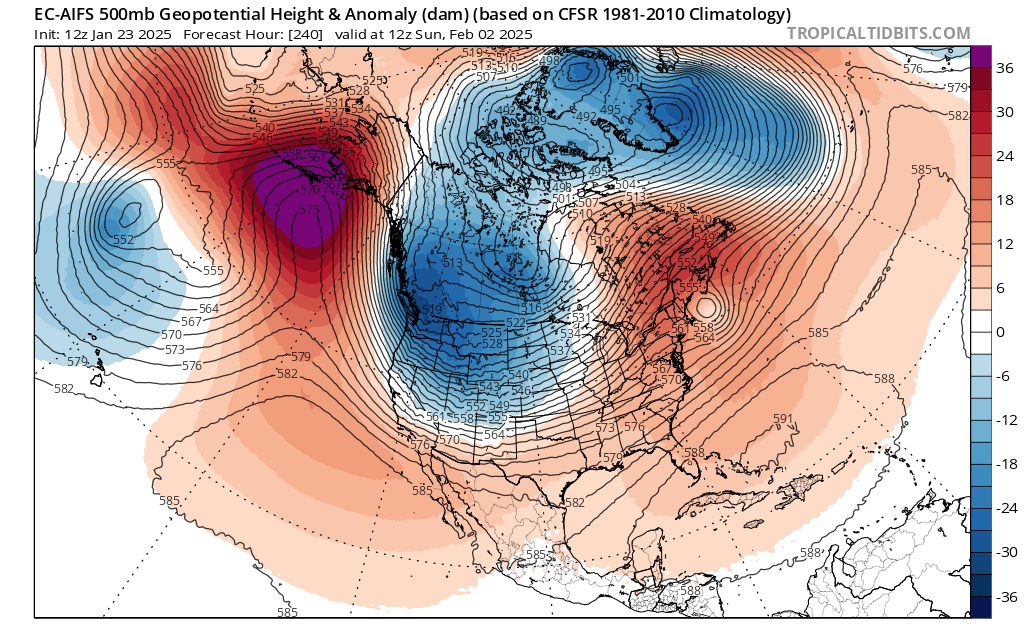
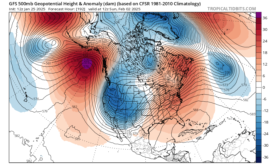
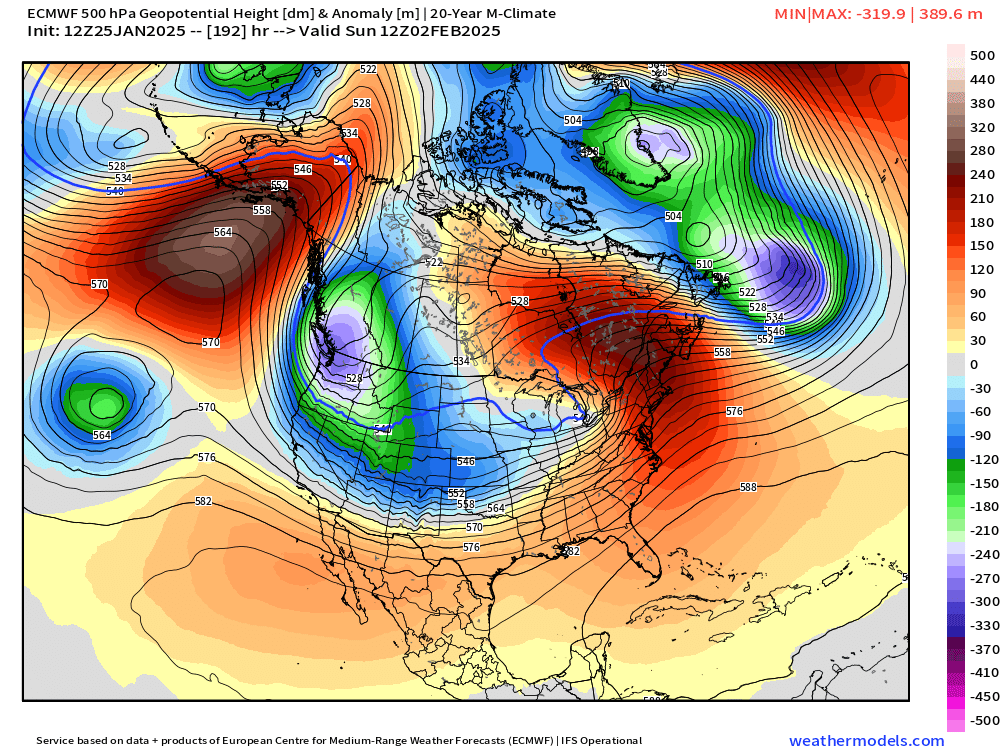
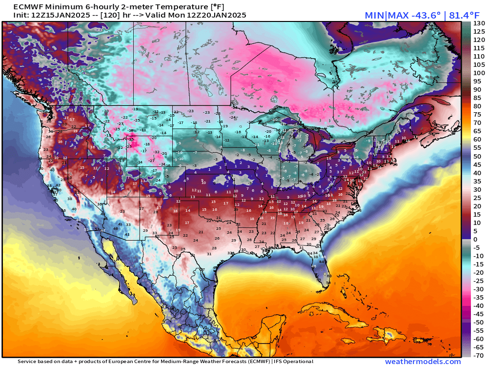
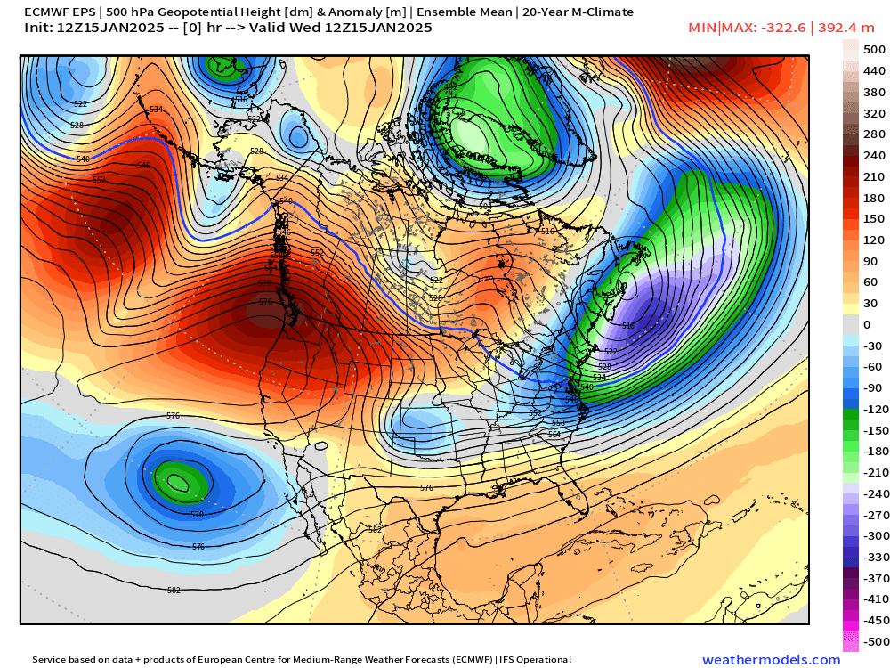
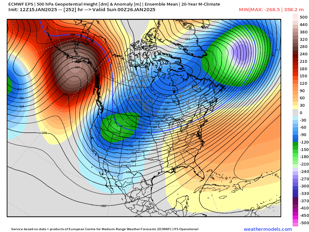
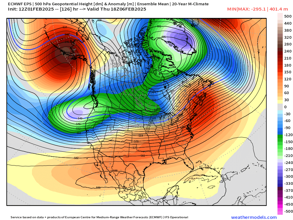
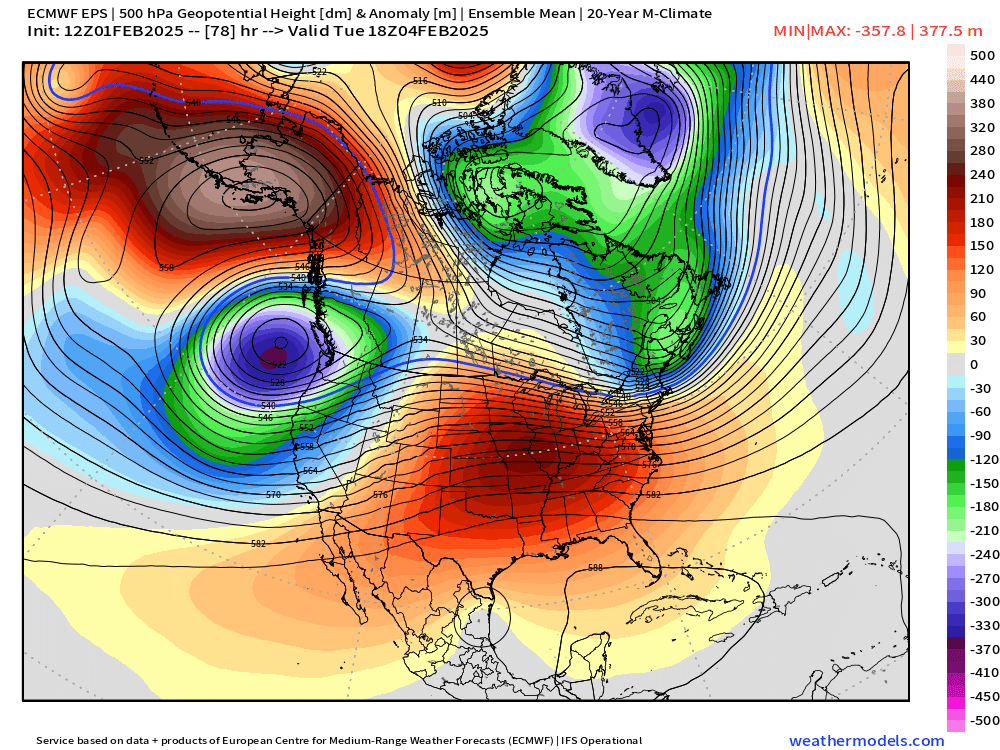
The maps below illustrate this quite well with cold anomalies centered over or very near to the pacific northwest this Sunday, Tuesday, Thursday, and even all the way into Tuesday the 11th with no sign of the pattern really changing. This lends me higher than usual confidence that we will be dealing with wintry weather for quite some time…

At the moment it’s sunny at my house, so I might head outside for a bit. Stay safe and enjoy the wild weather as much as possible. 🙂