I realize my previous forecast emphasized the Tuesday through Friday timeframe for our best shot at wintry weather; however, this morning the snow level dropped a little bit lower than I expected and locations like Sweet Home, Lyons, the hills around Silver Creek Falls, and Mill City all saw some snow this morning. A stalled out cold front, known as an “anafront,” brought the snow level down much lower around 8 to 10AM this morning. The rest of the today will be mostly cloudy with showers (some heavy) at times. High of 44°.
Important forecast thoughts. 🙂
In this weather pattern I cannot easily tell you who will or will not get snow. It depends on where the heaviest showers fall. Of course, higher elevations typically do better, but anyone could see snow this week if things line up right.
I’ve created two zones based on elevation. These are generalizations and should be taken with a few grains of salt. We will be dealing with a very showery pattern for much of this week meaning snow totals will not be uniform. Please use these zones as guidelines rather than set in stone boundaries keeping in mind that the scattered nature of these showers could throw things off a bit.
Zones
Zone one: The lowest elevations generally below 700′. This includes most of Salem, all of Keizer, Woodburn, Mount Angel, Albany, Independence/Monmouth, Scio, Stayton/Sublimity etc. Basically, if you know your elevation is below 700 feet, then you are in Zone one.
Zone two: Elevations 700 to 2000 feet. This includes the highest parts of the south and west Salem hills, Eola Hills, the hills around Amity and Bethel, hills around Dallas, locations outside of Silverton & around Silver Creek Falls, and any locations up against the Coast Range or Cascade Foothills with some elevation to them.
Highlights
TUE: Snow in the air with some slush in the highest hills around town. PM showers and sunbreaks. Zone one: Nothing – one inch. Zone two: Nothing – 3 inches.
WED: A few more spots of sticking snow. Cold enough that snow could accumulate anywhere. Same afternoon shower and sunbreak routine. Zone one: Nothing – one inch. Zone two: Nothing – 2 inches.
THU: This could be our best chance for widespread sticking snowfall. Expect more updates as we get closer, but I’m watching Thursday very closely. 🙂 The possibility exists for higher totals (a few inches) down to the valley floor if things setup as some models are showing. No details for Zone one yet. Zone two: 1 – 4 inches widespread.
FRI: Scattered snow showers will once again give a few neighborhoods accumulating snow, but not all. PM showers & sunbreaks. Zone one: Nothing – one inch. Zone two: Nothing – 2 inches.
Details
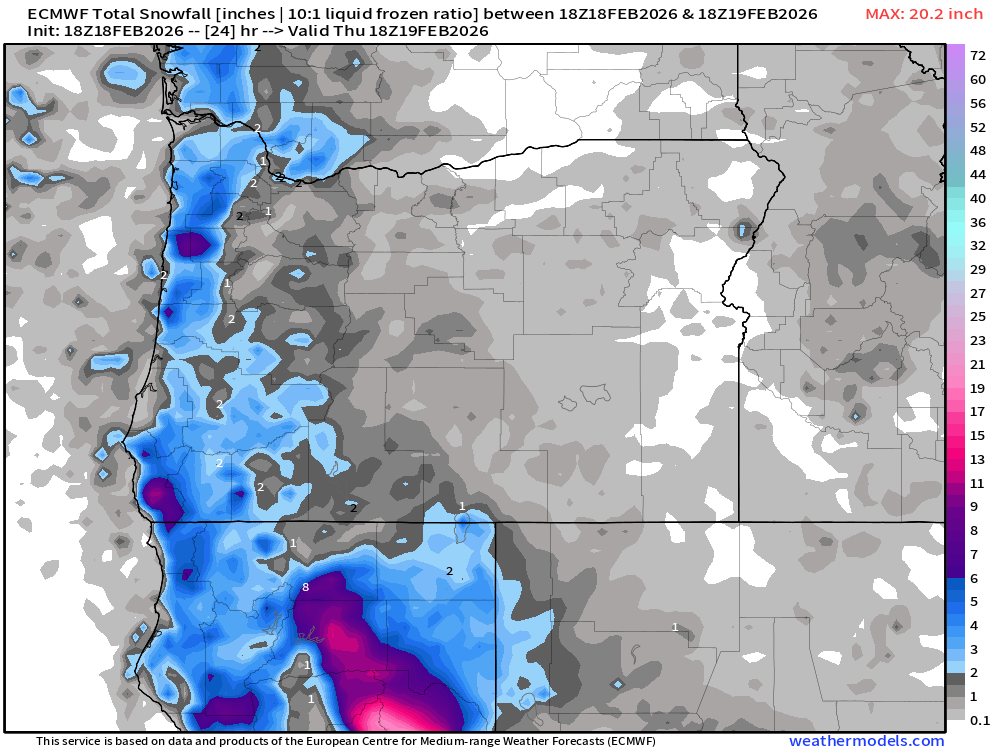
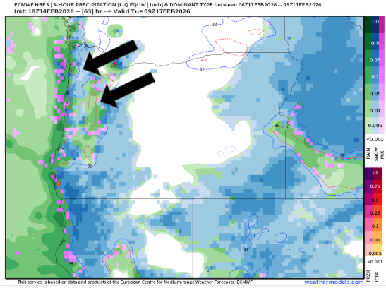
Tuesday: Lots of snow in the air in the Willamette Valley during the morning hours as numerous showers pass overhead. In general, higher elevations will do better, but it’s a game of where the heaviest showers setup. The map below shows estimated snowfall totals now through Tuesday afternoon. Take a look.
What stands out to me is the lack of any coloring (other than gray) over most of the Willamette Valley. This indicates the atmosphere will be a little too “warm” for sticking snow in the majority of those “Zone one” locations. I see the south Salem hills have a touch of blue on them. Could be slushy up there along Kuebler in the morning hours – maybe…
Heavier precip could drag the snow level lower Tuesday morning for areas around and south of Corvallis down to Eugene. Something else to watch for.
I’ve seen this setup before, and a few of the heavier showers Tuesday afternoon could turn your neighborhood white with small hail or graupel even if you miss out on the morning snow. High of 43°.
Wednesday: Slightly colder with a few scattered showers. Right now, I’m thinking Wednesday morning has a little bit higher chance for sticking snow down to the valley floor with a low of 31°. The limiting factor could be less moisture available. High of 44°.
Thursday: A morning low of 32° with more moisture moving through the valley than any other morning this week. This combo could set us up for some actual snowfall, but things need to line up just right. I plan to have additional updates in the days ahead to provide more details. For now, keep Thursday on your radar as having more potential for accumulating snow. High of only 40°.
Friday: Regardless of what happens Thursday, Friday morning will be the same routine as Tue & Wed. A few AM snow showers with afternoon showers of wet snow/rain/hail/graupel. Sunbreaks mixed in. Morning low of 31°. High of 43°.
The mountains
Coast Rang passes: Heavy showers at any point could briefly lay down a slick layer of snow or graupel (snow/ice pellets). Besides those exceptions, Coast Range roads remain just wet during the daylight hours turning snowy/slushy, or even a little bit icy during the nighttime and morning hours.
Cascade passes will be tricky in the next several days. I see there is currently a bit of traffic on highway 20 near Hoodoo due to a wreck. Take it easy, know your limits, and you should be fine traveling up there. Just be prepared for snow covered roads and icy spots with low visibility under the heavier snow showers. Snow totals of 12 to 18 inches through Friday with more snow continuing through the following week.
Hoodoo has a base of 21.5″ and counting. Hoping they get plenty of snow to open all their lifts and runs this weekend! Similar story for Willamette Pass.
Coastal locations
Coastal cities could see brief coatings of snow during the colder evening/overnight hours this week. Showers will be more frequent out along the coast over the next several days, and if temps are cold enough, some of those showers could be snow. Expect lots of downpours with a few sunbreaks mixed in at times during the afternoon hours.
That’s it for now. As always, stay safe out there. 🙂