Ice Storm 2021 Recap

This post has been a work in progress for several days now as I’ve gathered pictures and a few stats all while dealing with no internet up until this past Sunday. I wanted to do a detailed review of our historic and destructive ice storm including an overview of the events which took place, some photos and reports from around the region, and a few thoughts going forward. This was definitely a historic storm and deserves a post like this for reference in the future.

TIMELINE

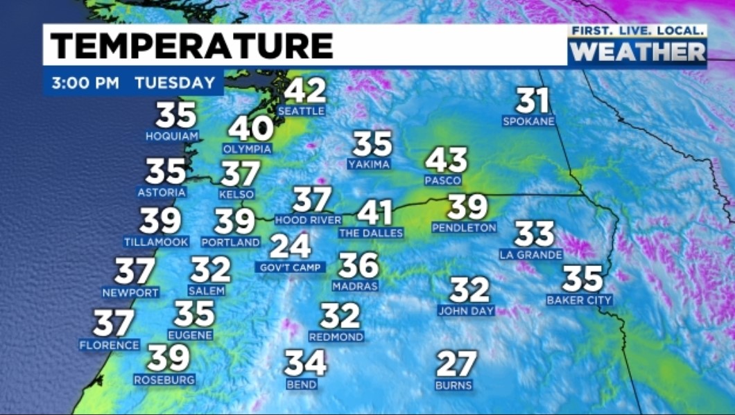
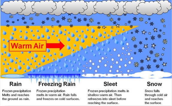
A combination of very cold arctic air pouring south from Canada and two very moist pacific systems led to what ended up being the worst ice storm here in decades. Around two tenths of an inch of freezing rain accumulated Thursday night as temps fell below freezing. A few snowflakes and a little bit of sleet mixed with the freezing rain specifically in areas north and west of downtown; however, for the most part it was freezing rain. I threw in this graphic again to illustrate why we saw freezing rain instead of snow despite temperatures being 28 to 32 degrees the whole time.

In short the cold air over Salem was just not deep enough to change the rain back into snow with this storm.

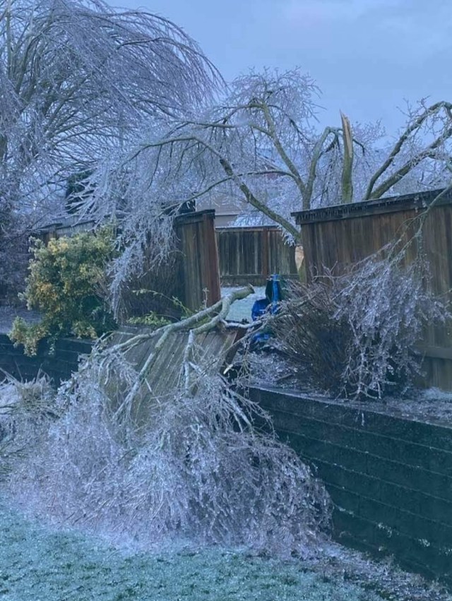
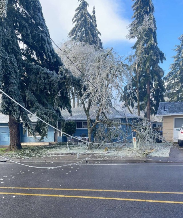
Friday was brutal with light freezing rain on and off all day long and a high of 30°. I still need to do some more digging, but it appears Salem tied its record for coldest high temp that day. BRRR!! Then a second and much stronger pacific storm rolled in right at sunset bringing around an inch of additional freezing rain which froze onto all elevated surfaces in the Salem area. A lot of widespread totals 1 – 1.25″ with a few isolated locations reported up to 1.5 inches of freezing rain when all was said and done! That is a ton of extra weight for trees and power lines to hold up which is why we saw so much destruction. To make matters worse the Portland area continued to see freezing rain Sunday through early Monday morning which led to thousands of outages up in that area as well turning this into a region wide disaster.

WHY SO BAD?

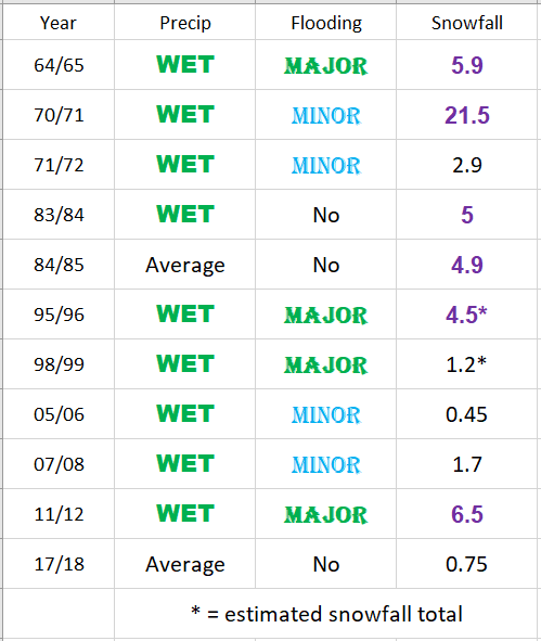
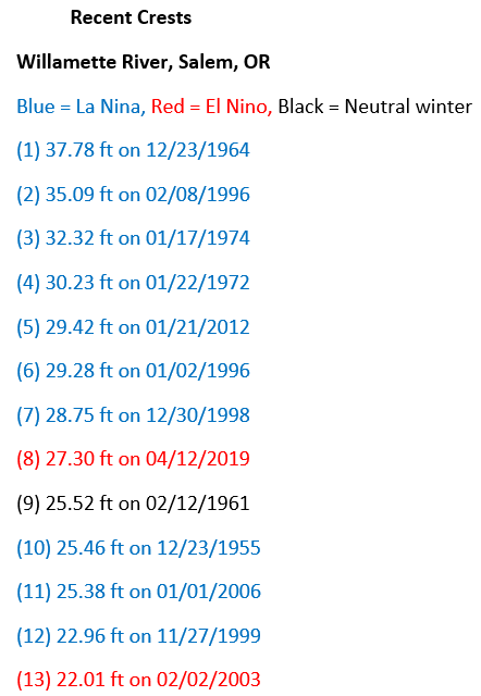
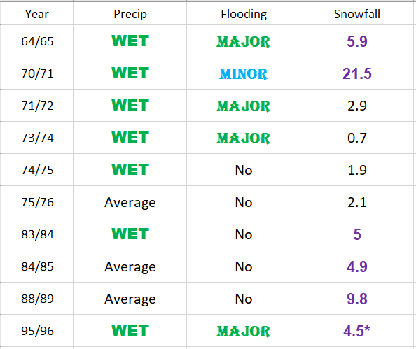
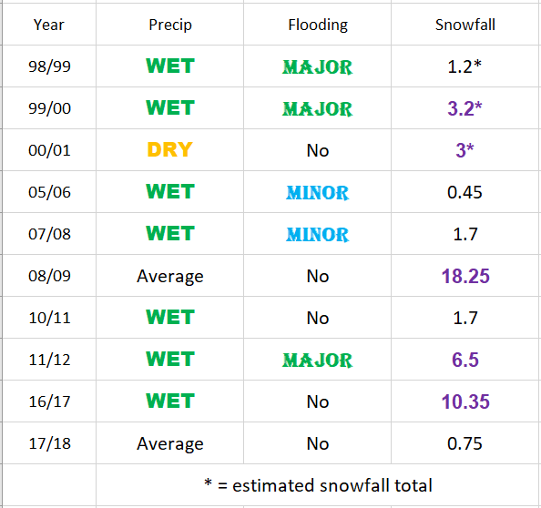
The shear amount of ice was hands down the main reason this ended up being a historic event here in the mid Willamette Valley, but there is a little more to it than that. The Salem area picks up somewhere close to a quarter inch of freezing rain ever few years with the winter of 2016/2017 being the last time we saw any. December 2008 gave parts of the Salem area a fairly major ice storm with around .75″ of ice. One has to go back to January 2004 for the last time any part of Salem received totals of an inch or so of freezing rain, and you have to go much further back (several decades) in time to find accumulations around here which come close to 1.5″ of ice!! So it’s been a very long time since we have seen a major (inch plus) ice storm. The long period of relatively “tame” weather has allowed our deciduous trees to grow and grow and grow much lager than they otherwise would be. Plus it’s not like Oregonians are known for keeping their trees trimmed lol. Something we could discuss another time… Anyway, the combination of overgrown trees and a historic amount of ice coupled together to give Salem and parts of the Portland metro area one of the most costly, darkest, and longest power outage disasters in decades.

THE STORM AND THE AFTERMATH

At the peak of the storm, more than 350,000 PGE customers here in Oregon had no power at the same time with over 5,000 power lines and three substations down! In total PGE had nearly 490,000 customers lose electricity at some point during the storm. Those stats do not include smaller utility companies, so when we add in the outages reported by companies like Salem Electric and Pacific Power, the number of customers without power goes up an additional 50,000 or so. A point of clarification, a customer is either a household, apartment complex, or business, which is one reason why it’s difficult to know exactly how many people ended up losing power. I imagine final numbers will come out eventually, but regardless, there were an awful lot of people without power, and the fact that there are still a few without electricity goes to show just how destructive this storm was.
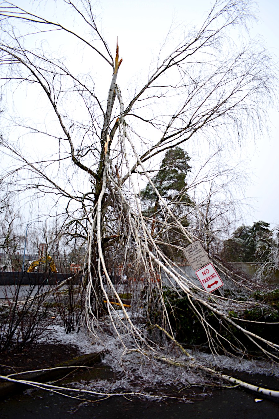
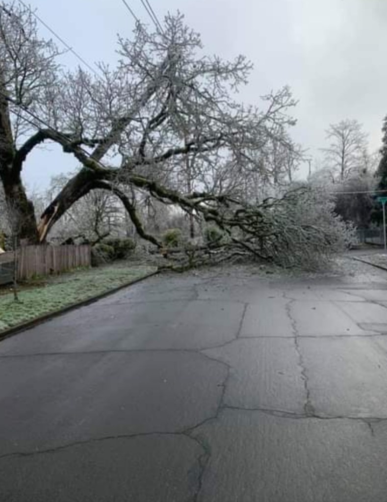
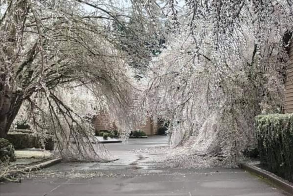
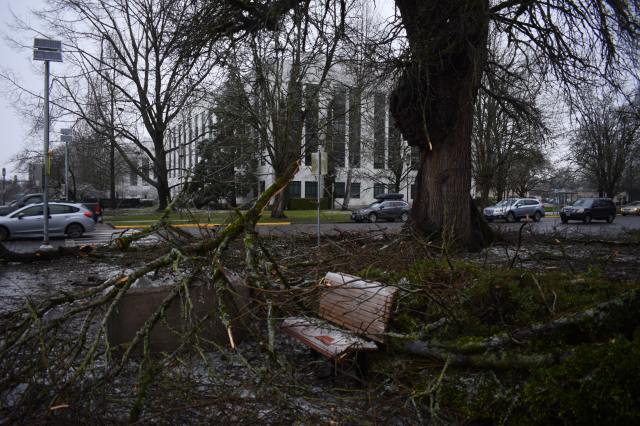
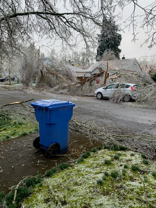
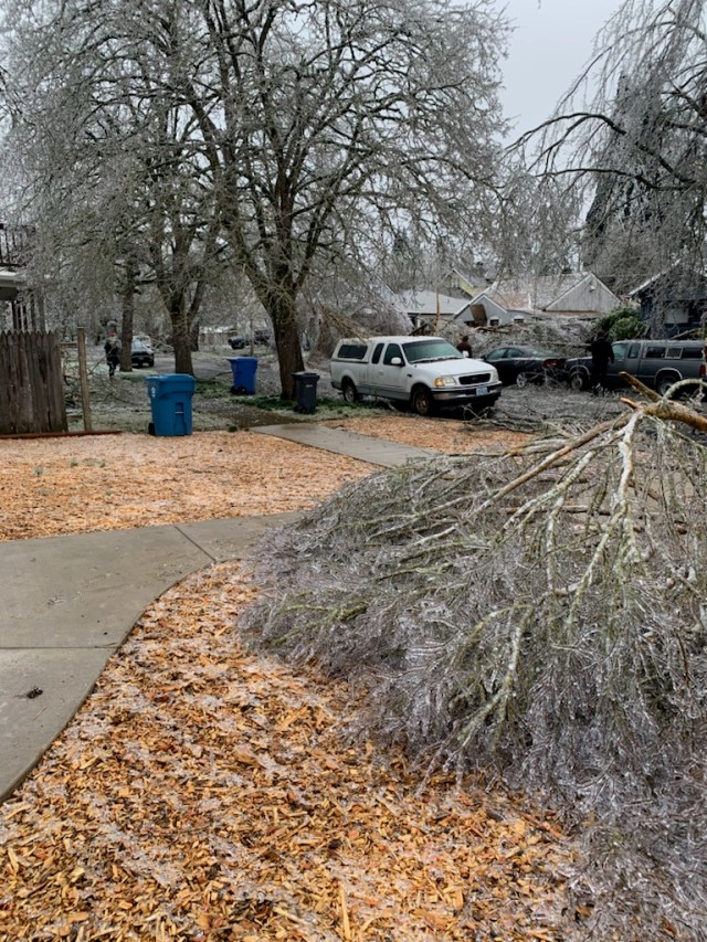
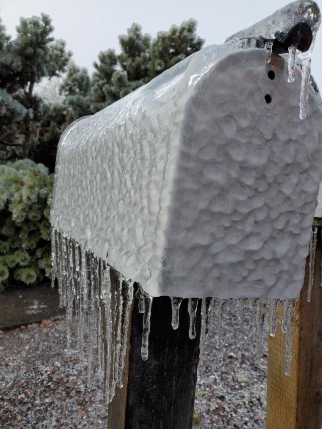
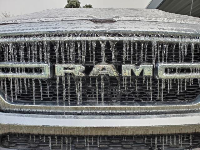
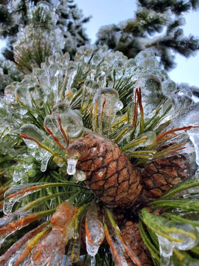
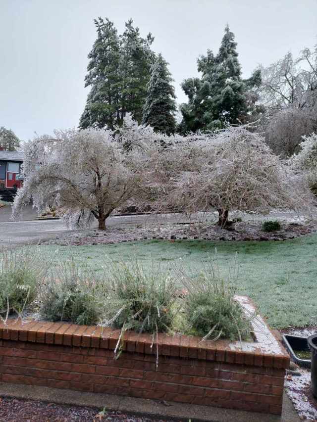
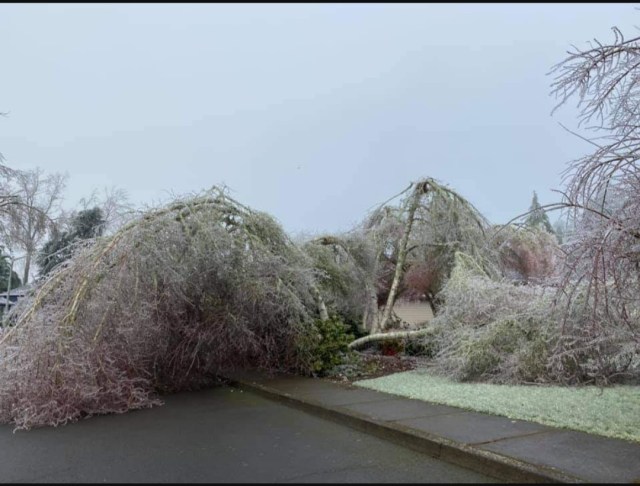
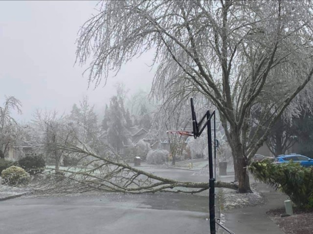
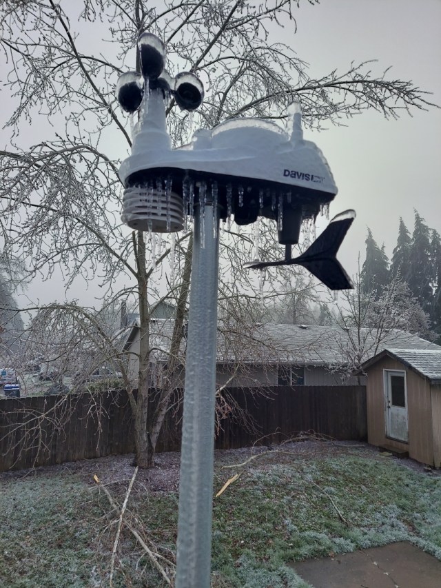
THE STORM IN PHOTOS

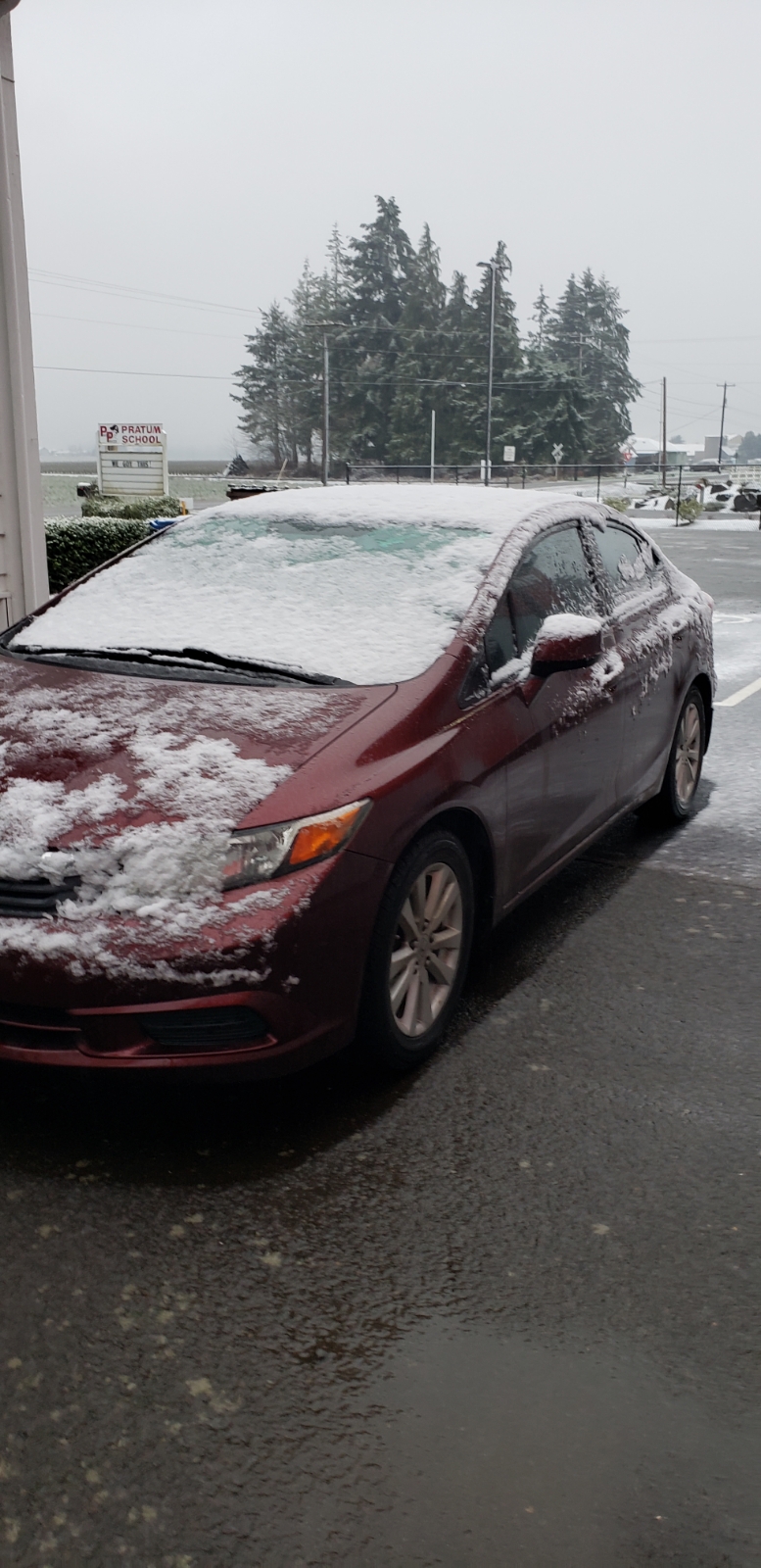
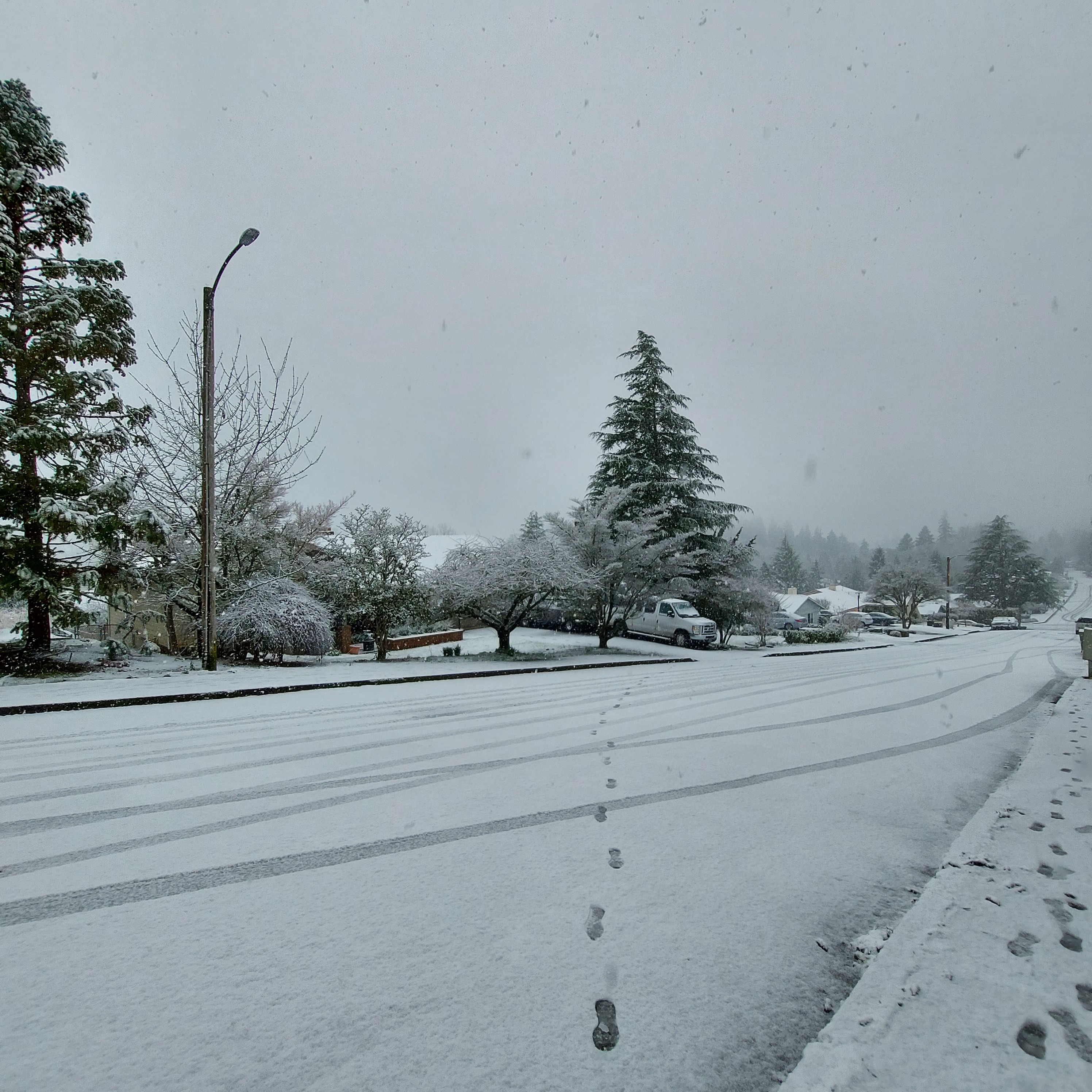
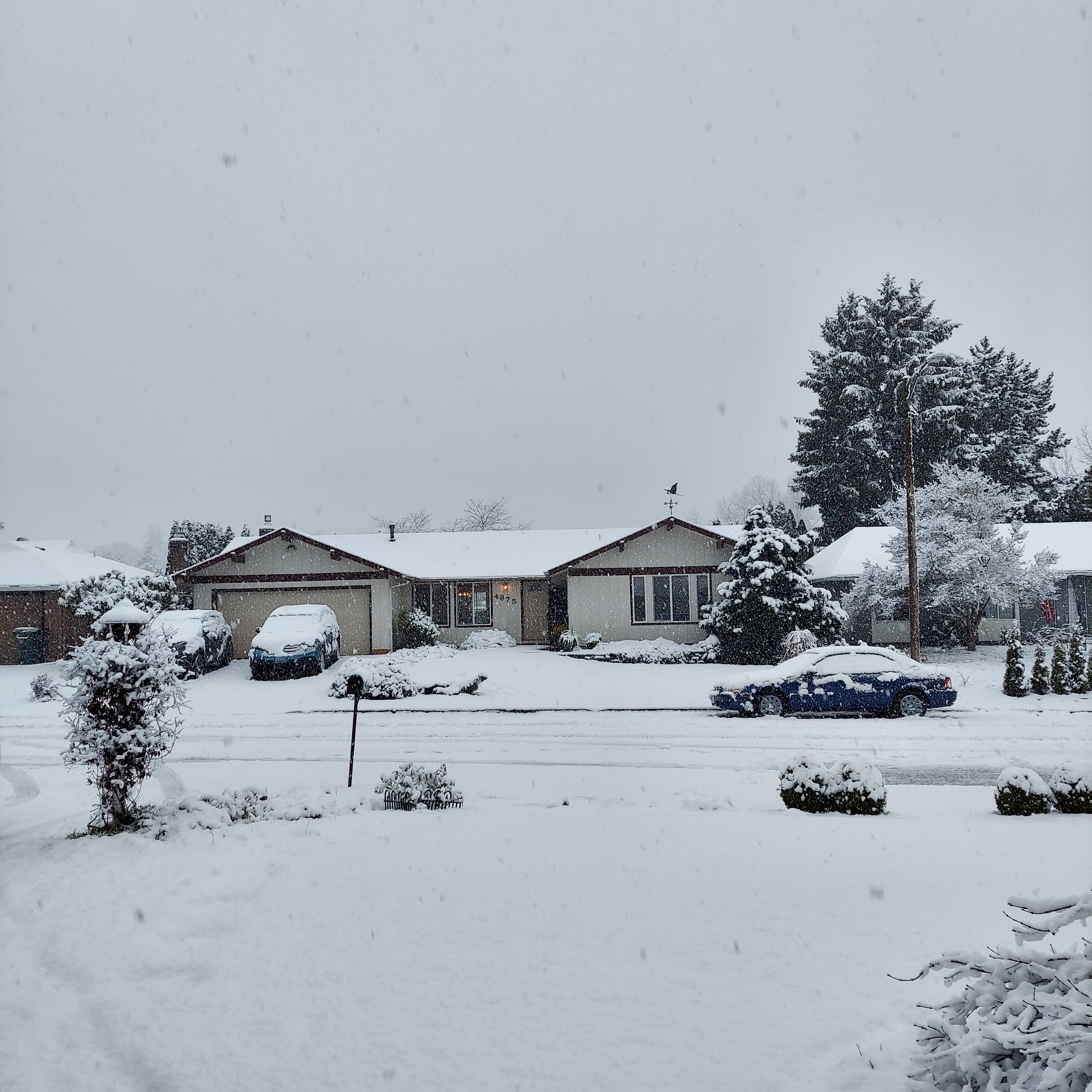
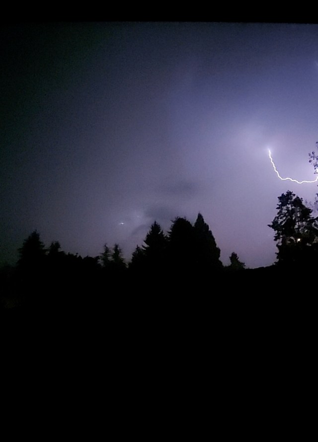
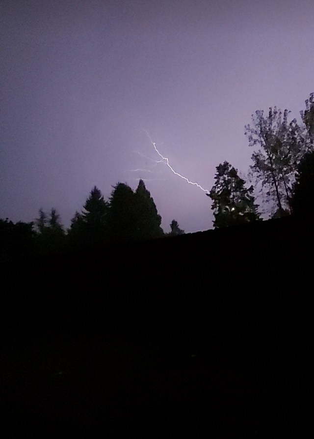
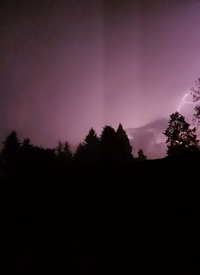
Below is a slideshow of photos which for the most part were shared with me by some wonderful followers, friends, and family members showing the ice and destruction from this historic freezing rain storm. This will be the storm we measure up to for years to come no doubt about it.

A FEW THOUGHTS ON STAYING PREPARED

Finally, I would add that between the shutdowns from COVID, the fire and smoke disaster this past September, and now this ice storm, it’s definitely (if you don’t already) a good idea to have at all time extra food, water, essential toiletries, medications, light sources, and sources of heat. I’m not promoting hording. In fact, hording is something I think people should avoid lol; however, there is something to be said about keeping some extra supplies on hand and gas in the car for when disaster strikes. While Salem does not received the sever weather that parts of the plains and gulf states receive, it is still remarkable looking back through history as a weather enthusiast and seeing the shear lack of extreme weather here in Salem (floods, snow or ice, and wind storms etc) over the past decade when compared to previous decades prior to this past September when we had the historic east wind event which helped spread the fires. Regardless, it would be foolish to think we will somehow be disaster free now for long time to come. There is no one season in which all disasters strike, and they can happen at anytime, so be prepared, be ready, and let’s all hope and pray that we are in fact done with these “once in a generation” events for awhile.

Bottom line is we never know when something could happen, so be ready. As the storm drew near it become clear we would see a “top tier” ice storm and we did, and while power outages were predicted, but I never would have guessed that so much of Salem, Keizer, and the northern Willamette Valley would end up without power for multiple days to over a week!

Lastly, let’s also hear it for the utility companies and related work forces who have worked incredibly hard restoring power and internet!! I’ve seen their trucks rolling around town at all hours of the day almost every time I’ve wondered out.

The Good, the Bad, and the Ugly. The January 2021 edition

I put together a nice little recap of our snowstorm and figured I might as well kick it off with a positive. THE GOOD. I believe I did a good job of emphasizing how the best chances for snow were going to be locations on the western side of the Willamette Valley, and that part held true. The highest snow totals were found in locations further west towards the Coast Range including Corvallis, Dallas, Amity, west Salem and Newberg. All of these locations scored really well. THE BAD. IT snowed in all of Salem, and in some spots it was a lot. The heaviest snow totals were west and south of town with lighter totals as one headed further east. In fact, there was generally very little snow at all east of Cordon Road. This picture came in from a loyal viewer, follower, and friend near Pratum just a few miles east of Salem. As you can see, not much snow there at all.

This second pic was taken around 2:30PM in West Salem. Definitely snowier here.

Of course, south Salem almost always scores big when it comes to snow, and this was no exception. 3 to 4 inches in the higher hills down south and that is where this third picture was taken.

Next take a look at the temps from around the region at 3PM Tuesday. Eugene was at 35°, Portland was at 39°, and even the gorge was fairly mild. Often times we get cold air through the gorge when we have valley snow, but this time that was not the case. The Dalles had a “balmy” temp of 41°. Notice Salem sticking out big time sitting at 32°. The whole event was bizarre when you look at how “mild” the rest of the region was.

In Salem we had a high of 40° at the airport right around 1PM, and then the snow moved in… By 2:05PM we were down to 32°. An 8 degree drop in one hour!! So where did the cold air come from? Well quite literally it came from above. Haha for real though, the heavy precip dragged cold air from higher up in the atmosphere down to the surface which is why as soon as the steady/heavy precip ended we switched back to a light rain that night. The second factor that led to snow was a process called evaporational cooling. When precipitation falls through a dry airmass like the one we started with Tuesday morning, it takes the heat out of the air causing the temperatures to drop. I just wasn’t expecting an 8 degree drop in one hour from those two factors. As someone who has watched and forecasted the weather around here for a while, the whole thing was a huge shock.

If I could go back in time and redo Tuesday’s forecast I honestly would not change much. Looking at my previous forecasts I clearly stated it was going to be a close call for snow, and I had been watching the possibility of snow on Tuesday for several days in advance. Instead of removing the chance for snow all together like I did, I should have left it in there, emphasized how the chance was slim, and then laid out exactly what had to happen in order for snow to stick in Salem. But oh well, I still enjoyed the snow a great deal even if it was a surprise, and I hope you all did too! It was a lot of fun seeing it come down, and I was thankful I had the ability to get out and enjoy it while it lasted!

The other thing I noticed was I had a few errors in my posts over the past few days. Sorry about that. I even forgot to attach an image of the forecasted radar that I wanted to share with you in one of the posts. Oops!!!! I’ve definitely been busy and sidetracked with some good, but big changes at work, looking for and getting ready to move into a new place here in Salem, and well I’m still out an editor. The biggest problem with finding an editor is the pay is crummy haha lol 😉 🙂

Anyway, have a great rest of your day! I’ll have a forecast out later tonight or tomorrow, and I can tell you with confidence that our chances for snow are not over…. 🙂 February is looking chilly!!

Winter 2020/2021 Outlook

Salem had a toasty high of 85° today!! The next several days are going to be much warmer than normal with highs in the mid 80s as we end September and begin October. I imagine everyone will be doing their best to enjoy the nice weather because we all know our wet season is just around the corner…

Since fall is here, even if it doesn’t totally feel like it, I figured it could be both fun and a good time to share a few thoughts on this upcoming winter. I’ve never done something quite like this before and to be honest some years, like last year, are more of a crapshoot; however, this year we are expecting a moderate La Nina which gives us a few extra hints as to what type of weather we are likely to see this winter.

For this discussion I analyzed 11 La Nina winters which had similar strength to the one being predicted this year. I’ll also be referring to the months of November through March which I consider to be our primary storm/winter season. There are some years where the storm season really gets going during mid October, and this could be one of those years, but the statistics I looked at and the focus of this discussion are centered on the months of Nov – Mar. This first chart shows those 11 La Nina winters and how they fared in terms of precipitation for Salem, whether or not there was a valley flooding event, and Salem’s total snowfall in inches during each of those winters.

* = Estimated snowfall total as official records are not available those years.

1.) Perhaps the number one thing that stands out is how wet La Nina winters typically are in the valley. 9 of the 11 La Ninas surveyed gave Salem above normal precip. That lends pretty solid confidence we will end up wetter than normal. As is the case every winter, Salem should still see a number of dry days mixed in. The key thing to remember is that overall statistics favor a wetter and rainier than normal winter for the Willamette Valley.

2.) Not shown on the chart, but odds also favor an above normal or at “worse” an average mountain snowpack this year which is great news for skiers/snowboarders and our water supply. One caveat is there have been a few La Nina winters which got off to a slow start in the snow department meaning Nov and Dec weren’t necessarily real good in terms of mountain snow; however, the vast majority of those winters still saw an excellent second half to the ski season as snow ramped up nicely in Jan and Feb of those years.

3.) This next one is not good news. Keep in mind I’m strictly talking odds here by looking at what happened in past La Ninas, but for this one the odds are not in our favor. Of the 11 years surveyed, 8 saw a notable (either minor or major) valley flooding event. The percentage of La Nina years with significant flooding events is high when compared to non La Nina winters. Below is a list of historic flood events on the Willamette River in Salem. This list only contains floods occurring since flood control dams were built in the 50s. It’s no coincidence that 10 of Salem’s 13 worse floods occurred in La Nina winters, and while it’s far from certain, one would be wise to keep this in the back of their mind, especially if you live in a flood or mudslide prone region as the odds of seeing some sort of flooding event this year are higher than normal….

Data courtesy of NOAA
https://water.weather.gov/

4.) Perhaps the most anticipated question is whether or not it’s going to snow here in the valley. Well, 11 of the 11 La Nina winters I reviewed in detail produced at least some snow here in Salem. Woo hoo! Breaking it down further, 6 of those years produced enough snow for sledding or building a snowman in (highlighted in purple on the chart). The other 5 only saw minor accumulations of a slushy inch or two. Take it for what you want, but odds are high we at least get an inch or so of snow, and odds are higher than normal we see a respectable/decent snowstorm at some point this winter. Far from a slam dunk as I like to say, and we are talking statistics, but it does provide some extra hope for us snow lovers. Definitely better odds than last winter! 🙂

So yes, may the odds be ever in our favor, and with how 2020 has gone I really do mean that. A quick recap for you:

1.) Odds favor a wetter/stormier than normal winter overall.

2.) Odds favor a good mountain snowpack and good year for ski resorts.

3.) Increased odds for a significant valley flooding event.

4.) Higher than normal odds for some valley snow.

For reference, here are all La Nina winters (regardless of their strength) since 1960. Again, the pattern is the same. Almost all of them ended up wetter than normal, many of the years had flooding here in the valley, the majority of these years had a good mountain snowpack, and all of them produced at least some measurable snow (albeit some years it was no more than an inch or two) down to the valley floor.

The odds definitely favor a more active winter, but only time will tell, so be ready for anything, and then I guess just sit back and see what happens…

Storm pics and the week ahead

It’s been a few day now, but those were some wild storms the other night, wouldn’t you agree? Many locations around Salem picked up over an inch of rain that Thursday night. I picked up 1.18″ at our south Salem home. Much of that falling within 30 min!! The other exciting part of those storms was the amount of lightning produced. Here are a few images I caught on video.

Looking forward we have a couple of nice dry days before rains move back into the region on Wed. Here’s your forecast for the week ahead:

Highlights

1.) Overall fairly high confidence with the forecast this week. Wed may initially start off dry, but it won’t last long as a steady rain and breezy winds move in. In fact Wednesday is looking like quite the soaking with anywhere from half an inch to an inch of rain expected. More good news for the fires continuing to burn up in the Cascades.

2.) Thu & Fri: Showers and sunbreaks. Chance for a thundershower Thursday, but this will be a more typical brief downpour, maybe a rumble of thunder, and small hail type of thundershower. Nothing like the storms we just had.

3.) Sat: An isolated shower or two, but overall mostly dry.

4.) Looking further out it appears September will end on a dry & warm note with Sunday through at least Wednesday of the following week looking sunny, mild, and dry!

Snow stats, fun facts, and a real fast forecast

Hehe, I gotta say I thought coming up with that title was pretty darn clever of me.  Anyway, all this extra time at home has allowed me to put together some fun weather graphics regarding snowfall here in Salem.  It’s a long read, but if you are like me you probably have some extra time on your hands now.  If you’re in a hurry the forecast is at the bottom of the post.  ENJOY!!!

Below are a couple of charts showing the total snowfall per winter here in Salem.  The type of winter each year was (meaning El Nino, La Nina, or Neutral) is also represented, and the winters are abbreviated, so for example this past winter is represented as “19/20.”  Yeah, I’m a teacher so I tend to explain things whether people need it or not.  Anyway, take a look at these charts and see what you think.

Salem snowfall by year 02 to 19

Salem snowfall by year 77 to 94

Something to keep in mind is that Salem quit keeping official snowfall totals after 1995 at the airport where “official” records are kept, so finding accurate snowfall totals for the years since than is not an easy task at all.  Of course you can make whatever conclusions you would like to make about these graphs, but I want to mention a few things that stood out to me.

1.)  In the 36 winters I have sampled here, La Nina winters were 10 for 10 with producing snowfall for Salem.  The winters of 05/06 and 17/18 were both very low with grand totals not even making the one inch mark, but even if we count those as “no snow” years it still means 80% of our La Nina years turned out to be “snowy” winters.  So, yes, La Nina winters really do have increased odds of bringing valley snow. Speaking of, I hear next winter might be a La Nina.  Just saying….   ðŸ˜‰

2.)  El Nino winters produce the vast majority of our no snow years.  6 of the 14 El Nino winters graphed on here gave Salem a big fat ZERO in the snow category.  Every so often there are exceptions, and last winter, an El Nino, was one of those exceptions with just over 6 inches of snow falling during that cold February.  With that said, when El Nino roles around the odds of seeing no snow increase a bit at least here in Salem.

3.)  Snowfall has decreased overtime.  I know 36 years is a small sample size when you consider the age of the earth, but the change between the two time frames is fairly considerable and worth noting.  The average winter snowfall for the 18 years between 1977 to 1995 was 5.89″.  The average winter snowfall for the past 18 years is 3.97.”  So an almost 2 inch drop between the two time periods.  Now, when looking at larger and more complete data sets including data for Portland there are decent indications that we have leveled off a bit and are no longer “dropping.”  Not sure if that will continue to be the case, but since I along with all the other forecasters on this planet struggle to get forecasts right a few days in advance, I’m not going to try and predict what our average snowfall will look like three or four decades out much less a few years from now.  Just some interesting facts I thought I would share.

4.)  The final thing I noticed is how it appears as though we have become more boom or bust in regards to our snowfall overtime.  Looking at the past 18 years we had 12 winters with less than 2 inches of snow, but 4 winters with over 10 inches.  In the 18 years from 1977 to 1995 we had only 6 winters with less than 2 inches of snow, but only 2 winters with totals over 10 inches.  Again, I know this sample size is small; however, it looks as though our climate has become more extreme in terms of snowfall with more years being “all or nothing” lately.  When looking specifically at the second chart you can see winters receiving 4 to 10 inches of snowfall were much more common than they are now.  Looking at the past 18 years both the number of winters with 2 or less inches of snow AND the number of winters with 10 inches or more have doubled when compared to the previous time frame.  Definitely a boom or bust pattern at least in my mind.  Interesting don’t you think????  Curious what you guys have to think about all this.

Switching gears a little and taking a closer look at snowfall for the past decade I broke down the snowfall totals by month which reveals more “interesting” statistics.  Take a look:

Salem snowfall by month

Over this past decade we saw the biggest March snowstorm in 60 years back in 2012.  You remember that one right?  Several inches fell right before spring break.  That month actually had a couple of smaller snowfalls earlier in the month in addition to the big storm which all together added up to a total of 5.25″.  We also had some big February snowfalls specifically in 2014 and more recently last year with all those small snow events adding up to a little over 6 inches for the month.  Those two years together really made February the big winner this past decade in terms of total snowfall by month, and while February was this past decade’s snowiest month, January and December are still on average the snowiest months of the year; although if this next decade looks anything like this past one than I believe those titles may be in jeopardy.  Here is how the numbers break down for the decade:

Feb:  19.25″

Jan:  6.9″

Mar:  6.05″

Dec:  5.25″

Nov:  0.35″

You can see how January barely beat out March for total snowfall, and to be honest it looks like December has some work to do as well if it wants to maintain its status as one of our snowiest months of the winter.  I know it doesn’t work this way, but I suppose one could say we are “due” for a snowy December and January as we head into this new decade, and maybe even a snowy November.  November 1985 was the last time Salem saw several inches of snow in November, and November 2010 was the last time Salem recorded any snowfall during that month.  Rare for sure, but it does happen….

Forecast

While I’m at it I might as well give a quick forecast for the next several days, but first I think we can all agree that we have been blessed with some very nice mid March weather lately.  It could easily be 50 something degrees and rainy this time of year.  Instead we have had almost a whole week with sunshine and high temps above 60 degrees, not too shabby!  Sure makes the little bit of snow we had last weekend seem like a distant memory.

Looking ahead Sunday will still be nice and mild, but with a few more clouds.

Mon:  Cloudy, cool and wet at times.

Tue & Wed:  Typical shower and sunbreak kind of days.  As is normal in this pattern, I expect some of the showers to be quite heavy with brief downpours and small hail mixed in.  Overall there should be more sunny times than wet both these days with Wednesday being the sunnier of the two days and thus a bit warmer.

Thu:  Dry, but with lots of cloud cover.

Fri:  Looks rainy at this time.

Bottom line:  Don’t let those weather apps scare you.  It may look like a washout of a week, but we should still have plenty of dry and even sunny times between the showers.  It won’t be as nice as this week, or even close, but with plenty of dry and sunny breaks between the showers I think it won’t be all that bad.  Not a bad time to begin prepping the garden!

Take care and be safe!!

Summer 2019 update, a look ahead, and special announcement

This summer has no doubt been cooler than a number of our more recent summers, but all & all still plenty of warm & sunny days, and there’s a benefit to our cooler and slightly wetter summer, and that’s the lack of wildfires.

I’ve noticed, and I imagine many of you have noticed the lack of thick smoke in the air both at the surface and far overhead like we have seen on so many occasions over the past few summers.  Definitely a lot more blue skies and a lot less haze this year.  Also, to the very best of my knowledge there are no major wildfires burning in the Cascades or Central Oregon for that matter which is a huge change from recent summers.

So a “cooler” summer really isn’t too bad with all things considered.

Extended Forecast

8.19


Details

Tuesday:  Sunny with increasing clouds & humidity later in the day.

Wednesday:  Lots of clouds around, muggy with a few showers.  Some showers could be rather vigorous.  Maybe even a clap or two of thunder.

Thursday:  A fairly cool start to the day with lows dipping close to 50°.

Friday:  Warm & sunny.

Saturday:  Slightly lower confidence Saturday (as noted by the lack of green highlighting).  For now I’m leaning towards a partly sunny day with highs around 80°.  There’s a weak little “storm” (or more accurately a batch of clouds) I’m watching which could ruin that forecast and keep temps down closer to the low 70s.

Sunday & Monday:  Warm with sunny skies!

Beyond next Monday:  Looks warm & dry as we head towards the end of August.


Special announcement…

I’m sure you all are waiting at the edge of your seat for this 😉

Are you ready?!?!?   I’m pleased to announce that Bryan Weather Alerts is expanding to the world of Instagram and Facebook!!!!!!!

LOL….  Okay, so it’s maybe not that exciting to you, but I’m thrilled!!  The Facebook Page in particular will be a great place for all of you, my incredible followers, to post awesome weather related photos for the purpose of sharing with others, for using right here on the website in updates, and on occasion, use on the Instagram Page.  This will be especially fun and useful during storms and snow events.  🙂   You can find the page right here:  https://www.facebook.com/Bryan-Weather-Alerts-105605014141422/


A very wet April

There has been a lot going on lately with the weather and I figured it was past time to get all caught up.  We are looking at one of the wettest Aprils on record, snow in the mountains, and intense flooding across the area.  Flooding in the Willamette Valley has been the worse since January 2012, and in some places all the way back to November 1996!  Right now Salem is 3 inches above normal for rainfall at this point in the month.

This picture was taken on Wednesday.  It shows highway 34 crossing the Willamette River on the eastern edge of Corvallis.  Very high water levels will continue for another day or two.

river flooding 4.10.19

This is a chart of the Willamette’s river level in Corvallis.  It crested at 32.8 feet.  For reference the February ’96 flood crested at 33.5 feet down there.  Pretty incredible!

Corvallis river level


Extended Forecast

I’ve got an updated extended forecast here for you as I’m sure you’ve all been struggling through life without one over the past several days 😉

April 11

Details

Fairly high confidence with the exception of Tuesday and Wednesday.  Both those days could be wetter or drier than currently forecast.  Right now I’m sorta splitting the difference and banking on Wednesday being a drier day while Tuesday stays on the showery side of things. 

High confidence that we enter into a dry spell stating next Wednesday/Thursday, and there are indications that this dry spell will last through Easter weekend 🙂

In the meantime we have several more cool and showery days ahead.  I’ll leave you with this snowfall map showing a solid 10 to 20 inches of new snow for the Cascades by the end of Tuesday with the highest amounts above 5000′.  Winter is trying hard to hang on. 

mountain snow mid April