The forecast
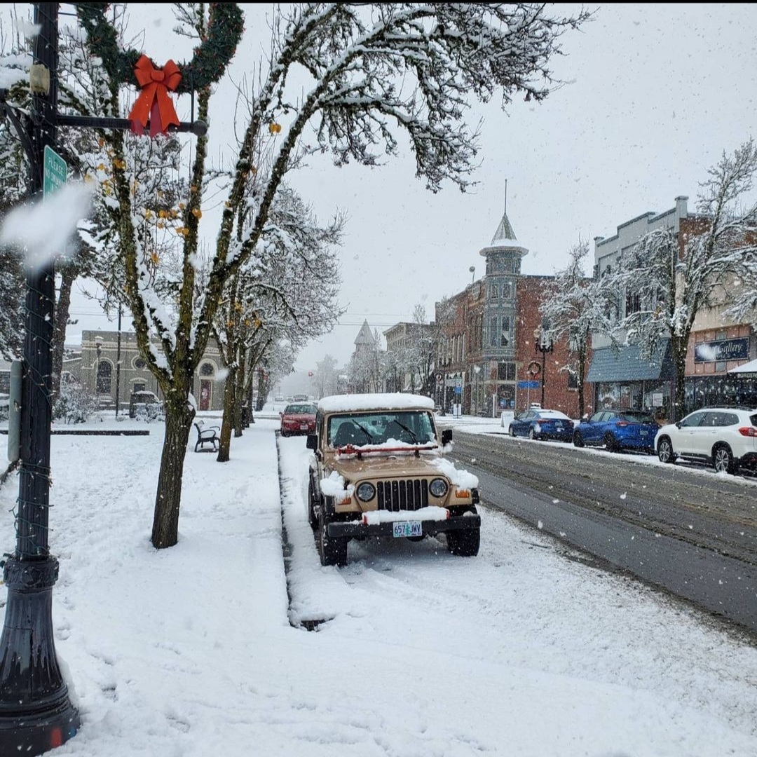
Periods of rain and breezy conditions will prevail through Sunday. This is typical northwestern Oregon rain. Nothing real wild.
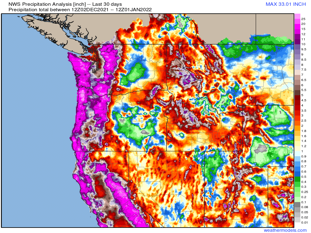
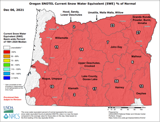
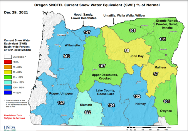
Temperatures will stay chilly though which means the incredibly healthy Cascade snowpack will continue to grow. Check out this image showing our current water equivalent snowpack percentages by region.
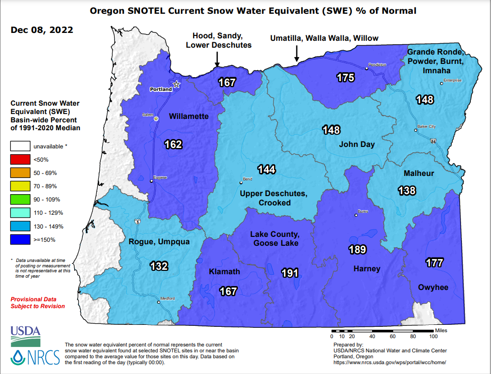
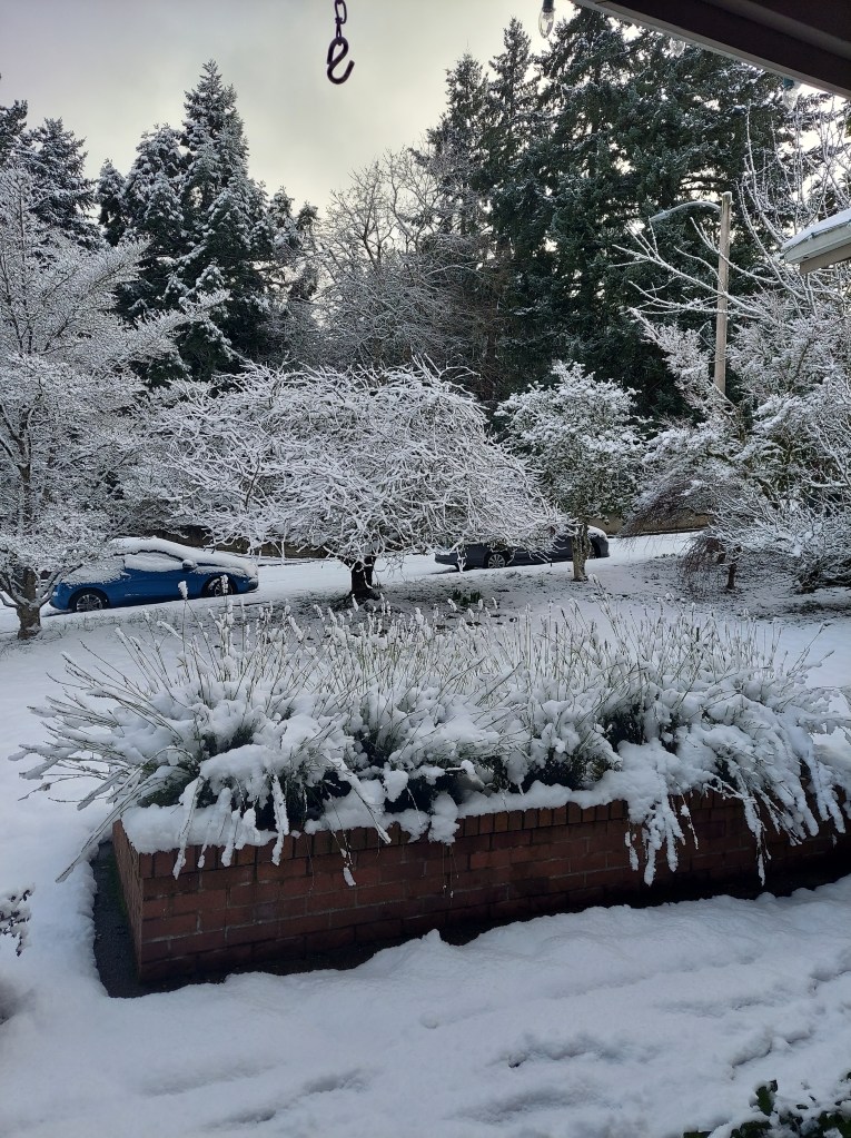
The entire state is running well above normal for early December. Hoodoo Ski Area currently has 42″ of snow at its base. I was just up in the Cascades last weekend and I can attest to the fact that there is a lot of snow up there already. The storms this weekend will dump another 18 to 24 inches of snow through Sunday night. Snow levels will also stay below the passes the vast majority of the time, so expect snow covered roads if you’re heading up there.
Next week is going to be cold. No clear signs of moisture interacting with the cold yet; however, this will almost certainly be the coldest weather we have seen this winter. I’m watching things closely for sure! 🙂
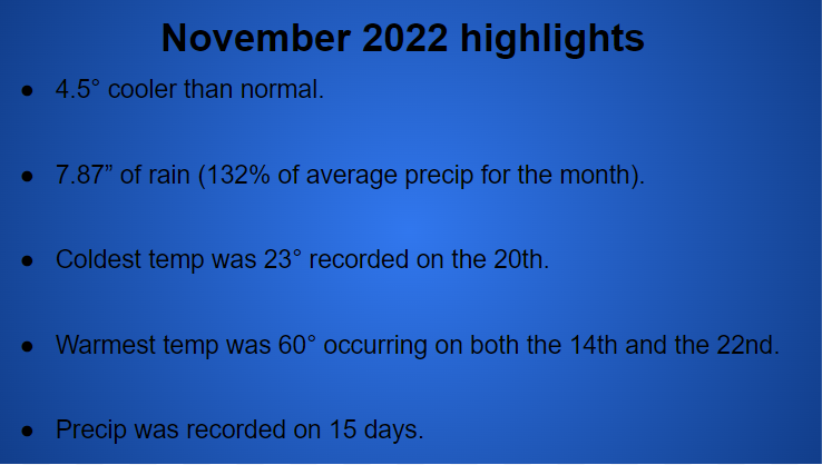
November 2022
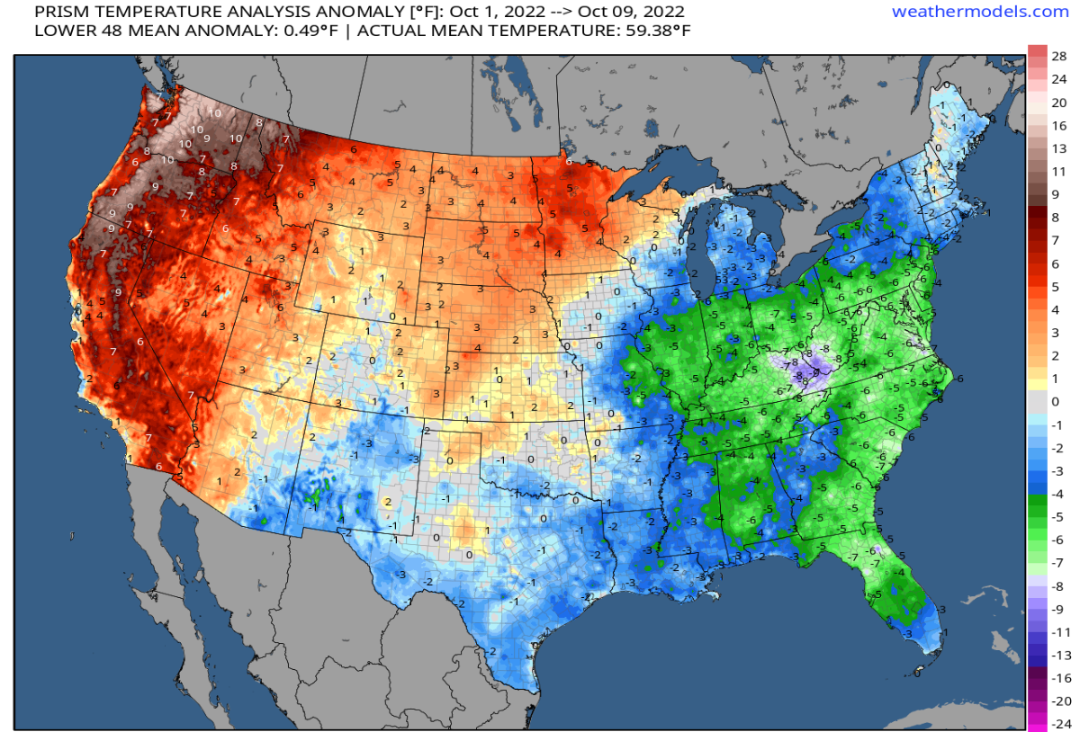
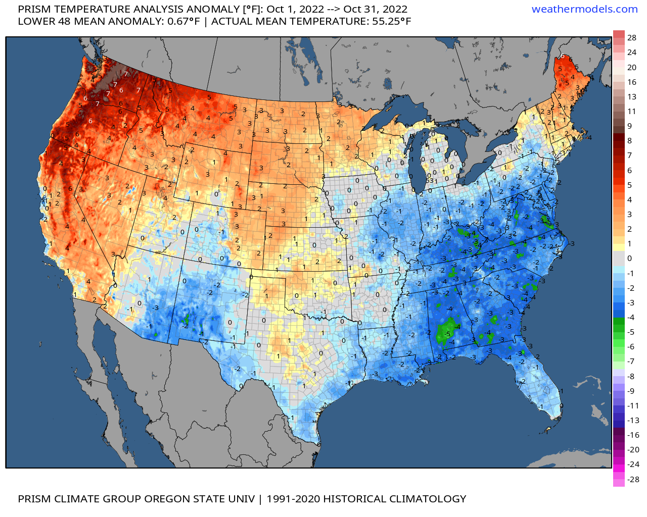
November stood in stark contrast to the extremely warm weather we saw in October. Check out this comparison between October and November for temperature departures from normal.

Highlights from the month include the little bit of wet snow which fell on the evening of the 6th. Slushy accumulations of less than an inch were reported in the higher hills south of Salem as well as areas near Corvallis.
The wettest day of the entire month actually took place just two days prior on the 4th with 1.65″ of rain falling in just 24 hours.
For almost 3 weeks nothing really happened through the majority of the month other than it was freezing cold, and dry.
The month closed out with a bang as a strong cold front moved through. Salem recorded a wind gust of 44mph and picked up another inch and a half of rain while the mountains received a couple feet of snow. For you guys who enjoy statistics, here’s a quick recap of November 2022.
That’s all for now. Have a fantastic weekend and stay safe out there!