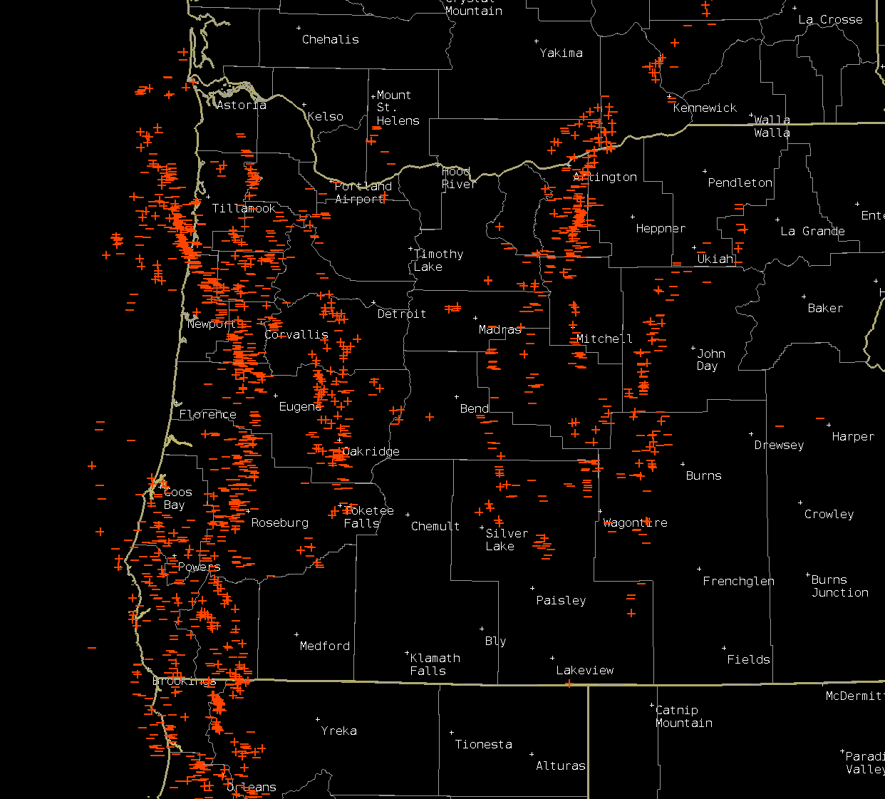
We have yet another beautiful week ahead, and I have the forecast right here, but if you have some extra time, I would appreciate if you could read some thoughts I felt like sharing. I steer clear of politics in my forecasts, and to be straight forward with you, I don’t believe I am stepping into politics all that much even in this post. In general it is forecasting weather and getting outside to enjoy it which I love so much; however, I’m not oblivious to the things going on around me, and as we approach the anniversary of 9/11, I feel it is important to share some thoughts as to why America is such a wonderful country to live in.
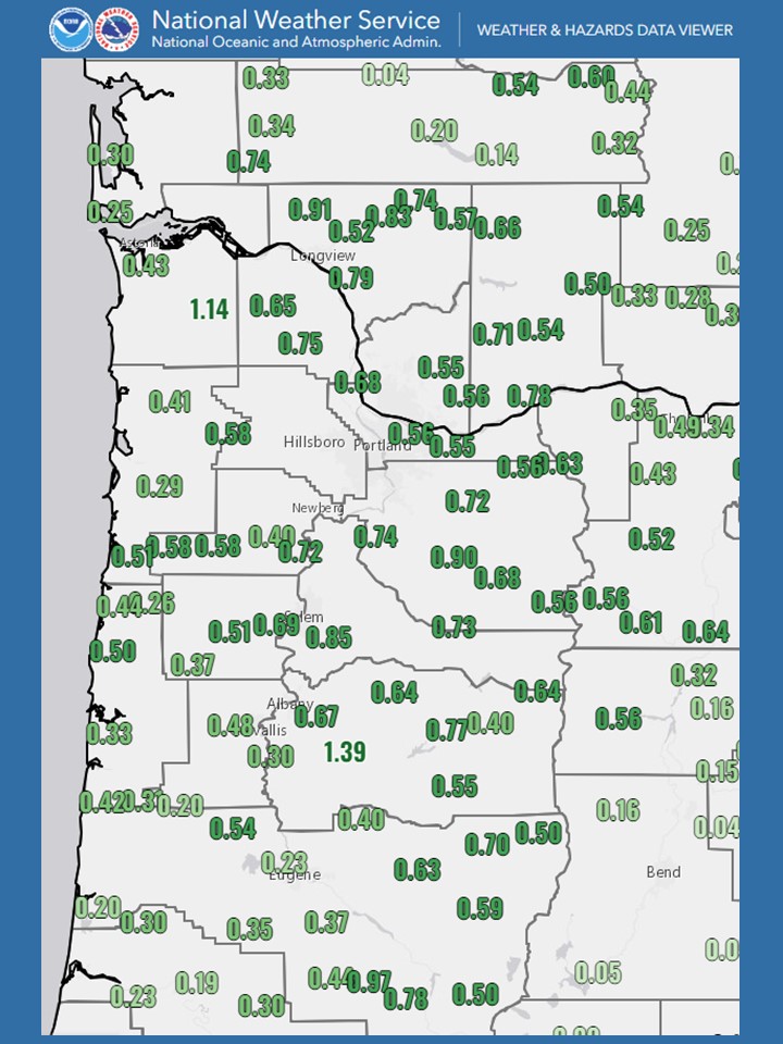
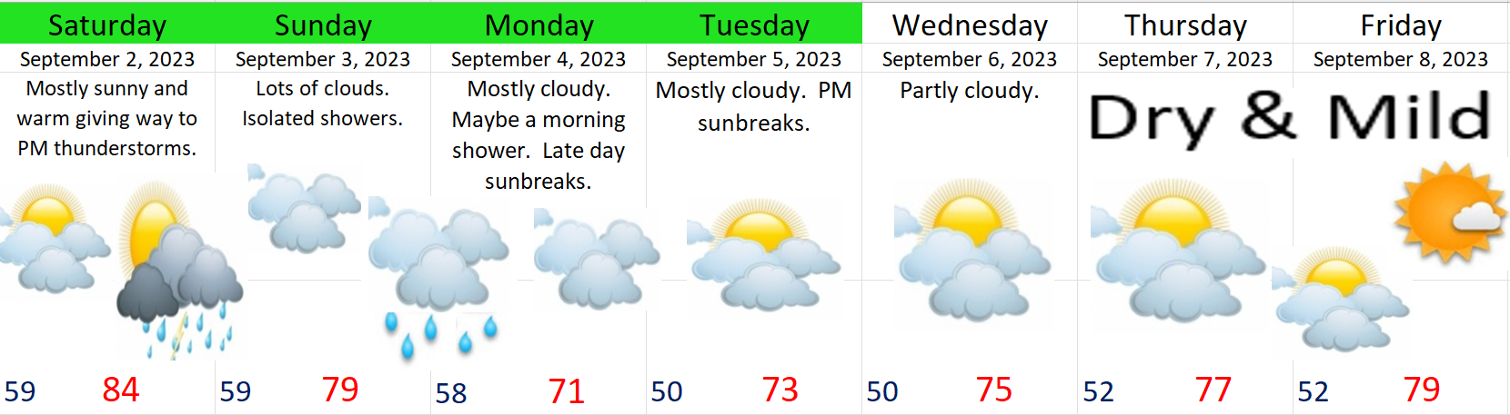
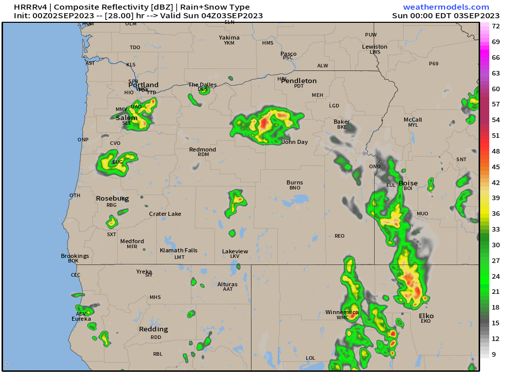
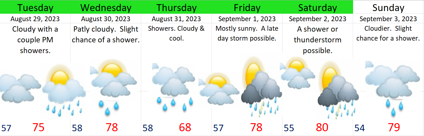
Here’s the next 7 days

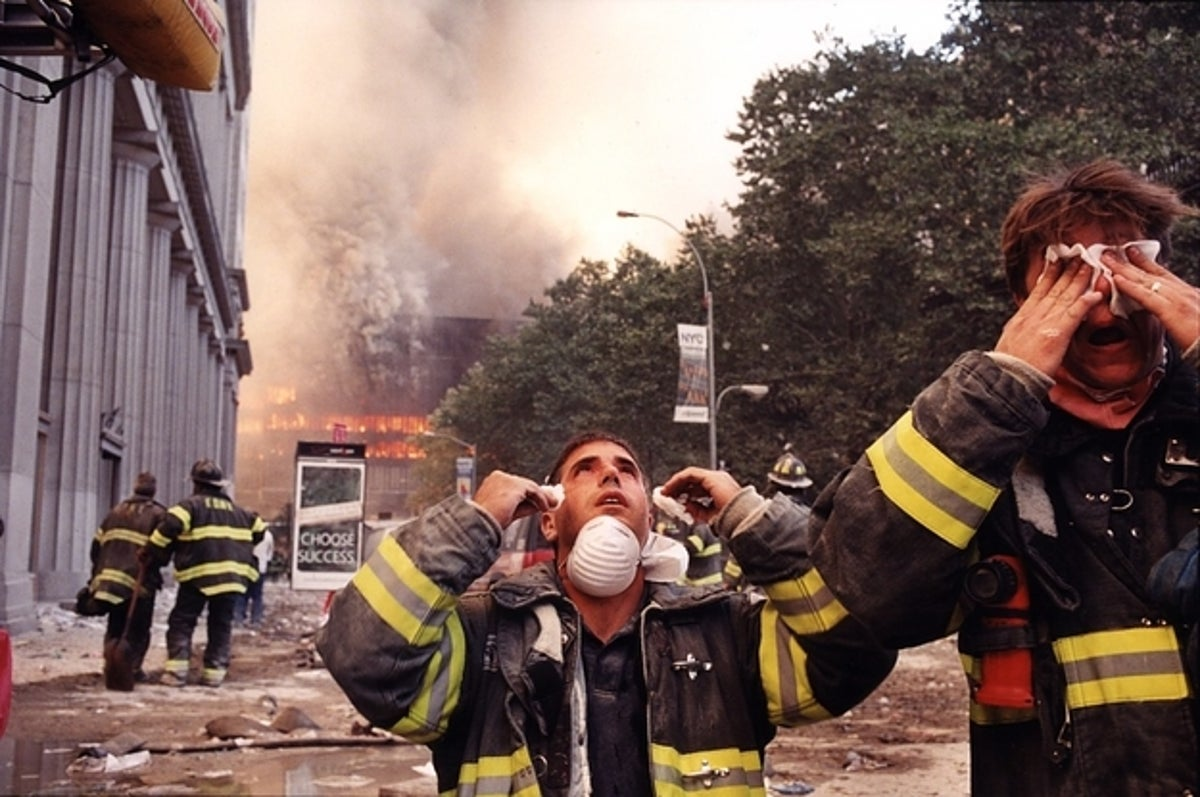
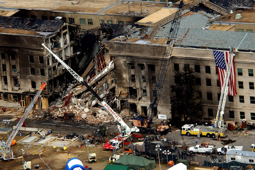
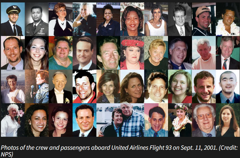
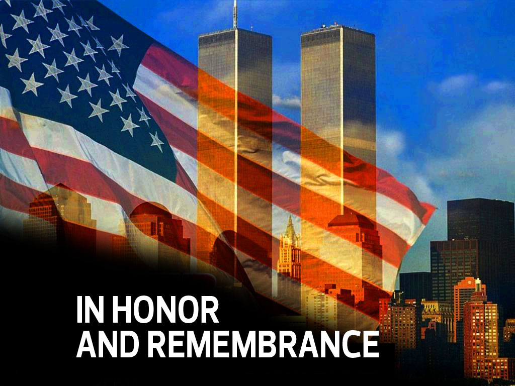
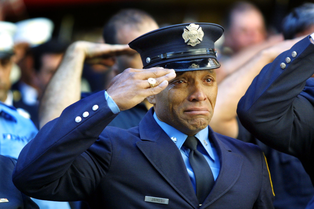
22 years ago already. Do you remember 9/11? I wish to share a few pictures to spark our memories, because it should be more than just a saying. Let us truly never forget the loss of life and the sacrifice our brave and selfless fellow Americans displayed on that day as they tried to save others. It is good for us to feel emotional sometimes about these things in order to help us never forget.
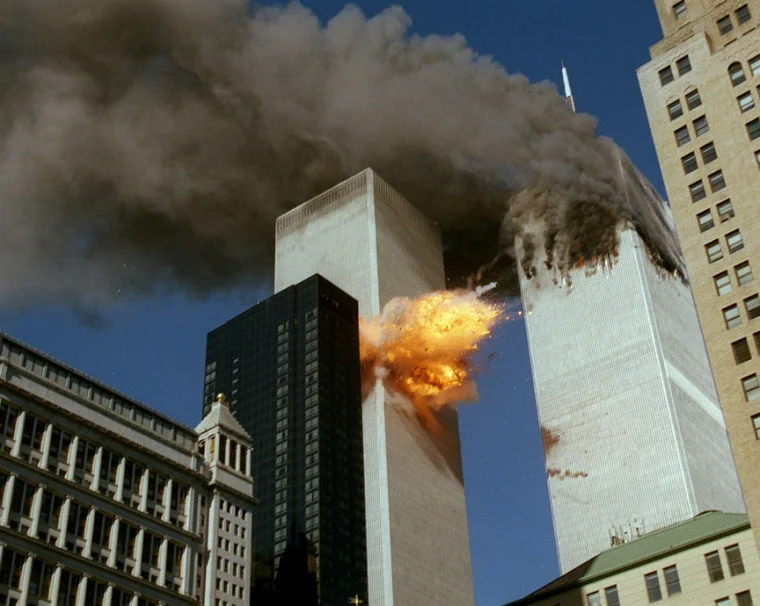
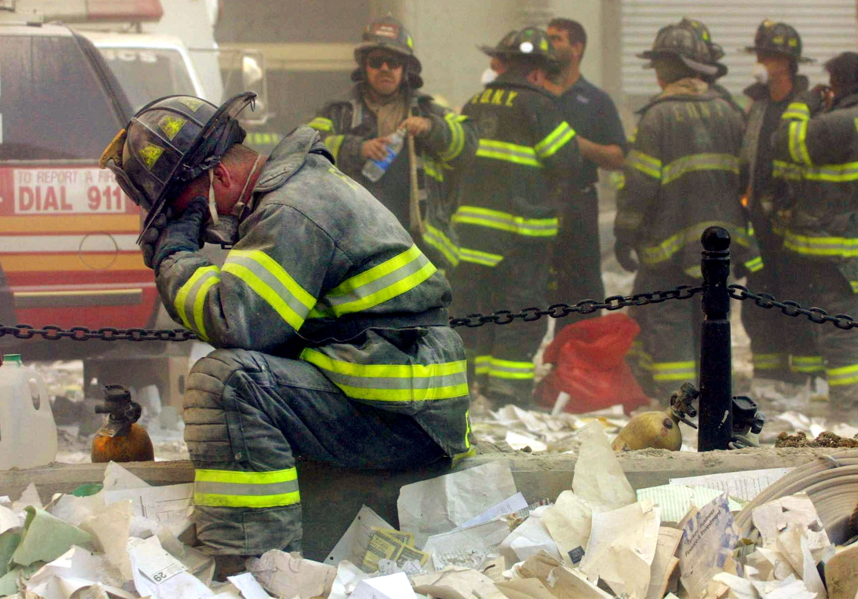
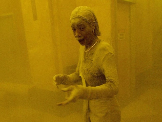
When I see those images, and when I replay things in my mind, I ball my eyes. I cry thinking about the selflessness actions took by so many that day and the huge loss of life. The moms, dads, spouses, brothers, and sisters who never came home that day due to this evil attack. The stories of people showing love and compassion that day are also countless. Heroes on that day didn’t ask people who they voted for first before deciding if they would help. Nor did they ask what their religion was, who they were attracted to, or if they were vaccinated, or what their race was, or any other prequalifying bullshit like we see all too often today. No, they acted like regular decent human beings, and they put other people first with a touch of American heroism and selflessness. On that day we saw people helping other people out. Many people sacrificed their lives for others that day, and we honor them by learning from them, looking up to them, and remembering them.
It is important to me that we remember several things this year on the anniversary of 9/11. Let us remember those things which make America such a wonderful place to live for millions and millions of people. The next time you hear someone ripping on how awful America is, be sure to remind them how for every bad story there is out there, there are a hundred good stories of success, redemption, sacrifice for the common good, and dreams being fulfilled right here in the United States of America.
No other nation tries to do what we do. No other nation has the amount of diversity that we have. No other nation offers the same freedoms, vast tracks of beautiful wildernesses, opportunities, and potential as we have. Show me a nation that has people from all corners of the world living together with freedom like we have here. Do we muddle in world affairs too much and do we have our issues? Most certainly, but do you know what else we do as Americans? We sacrifice, we protect, we care, and we help people in need. When other countries cry out for help or when disaster strikes, we are there to help. Not only our brave men and women in uniform, but volunteers in church groups, non profits, The Peace Corps, and on and on. We are a generous nation. We don’t always get it right, but if you’re focusing only on the bad, then you are missing the whole picture.
This country for many years has been blessed, and if we stop praying for protection and if we stop thanking God for what we have both in the good times and bad, and if we turn our back on what made this country a great place in the first place, then we will fall. If we stay divided arguing over silly things or even serious things alike without ever being able to put those differences aside so we can work together, then we will fall.
We must remember to pray for our nation, pray for our leaders, support our local businesses, be friendly towards people we disagree with, and we must remember it is freedom of religion, freedom of speech, and freedom of expression which are found at our nation’s core.
We hold the power to make our country a better place. We hold more power to affect change than any government policy or politician could ever do. A friendly face, a kind word, a thoughtful tip, and a patient attitude for someone like a busy cashier or waitress can go a lot further for an individual than anything the government could ever do for that same person. It is things like those which help unite us together making us strong, but if we dwell on our differences and the negative things only, and if we continue to fight amongst ourselves, then we will fall.
It makes me so happy to go to a place like the Oregon coast and see people living their best lives enjoying nature and enjoying family, friends, and freedom. It’s in those moments when all of a sudden all those things we argue about in anger endlessly online seem to disappear. Let’s remember each of us are flawed and in need of grace. Let us also remember we all desire some of the same basic things in life: life, liberty, and the pursuit of happiness. Let us focus on those things we have in common and let us remember there really is an evil in the world hell bent on destroying us, and how can we defeat such an evil force if we ourselves are constantly fighting and divided?
A house divided cannot stand. I think it is time we as Americans stand up united again before it is too late for this incredible land we have been blessed beyond measure to call home.
I do pray for God’s hand of protection on this land and its people. As we start a new school year, and as we enter into a new fall and winter season here in the beautiful Pacific Northwest, let us remember to pray, let us never forget how costly freedom is, and let us remember how important it is for us to be responsible with the freedoms we still have.