Headlines
- Dry and partly sunny through Saturday evening.
- Rain arrives Saturday night.
- Showers, downpours, sunbreaks, and breezy winds Sunday.
- Dry Mon – Wed. Highs 62 – 65°.
- Much stormier weather arrives Thursday and will last through next weekend and beyond.
Details
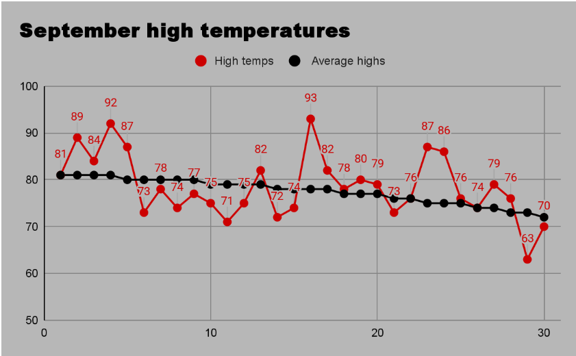
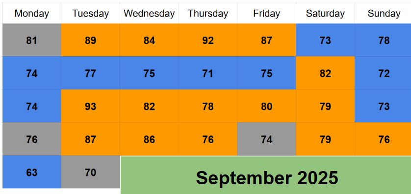
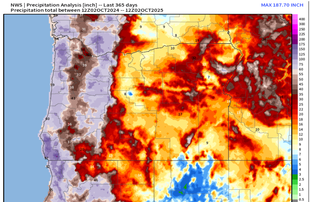
Fall around here seems to have two stages. The first stage is what we’ve been experiencing for over a month now: brief periods of rainy weather and showers followed by several days of nice sunny weather. As you know, that’s exactly what has taken place since mid September. In fact, dry days have just barely doubled the amount of rainy days since mid September – a pretty great mix if you ask me! 🙂
The second stage of fall takes place when those numbers switch with wet, soggy, and grey days dominating our region. Typically, this takes place during the second half of October or early November, and this year it appears to be right on schedule.
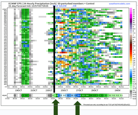
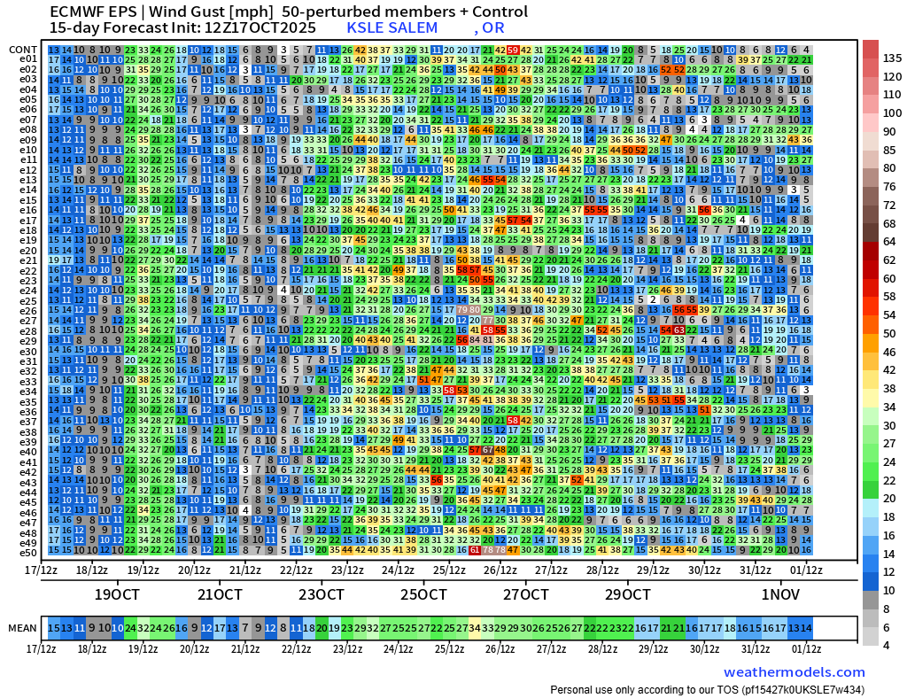
I’ve shared a few of those ensemble charts I enjoy using from time to time. The two charts we have today are showing 24 hour rainfall totals, and max wind gust speeds in mph for Salem. More than 4 or 5 days out it’s best to focus on general trends and large scale patterns, and not so much on the details yet… Remember, time goes from left to right and each horizontal line is a possible outcome.
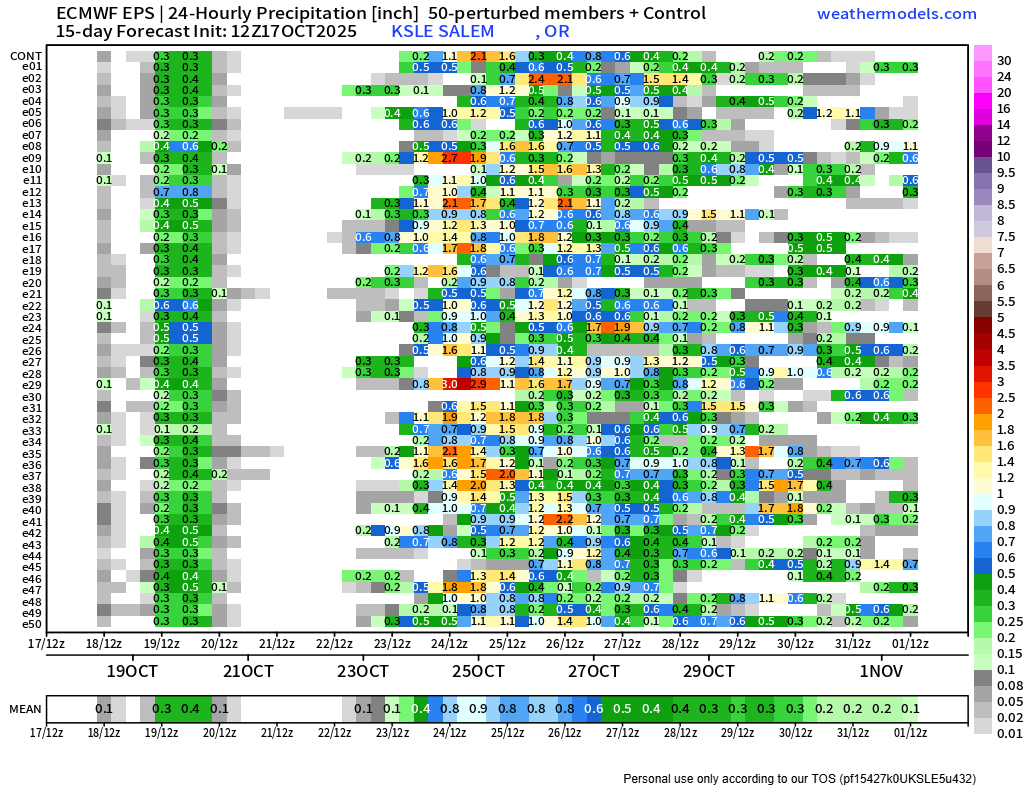

Often what will happen is the extreme solutions shown by individual members (horizontal lines) will fade as time gets closer; however, if we continue to see an increasing amount of members showing a certain outcome then we do want to pay attention to that possible outcome as consensus grows.
When viewing both those charts I saw two clear messages. The first one is that stage two is coming for western Oregon next week. Regular rainy weather with frequent storms will dominate our weather beginning next Thursday, and it looks to stay active for as far as the eye can see. I drew a nice line right around Thursday morning to illustrate the solid agreement rain will begin on that day. Notice how wet it gets in the days following as highlighted by the arrows. The heaviest rain totals are indicated by yellow, orange, and red coloring.
The second thing I notice is these storms have the potential to be quite active/strong. In addition to the heavy rain potential, there is also a potential for very strong winds. The max wind speed chart has it’s share of impressive wind gusts as well with orange, red, and brown shadings representing much stronger than usual wind speeds. Here it is again. Remember to click on it for a closer look.
The weather models definitely have my attention, and I’ll be keeping an eye out for any strong frontal systems, “atmospheric rivers”, or powerful low pressure systems that might be heading our direction. Regardless, stay safe out there and enjoy what could be the last of the 60s for the season next week, because stormy weather is quickly approaching!