Important weekend changes

The forecast for the most part has been working out just fine.  We had some heavy showers and even a few claps of thunder in the area yesterday making for a rather exciting day weather wise at least for a weather guy like myself… 

Today:  a few showers.  More dry time than rainy time.

Friday:  mostly dry with just an isolated shower possible.

Saturday:  BIG changes here:  it’s now looking dry & mild Saturday.  The storm that was posed to come in Saturday morning is now looking to arrive Sunday which means…

Sunday will be a wet and breezy.

Much of next week still looks dry, but not quite as warm.  Should be more like mid 70s which will still feel very nice after this week.

Thursday of next week is highlighted yellow due to higher than normal uncertainty as we will be right on the edge of a warm & dry air mass and a wet system out in the Pacific.

Sept 9.13


Heavier rain arriving

If it is not raining on you already then it will be soon.  Some heavier rain showers are moving in from the west

Here is the radar image from around 11:45am.  You can see a nice swath of yellow and even some orange echos indicating heavier rain to the west of I-5 (the yellow line on the map) and it’s headed east.

rain moving in

Rainy Cascades

The rain showers this week will dramatically reduce the fire threat west of the Cascade crest.  Too early in the season for any real snowfall up there, so just expect rain.

Central Oregon will see a couple showers, but most of the moisture coming this week will struggle to make it over there which means if you find yourself in Central Oregon this week then odds are it will be dry for you.


Showery week ahead.

The little bit of rain this morning ended our historic dry streak with 90 days straight at the Salem Airport with no measurable rain.

A big change in the weather pattern this week with showers dominating the forecast and highs struggling to reach 70.  Here’s your extended forecast:

extended 9.10

Basically showery and cool through at least the first half of Saturday.

Second half of Saturday & Sunday should be dry.

Some of the showers this week could be heavy with a clap or two of thunder and some hail especially Tuesday & Wednesday.  Also very breezy at times.  It will feel like summer is coming to an end, but wait….

Take a glance at the forecast for much of next week:

next week sept 1

It looks like summer will make a nice little comeback with highs back into the low 80s possible.  Still a long ways out so confidence isn’t as high, but indications are that next week will be much sunnier and drier.  Something to keep in mind if you have more outdoor projects to finish up.

The rain is coming…

We just had back to back days with highs of 88 degrees.  Very warm, but that is all about to end.  Details below:

Sept 3


Highlights

Today:  sunny, mild, & dry.  Highs 78 – 82.

Saturday:  small chance for a sprinkle or two, but don’t let it keep you from outdoor plans.  Overall a mostly dry day, just much cloudier & cooler than it has been.

Sunday:  mostly sunny & dry.

Monday:  some light rain with a couple sunbreaks mixed in.

Tuesday – Thursday:  Best chance for rain since early June.  Showers could be heavy at times during this period.  The sun will peak through every now and then all 3 days, but overall the main story here will be the showers.

Friday:  still wet and cool.


Historic Dry Streak

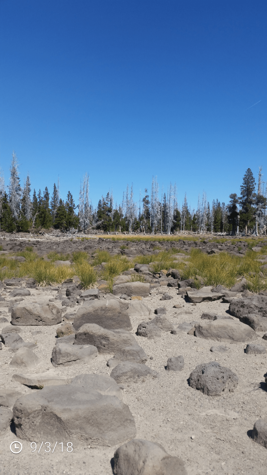
As of September 4th we have gone 85 days straight with no measurable rain at the Salem Airport.  In the weather world “measurable rain” is one hundredth of an inch (.01″) or more which means “trace” amounts do not count.


Putting our drought & historic dry streak in perspective

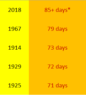
1.)   Long periods without rain here in Salem is nothing new.  85 plus days in a row is no doubt a heafty streatch of days, but 3 of our top 5 longest dry streaks in recorded history took place before the Great Depression, and all 4 runner ups took place over 50 years ago.

dry graphic

2.)   Keep in mind that summer in Oregon is always dry with the exception of a rare thunderstorm or light shower.  This year we just so happened to not get any of those at all.

3.)   Winter is when we typically receive most of our precipitation and snowpack up in the mountains which is why having a dry winter is much more worrisome than having a dry summer.  Our wet fall/winter seasons usually have little trouble erasing summer drought every year with the exception of eastern Oregon which relies heavily on rain from springtime thunderstorms in addition to winter rain & snow.

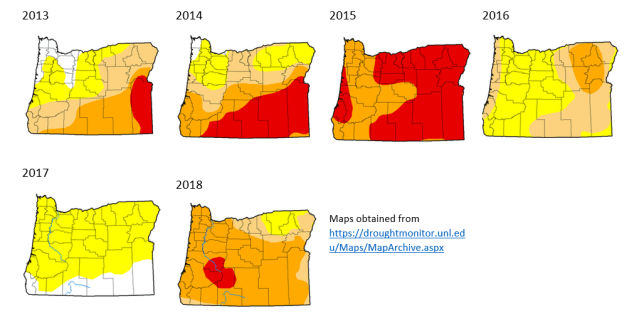
4.)   For comparison I put together this graphic showing statewide drought conditions centered on the end of August from recent years, and it shows quite well that drier than normal conditions in summer is nothing new.  Most of these years the drought in the western half of the state was completely gone by the following spring.  It’s amazing what our rainy winters can do!!

fun drought map chart

5.)    One final thing to help us gauge where we are at with this drought.  Take a look at the water level of Detroit Lake.  This chart goes back to September 2015.  You can see we are in the ballpark of where we ought to be this time of year and a lot better than where we were at in September 2015 which was a very bad drought year.  So all in all no major concerns here for now.

Detroit Lake stats

6.)   Lastly, I understand that many of us get tired of our winter rains, but we all know it’s the rain that keeps this state going.  With that in mind, let’s hope we have a nice rainy winter so this drought can become a thing of the past and nothing worse.