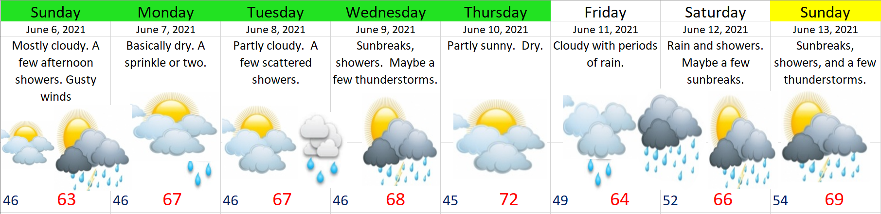
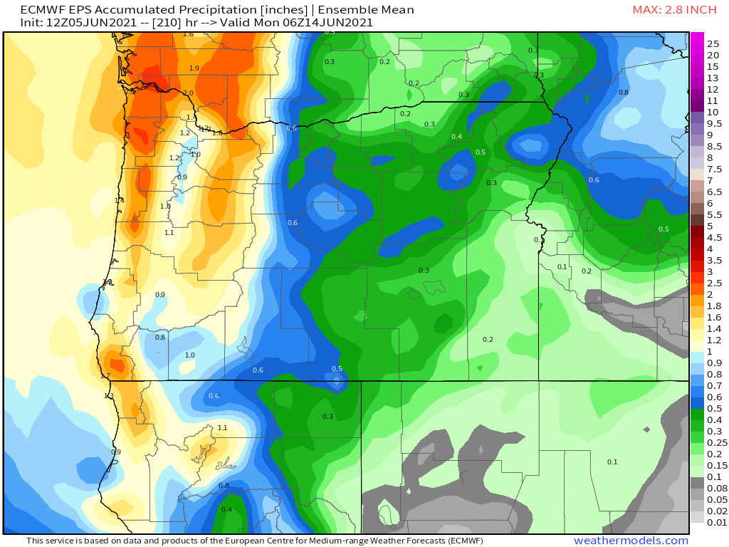
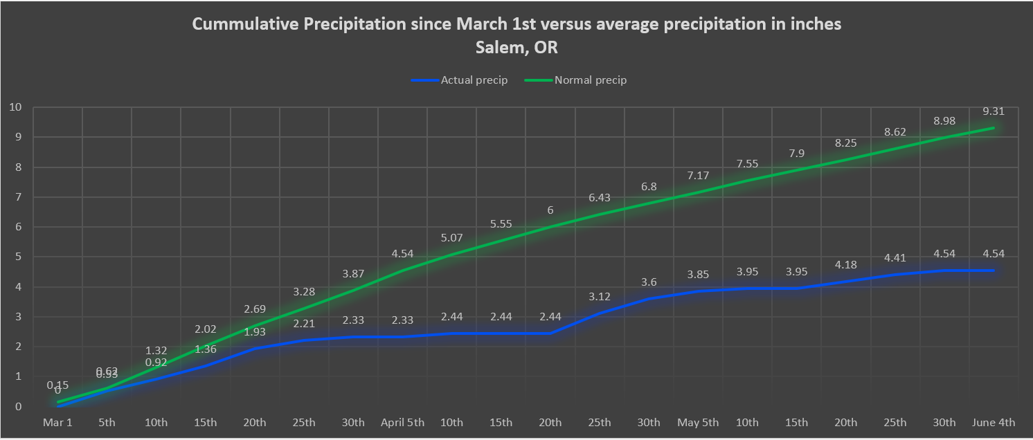
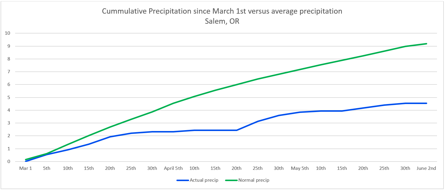
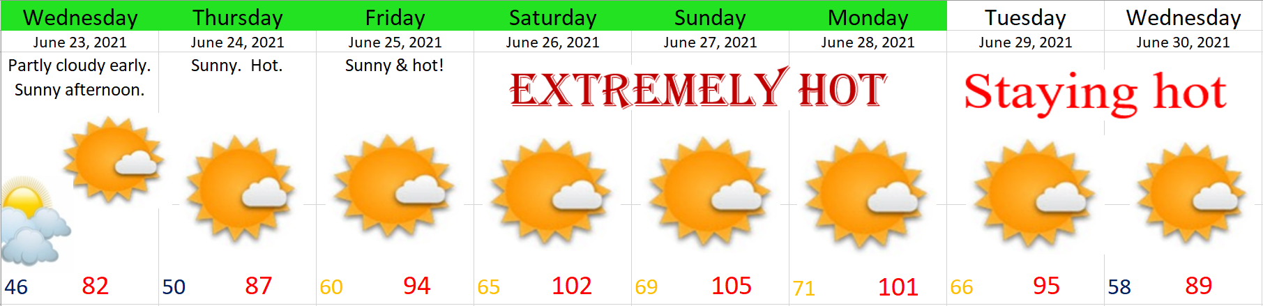
The weather is losing it’s freaking mind. That’s how I felt after glancing over all the weather models today. The hot weather we have seen this month has already been historic in some manners, but to think the hottest and most extreme heat is yet to come is just mind boggling. Below is my best guess for the coming week. Keep in mind that other than our brief 5 day wet spell, this month has been and will continue to be way above normal.
Important things to note:
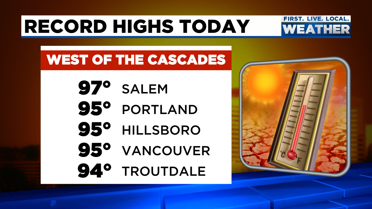
Whether we end up closer to 99 or a brutal record 110+ degrees, the screaming message here is it’s going to be scorching hot for several days in a row. These conditions will be dangerous for anyone working outside, or anyone who is living or working in an indoor facility that doesn’t have AC. Nighttime temps will also be some 15 to 20 degrees above normal making it even harder for people to cool off houses and buildings at night.
It’s becoming increasingly likely that this will be a historic heat wave which means you need to be prepared if you’re not already. In the past couple of years we have been through Covid, a historic fire and smoke disaster, and of course most recently a historic ice storm leading to power outages – a number of which lasted well over a week. Too many “historic” fill in the blank events lately don’t you think??? It’s definitely a good idea to be prepared for disasters and emergencies including having extra food, water, essential toiletries, medications, light sources, and sources of heat on hand at all times. Okay, okay, so the sources of heat won’t be needed necessarily anytime soon, but I know thousands of Oregonians were happy to have such sources back in February when it was 30 degrees and no power…. Anyway, I’m not promoting hording. In fact, hording is something I think people should avoid lol; however, there’s something to be said about keeping extra supplies on hand and gas in the car for when disaster strikes. In this particular case having food, water, and a plan to stay cool should the power go out are perhaps the most important things you can do to be prepared. Please keep people who may not have AC in mind also as weather this hot can be deadly as this type of heat is something we are not use to.
Finally, last, but not least, be aware of how much energy you are using as strains on the power grid are expected. Stay cool of course, but try your best to conserve energy in other areas. Just some food for thought.
Okay, stay cool! I’ll likely have an update for you all on Friday.