There is a lot to cover tonight. I’ll start with the highlights and details for the Salem area.
Highlights and details for Salem
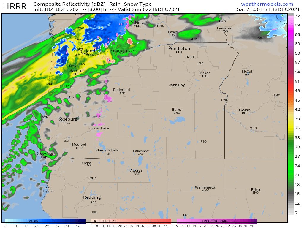
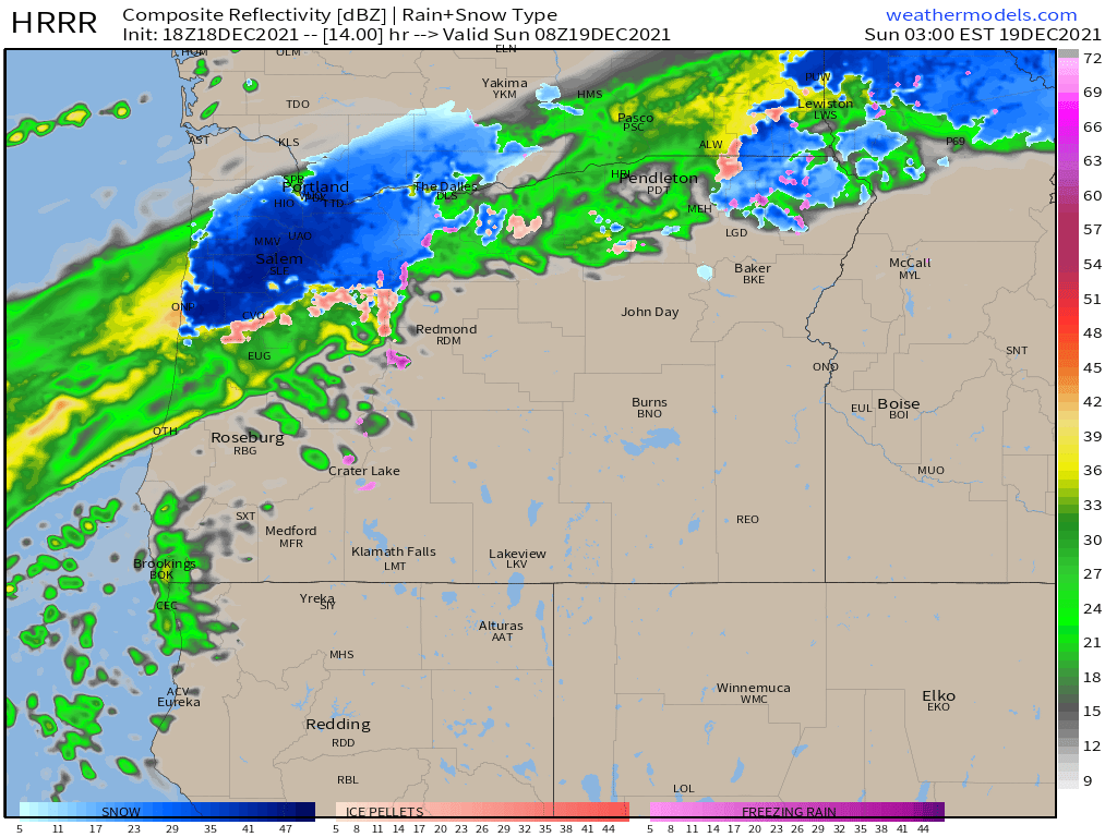
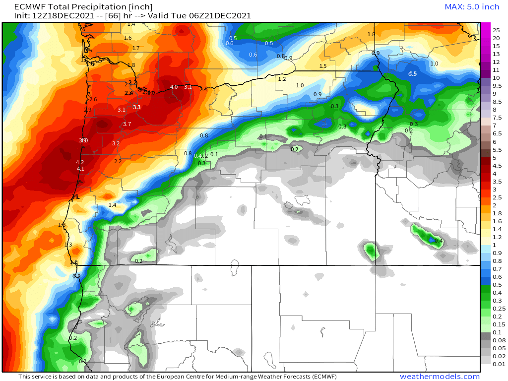
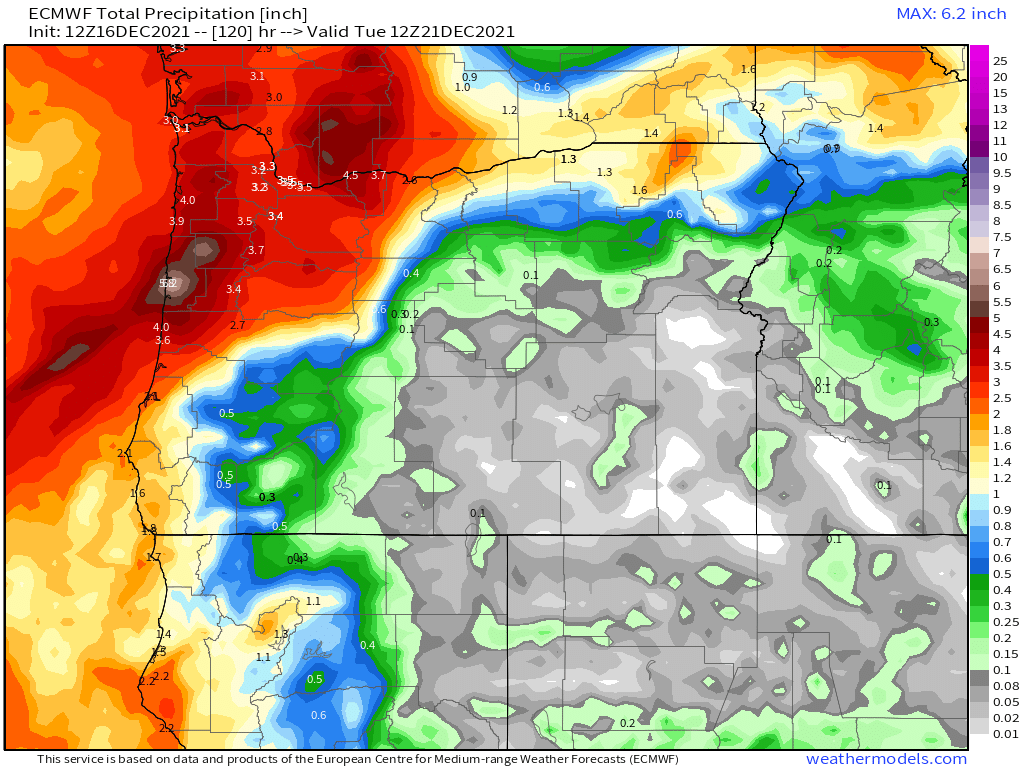
1.) Winds will become increasingly strong Sunday afternoon ahead of a potent cold front. Wind gusts of 35 to 45mph seem likely beginning around 2 or 3PM Sunday, and should last until just before sunrise Monday morning. Expect localized flooding again across the valley and the entire region for that matter. Flooding could be worse than what we saw in December with nearly 2 inches expected to fall with this storm here in Salem and up to 4 inches of rain (or melted snow) in the mountains. The heavy rain plus melting snow from the Coast Range will cause a sharp rise on area rivers and streams.
2.) Another half inch of rain falls on Tuesday along with more mountain snow.
3.) Wednesday should be fairly tame with a few sunbreaks and not much in the way of rain at all.
4.) Another wet storm system moves in Thursday and Friday bringing another inch plus of rain and more mountain snow.
The coast
High winds and powerful waves will create hazardous conditions for all communities along highway 101. Could be a great couples of days to storm watch as long as you are protected from the surf. Coastal flooding is likely Sunday afternoon through Monday. Waves will range from 30 to 40 feet!
The Coast Range
Heavy snow will fall Monday above about 1500′ The lower passes like highways 22 and 18 between Salem and the coast should see more in the way of heavy rain or a rain snow mix than accumulating snow (subject to change), but that’s not to say travel won’t be awful along those highways still. The higher elevations could end up with 8 to 12 inches of new snow. Snow will continue through Tuesday before warmer air moves Wednesday.
The Cascades
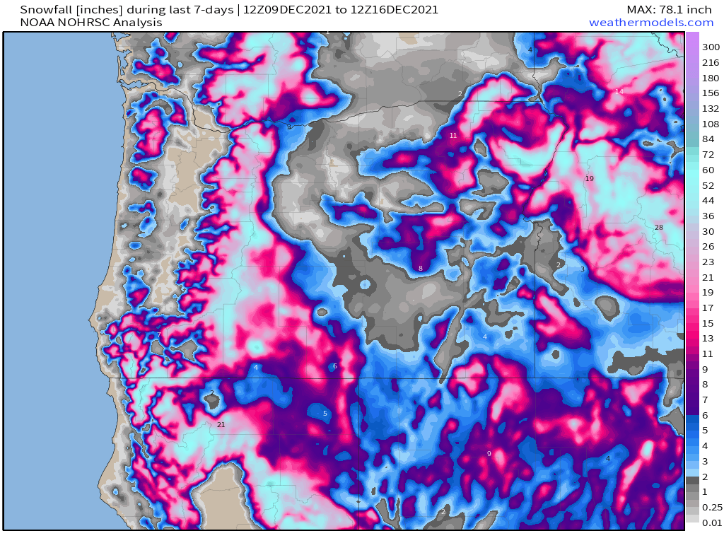
Heavy, heavy snow Sunday night through Tuesday with 30 to 40 inches of new snow falling during this time frame! Terrible driving conditions with gusty winds to boot. Not a good time for mountain travel at all. Below is a map showing total snowfall now through 4AM Tuesday morning. Keep in mind the snow continues up in the mountains for the remainder of Tuesday.
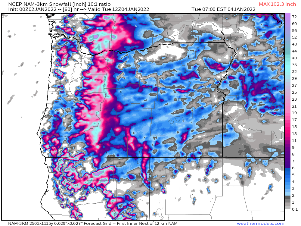
I’ll keep on eye out for any changes. As you can see from this map snow levels will be quite low over the next few days, so any changes in temps could lead to major changes in who does or doesn’t receive snowfall.
It’s just been one thing after another lately, and there is no sign of things slowing down yet…. Maybe some hope for dry weather next weekend and the week after, but let’s not get too excited as we have a busy week of crazy weather to get through first.
Have a great rest of your weekend!