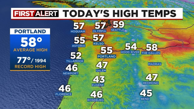
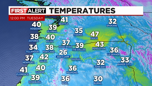
We are having a hard time shaking the cold and wintry weather this year. I mean, it seems to be like that a lot of years, but this year we are having an especially difficult time. Our average high this time of year is 55°. We won’t even be close. In fact, we will likely barely scrape 50 degrees this week.
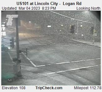
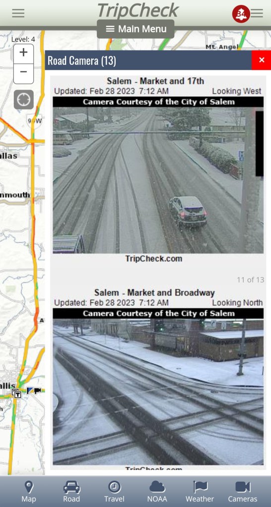
We are in a cold and showery pattern, and last night was a perfect example of what could happen any night this week. Late Saturday evening a band of showers moved over Newport and Lincoln City dropping the snow down to sea level in both locations. Here’s a traffic cam pic from around 8:30PM showing fairly heavy snow falling over Highway 101.
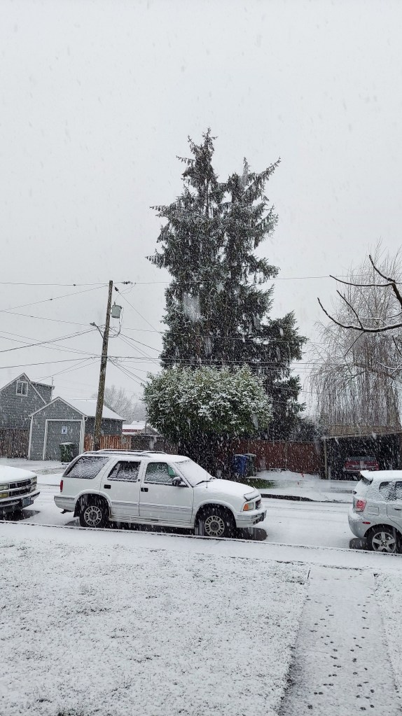
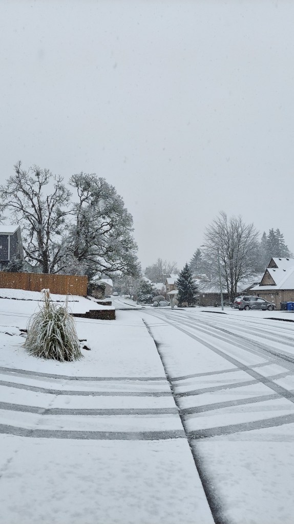
Much of the city ended up getting a nice coating of snow. Many residents down in the Eugene area also woke up to snow this morning. We remain locked in this same chilly and stormy pattern for the rest of today, Monday, Tuesday, and Wednesday. Keep in mind today will almost certainly be the cloudiest day of the next 4 days.
HIGHLIGHTS
Each day will feature sunbreaks (perhaps quite a few), but each day will also feature downpours of rain, graupel, and hail. Thunder is possible as well. The tricky part is that should an organized group of heavier showers move through during the evening/overnight hours, anyone could see an inch or two of snow. Lows each morning will be around 30 to 33 degrees, and highs should reach the upper 40s.
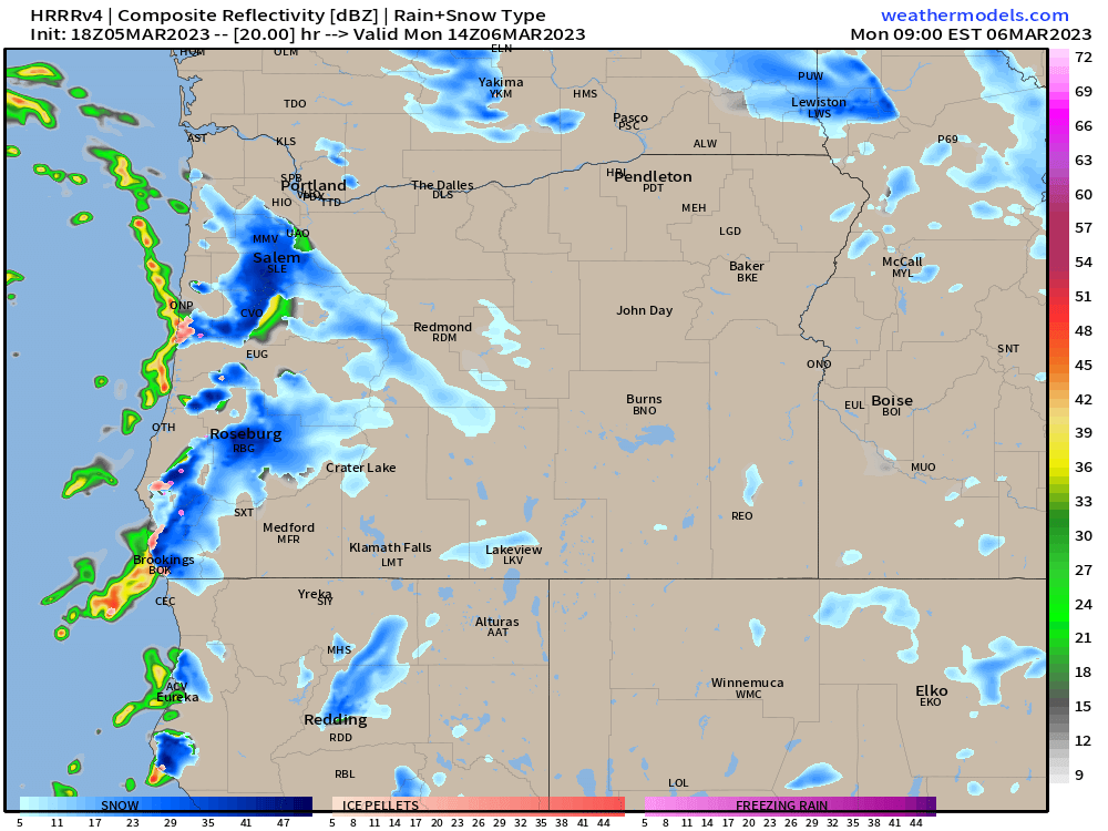
This chilly and showery pattern is depicted well on these simulated radar images. Basically this model (which I like to use often) guesses exactly where precipitation will occur, how heavy it will be, and what type of precipitation will actually be falling. The greens, yellows are light to moderate rain, and the oranges and reds indicate very heavy rain. Blue represents snow with the darker blues standing for heavy snow.
This first image is for 6AM Monday morning.
This shows a big snow shower moving directly over Salem just prior to the morning commute. Of course if that band of snow shifts slightly to the north or south then we end up with nothing. Very similar to last week in that where the bands of snow setup will determine who does and who doesn’t get accumulating snowfall during the overnight hours.
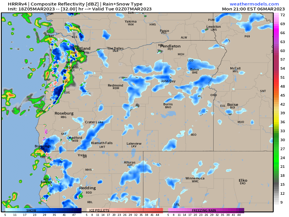
This next image is for 6PM Monday evening.
This gives a good indication of what our afternoons each day this week will look like. Notice the strong line of convection (heavy showers) stretching from Portland down to around Eugene. I imagine hail, graupel, and heavy rain occurring with this line of storms all thanks to the very cold and unstable air up in the atmosphere fueled by sunbreaks earlier in the day. The rule of thumb in this pattern is: the more sunbreaks you get with a chilly and moist unstable atmosphere in place, the more likely you are to “pay for it” later with heavy showers/downpours or even a thunderstorm.
Hopefully you’re catching my drift here. Lots of showers and sunbreaks with heavier showers increasingly likely during the afternoons and early evenings. Showers will remain possible at all times of the day and night and that’s where are chance for snow comes in.
Any snow that falls would not add up to more than an inch or two at the very most, and it would melt very quickly as the days are growing longer, the sun sits higher in the sky, and we have no arctic air to keep us really cold during the daytime hours.
Looking further ahead
Thursday through next weekend could end up being quite stormy with some potentially strong systems effecting our region. The main impacts at this time look to be heavy rain in the valley, and lots of mountain snow. Too early to know how low snow levels will be and how much rain we get etc. Just keep in mind that some bigger storms could be aimed at us the second half of this week.
The Cascades
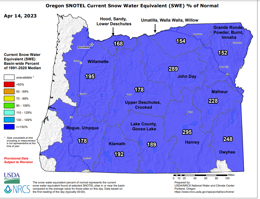
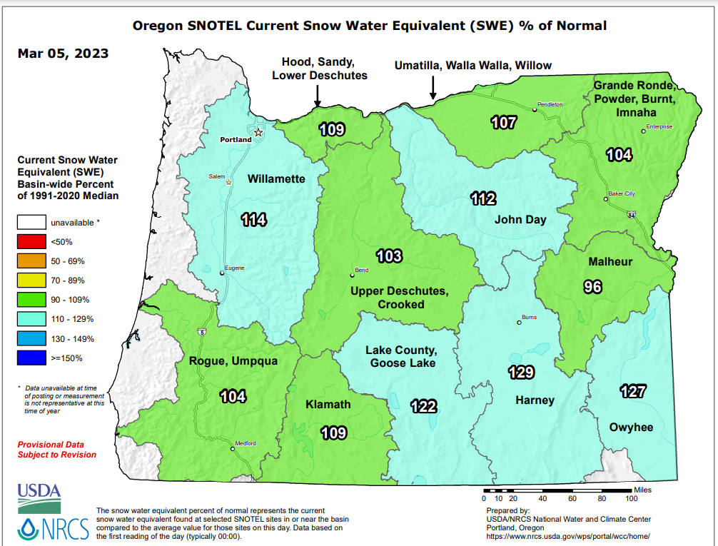
The mountains are doing great with all this chilly and wet weather. Tons of snow up in the Cascades right now. I believe Hoodoo Ski Area is a little over 81 inches at their base. According to this chart it appears the snowpack in every region in Oregon is doing really well with more on the way and again, no sign of warm weather yet.
Expect snow showers over both the Cascades and Coast Range this week with sunbreaks at times. Should be great skiing weather! I’ll keep an eye on the forecast for the end of the week as there could be a lot going on then. In the meantime enjoy this cold showery pattern and stay safe out there! 🙂