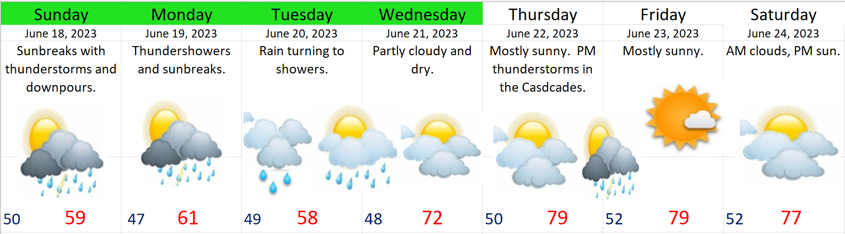
It may be hard to believe, but with the exception of a few brief rainy days, western Oregon has largely been dry and warm since mid April. We are now in the heart of summertime here in the Willamette Valley. We have one item to address and that is a chance for some light showers next Monday and Tuesday.
Summer in Salem is a reliably dry time, but it’s normal to have a drippy day mixed in every great once in awhile, and that’s pretty much what is happening for Monday and Tuesday of next week. Here’s our extended forecast:

I don’t have raindrops on Tuesday, but don’t be shocked if a few fall from the sky that day too. Monday however, will feature the primary shower threat. Notice it’s right back to summer afterwards.
Sometimes it can be interesting to look back into the past for a glimpse at the larger picture as it can offer us a different perspective. This first chart shows total rainfall for each July here in Salem going back to 1970.
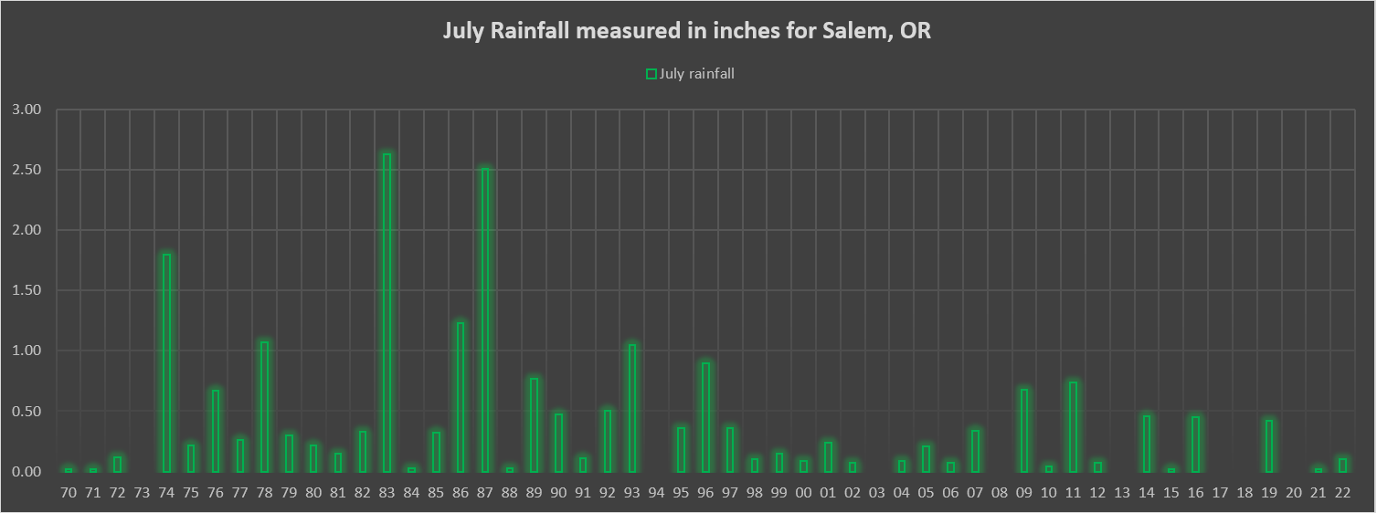
The wetter Julys back in the 70s and 80s versus the consistently dry Julys since the 90s really stands out to me. If you are a long term resident of Salem, than maybe you remember Julys being a little bit “rainier” than what we have seen lately, and you would be right. Between 1970 and 1993, we had six years where our July rainfall topped the one inch mark, but we have not topped one inch since ’93 – going on 30 years of Julys having less than an inch of rain. Seems like a drying trend, and to it is, but were Julys always wetter in the past????
Check out this next chart which shows total July rainfall by decade:

Seems like the 70s and 80s were more of an anomaly, and not so much “the usual.” The Julys of the 1950s saw a cumulative rainfall total almost identical to the total saw in the 2010s. July has always been (in my opinion) the peak summer month. Days are long with daylight stretching well into the evenings (which I love), and the weather is reliably dry and warm. August of course is a great month too, but those late evenings start to shorten a bit, and of course there is the “well known” idea that it always rains during the State Fair. We really are in the heart of summer right now. The cool and possibly drippy downturn next week will be very short lived, and before anyone knows it, we will be right back into the 80s. Enjoy and stay safe! 🙂