
After a loooong long stretch of not posting, I’m back with a helpful update for you all.
I’ve seen a number of various forecasts for the coming days all disagreeing on whether or not it is going to rain here the next several days, and I figured it was time to leap back into action. I have all the details below.
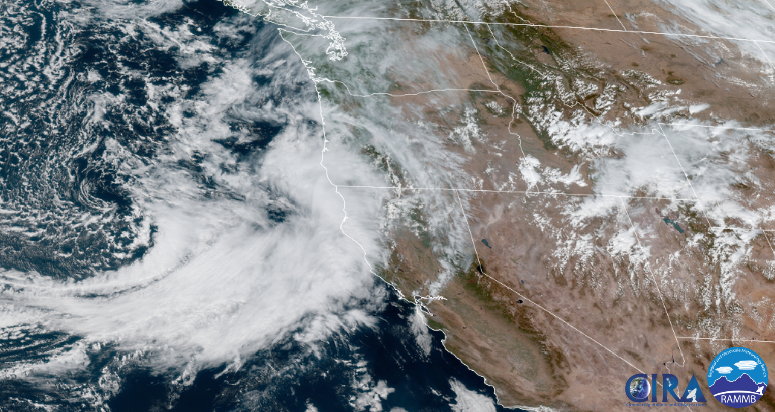
Basically we are on the northern edge of very moist storm which is aimed for California. This is GREAT news for bringing the wildfires under control plus a good soaking rain like this should help prevent any new late season fires from starting. This satellite image from around 1:30PM does a good job of showing the storm’s location as it prepares to hit California.
Highlights
A round of showers and maybe even some thunderstorms roll into our region later this evening through the early morning hours of Sunday from the south/southeast – a fairly unusual pattern for western Oregon.
Monday: Mild and dry with highs in the low 80s.
Tuesday: Mainly dry here in Salem with the exception being locations just south of us roughly from Albany and Corvallis southward. Showers are much more likely down there.
Wed & Thu: Showers both days with highs in the low 70s.
Fri: Back to regular dry and mostly sunny early fall weather! 🙂
The rain coming up from the south should also help significantly with Oregon’s major fires too including the Cedar Creek fire. I fully expect much better news on the fire front come mid week.
Take care and stay tuned for more updates! 😉
