
This past October was odd in a few ways. Salem received rainfall 18 days this October; however, the vast majority of that rain was not heavy enough to give us a “wet month.” We ended up with 78% of our normal rainfall at 2.71″.
As far as temperature goes, it was a near average October. at 0.3° below normal. There was no widespread freeze this month with our coldest temp only being 35° on the 12th. We have had some cold October weather in recent years, but not this year. There were no significant warm spells either. In fact, our warmest temp was just 73° on the 3rd.
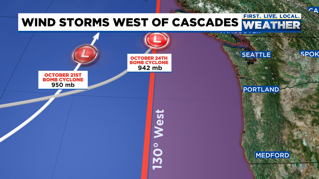
On October 24th and 25th a powerful low pressure spun up several hundred miles offshore. There were no historic impacts right here as it was several hundred miles away; however, the storm still brought some locally heavy rain and a solid 24 hours of south/southwest winds which gusted between 30 and 45mph right here in Salem. This lead to some power outages and a few downed tree branches and limbs. Massive waves were also common along the coast during this storm. Below is an image from Mark Nelson over at Fox12 Oregon. It shows the strength and path of both “bomb cyclones” which effected the Pacific Northwest. Had the storms moved up the coast “inside” (east) of the red line then we would have seen significant damage, so I guess you could say we dodged a couple of big bullets with these two storms.
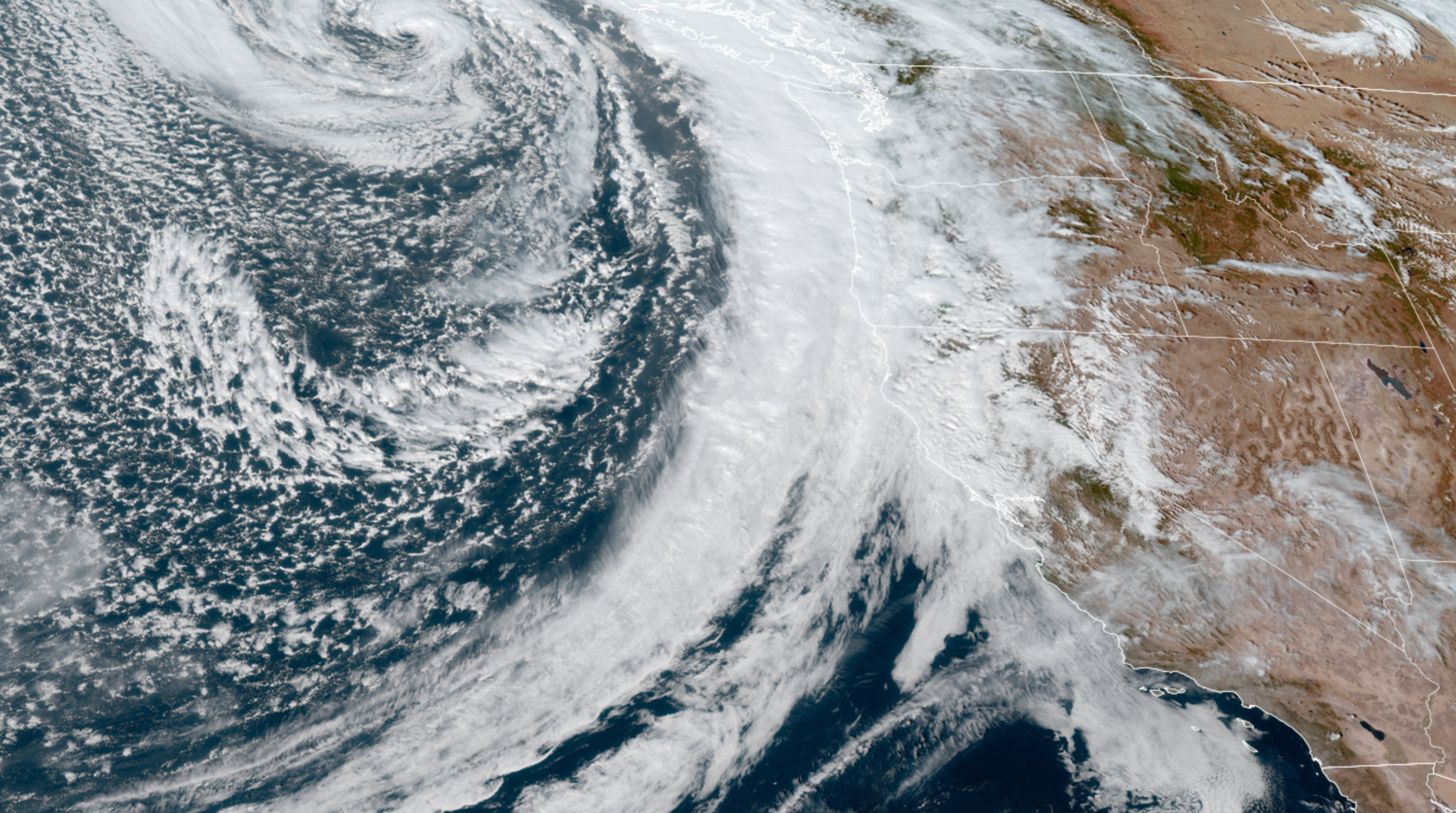
Satellite image of the first big storm on the 21st.
SUMMARY
All in all it was a fairly typical October with a mostly dry first half, and then the rainy season showed up right on cue the second half of the month. Those two big cyclone storms were hands down the highlights of this month otherwise nothing too crazy.
