
This past summer has been a “blockbuster” with numerous records set. In addition to seeing the hottest temperature ever recorded two days in a row back in June, we’ve also seen record warm low temps, the highest number of 100+ degree days ever recorded in a single year, and on top of that, a record number of 90+ degree days!! It’s truly been a historic and extremely hot summer. In fact the June, July, August period will go down as Salem’s hottest summer since records began in the late 1800s!
June will be remembered for the historic and record breaking heatwave which took place at the end of the month; however, it was hot even earlier in the month as well with near record high temps occurring on June 1st.

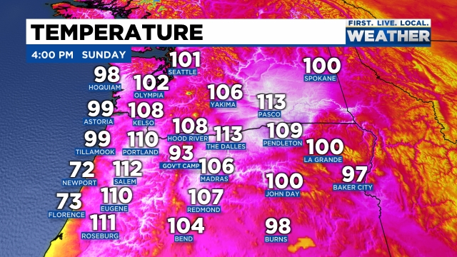
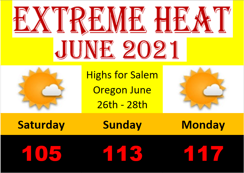
The heat continued through the month with several more 90+ degree days before the big heatwave hit. Here were the temperatures at 4PM that Sunday. Incredible heat for this region!
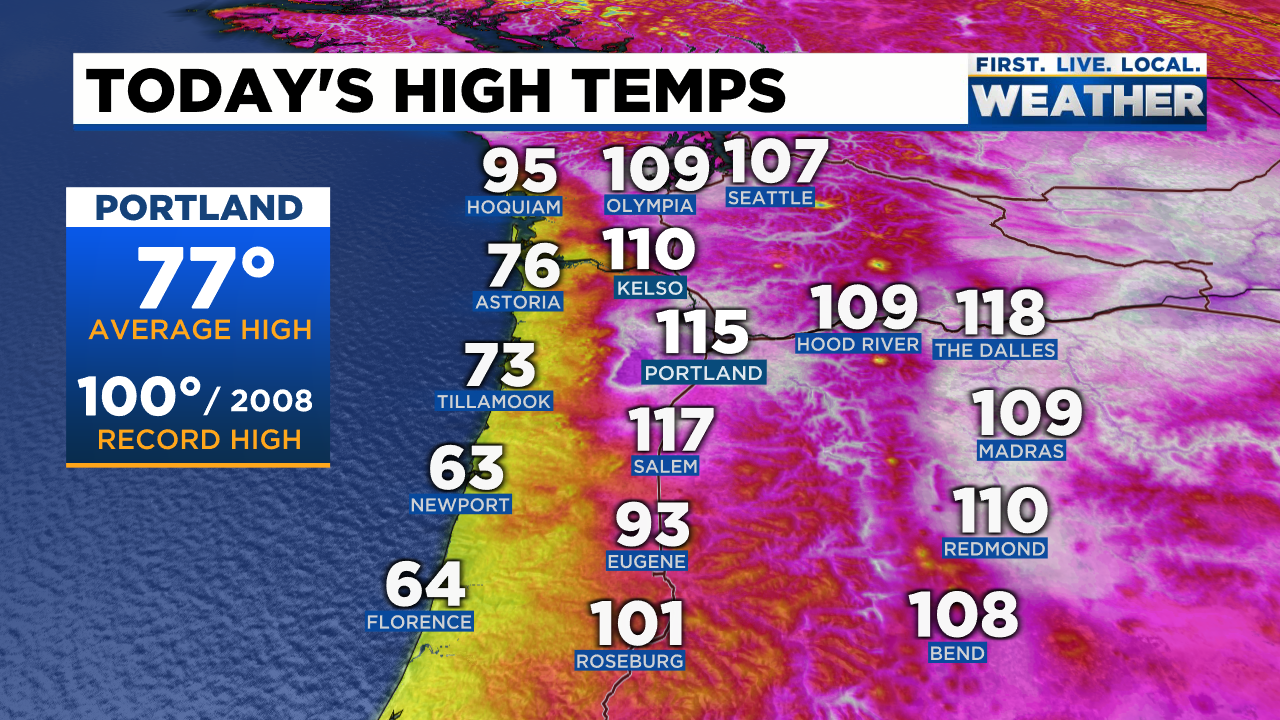
Then even hotter high temps the very next day before cool marine air rushed in from the southwest.
The heat continued through July and the first half of August with Salem hitting 103° on the 11th and 12th. When all was said and done by mid September, Salem had recorded an astonishing 41 days at or above 90 including 6 days at or above 100° which is also a new record! Nothing like that in any other year!
It was a hot one, and it was dry. This was the US drought monitor map for Oregon as of September 7th before the rains started.

Believe it or not the wildfire season was nearly as bad as it could have been, nor was it as bad as some predictions suggested with around 290,616 acres burned so far versus the 1.1 million acres burned in 2020. A big improvement!
There are many reasons for this drop, but perhaps the biggest two reasons, okay three reasons were: A very inactive thunderstorm season. A lack of lightning strikes significantly reduced the amount of fires started especially east of the Cascades. Two, we had just enough pushes of cooler marine air and even a couple shots of light rain in July and August which helped conditions west of the Cascades. The third reason was the lack of a strong east wind event like we saw last year in September. All in all it was a dodged bullet if you ask me. Goes to show that drought conditions, snowpack levels, and the weather conditions in spring are not nearly as important as what actually takes place during the summer and wildfire season. Something everyone should keep in mind for in the future.
There you have it, summer 2021. Switching gears I’ll have a fresh forecast Sunday plus I’m currently working on my winter outlook. With a La Nina on tap and looking at the current sea surface temperatures & overall weather trends it appears we have a good shot at seeing a very wet & active fall/winter season…. More on that in the coming week.
Enjoy the rest of your weekend!!
