
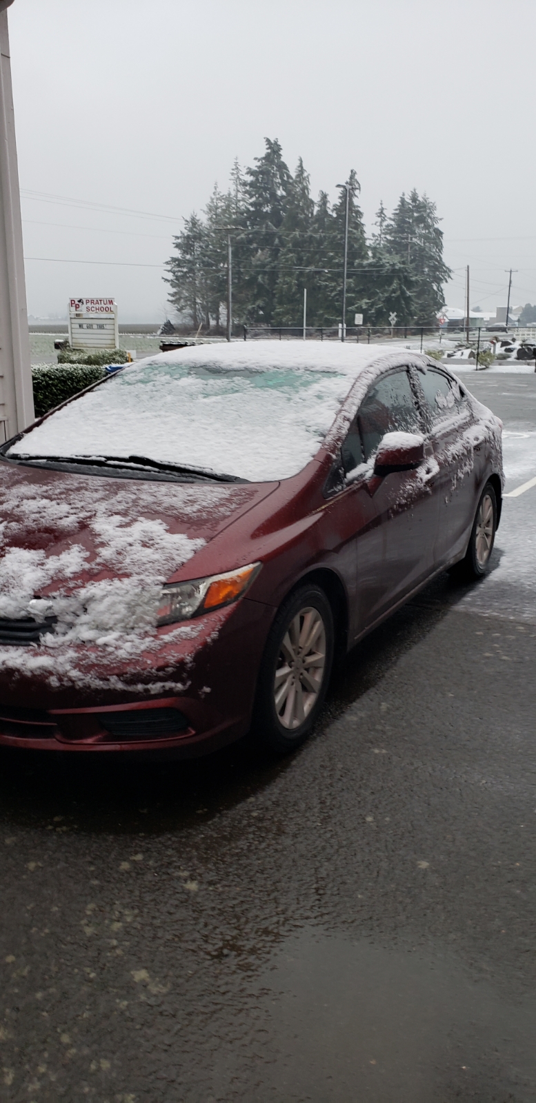
I put together a nice little recap of our snowstorm and figured I might as well kick it off with a positive. THE GOOD. I believe I did a good job of emphasizing how the best chances for snow were going to be locations on the western side of the Willamette Valley, and that part held true. The highest snow totals were found in locations further west towards the Coast Range including Corvallis, Dallas, Amity, west Salem and Newberg. All of these locations scored really well. THE BAD. IT snowed in all of Salem, and in some spots it was a lot. The heaviest snow totals were west and south of town with lighter totals as one headed further east. In fact, there was generally very little snow at all east of Cordon Road. This picture came in from a loyal viewer, follower, and friend near Pratum just a few miles east of Salem. As you can see, not much snow there at all.
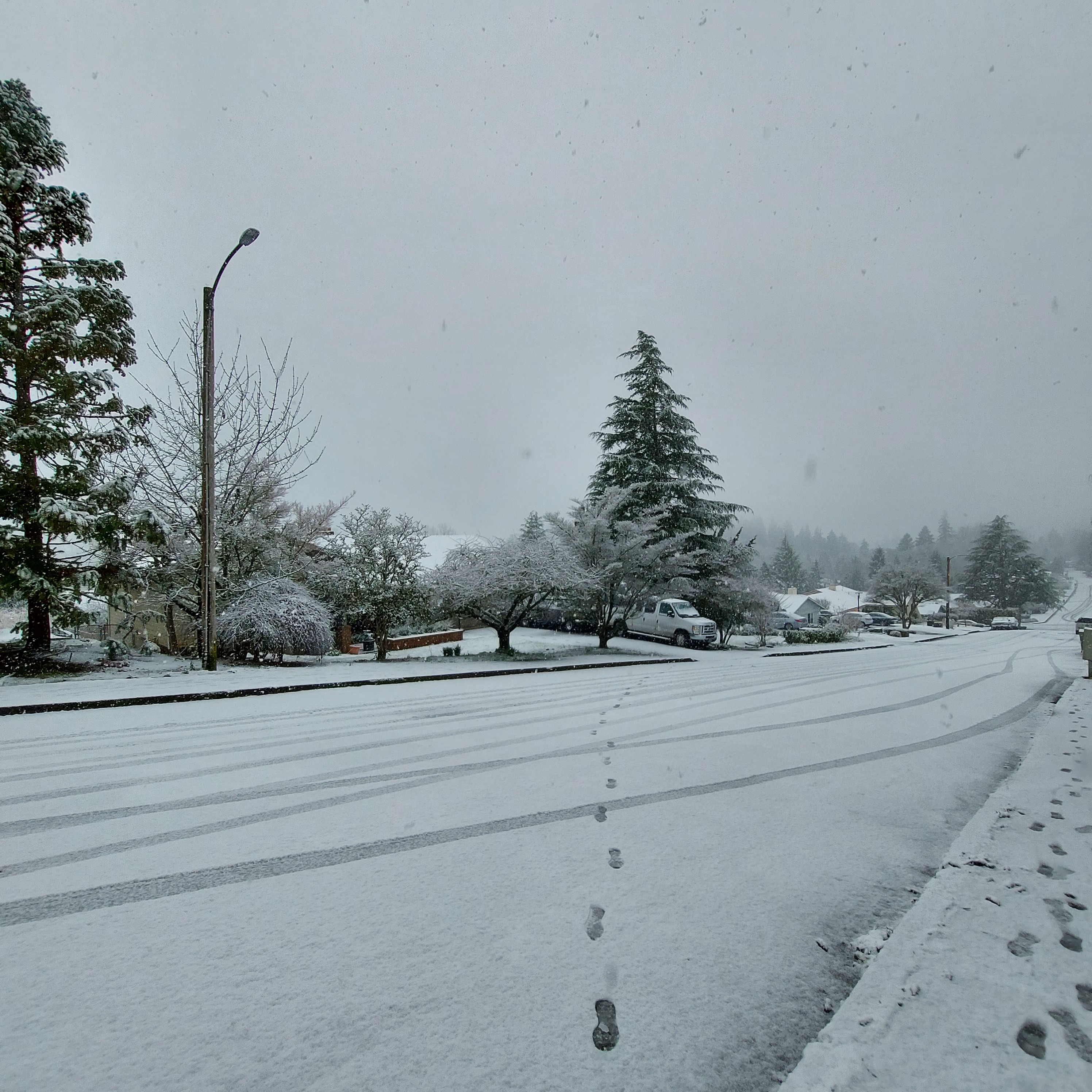
This second pic was taken around 2:30PM in West Salem. Definitely snowier here.
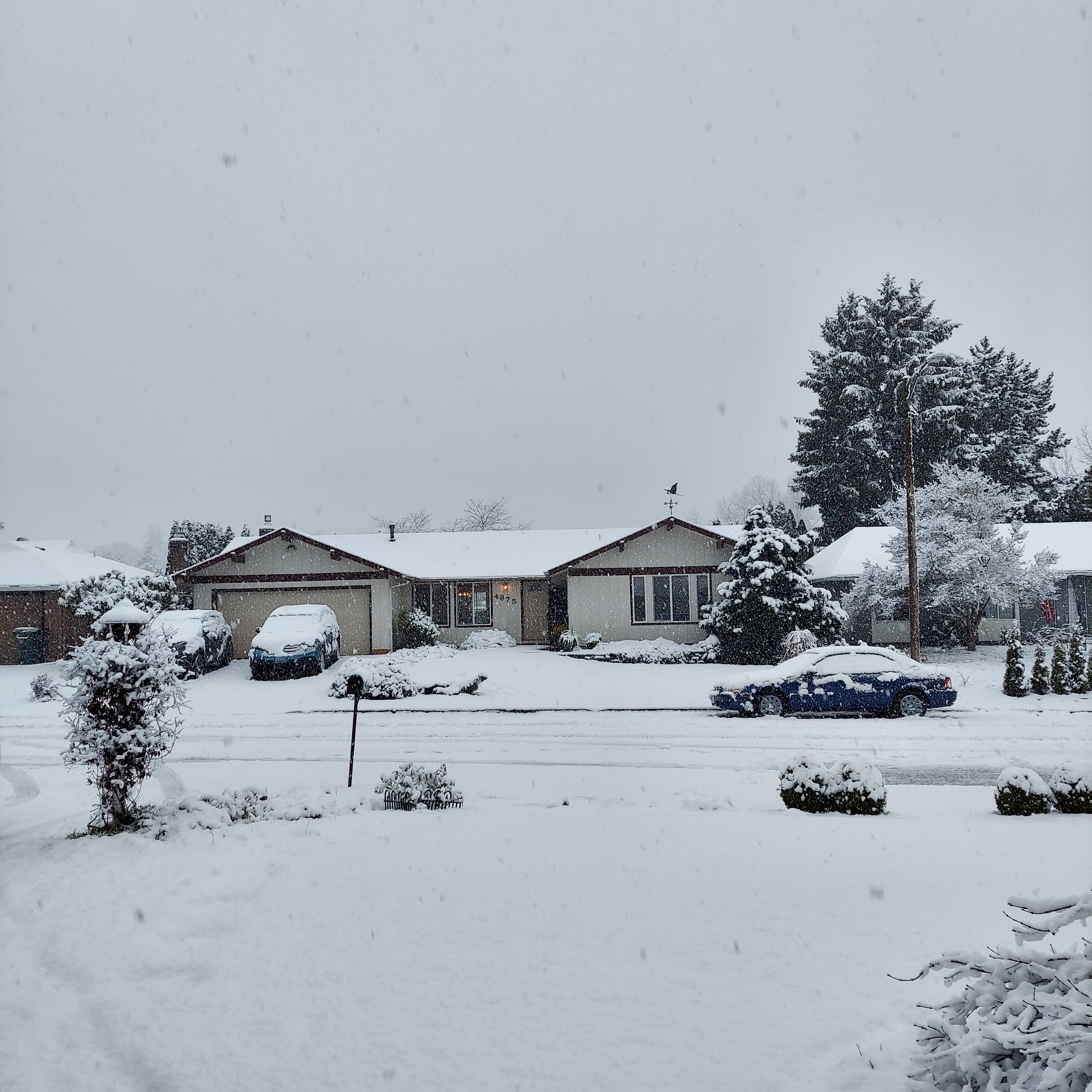
Of course, south Salem almost always scores big when it comes to snow, and this was no exception. 3 to 4 inches in the higher hills down south and that is where this third picture was taken.
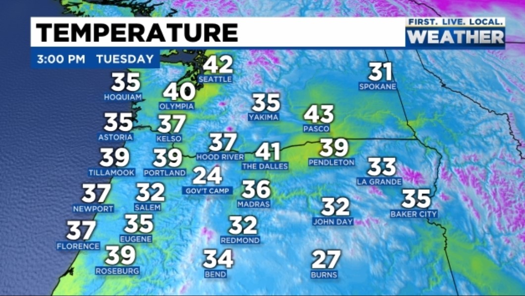
Next take a look at the temps from around the region at 3PM Tuesday. Eugene was at 35°, Portland was at 39°, and even the gorge was fairly mild. Often times we get cold air through the gorge when we have valley snow, but this time that was not the case. The Dalles had a “balmy” temp of 41°. Notice Salem sticking out big time sitting at 32°. The whole event was bizarre when you look at how “mild” the rest of the region was.
In Salem we had a high of 40° at the airport right around 1PM, and then the snow moved in… By 2:05PM we were down to 32°. An 8 degree drop in one hour!! So where did the cold air come from? Well quite literally it came from above. Haha for real though, the heavy precip dragged cold air from higher up in the atmosphere down to the surface which is why as soon as the steady/heavy precip ended we switched back to a light rain that night. The second factor that led to snow was a process called evaporational cooling. When precipitation falls through a dry airmass like the one we started with Tuesday morning, it takes the heat out of the air causing the temperatures to drop. I just wasn’t expecting an 8 degree drop in one hour from those two factors. As someone who has watched and forecasted the weather around here for a while, the whole thing was a huge shock.
If I could go back in time and redo Tuesday’s forecast I honestly would not change much. Looking at my previous forecasts I clearly stated it was going to be a close call for snow, and I had been watching the possibility of snow on Tuesday for several days in advance. Instead of removing the chance for snow all together like I did, I should have left it in there, emphasized how the chance was slim, and then laid out exactly what had to happen in order for snow to stick in Salem. But oh well, I still enjoyed the snow a great deal even if it was a surprise, and I hope you all did too! It was a lot of fun seeing it come down, and I was thankful I had the ability to get out and enjoy it while it lasted!
The other thing I noticed was I had a few errors in my posts over the past few days. Sorry about that. I even forgot to attach an image of the forecasted radar that I wanted to share with you in one of the posts. Oops!!!! I’ve definitely been busy and sidetracked with some good, but big changes at work, looking for and getting ready to move into a new place here in Salem, and well I’m still out an editor. The biggest problem with finding an editor is the pay is crummy haha lol 😉 🙂
Anyway, have a great rest of your day! I’ll have a forecast out later tonight or tomorrow, and I can tell you with confidence that our chances for snow are not over…. 🙂 February is looking chilly!!
