Headlines
- Hot afternoons this week equals hot homes, businesses, and hot classrooms for this first week of school.
- Clouds and increasing smoke keep the extremely hot temperatures at bay.
- Clouds and increased humidity will result in warmer nights.
- Slight chance for thunderstorms/showers tonight and Wednesday.
- Higher chance for more widespread thunderstorms and showers Friday night and Saturday.
- Thunderstorms are likely in the Cascades each afternoon and evening today through Saturday.
Details
The heat is still on, but with a familiar plot twist. Similar to what we experienced last week, thunderstorms and clouds from dissipating storms are going to keep the hottest temperatures down, but with the clouds comes increased moisture. The humidity this week cause nighttime temperatures to be noticeable warmer than what we experienced this past weekend. Expect lows to range from 62 to 65° through Friday night. Lows return to the 50s again come Sunday morning.
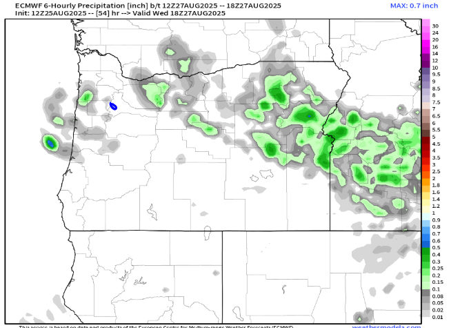
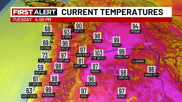
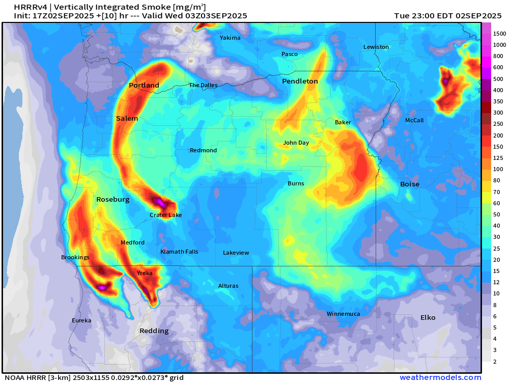
Smoke (mostly high above us) will become more pronounced today. This makes for hazy skies, and consequently, lower daytime high temperatures than what I was predicting just a few days ago. I’m thinking we hit 92° today. Below is a forecast showing smoke density through the atmosphere. Smoke here in Salem should primarily stay above the surface, but it will make for a hazy sunset tonight.
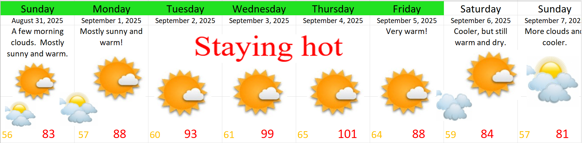
Tonight and Wednesday: A small disturbance, quite similar to the one we saw last week (which triggered a few storms), moves northward late tonight through Wednesday. This has the potential to give anyone either a shower or a thunderstorm tonight through Wednesday night. Highs Wednesday topping out only around 85° due to cloud cover. The majority of locations stay dry for the majority of the day tomorrow. Just know we have a slight shot at seeing a shower or storm anywhere.
Thursday: Mostly sunny skies coupled with a hot atmosphere will allow highs to soar into the 90s! High of 94°. Smoke or leftover clouds could once again hinder this forecast, but for now Thursday is looking hot and mostly sunny!
Fri & Sat: Warm with highs well into the 80s on Friday, but with increasing clouds and threat for widespread thunderstorms and showers beginning Friday evening. Storms and showers are even more likely Saturday & Saturday night. Highs Saturday are capped at around 80° due to cloud cover and showers.
Sunday: Partly cloudy with highs in the low 80s.
Mon & Tue: Showers likely. Highs in the mid 70s.
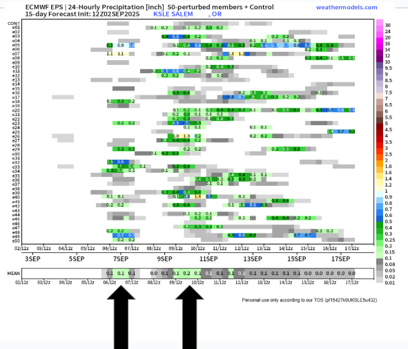
The chart below is a helpful tool I enjoy using, especially during our fall and winter season. Remember, time goes from left to right when reading this chart, each horizontal line is a potential outcome being forecasted by this computer (in this case rainfall for Salem, OR), there are 51 potential outcomes on here, and what we are looking for is consistency. The more consistency we see, then the more confident we can be in that general outcome taking place.
On here we can see the rainfall potential for Friday night and Saturday indicated by the first arrow, and the second arrow shows the widespread showers expected next Monday and Tuesday.
That’s all for now! Enjoy the heat the best you can, and stay safe out there!!