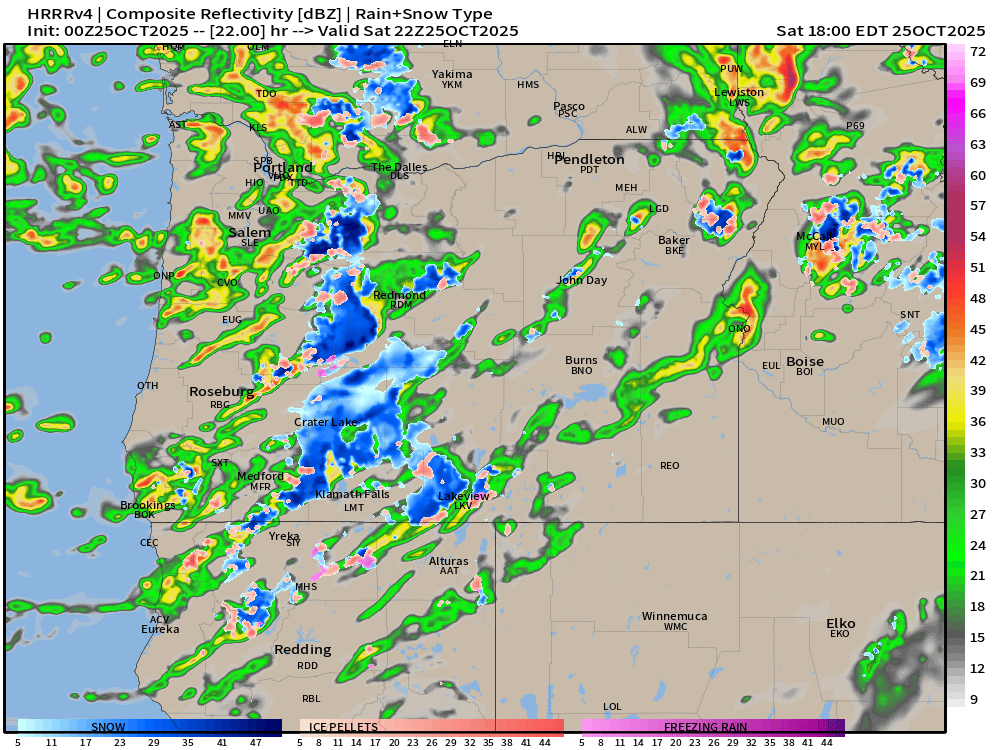
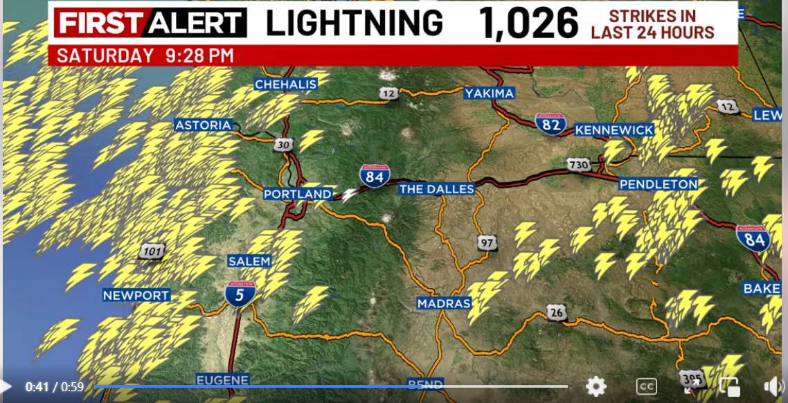
What an exciting and wild weekend of stormy weather we just had! Numerous thunderstorms popped up Saturday up and down the coastline, and even the valley got in on the action too! A strong line of storms dropped heavy rain, brought gusty winds, and put down multiple lightning strikes Saturday afternoon across much of the mid valley region. I’m borrowing this image from Fox 12 Weather (the best Portland weather team), and it shows really well the vast amount of lightning strikes that occurred Saturday.
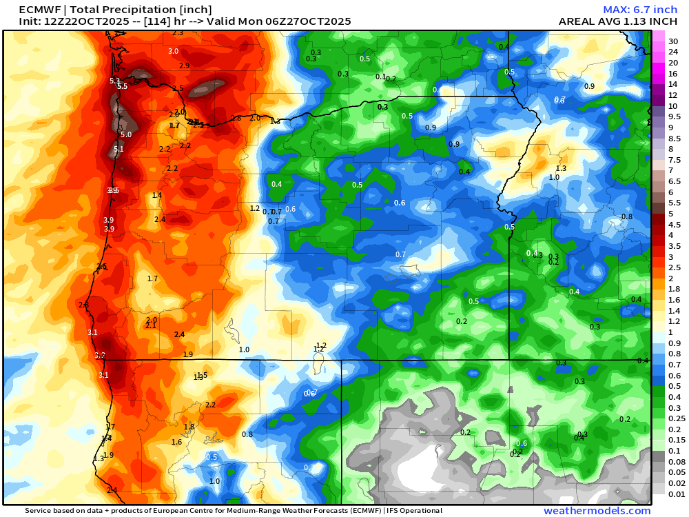
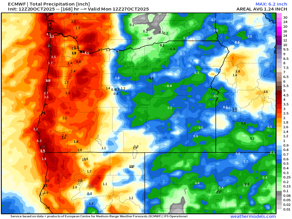
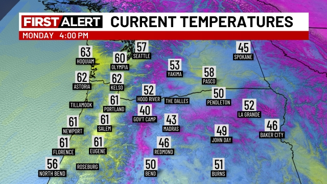
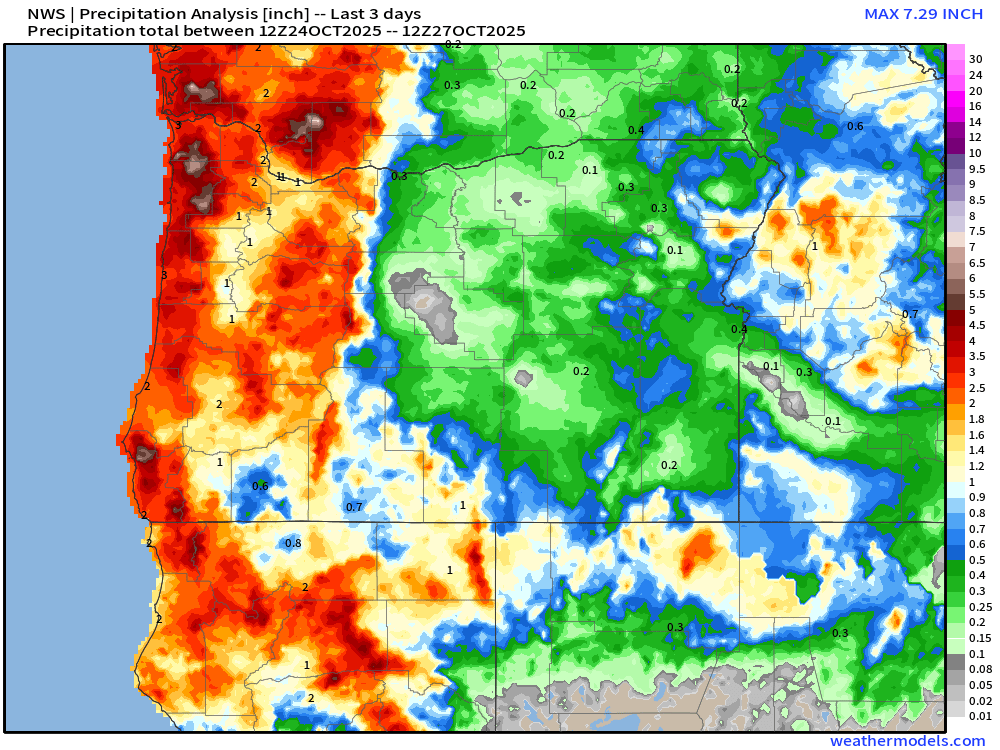
For the most part, I’m pleased with how the forecast went: winds were widespread with Salem officially recording a 45mph gust, many of us experienced intense downpours, and thunderstorms were frequent along the coast making for a very stormy fall-like weekend. Rainfall totals ended on the lighter side, but I imagine not too many people noticed that… Below is a map with three day rain totals from Friday through early this morning.
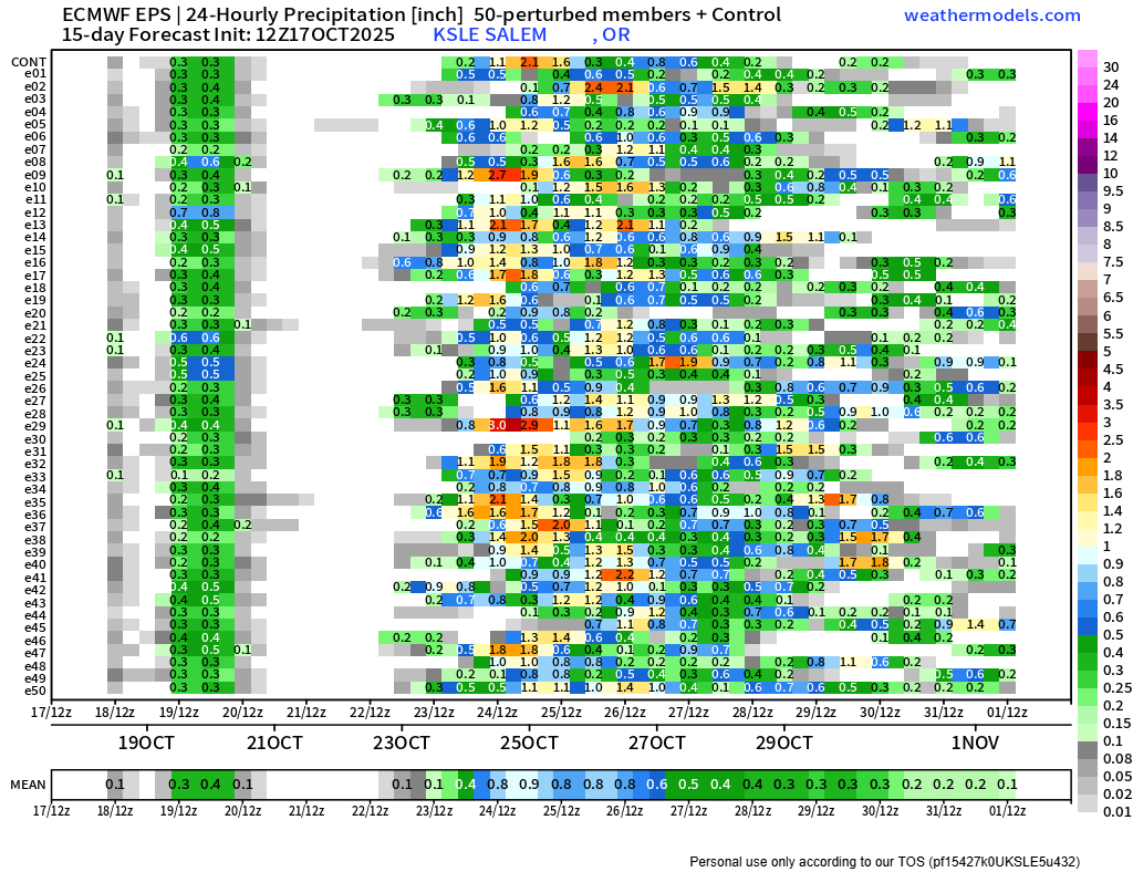
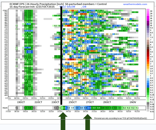
We have two more shots at seeing rainfall over the next seven days, and I’ve listed both of them out for you below:
- Tuesday night – early Wednesday morning a few hours of steady rainfall during the middle of the night. So unless you’re on night shift or you’re running packages for Amazon in the wee hours of Wednesday morning, you probably won’t even notice this rain event. The daylight hours on Wednesday look dry.
- Saturday. This will be a bigger soaking. Rain begins at some point Saturday morning and continues through the duration of the day. No strong winds or wild thunderstorms this go around, just plain ol’ Oregon rain. Probably looking at a solid half inch. High of 62°.
I think many of you will appreciate the timing of our rainfall with the majority of this week’s rain taking place at night – a far cry from the rain these past few days.
Tuesday, Wednesday, Thursday, and Friday will all stay basically dry during the “regular” daytime hours this week. Fog is likely during the mornings of our dry days, especially with all the ground moisture, longer nights, and cool airmass near the surface. So our dry days might not feature as much sunshine as the dry days we saw last week – something to keep in mind. Highs in the upper 50s to near 60°.
The Cascades
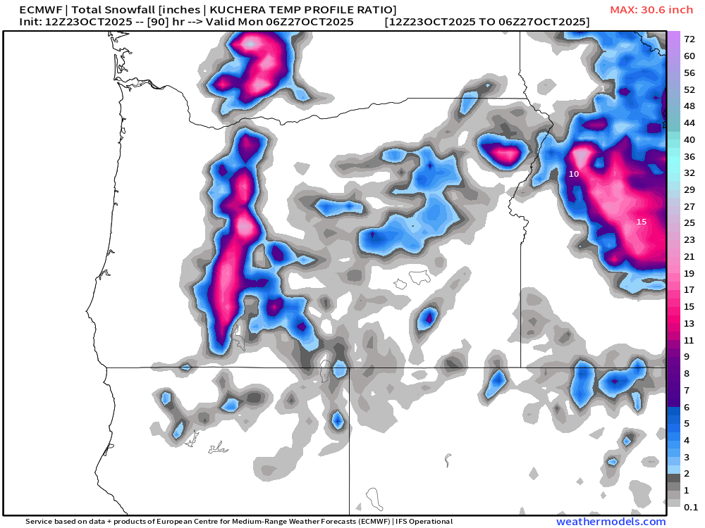
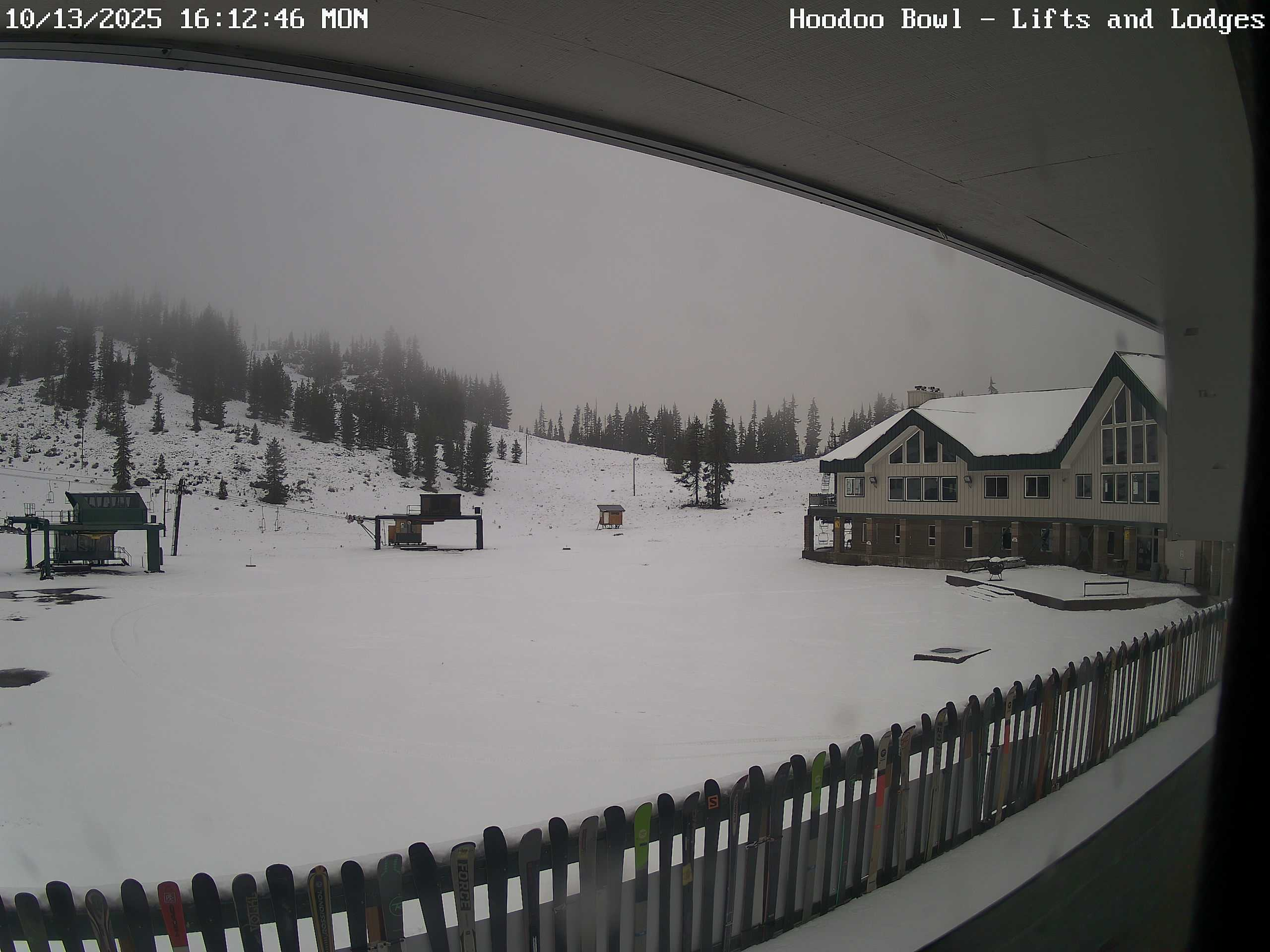
Finally, no snow in the Cascade passes this week. The brief rain events we do have on tap are bringing in warmer air, so snow levels will climb well above the passes. Bare and/or wet roads can be expected up there through at least Sunday.
Have an excellent and safe rest of your week! 🙂