Things have been real mellow around here, and up until the past couple of days, it’s been quite mild too. Salem achieved a record high of 65° this past Saturday. The only thing that has really changed from this week compared to the previous week are the cooler temperatures. We hit the 60 degree mark eight days this month, but since that record high on the 15th, we have been in a cooling trend. Salem finally got down to 32° this morning for the first time this fall, and we never broke out of the 40s. Inversion season is definitely here!
The main message is that there are still no big storms on our horizon. No flooding scenarios, strong winds, chances for snow etc. Just more of the same: a little rain at times, some fog, and a few sunbreaks. The riveting details are below:
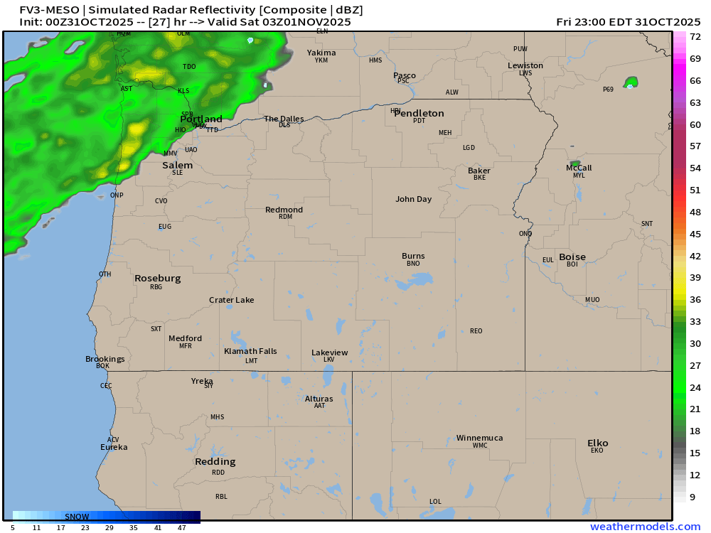
Tonight: Light rain switching over to scattered showers overnight. Chilly with temps in the mid to low 40s. Brrrrr!
THU: A few showers early. Dry afternoon and evening. High of 54°.
FRI & SAT: Dry. Fog seems very likely both days with a few sunbreaks possible during the afternoons. Highs in the upper 40s.
SUN & MON: Some rain both days, but nothing big or major that would cause significant issues for our day to day lives.
Looking ahead to the days leading up to Thanksgiving, and Thanksgiving itself, I continue to see no big storms. Maybe some mountain snow to deal with, but will have more updates again as we get closer to the holiday. The main message is that this rather calm weather pattern appears to continue for another week.
Warm Novembers
We have had a very warm November so far running almost 4 degrees above normal! Check out this map showing temperature departures from average so far this November.
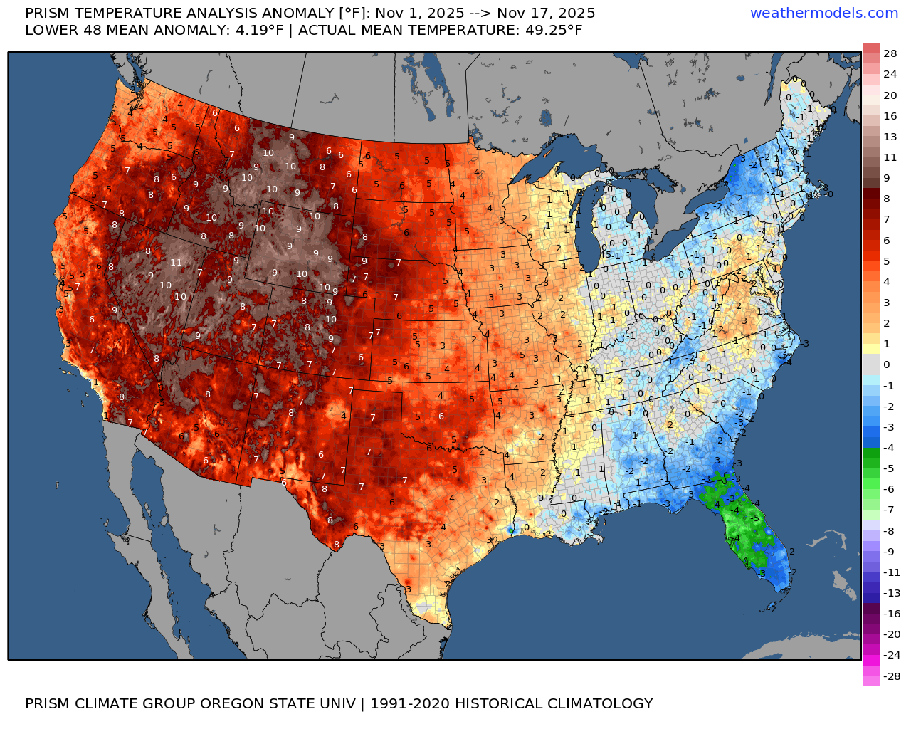
Very warm in the west, and cooler along the east coast. Well I’m here to tell you that warm Novembers do not correlate to warm winters. In fact, maybe quite the opposite. Below I’ve charted temperature departure maps from four different years. All four of these years had similar La Nina conditions to what we have now, and all four of these years had very mild November temperatures – also very similar to what we have seen so far this November.
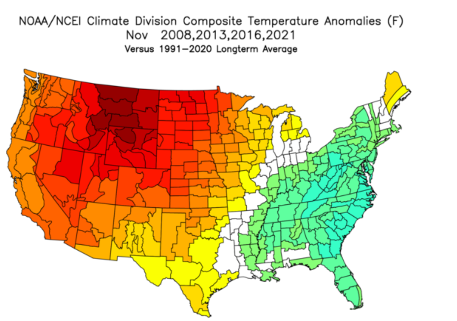
Looks similar right? Very warm out west and cooler along the east coast. Well, what happened after each of those warm Novembers? This next chart shows temperature departures for December through February from all four of those same years.
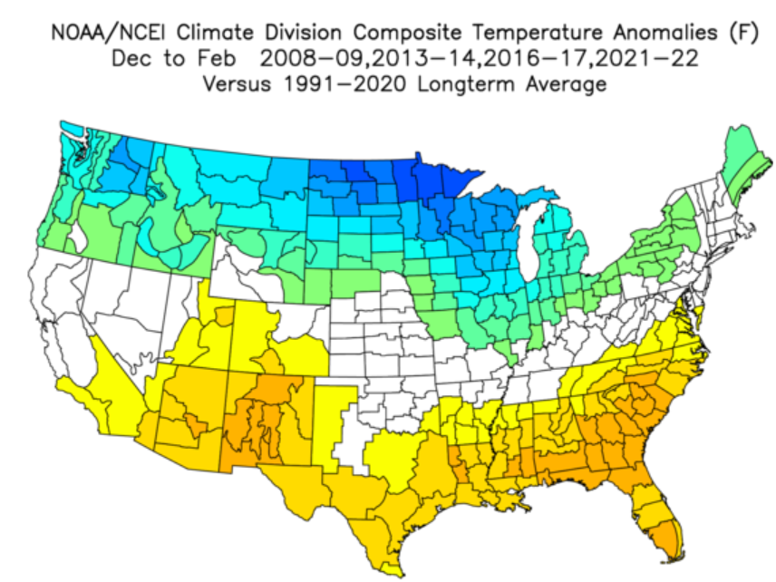
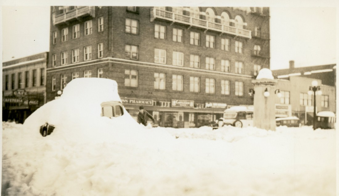
As you can see, the rest of those winters actually ended up on the cooler side. In some cases significant cooldowns occurred which lead to valley snowfall. How many of you remember December 2008 when it snowed several times in the weeks leading up to Christmas? Or December 2016 when it snowed several inches leading to an early Christmas break. Point is, a warm November does not equal a warm winter. If you could only see some of the comments in the weather forums I’m in then you would be laughing yourself to sleep. People claiming winter is over, others saying things like it’s difficult to imagine even the ski resorts getting enough snow to open this winter, and other super ridiculous nonsense.
We could end up with a dry and mild winter (has happened before, and it will happen again), but I’m not real worried considering it’s only the 19th of November, and again, the data I just shared indicates that warm Novembers do not necessarily lead to warm winters. Let’s see what happens…
Enjoy the rest of your evening and stay safe out there!