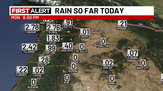
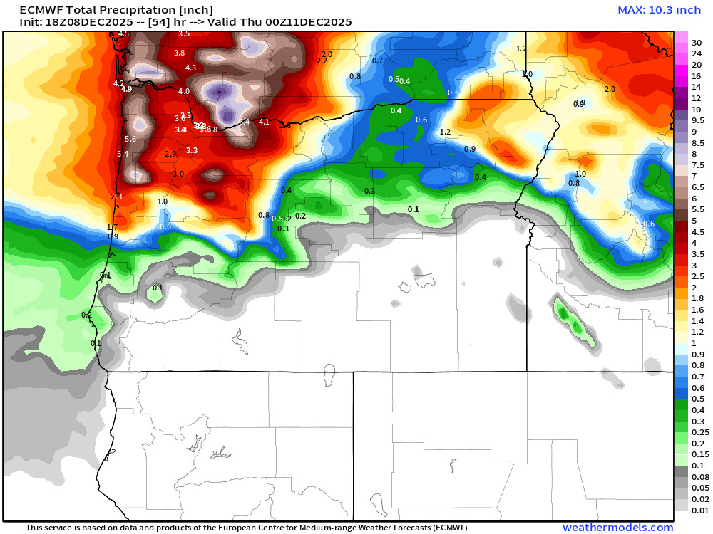
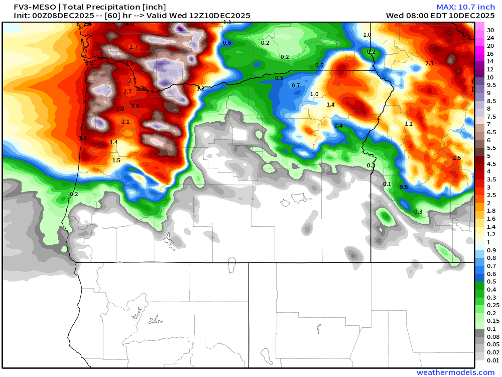
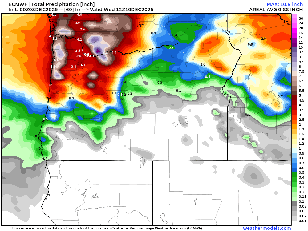
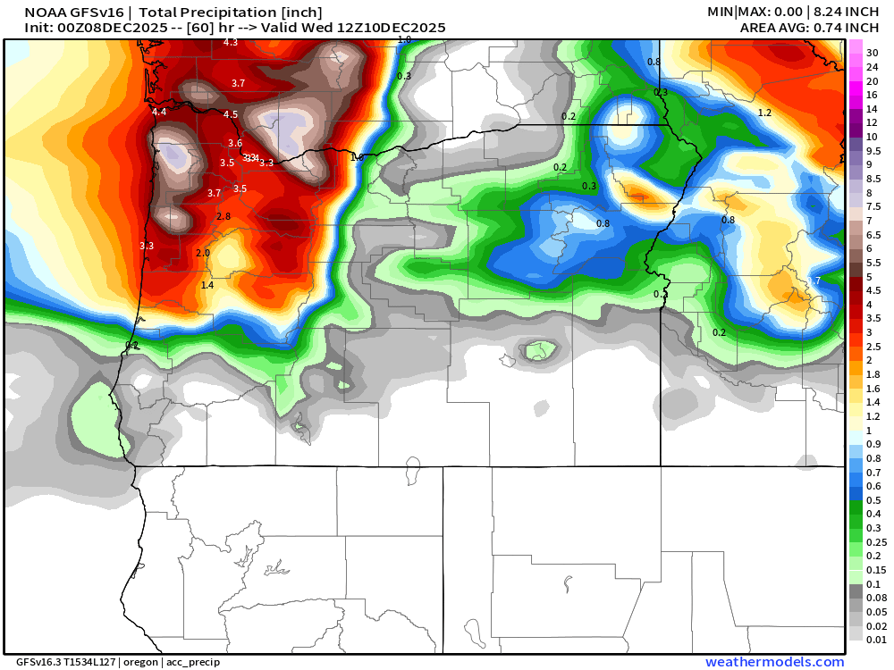
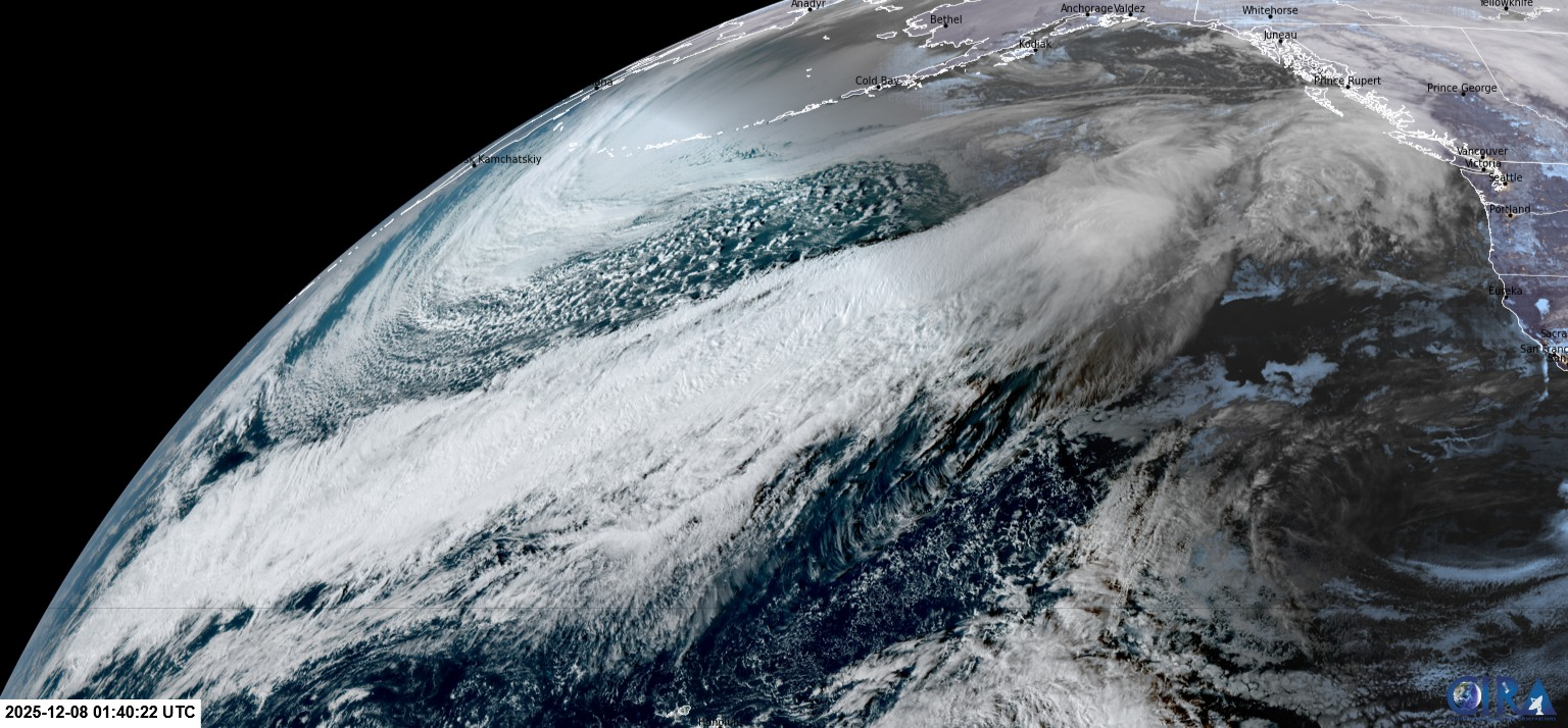
It’s been a soaker the past couple of days! Some hefty rain totals as shown on this map.
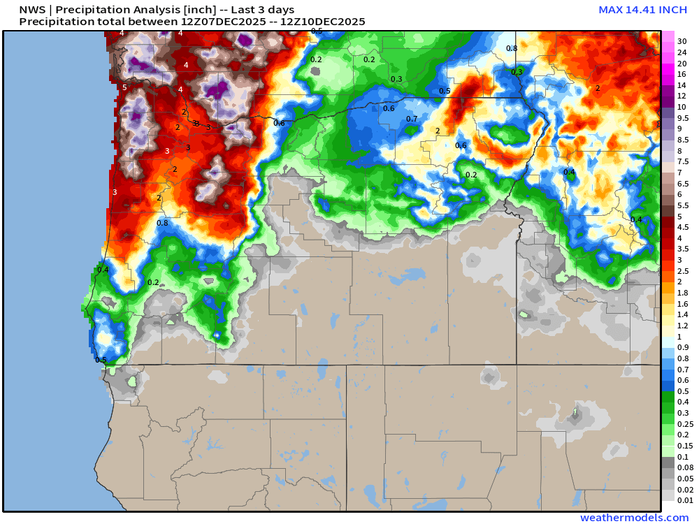
You can see how effective the mountains are in this pattern at ringing out available moisture with 8 to 10 inches falling in parts of the Coast and Cascade ranges.
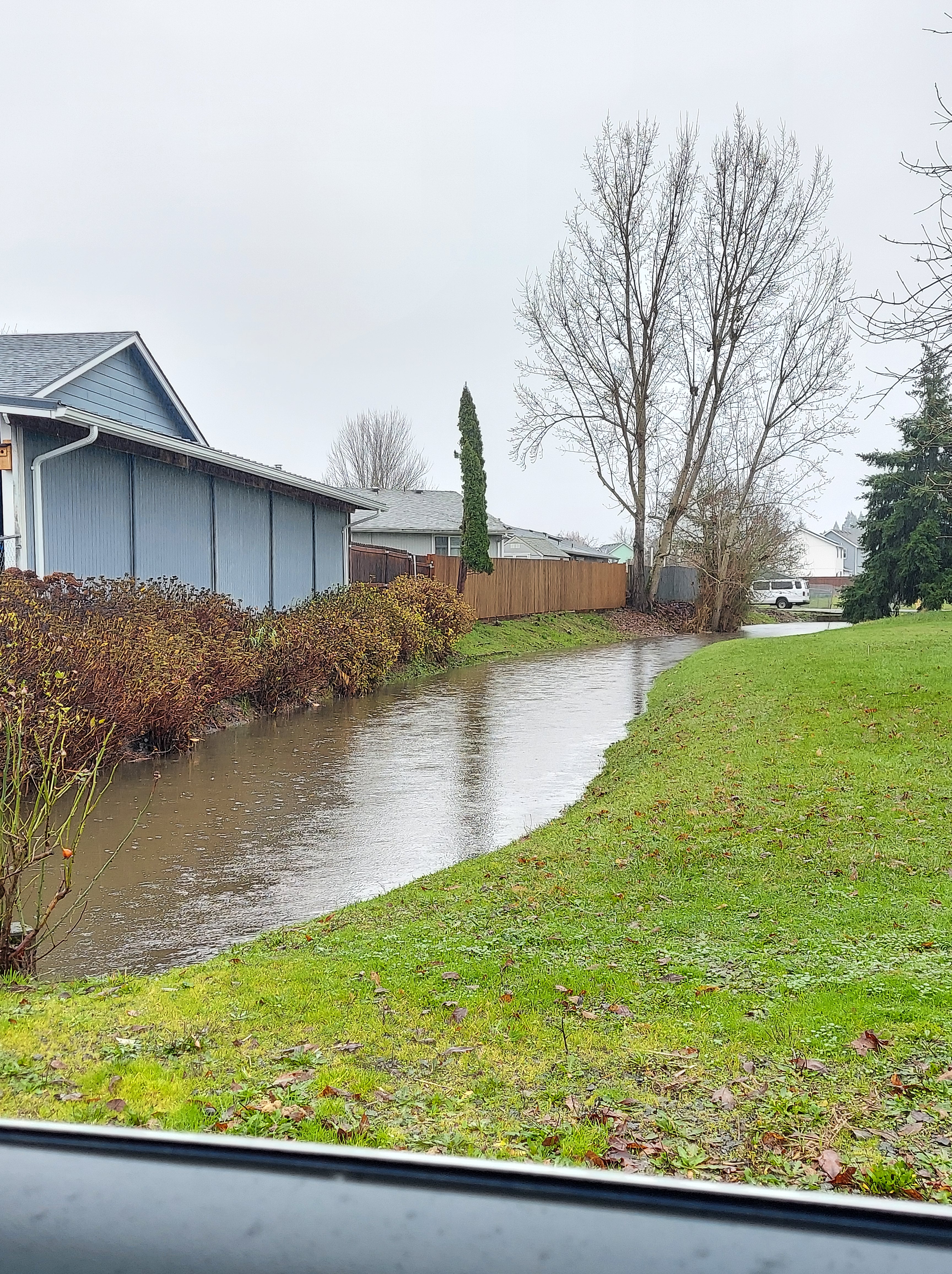
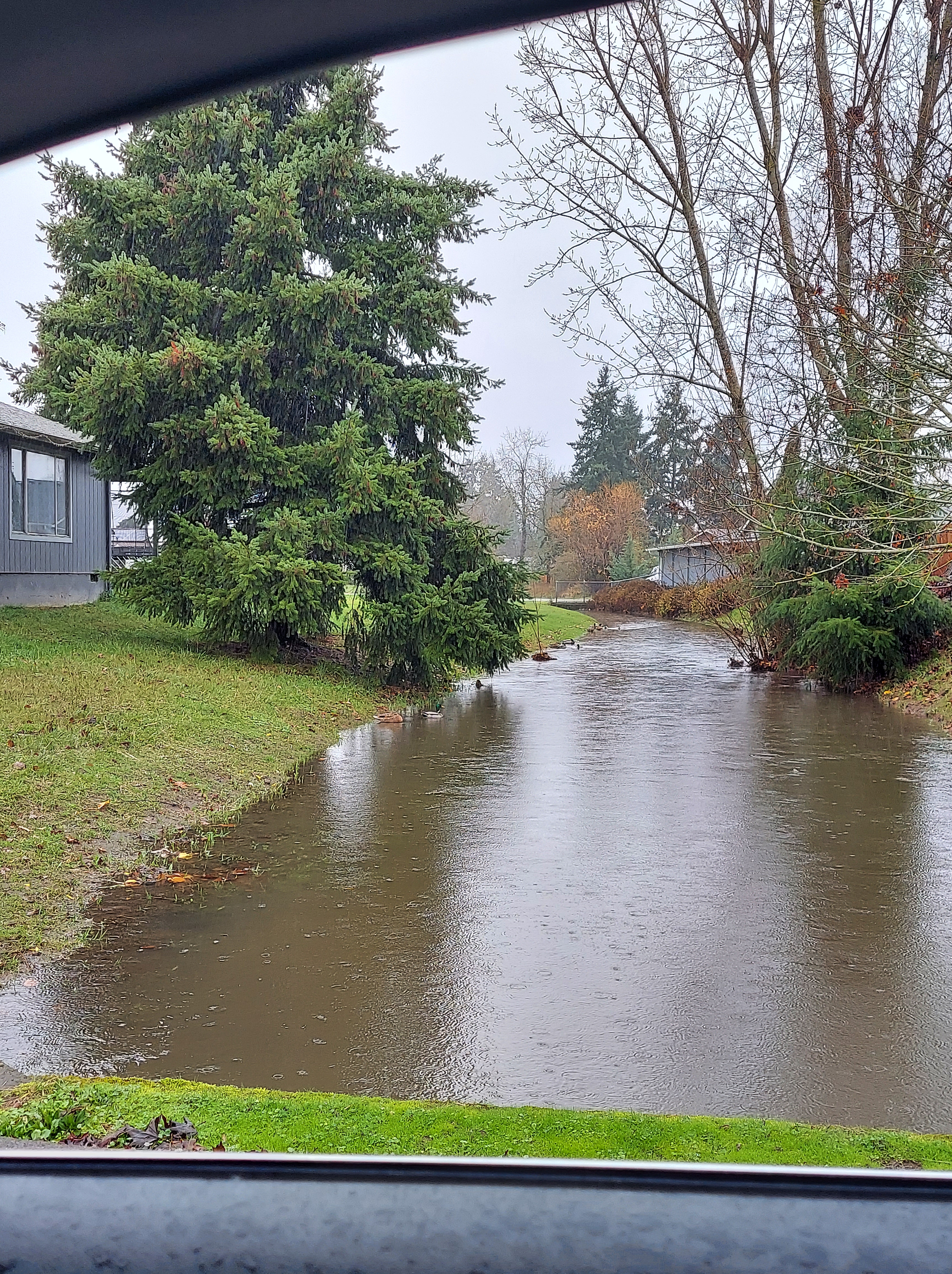
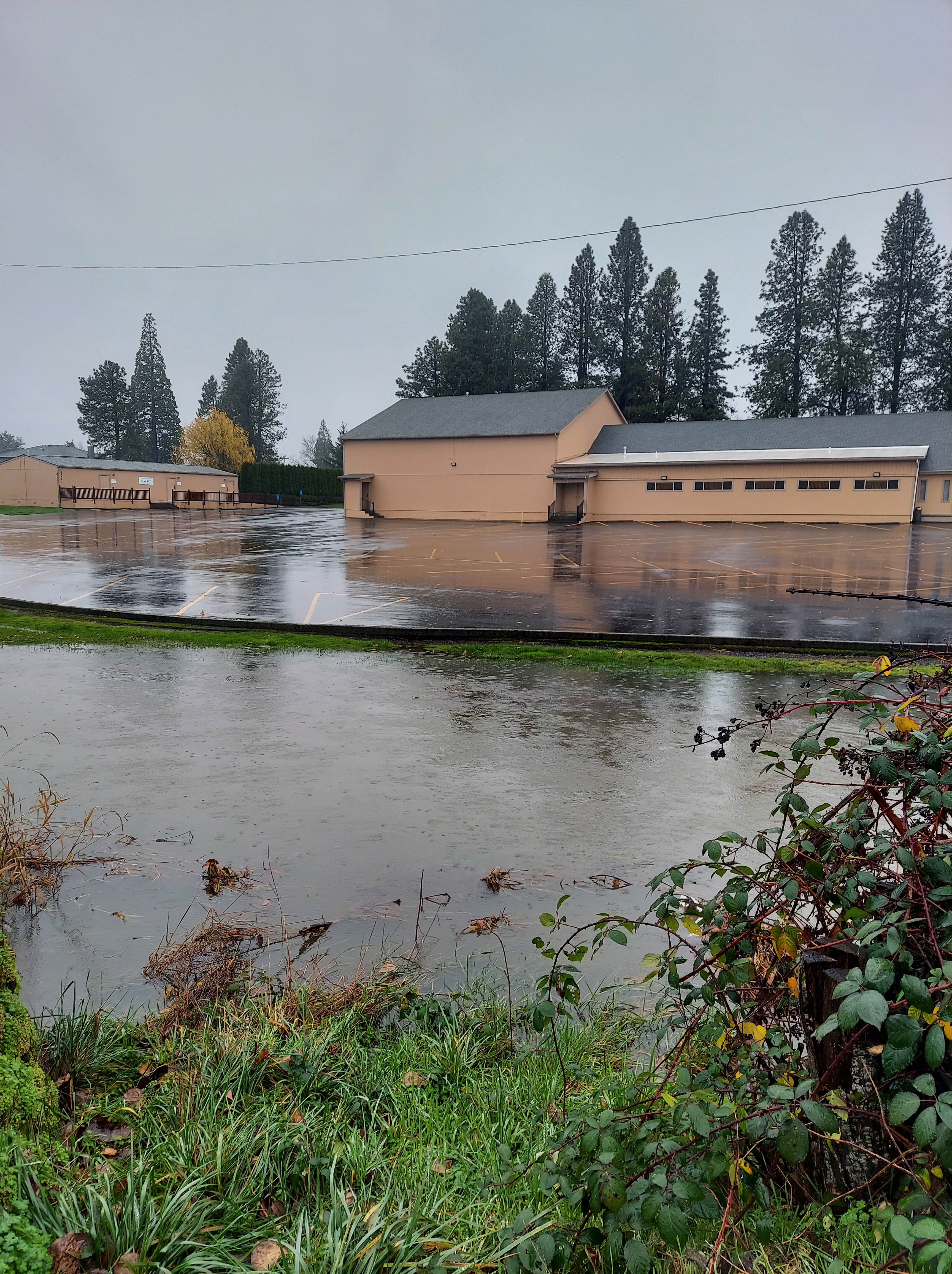
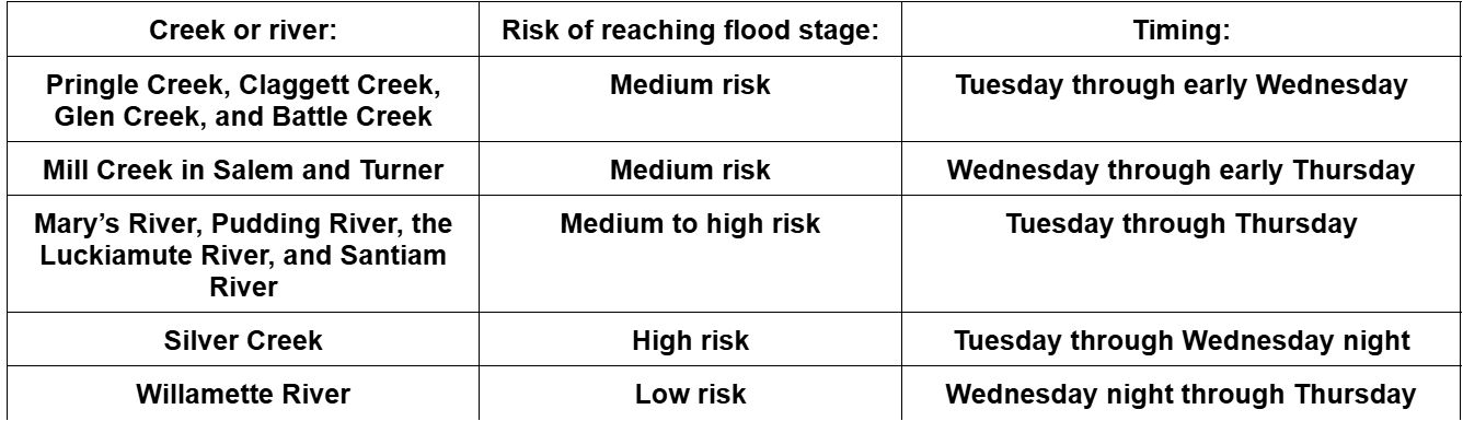
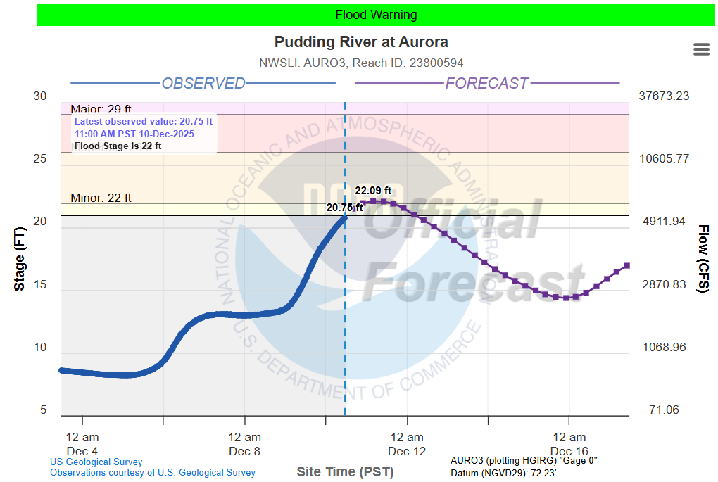
Focusing on the mid Willamette Valley, it appears as though the biggest flooding issues were a few closed streets, some flooded parking lots, and a lot of field flooding outside of town. No major/widespread flooding here. Both the Luckiamute and Pudding rivers are still rising, and will peak this afternoon/evening. Here’s a forecast for the Pudding River by the time it reaches Aurora.
Flooding has been more serious out along the coast, in the Coast Range, and up in western Washington where the flooding has been much more severe.
Forecast
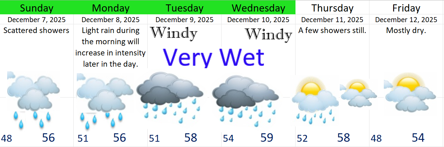
If you want drier weather, then you are in luck. Counting today, we have two mostly dry days followed by two completely dry (albeit foggy) days. A four day stretch of mostly dry weather. Seems deserved doesn’t it?
Today and Thursday: Mostly cloudy and mostly dry. Slight chance for a few light showers, especially overnight into early Thursday morning. Very warm for this time of year as we continue to be on the warm side of the jet stream. Highs near 60 today and Thursday.
FRI & SAT: Dry, but fog is very likely along with afternoon clouds each day. Highs closer to 50°.
SUN: Periods of light rain. Still very warm with a high of 55°.
Next week
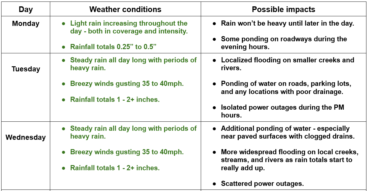
Next week looks really wet again. At the moment I see three more significant storms with showers during the in-between times. The first storm comes in on Monday, another one Wednesday, and a third arrives for Thursday & Friday. The third storm looks “juicy” with lots of moisture to work with, and since we have saturated soils, plus rivers running higher than normal, we could be looking at another flooding scenario. Too far out to know details, but keep this in mind.
Disaster preparedness
Hey, if you’re not already, use this week to make sure you have the essentials you need to survive if we have a major storm or disruption to our supply chains. For the vast majority of us, this rainstorm did not cause any serious issues, but that might not be the case next time, and why wait to rush to the store for basic essentials when a storm is on our doorstep?
Finally, I see some hope for our mountain snowpack and ski resorts. Wednesday’s storm might end up being a big mountain snow producer as we finally dip to the colder side of the jet stream. Not sure if the snow will last or not, but it’s a good sign as our mountains are way behind in snowpack for the moment.
I’ll have plenty more details on next week’s storms in a few days. For now, time to take it easy, and I leave you with these high water photos taken around the Salem area Tuesday.