Confidence is remarkably low for being less than 24 hours from this storm, but confidence is growing in a very impactful wind scenario. Please read through all of these important headlines concerning the potential wind storm for Wednesday.
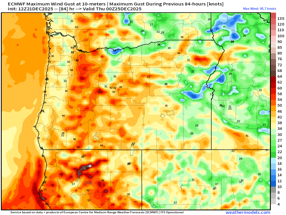
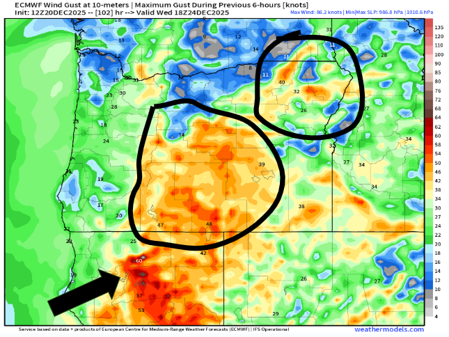
1.) I’m forecasting wind gusts of 45 to 55mph here in the Willamette Valley. This is plenty strong enough to cause power outages and bring down more trees. This will be a very short hitting, but powerful storm. Look at this forecasting chart for Salem. I have arrows pointing to the day and time columns, the surface wind gusts, and the precip column.
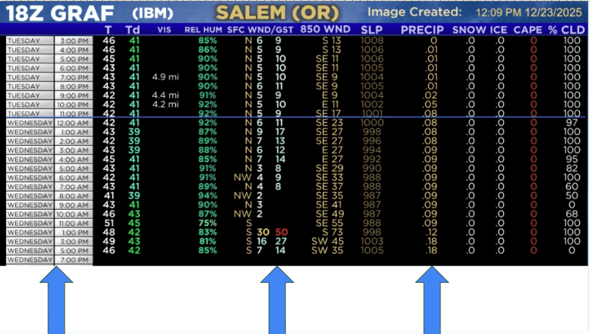
This storm is not a rain maker at all, and it will feel like it came out of nowhere, and will be over within a few hours, but the damage will already be done. This model actually had even higher wind gusts in its previous run, and has been bouncing around some. Right now, 45 to 55mph for the Salem area is a good bet with higher gusts still on the table.
2.) Plan on the possibility of doing Christmas Eve and maybe Christmas without power. This sucks I know, but it’s what I see as a real possibility.
3.) Plan on some of the coastal highways and highways going over the Cascades closing tomorrow during/after the storm due to downed trees.
4.) Copied from my last update, but still very relevant: Understand that highways may close Wednesday and stay closed through at least part of Christmas day due to downed trees or power lines. Again, please consider traveling sooner rather than later if you have the option to avoid closed highways. If you end up leaving early and nothing happens, I doubt you will regret it, but if you miss celebrating Christmas with family because every highway crossing the Cascades is closed, then it’s a much sadder story.
5.) Please prepare for power outages Christmas Eve and possibly lasting longer. Please plan on some road and highway closures Christmas Eve and possibly lasting longer.
Adding to this, I don’t think you will be sad if you plan and are prepared for power outages and they don’t happen, but you will be frustrated if you’re not prepared and they do take place.
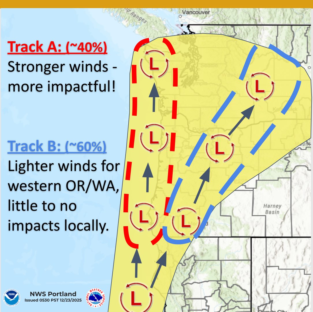
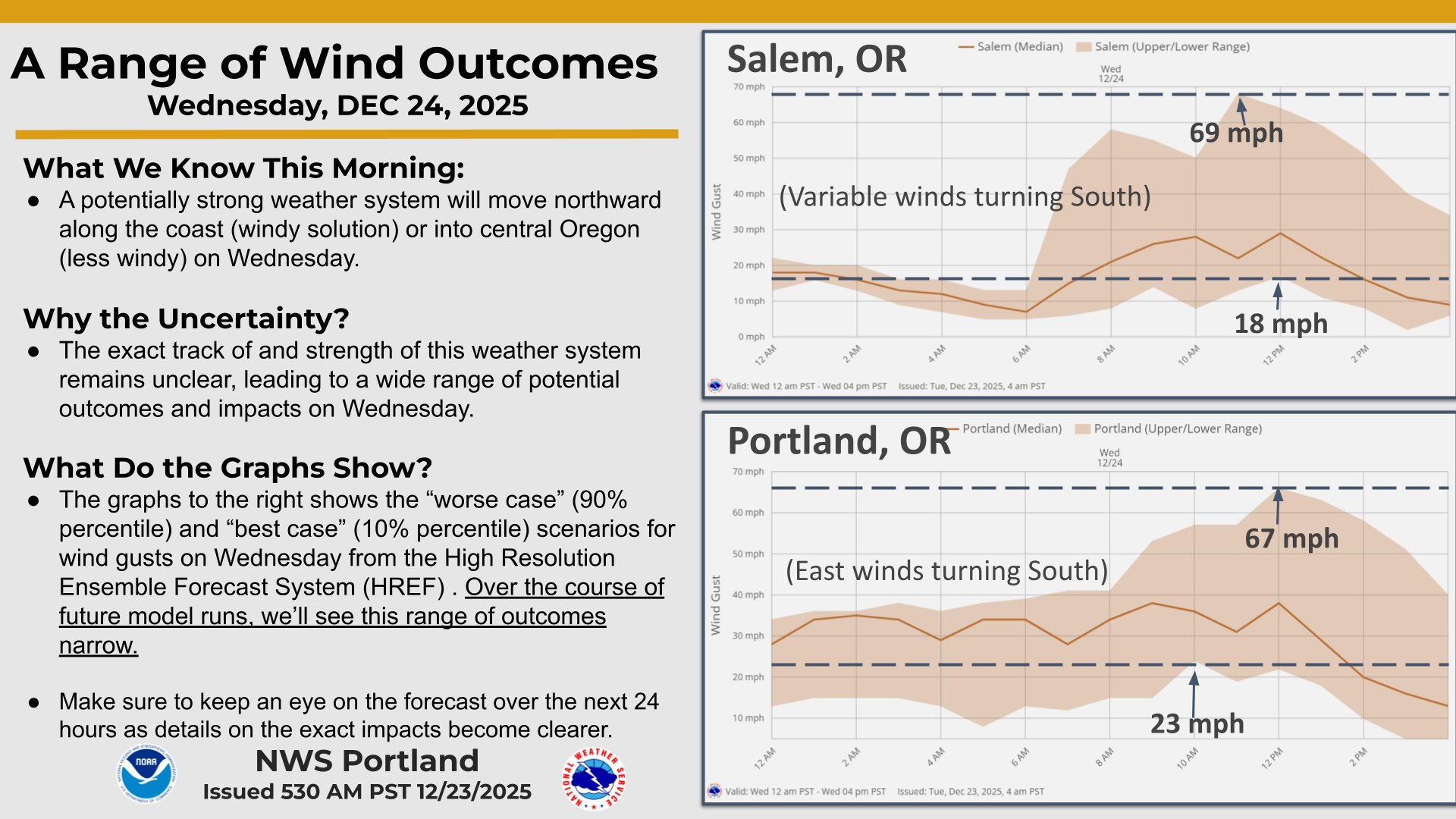
Like always, feel free to search elsewhere for additional details, but you may struggle to find more. Look at what the National Weather Service is putting out today. Talk about a wide range of possibilities…
6.) Unsure if I will have a final update before the storm. I suppose the only reason to have another would be if a more severe outcome is looking more likely; otherwise, please be ready, be safe, and hopefully we get through this with minimal damage.