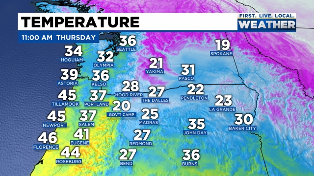
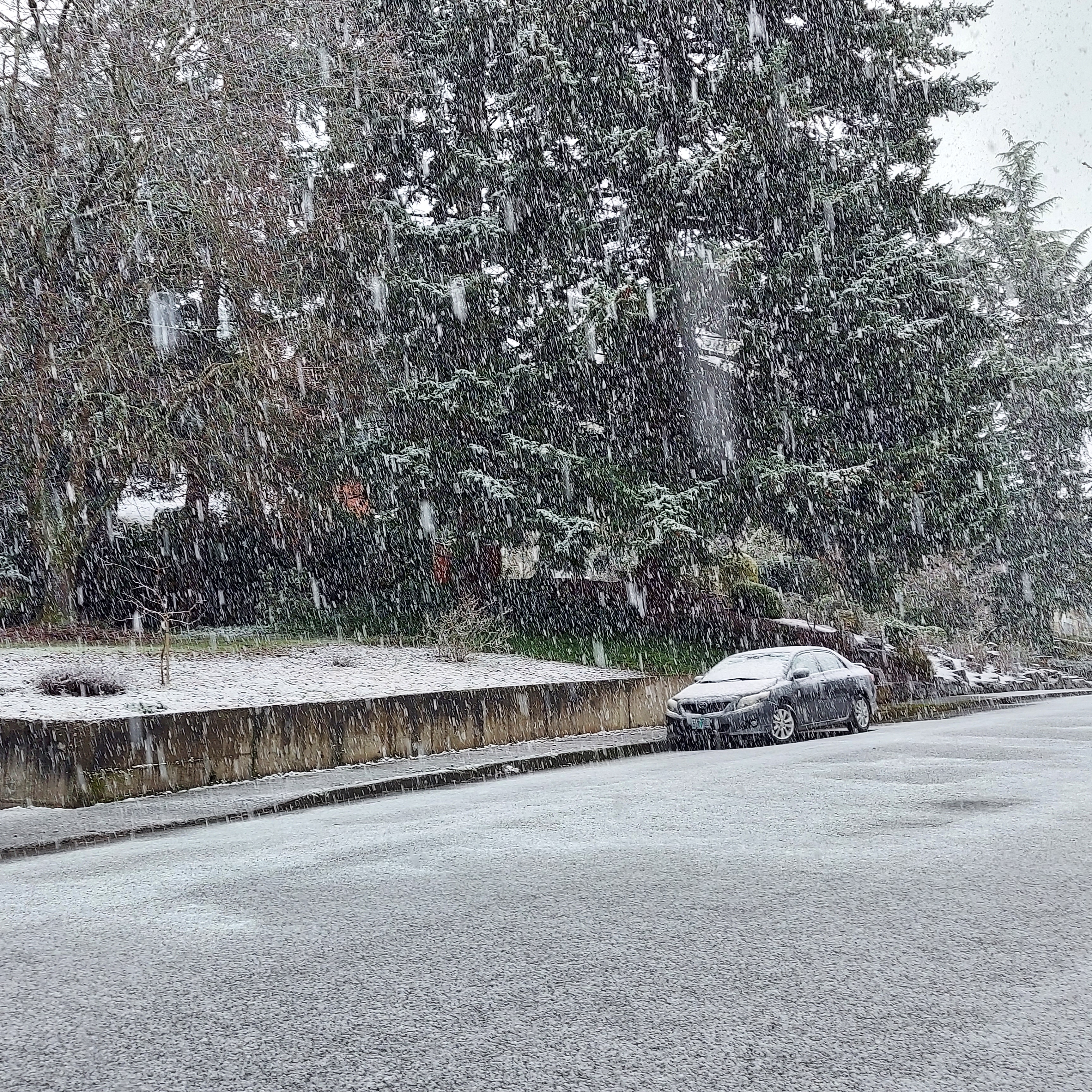
From what I can see out there we still don’t have any major surprises going on yet which as a forecaster is always a relief lol. There is a nice layer of ice on basically everything outside here in Salem. Trees, plants, and cars are all coated in a glaze of ice. Our major roadways are looking okay; however, most of our sideroads and parking lots still have a lot of slick spots of ice on them. Be very careful out there and drive or walk as if there could be ice even if it looks just wet. Here are regional temps as of 8AM:
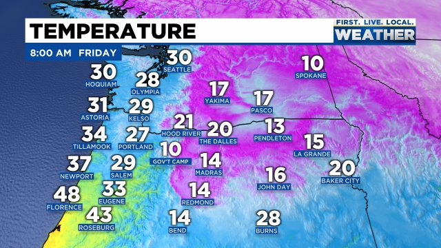
You can very clearly see the influence of the Columbia River Gorge with very cold air moving west right into the northern Willamette Valley. Roads should thaw out slowly and driving conditions shouldn’t be all that bad on the main roads thanks to our limited “heating” of the day, but don’t be fooled into thinking we are all done. This second storm moving in is juicy and will be packing quite a punch. Unlike last night where the freezing over process was slow, main roads tonight will freeze over very quickly between 2 and 5PM depending on temps and how heavy the precip falls this afternoon. It’s worth pointing out that some of the side roads around town may not even truly thaw out before this next round of freezing rain and snow moves in.
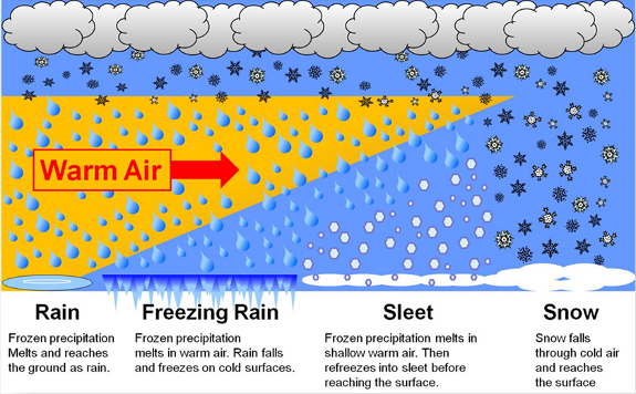
Freezing rain will again be the dominate precip type later today through Saturday morning with sleet and a little bit of snow mixing in at times. As mentioned, this storm has a lot of precipitation with it, so the potential is there for some serious ice accumulations. Tonight and Saturday morning will be the “main event” of this whole wintry weather ordeal. This is also the time frame that some of you may lose power due to what could end up being heavy freezing rain.
Portland is still on track for a major snowstorm later today through Saturday morning. I’m thinking 6 to 14 inches up there depending on location. A crazy big snowstorm for them!
In theory Salem should begin to thaw out Saturday afternoon – at least some. This is subject to change of course, but as for right now that is the plan.
Alrighty, there you have it! Plan on main roads being okay for the middle of the day, but turning bad quickly late this afternoon/early this evening, and plan on power outages tonight with lots more freezing rain tonight and tomorrow with varying amounts of snow and sleet mixed in.
Stay safe and enjoy our wintry weather!