Good morning! It’s been a truly historic summer in regards to heat and record high temps. I’ll have a final look back at our incredibly hot summer another time. For now I’m back in the forecasting saddle and it feels great to be back! Forecasting is a huge passion of mine; however, for the past 6 weeks I’ve been absolutely swamped with my new teaching job. In fact it’s been a long time since you’ve heard from me as summer is already a slow time of year regarding the weather not to mention the many hikes and little trips I took over summer in addition to all the work I’ve had.
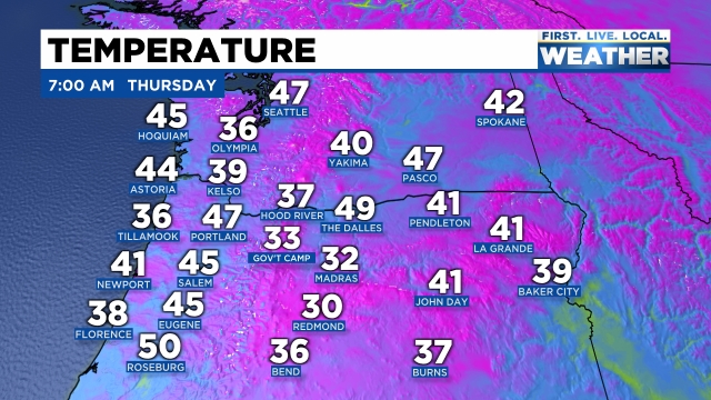
So yes, I’m back and it’s good to be returning to the swing of things. Looking ahead it’s very clear to me that summer is over. Sure, we will still have plenty of 70 degree days and maybe even a few more 80 degree days, but have you noticed the chillier nighttime lows? The heat of the day doesn’t last real long this time of year. Speaking of cool nighttime lows, the coolest temps we have seen since early June are occurring this morning with lots of low to mid 40s. Salem was at 45° as of AM. In fact check out all of the chilly temps this morning across the region!
Here’s a look at the next 7 days with highlights and details below.
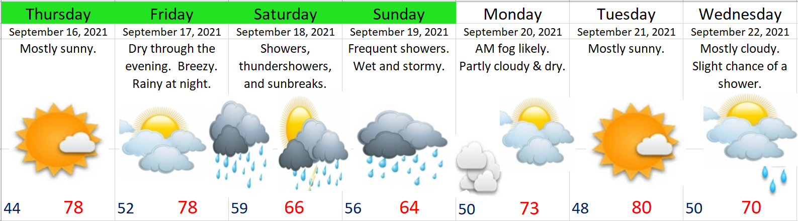
Highlights
I’m confident rain should move in after “dinner time” Friday night meaning your Friday plans should be good to go through at least 7 or 8PM – maybe even later.
This map shows Salem picking up .8″ of rain in only 6 hours early Saturday morning with more as we go through the remainder of the day.
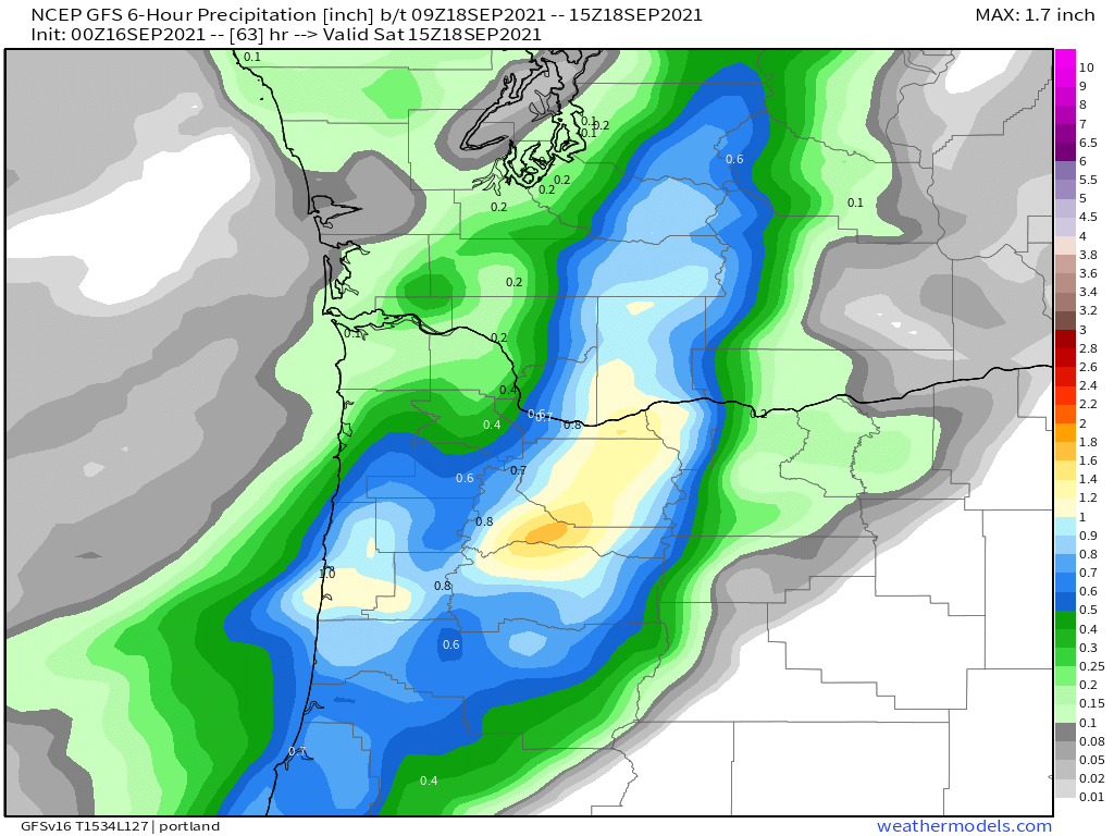
Indeed it’s going to be quite the soaker Friday night & Saturday morning with close to an inch of rain falling! Saturday afternoon will feature a more typical shower/sunbreak pattern – maybe a rumble of thunder.
Showers increase on Sunday. Again, slight chance for a rumble of thunder or even a funnel cloud.
The rain shuts off abruptly Sunday night making for a dry Monday (maybe some morning fog), and then Tue will be sunny and mild.
Forecasting confidence goes down on Wed as it looks like we will be on the edge of a weak system. For now plan on a mostly cloudy day with a light shower or two – nothing big.
Your dry days for getting things done outside are today, Friday, and again next Mon & Tue.
That’s all I have for now. Feels great making a forecast like this again! We have another La Nina winter in store which means it’s likely going to be a busy year with plenty of storms and exciting weather events, and I plan on being the guy you can count on to keep you informed and in the know 😉 🙂
Take care and I hope you all are staying healthy and safe!