Highlights
Here’s the plan. Tonight we will continue to see rain showers with snow mixing in at times.
Christmas Day: A mix of rain and snow showers – more snow than rain and turning to all snow through the day. The chances for accumulating snow will also increase as the day goes on. Anyone could see a white Christmas if you get lucky.
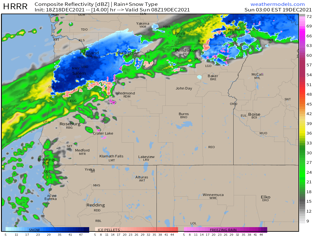
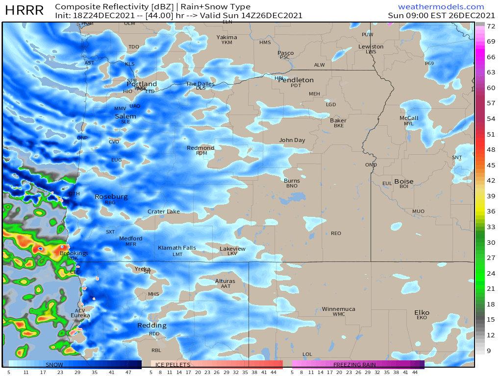
Christmas night through Monday morning: Snow showers for everyone. Pretty decent chance everyone sees at least 1 or 2 inches, and many of you could see closer to 3 to 6 inches! All depends on where the lines of heavy snow showers set up. This picture shows what the radar might look like early Sunday morning. Basically lots of snow showers which means not everyone is going to see the same amount of snow, but everyone should get at least an inch or 2 at a minimum.
Temperatures stay right around freezing Sunday.
Monday – Wednesday will see a hard freeze with highs struggling to get out of the 20s, and lows in the teens or even single digits. Extremely cold weather and colder than anything we have seen in several years. Watching the potential for another snowstorm Tuesday. More details another day.
Plan on snowy and icy roads beginning at some point on Christmas everywhere west of the Cascades and lasting through Wednesday at least.
Merry Christmas!! Be safe and have a lot of fun!!!